Overview
A powerful storm system brought impactful weather to the Mississippi and Ohio Valleys on March 14-15, 2025. Over southern Indiana and northern Kentucky, multiple supercells and QLCSs moved over the area bringing an EF1 tornado, winds up to 70mph, and up to 2 inch hail in the morning of March 15th, 2025.
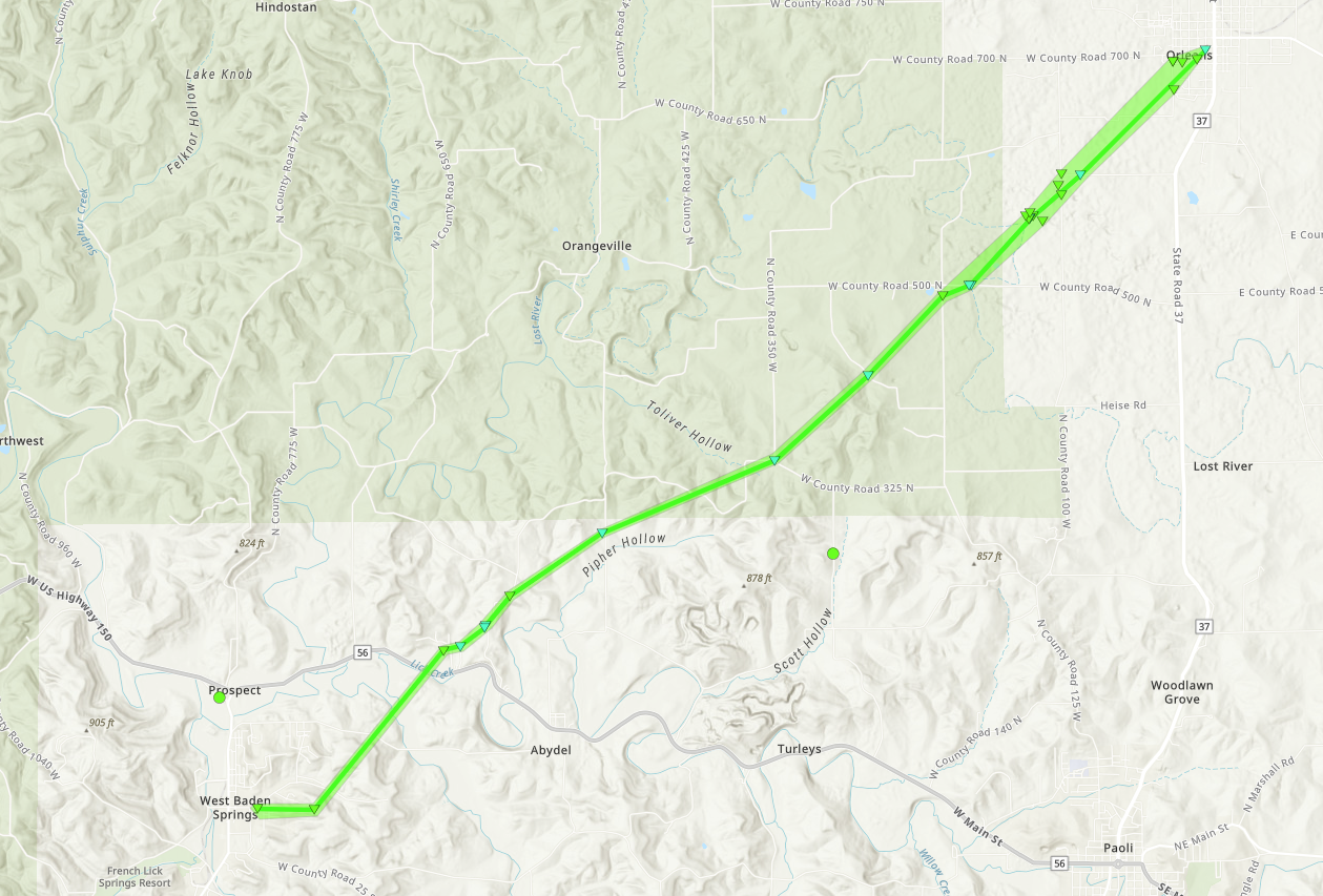
Tornadoes
|
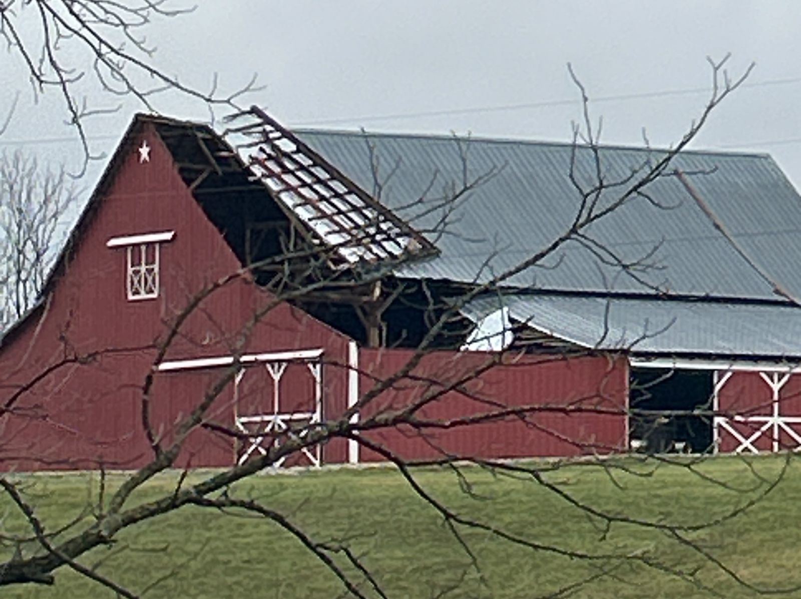
Tornado - Orleans
|
||||||||||||||||
|
||||||||||||||||
The Enhanced Fujita (EF) Scale classifies tornadoes into the following categories:
| EF0 Weak 65-85 mph |
EF1 Moderate 86-110 mph |
EF2 Significant 111-135 mph |
EF3 Severe 136-165 mph |
EF4 Extreme 166-200 mph |
EF5 Catastrophic 200+ mph |
 |
|||||
Wind & Hail:
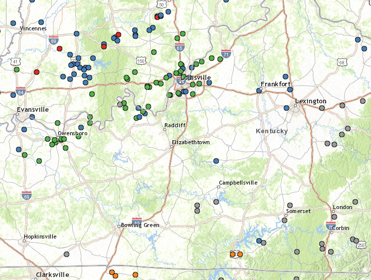
A link to the Storm Report Summary can be found here
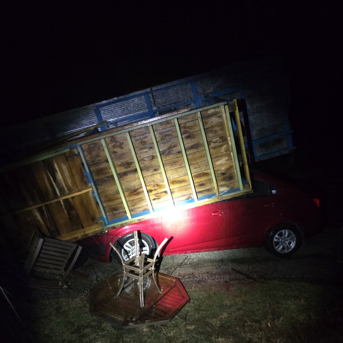
Wind
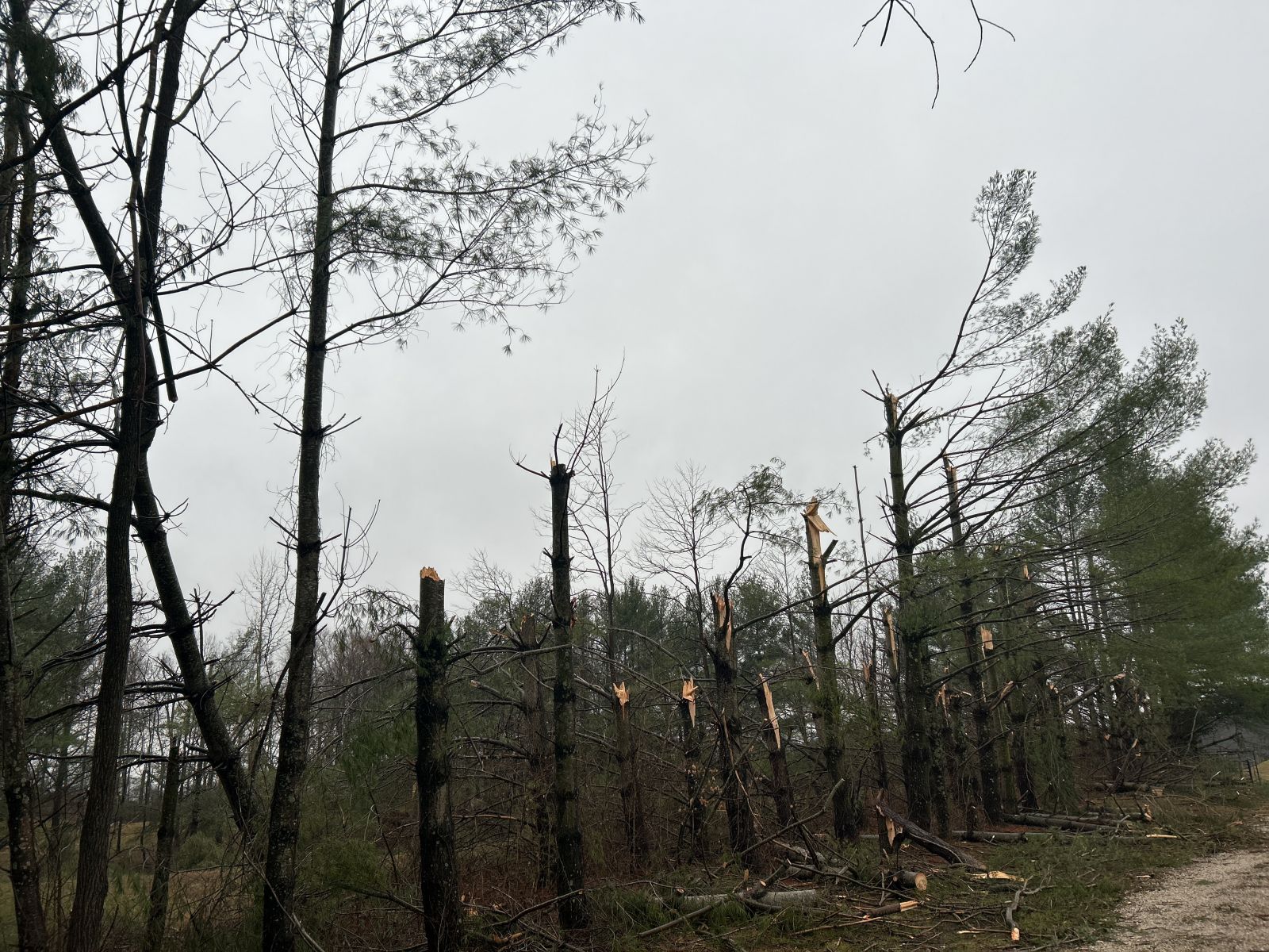
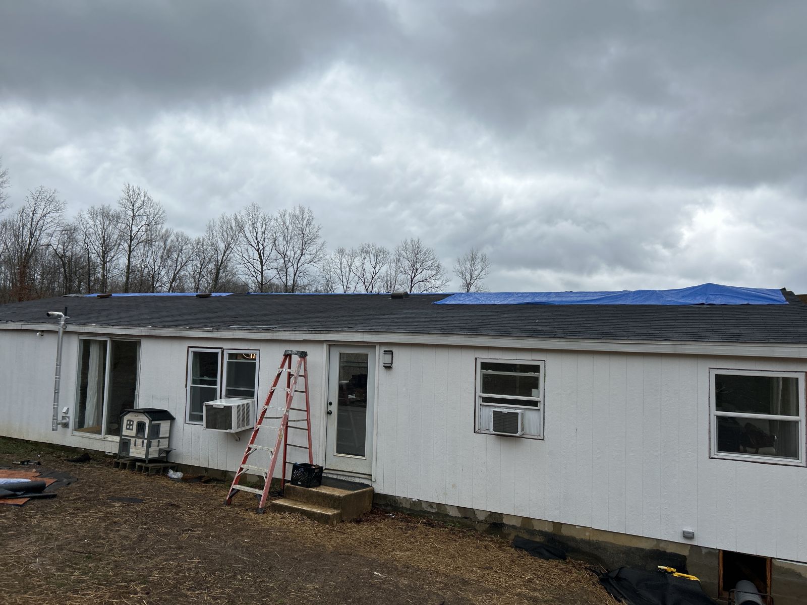
Multiple reports of structural and tree damage in Dubois County, IN, Meade County, KY, Clark County, IN, and Jefferson County, KY.
 |
 |
| Shed thrown on top of car in Holland, IN | Wind Damage to a construction site in Jeffersonville, IN |
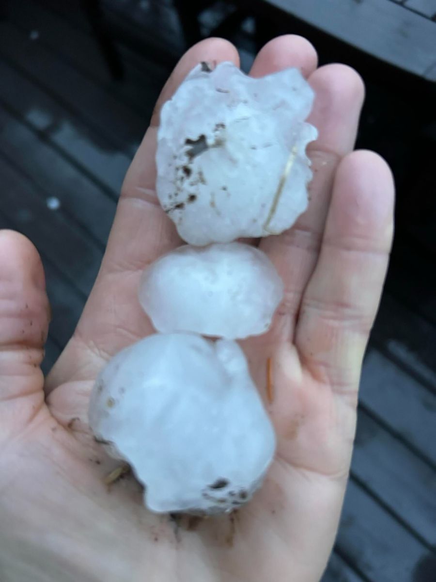
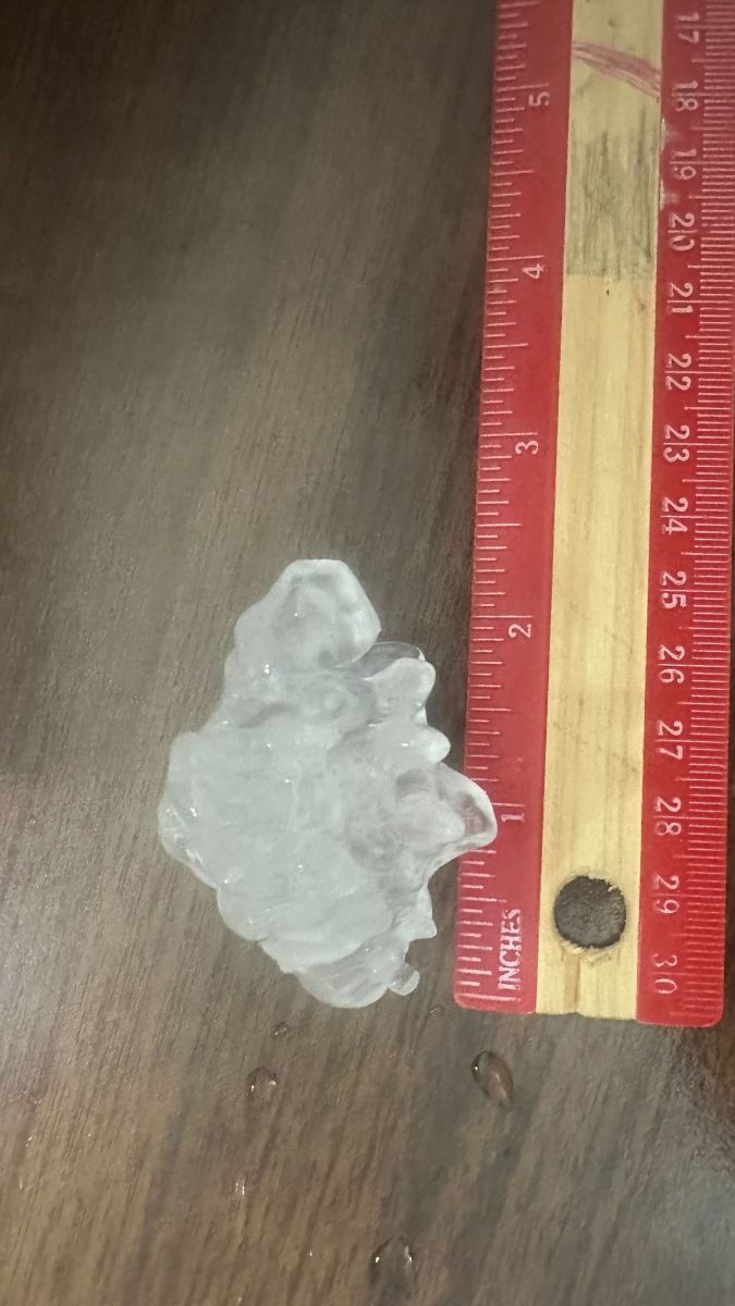
Hail
Multiple reports of hail up to 2 inches were reported in northern Kentucky and southern Indiana. Some areas in Clark County, IN and Jefferson County, KY reported accumulating hail.
 |
 |
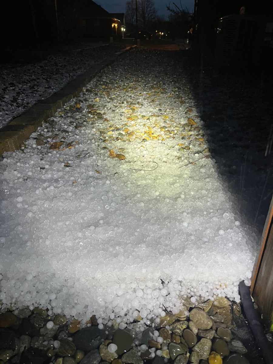 |
| Golf ball sized hail in Goshen, KY | 2 inch hail in Jeffersonville, IN | Accumulated quarter sized hail in Sellersburg, IN |
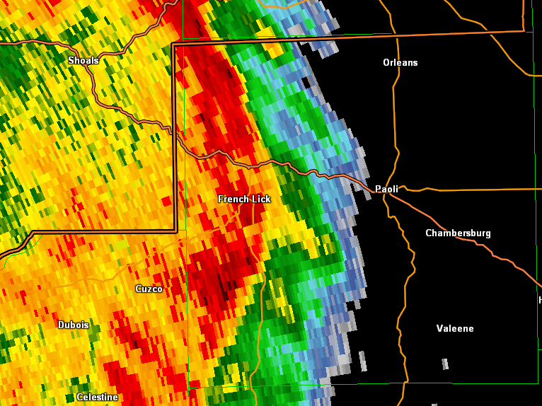
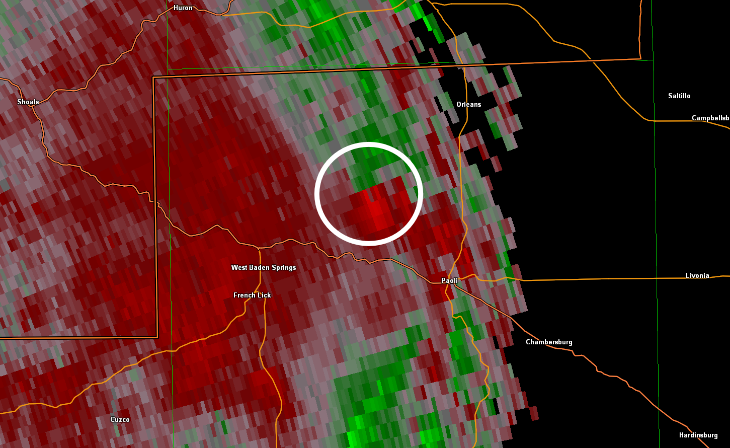
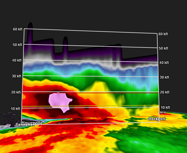
Radar
 |
 |
 |
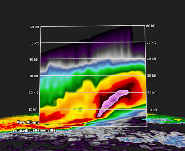 |
| Bowing line moving into Orange county as a tornado touches down east of West Baden Springs, IN | Storm Relative Velocity of the tornado as it moves into Orleans, IN | Hail Core over Hancock County, which produced up to 2 inch hail | Hail Core over southern Indiana that brought up to 2 inch hail |
Rain Reports
48-hour rainfall totals across the region. This lead to some minor areal flooding and river flooding.
-RainfallAnalysisPublic.png)
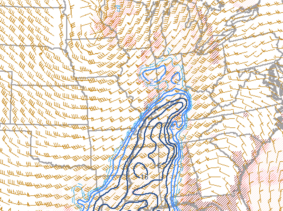
Environment
Synoptic Maps at 8Z
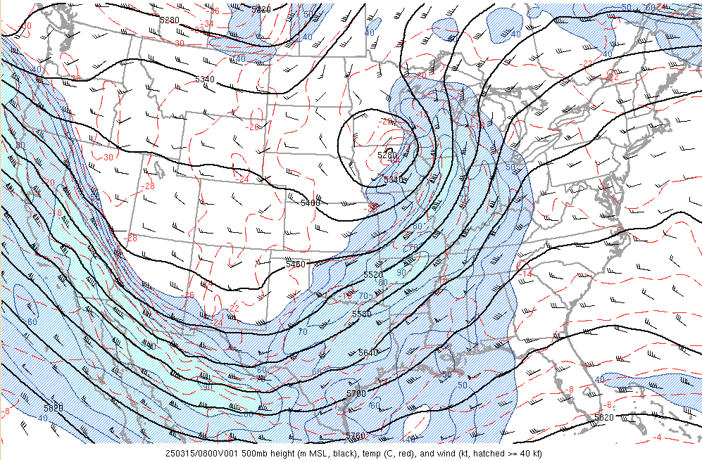 |
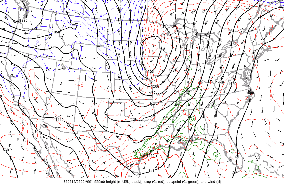 |
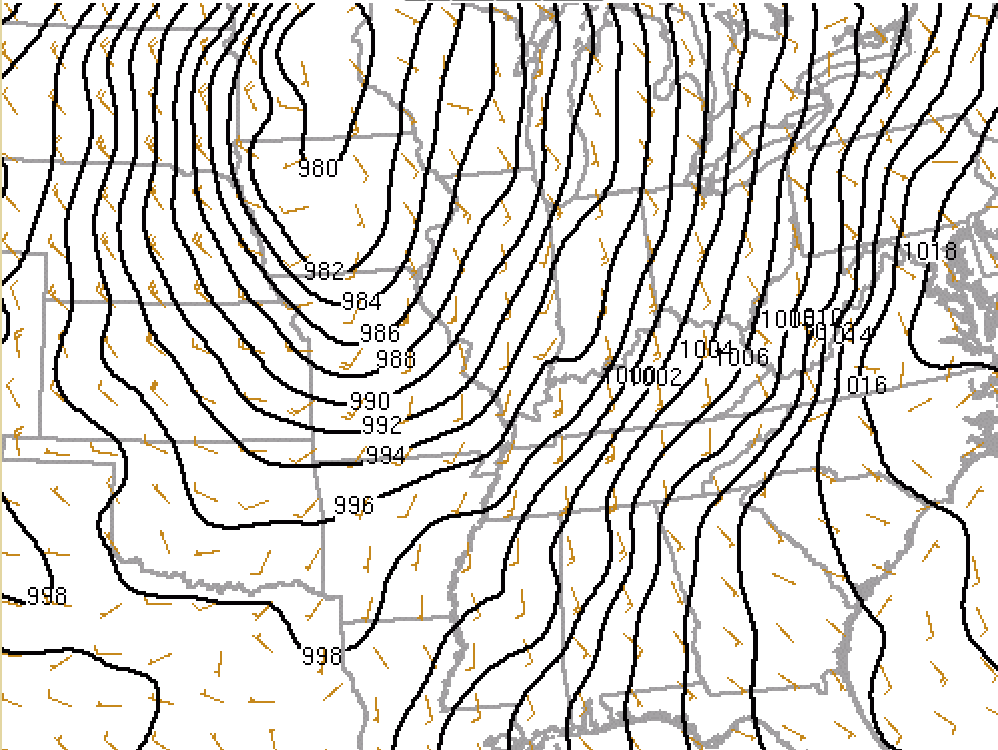 |
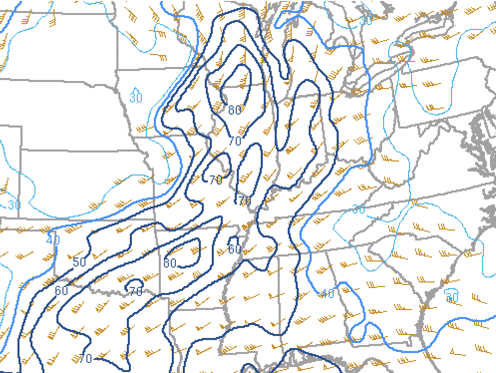
| Figure 7: 500mb | Figure 8: 850mb | Figure 9: Surface |
8Z Environment Maps for the Orange County Tornado
 |
 |
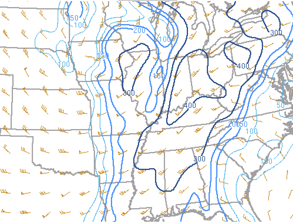 |
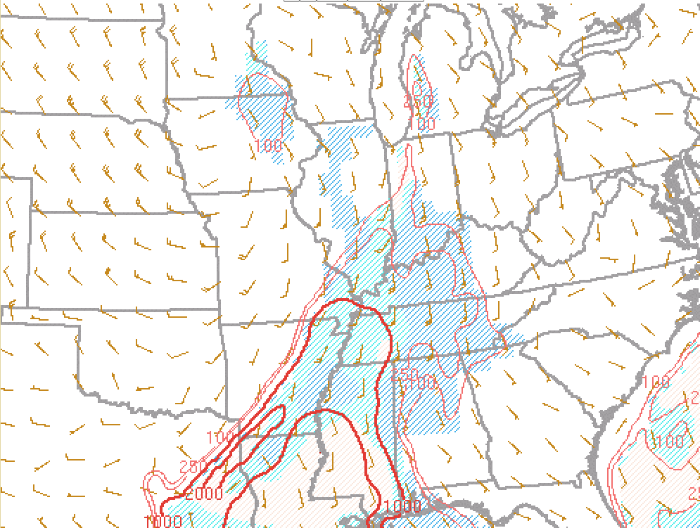
| Figure 1: 0-6km Shear | Figure 2: Surface based CAPE and CIN | Figure 3: 0-1km Storm Relative Helicity |
 |
 |
 |
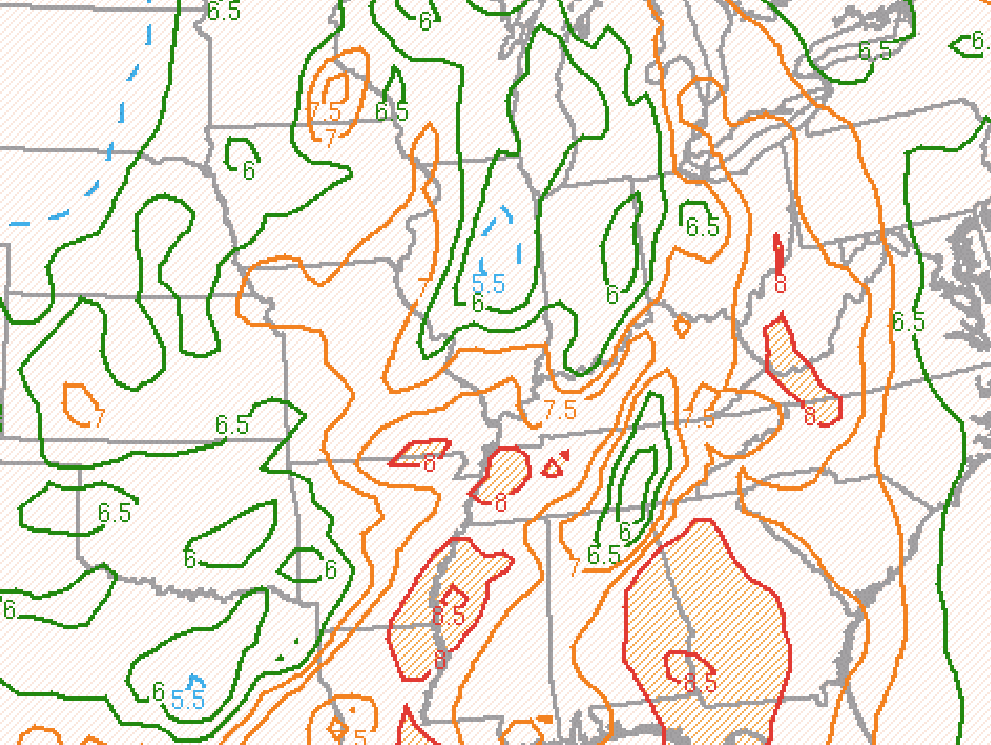
| Figure 4: Mid-level lapse rates | Figure 5: Supercell Composite Parameter | Figure 6: Significant Hail Parameter |
 |
Media use of NWS Web News Stories is encouraged! Please acknowledge the NWS as the source of any news information accessed from this site. |
|


.jpg)
 Weather Story
 Weather Map
 Local Radar