Louisville, KY
Weather Forecast Office
Although the Great Flood of 1937 gets most of the attention, and perhaps deservedly so, the flood that beset the Ohio River Valley eight years later was also extremely damaging. While 1937 is the flood of record at Louisville, 1945 is in second place (albeit a distant 2nd), with a peak stage at Louisville of 74.4 feet. This stage is about eleven feet below the 1937 stage, and ties with the stage set during the devastating 1884 flood.
| 1937 Stage | Rank | 1945 Stage | Rank | 1884 Stage | Rank | |
| Clifty Creek | 475.9 | 1 | 464.0 | 3 | 464.3 | 2 |
| McAlpine Upper | 52.15 | 1 | 42.1 | 2 | 41.7 | 3 |
| McAlpine Lower | 85.44 | 1 | 74.4 | 2 (tie) | 74.4 | 2 (tie)* |
| Cannelton | 60.8 | 1 | 54.4 | 2 | N/A** | N/A** |
| Tell City | 56.95 | 1 | 52.0 | 3 | 50.8 | 4*** |
* McAlpine Lower's 3rd highest stage is 73.46' set in 1964
** Cannelton's 3rd highest stage is 53.9' set in 1964
*** Tell City's 2nd highest stage is 53.0' set in 1964
As is almost always the case with massive Ohio River floods, snow melt had very little impact. The deepest snow cover at Louisville between New Year's Day and the flood was only 3 inches on the 29th of January, and that melted away in a few days. The bulk of the heavy rain that caused the flood fell during a three week period leading up to the flood. Rainfall during that time was over 500% of normal in southern Indiana, and around 400% of normal along the length of the Ohio River (see graphics below -- click on them for a larger image).
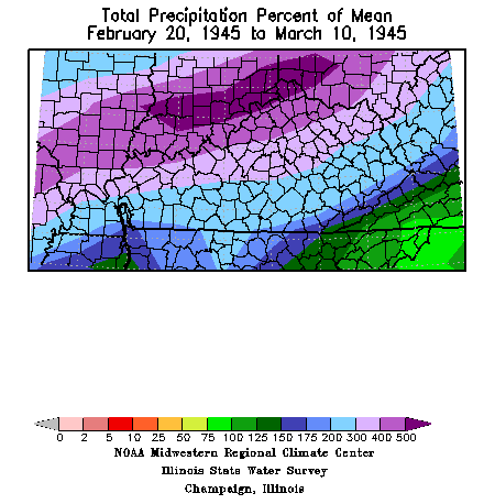 |
Kentucky/southern Indiana precipitation departure from normal. |
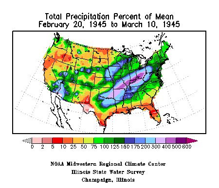 |
U.S. precipitation departure from normal. |
The rain came in four main waves, on February 20-21, February 25-26, March 1-2, and March 5-6. February 26 still stands as Louisville's 5th wettest February day on record (2.85"), and March 6 is the 10th wettest March day on record (2.66"). March 1945 is the 3rd wettest March on record, and February 1945 is actually only #19 on the list. However, instead of looking at calendar months, the period February 20 - March 8, 1945 is the second wettest such period on record at Louisville (1997 is #1).
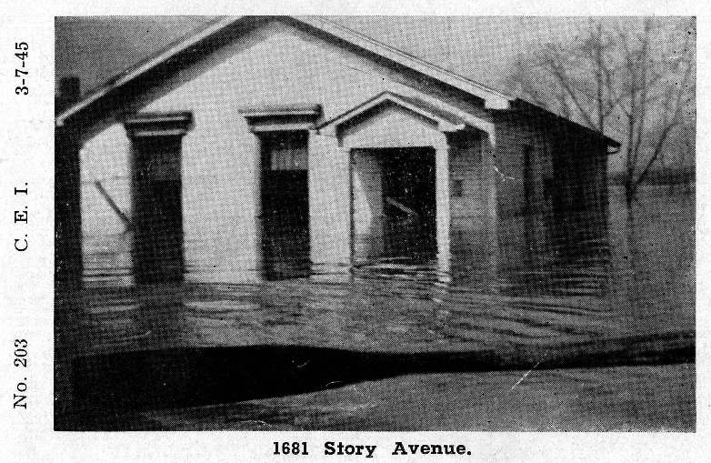
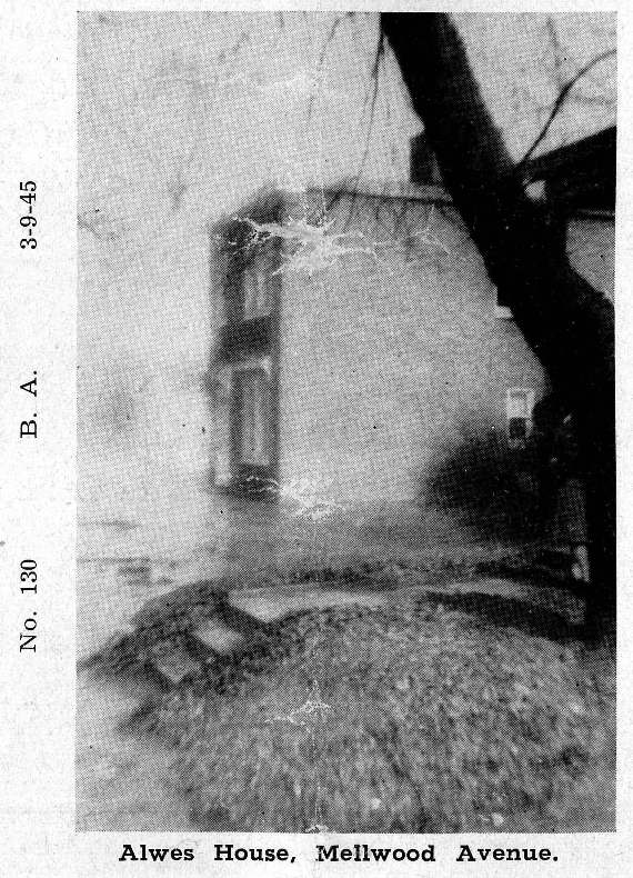
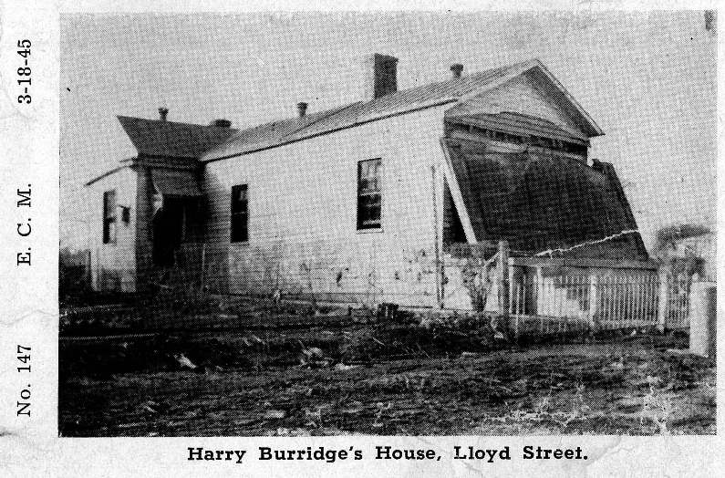
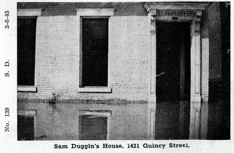
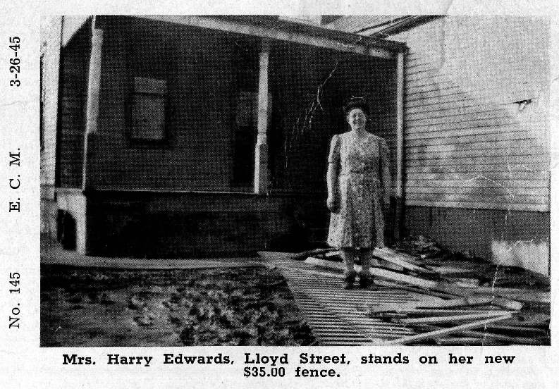
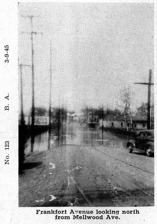
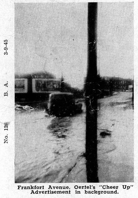
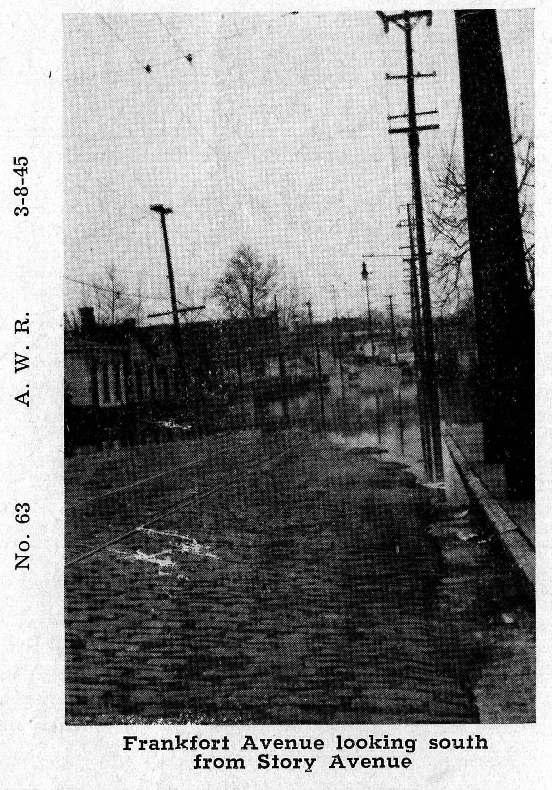
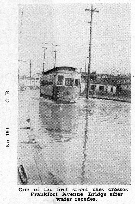
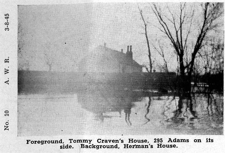
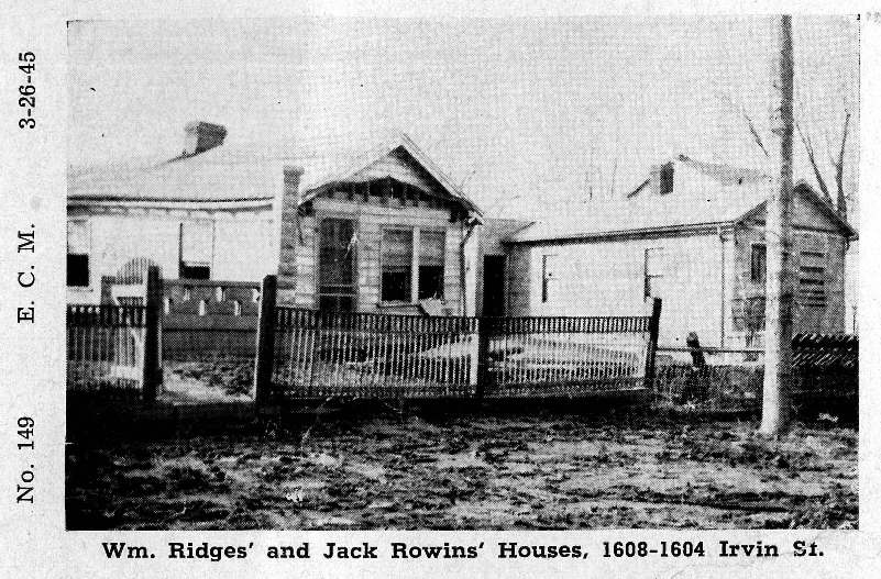
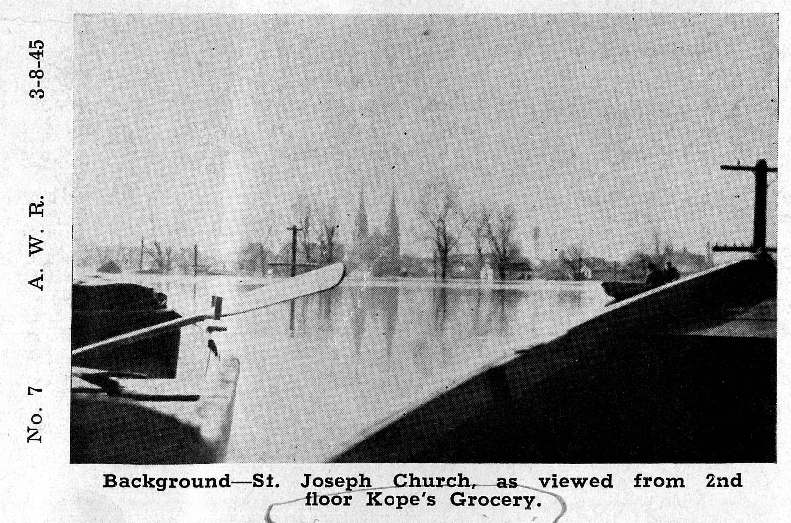
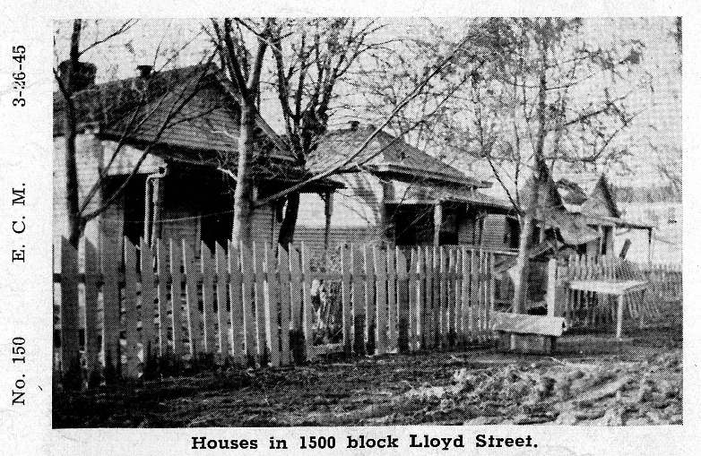
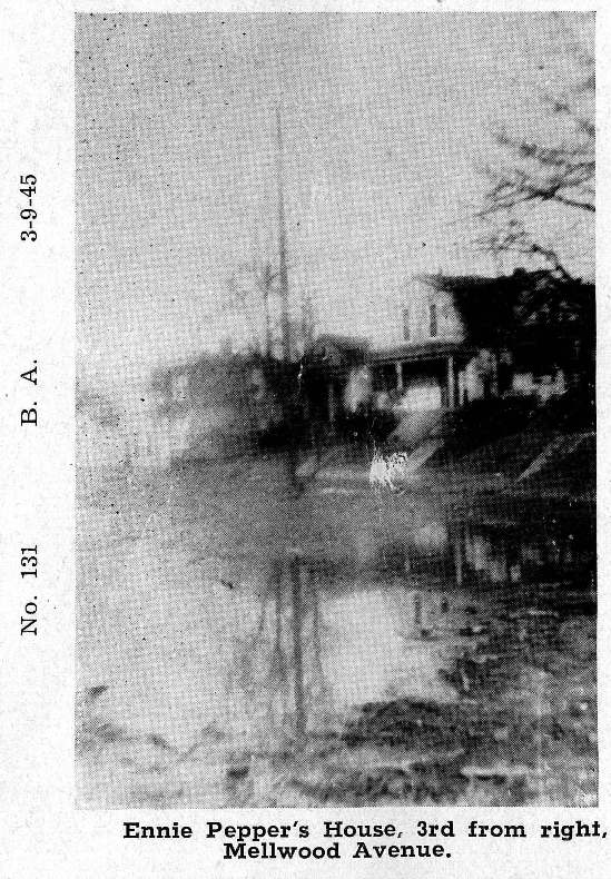
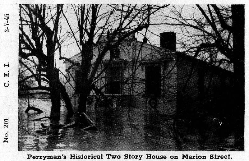
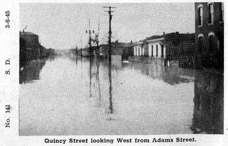
The following photos were taken in the Butchertown neighborhood in the vicinity of today's I-64/71 split.
 |
 |
 |
 |
 |
 |
 |
 |
 |
 |
 |
 |
 |
 |
 |
 |
Current Hazards
Hazardous Weather Outlook
Storm Prediction Center
Submit a Storm Report
Advisory/Warning Criteria
Radar
Fort Knox
Evansville
Fort Campbell
Nashville
Jackson
Wilmington
Latest Forecasts
El Nino and La Nina
Climate Prediction
Central U.S. Weather Stories
1-Stop Winter Forecast
Aviation
Spot Request
Air Quality
Fire Weather
Recreation Forecasts
1-Stop Drought
Event Ready
1-Stop Severe Forecast
Past Weather
Climate Graphs
1-Stop Climate
CoCoRaHS
Local Climate Pages
Tornado History
Past Derby/Oaks/Thunder Weather
Football Weather
Local Information
About the NWS
Forecast Discussion
Items of Interest
Spotter Training
Regional Weather Map
Decision Support Page
Text Products
Science and Technology
Outreach
LMK Warning Area
About Our Office
Station History
Hazardous Weather Outlook
Local Climate Page
Tornado Machine Plans
Weather Enterprise Resources
US Dept of Commerce
National Oceanic and Atmospheric Administration
National Weather Service
Louisville, KY
6201 Theiler Lane
Louisville, KY 40229-1476
502-969-8842
Comments? Questions? Please Contact Us.


 Weather Story
 Weather Map
 Local Radar