Louisville, KY
Weather Forecast Office
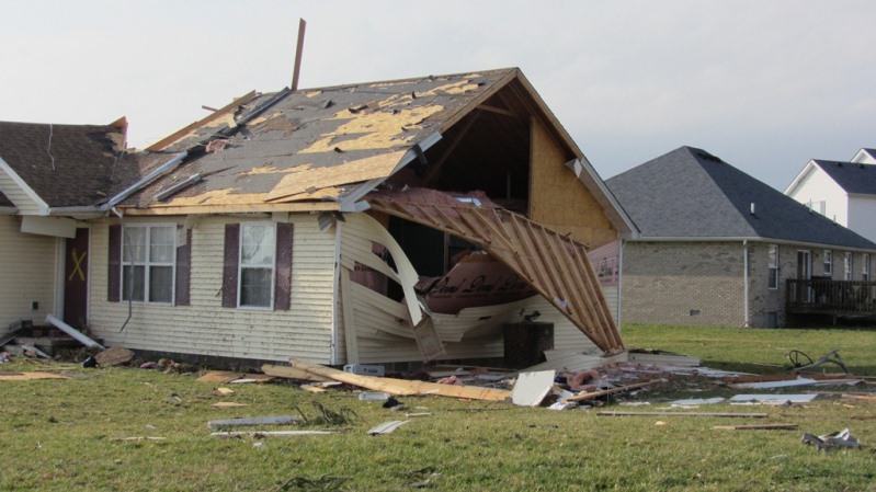
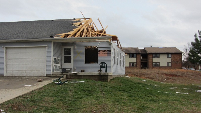
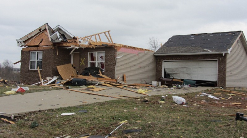
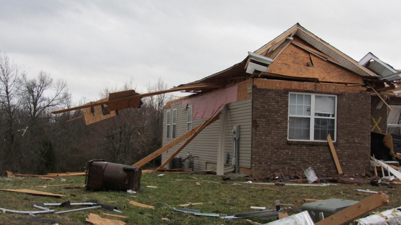
Strength: EF-2
Wind Speed: 125 MPH
Path Length: 1.7 miles
Path Width: 200 yards
Estimated touchdown/ending time: 11:05 AM EST - 11:13 AM EST
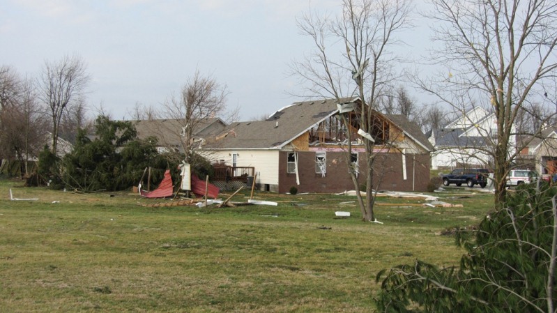
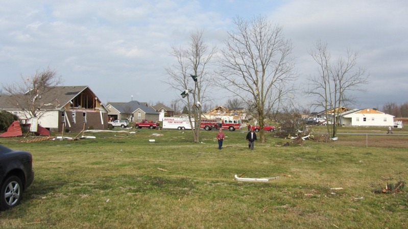
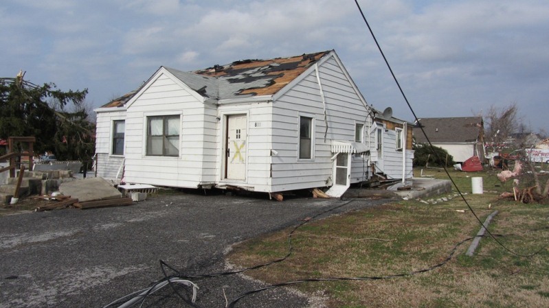
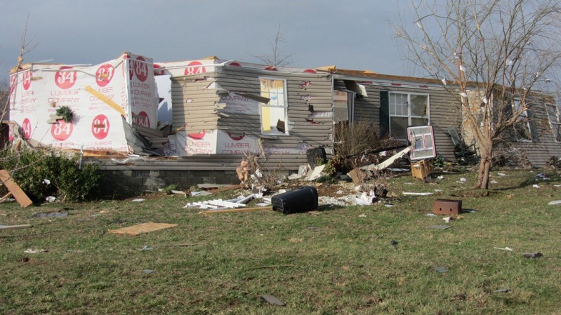
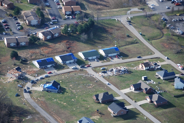
A National Weather Service Survey Team in conjunction with LaRue County EMA determined a tornado began near Kyle Lane which is 2 miles west of Hodgenville. It began as a very narrow 80 yard wide tornado mainly near tree top level. It did some minor roof and shingle damage, uprooted some cedar trees, and damaged fencing. The tornado crossed Tanner Road and lifted just west of downtown Hodgenville. The tornado was rated an EF1 at this location. The length of this touchdown was .9 mile. The same tornado once again touched down on the east side of Main Street at the State Farm Insurance agency and Citizens Union Bank. This tornado touchdown was much stronger. Two cars moved several feet and were turned 45 degrees with one on top of the other in the State Farm parking lot. The tornado increased in width to 200 yards on Woebegona Way significantly damaging several homes. This included large sections of roof structure being removed and exterior walls collapsing at 202 Woebegona Way. It went into a wooded area narrowing in Miami Court to about 75 yards and becoming more elevated. It damaged many roofs with the heaviest damage at a day care center in a residential home off Miami Court. The twister knocked down many power lines and twisted and snapped trees and did roof damage to several homes and then crossed Highway 210. Next it snapped and uprooted trees and did roof damage to a couple of homes before lifting 200 yards downwind. The length of this touchdown was .8 mile.
NWS storm survey pictures of damage in LaRue County:
 |
 |
 |
 |
 |
 |
 |
 |
 |
 |
 |
|
Aerial photo of damage in LaRue County, courtesy Paul Osborne of Kentucky Volunteer Aviators:
Current Hazards
Hazardous Weather Outlook
Storm Prediction Center
Submit a Storm Report
Advisory/Warning Criteria
Radar
Fort Knox
Evansville
Fort Campbell
Nashville
Jackson
Wilmington
Latest Forecasts
El Nino and La Nina
Climate Prediction
Central U.S. Weather Stories
1-Stop Winter Forecast
Aviation
Spot Request
Air Quality
Fire Weather
Recreation Forecasts
1-Stop Drought
Event Ready
1-Stop Severe Forecast
Past Weather
Climate Graphs
1-Stop Climate
CoCoRaHS
Local Climate Pages
Tornado History
Past Derby/Oaks/Thunder Weather
Football Weather
Local Information
About the NWS
Forecast Discussion
Items of Interest
Spotter Training
Regional Weather Map
Decision Support Page
Text Products
Science and Technology
Outreach
LMK Warning Area
About Our Office
Station History
Hazardous Weather Outlook
Local Climate Page
Tornado Machine Plans
Weather Enterprise Resources
US Dept of Commerce
National Oceanic and Atmospheric Administration
National Weather Service
Louisville, KY
6201 Theiler Lane
Louisville, KY 40229-1476
502-969-8842
Comments? Questions? Please Contact Us.


 Weather Story
 Weather Map
 Local Radar