Northern Indiana
Weather Forecast Office
This page contains pictures of flooding and high water.
(Click here for pictures of flash flooding in Cass and Miami counties in Indiana from July 4-6, 2003)
and for pictures of river flooding in Decatur, Pleasant Mills, Geneva and Willshire from July 4-6, 2003
(Click here for pictures of the Defiance/Paulding Flood of June 17, 2003)
(Click here for pictures of flooding along the Elkhart River in Goshen May 16, 2002)
 |
Flash flooding in Woodburn, Indiana August 1, 2003. Photo courtesy Ryan Chandler. |
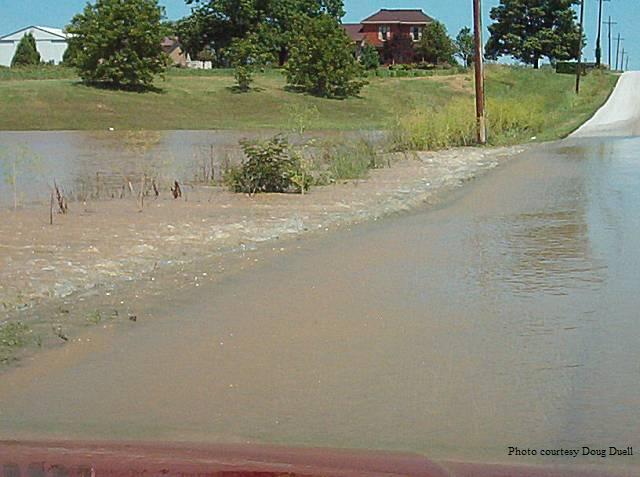 |
Flooding of Paw Paw Creek at 600W (near Roann) July 5, 2003, in Wabash County, Indiana. Photo courtesy Doug Duell. |
 |
Blanchard River flooding in Ottawa, Ohio, on May 10, 2003, at 9:30am. Photo courtesy Chad Wright. |
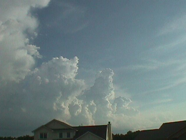 |
Northern edge of the local storm system responsible for the phenomenal flash flooding in Fort Wayne on June 26, 2002. |
 |
Northern edge of the local storm system responsible for the phenomenal flash flooding in Fort Wayne on June 26, 2002. |
 |
Map showing radar-estimated rainfall totals from the June 26, 2002 flash flood in Fort Wayne. It is easy to see how the storms repeatedly regenerated directly over the city and did not move much. While downtown and the west side received as much as eight inches of rain, the southwest corner of Allen County got almost nothing. |
 |
Graph showing how the Spy Run Creek water level shot up from around 3 feet to a new record crest of 12.3 feet in eight hours. (Old record was 10.7 feet). June 26, 2002 in Fort Wayne. |
 |
Flooding near Liberty Mills, Indiana July 24, 1997 |
 |
Highway 105 under water in Whitley County July, 1997 |
 |
Eel River at Collamer dam in Whitley County. January, 1998 |
 |
Eel River, June 1998 |
 |
Eel River, June 1998 |
 |
Eel River, June 1998. |
 |
Eel River, June 1998. |
 |
Flooding near Roann, Indiana in June 1998. |
 |
Wabash River in Geneva, Indiana, July 1998 |
 |
Wabash River in Bluffton, Indiana, July 1998 |
 |
Fish Creek near Hamilton Lake, February 2001 |
 |
St. Joseph River flooding near Newville, Indiana, February 2001 |
 |
The Saint Mary's River in Fort Wayne at the corner of Tillman and Lower Huntington roads during the record flooding in March 1982. |
Select Another picture page
|
Tornado / Lightning, Wind, and Hail / Winter/ Flooding / Clouds and Sun / History / Main |
Hazards
Heat Related
Watch/Warning
Outlook
Storm Prediction Center
Storm Reports
Submit a Report
Outdoor Event Watcher
EM Briefing
Current Conditions
Hourly Weather
Surface Observations
Regional Temps/Precip
Precip Reports
Satellite
Climate
CoCoRaHS
FWA Daily
SBN Daily
FWA Monthly
SBN Monthly
Cliplot
Spring Frost Climatology
Fall Frost Climatology
Severe Climatology
Tornado Climatology
Local Information
Public Information Statement
Probabilistic Snowfall
Storm Data
Skywarn
COOP
Our Office
WSR-88D
Headline Criteria
NOAA Weather Radio
Weather History
Social Media Feeds
Weather Events Page
US Dept of Commerce
National Oceanic and Atmospheric Administration
National Weather Service
Northern Indiana
7506 E 850 N
Syracuse, IN 46567
574-834-1104
Comments? Questions? Please Contact Us.

