A stationary front will continue to bring heavy to excessive rainfall to South Florida into Saturday with localized and urban flooding possible. Heavy to excessive rainfall is forecast through Saturday over the southern Rockies into the northern Plains. Instances of flash flooding are possible, especially in higher terrain and burn scars. Read More >
Hawaiʻi > Hawaiʻi Tsunamis
|
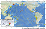
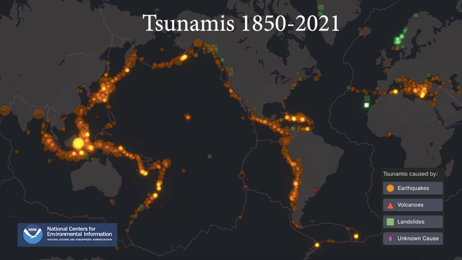
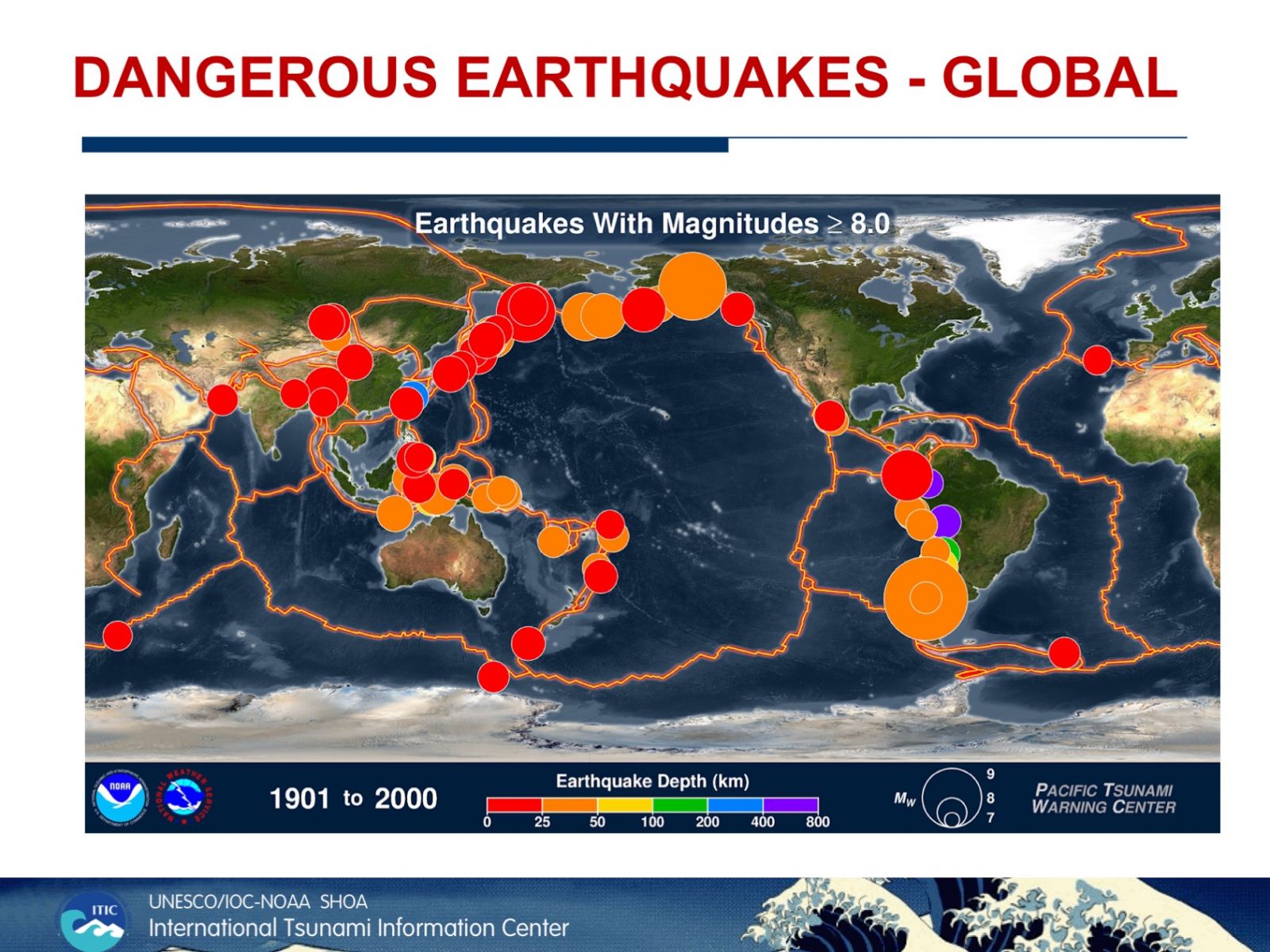
Hawaiʻi is one of the most unique locations in the world for studying tsunami effects. Not only are there large local tsunami sources, but Hawaiʻi is also in the crosshairs of distant tsunamis generated along the Pacific Ring of Fire, 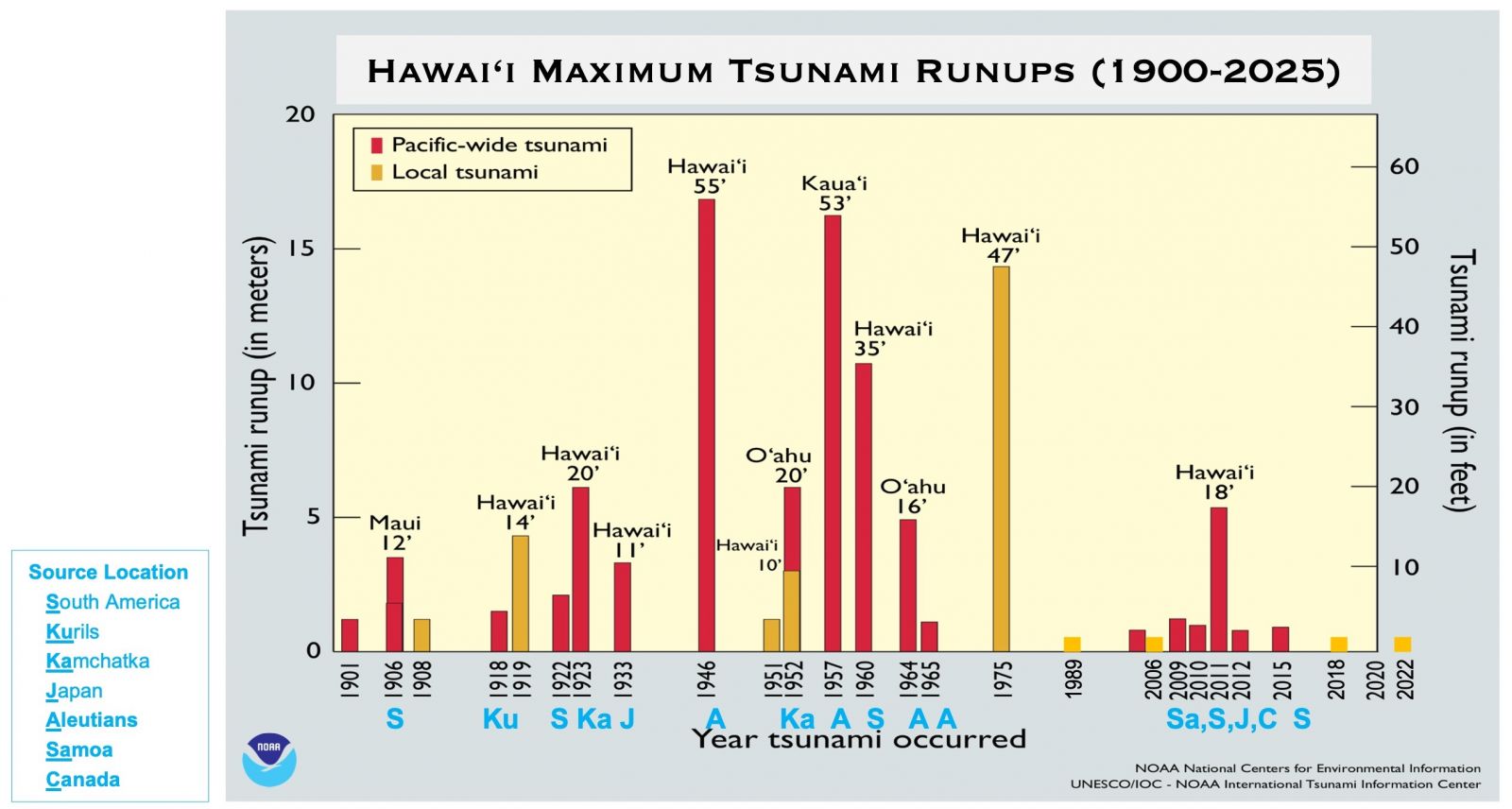 notably from South America (18%), Kamchatka and Kuril Islands (15%), West Coast of North and Central America (13%), Alaska and Aleutian Islands (14%), and South Pacific Islands and New Zealand (12%).
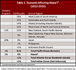
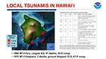
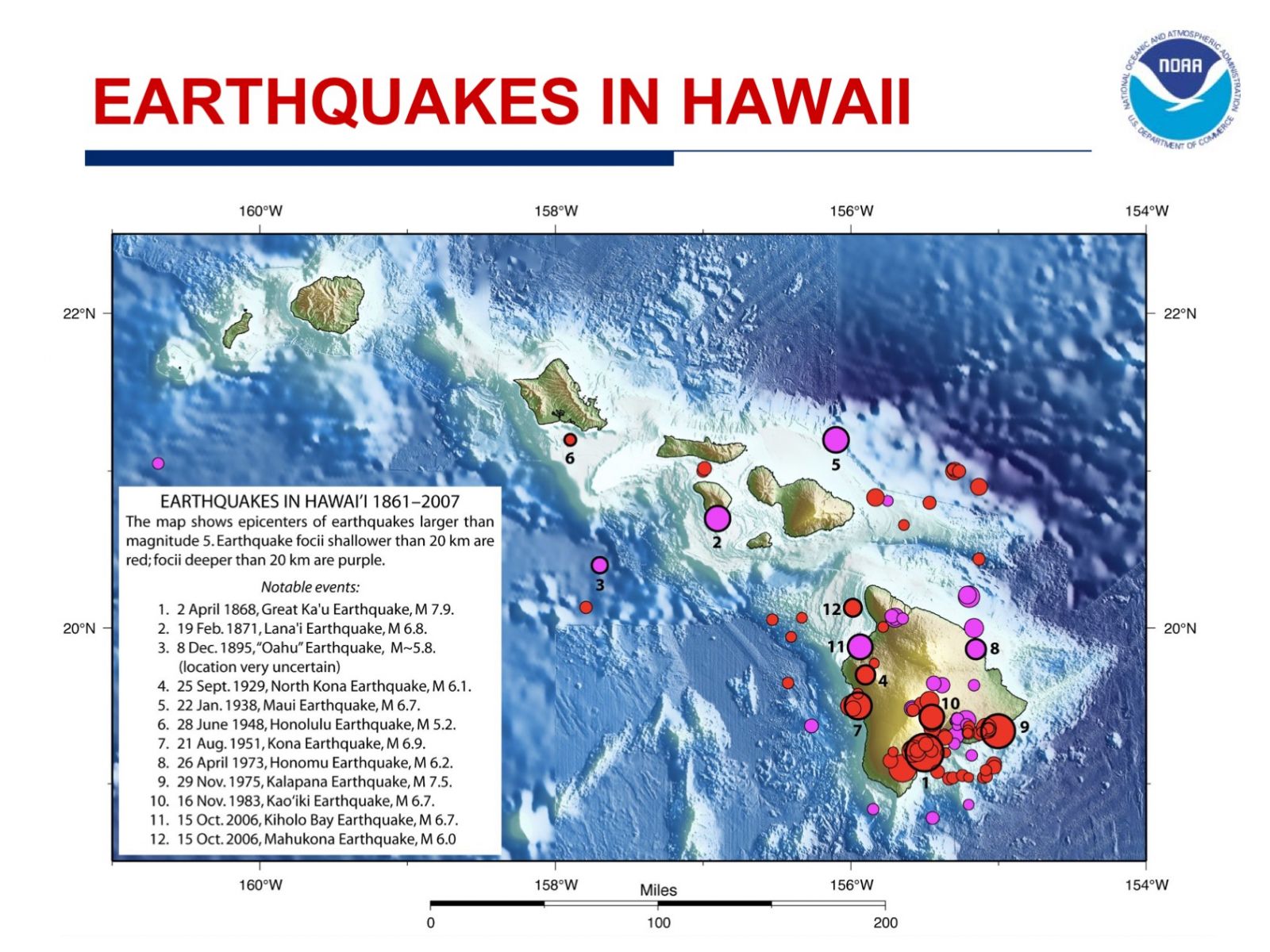
The earliest historical account of a Hawaiʻi tsunami was from a 16th century Hawaiian chant that described a huge wave that struck the coast of Moloka‘i. The earliest confirmed tsunami was on Dec 21, 1812, when a wave from Southern California was observed at Ho‘okena on the west coast of the Big Island (Hawaiʻi island). Maximum runups in excess of 15 m were measured for the 1946 and 1957 distant tsunamis and the 1975 local tsunami.
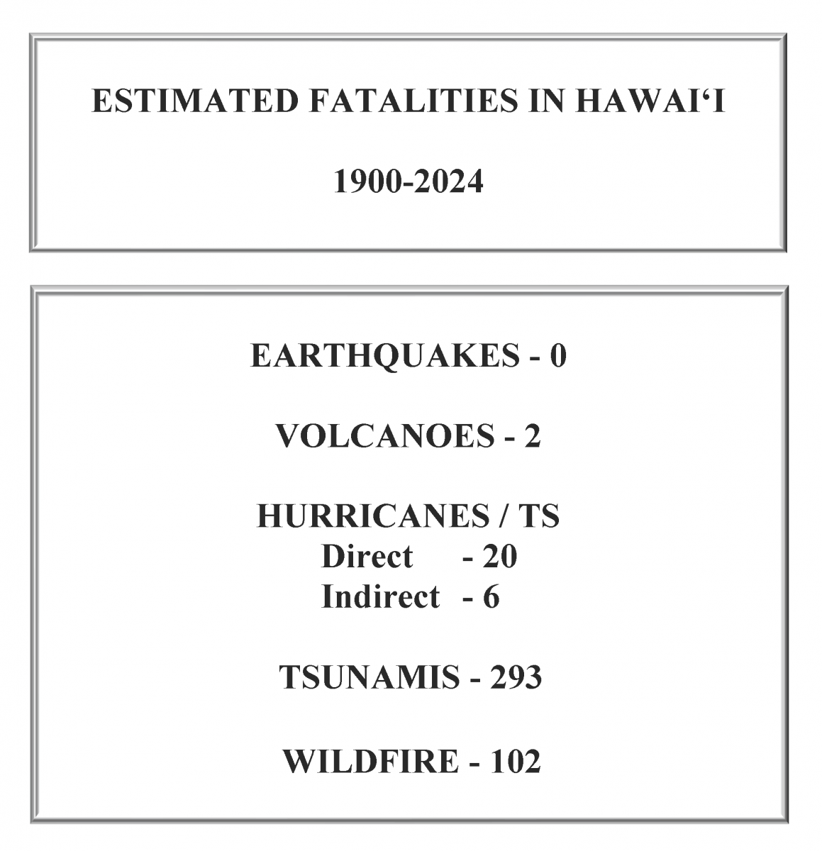
Since 1812, there have been more than 160 confirmed tsunamis. Nine tsunamis caused 293 deaths and damage totaling over USD $625 million (2022 dollars), with 86% of the fatalities on Hawaiʻi island (60% in Hilo). 245 of the 293 deaths were from distant tsunami sources.
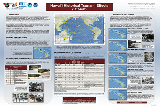 Hawaiʻi Historical Tsunami Effects 1812-2022 Hawaiʻi Historical Tsunami Effects 1812-2022 |
|
|
Tsunamis affecting Hawaiʻi (NCEI, ITIC, 2015, 2022) |
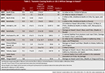
Tsunami Deaths and Damage 1812-2022 |
|
|
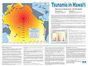
Tsunamis in Hawaiʻi |
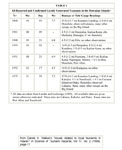
Reported and Confirmed Locally Generated Tsunamis in Hawaiʻi |
|
Fatalities in Hawaiʻi from Earthquakes, Volcanoes, Hurricanes, Tsunami & Wildfire |
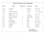
Hawaiʻi‘s Worst Natural Disasters (dates / cost / fatalities) |
|
|
|
Earthquakes Global, M6.5or greater |
|