National Weather Service United States Department of Commerce

Active Weather for the West, Warming in the East

The potential for heavy snow at higher elevations in the western U.S. will continue for many spots through the weekend. In the meantime, the eastern half of the continental U.S. will transition to above normal temperatures ahead of a pair of cold fronts next week that will bring readings back to closer to normal as we approach Thanksgiving Day. Read More >

Click a location below for detailed forecast.

Last Map Update: Sun, Nov 24, 2024 at 6:06:24 pm CST

A cold front will bring much colder temperatures Monday morning. Combined with breezy winds, wind chills will fall into the 20s in northwest Oklahoma to the 30s and 40s across much of central and southern Oklahoma and western north Texas.
Many locations across central/southern Oklahoma and western north Texas will see their first freeze of the season this week. This will be several weeks past our average first freeze of the season in many areas.
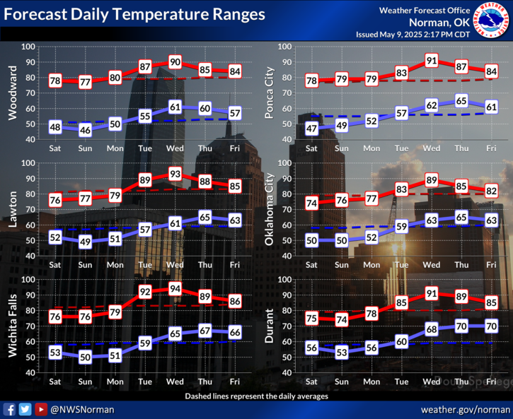
Much cooler air arrives Monday. Temperatures through the week will generally be at or below normal, with a brief warm day midweek.

 Current Weather Observations...
Location Time
(CST)
Weather Vsby.
(SM)
Temp.
(ºF)
Dewpt.
(ºF)
Hum.
(%)
Wind
(mph)
Wind Chill / Heat Index
(ºF)
Pres.
(in)
Oklahoma City, OK17:52Mostly Clear10674952SSW 14-29.72
Norman, OK17:45Clear10665159S 10-29.71
Stillwater, OK17:53Clear10684950SW 6-29.70
Lawton, OK17:53Clear10665260ESE 6-29.73
Wichita Falls, TX17:52Clear10745449SSW 16-29.74
Ponca City, OK17:53Clear10644855S 3-29.69
Enid, OK16:55Clear10694745S 8-29.64
Alva, OK17:35Clear10594662NE 10-29.69
Woodward, OK17:15Clear10623739NNE 7-29.73
Gage, OK21:53Clear10563952S 26G38-29.80
Watonga, OK17:35Clear10654446SSE 5-29.72
Clinton, OK17:53Clear10644651S 14-29.71
Weatherford, OK17:15Clear10704540SSW 10-29.71
Altus, OK15:35Clear9784429SSW 17G24-29.67
Frederick, OK17:53Clear10695050SSW 12-29.69
Ardmore, OK17:15Clear10735756S 13-29.74
Ada, OK17:15Clear10735960S 8-29.74

Local Weather History For November 24th...
On November 24th, 2013, snow and sleet affected western and central
Oklahoma. A band of accumulations over four inches stretched from
near Hollis to just north of Lawton, with a maximum of thirteen
inches near Vinson. A mixture of snow and sleet resulted in
accumulations of almost two inches as far east as Oklahoma City.

Text Product Selector (Selected product opens in current window)
Weather Observations Area Forecast Discussion Air Quality Forecasts Hydrology Information Frequently Asked Questions Social Media
Observations Discussion Air Quality Hydrology FAQ Social Media
 
Submit a Storm Report Graphical Weather Forecasts Aviation Weather Forecasts Climate Data Storm Data Weather Radio Information
Storm Reports Gridded Forecast Aviation Climate Storm Data Weather Radio  
 
Satellite Information Hourly Weather Forecast Fire Weather Information Past Weather Events StormReady Skywarn/Storm Spotters
Satellite Hourly Forecast Fire Weather Past Events StormReady Storm Spotters