NWS Birmingham, Alabama
Weather Forecast Office

Below are data and images of Hurricane Georges as it approached and moved over parts of the Northern Gulf of America and some of its effects on the state of Alabama and the Florida Panhandle during late September of 1998.
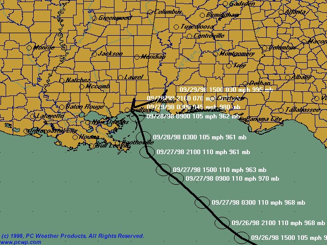
| Track of Hurricane Georges |
Images below include the gage rainfall totals and rainfall totals analysis associated with Hurricane Georges.

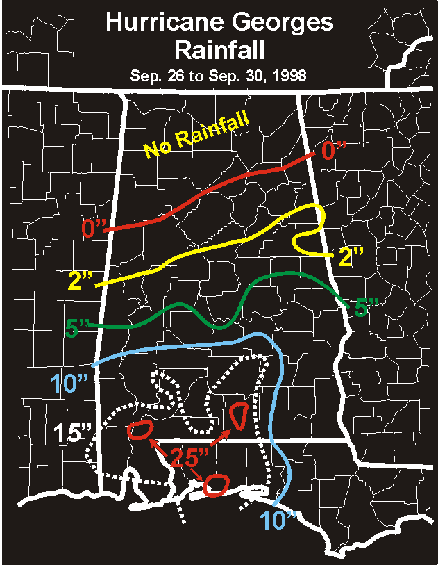
| Rainfall Plot associated with Hurricane Georges | Analyzed Rainfall Totals from Hurricane Georges |
Images below include 3 groups of pictures: First, infared (IR) satellite images are overlaid with surface, buoy, and CMAN observation reports. Second, surface maps are overlaid with sea level pressure analysis. Lastly, radar display is from KMOB (Mobile, AL). All data is from just before and after landfall on Monday, September 28th.

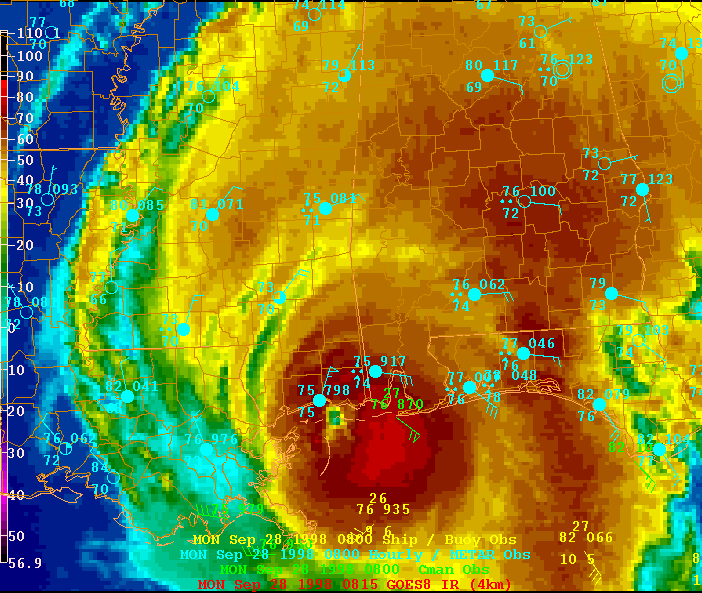
| IR Image from 09/28/1998 at 2 AM CDT/7 UTC | IR Image from 09/28/1998 at 3 AM CDT/8 UTC |


| IR Image from 09/28/1998 at 4 AM CDT/9 UTC | IR Image from 09/28/1998 at 5 AM CDT/10 UTC |
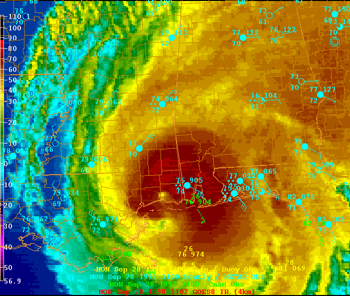

| IR Image from 09/28/1998 at 6 AM CDT/11 UTC | IR Image from 09/28/1998 at 7 AM CDT/12 UTC |
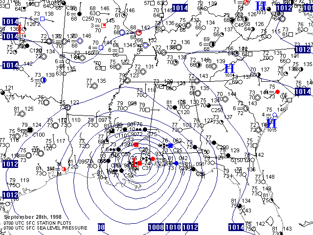

| Surface Map from 09/28/1998 at 2 AM CDT/7 UTC | Surface Map from 09/28/1998 at 3 AM CDT/8 UTC |


| Surface Map from 09/28/1998 at 4 AM CDT/9 UTC | Surface Map from 09/28/1998 at 5 AM CDT/10 UTC |
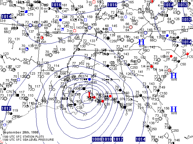
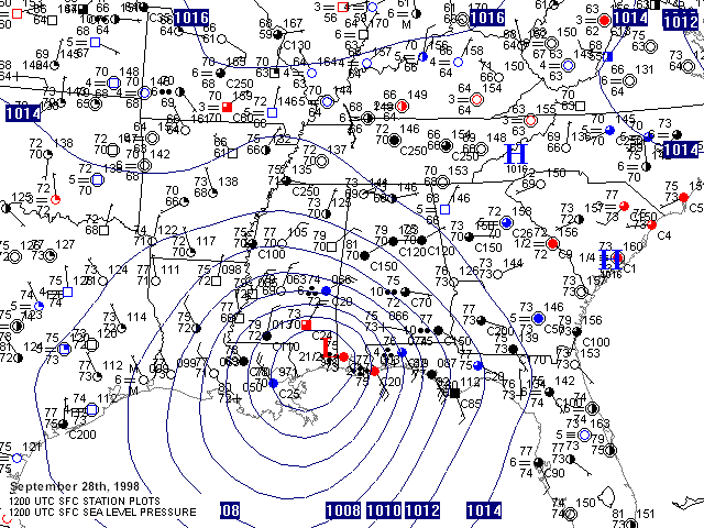
| Surface Map from 09/28/1998 at 6 AM CDT/11 UTC | Surface Map from 09/28/1998 at 7 AM CDT/12 UTC |

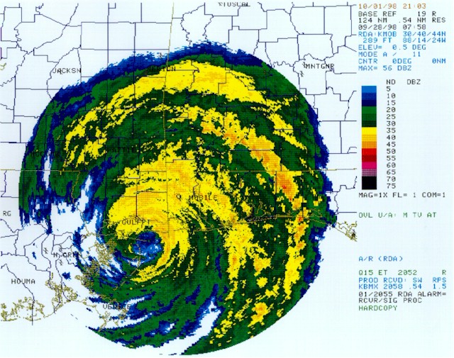
| KMOB Radar Image from 09/28/1998 at 2 AM CDT/7 UTC | KMOB Radar Image from 09/28/1998 at 3 AM CDT/8 UTC |
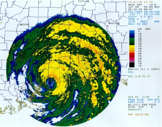

| KMOB Radar Image from 09/28/1998 at 4 AM CDT/9 UTC | KMOB Radar Image from 09/28/1998 at 5 AM CDT/10 UTC |
The following links are to post event reports, areal photos, and various rainfall maps from the event:
Current Hazards
National Outlooks
Tropical
Local Storm Reports
Public Information Statement
Graphical Hazardous Weather Outlook
Current Conditions
Regional Weather Roundup
Rivers and Lakes
Drought Monitor
Forecasts
Aviation Weather
Graphical Forecasts
Forecast Discussion
Air Quality
Fire Weather
Climate and Past Weather
Past Events
Storm Data
Tornado Database
Daily Rainfall Plots
Tropical Cyclone Reports
Warnings and Other Products
Tornado Warnings
Severe Thunderstorm Warnings
Flash Flood Warnings
Winter Weather Warnings
Special Weather Statements
Non-Precipitation Warnings
Flood/River Flood Warnings
Productos en Español
Conciencia y Preparación
Previsión de 7 Días
Weather Safety
NOAA Weather Radio
Severe Weather Preparedness
Severe Safety Rules
Tornado Safety Rules
Severe Safety w/ ASL
Awareness Weeks
Severe Weather
Hurricane Preparedness
Summer Safety Campaign
Winter Weather
US Dept of Commerce
National Oceanic and Atmospheric Administration
National Weather Service
NWS Birmingham, Alabama
465 Weathervane Road
Calera, AL 35040
205-664-3010
Comments? Questions? Please Contact Us.

