
Canadian wildfire smoke will push into the Midwest, worsening air quality. A frontal system brings severe storms from the Northern Plains to the Mid‑Atlantic the next few days. Heavy Gulf Coast rain is possible as we closely monitor tropical development, while monsoonal storms persist in the Southwest with heavy rainfall. Hazardous heat expands from the Plains into the Lower Mississippi Valley. Read More >
|
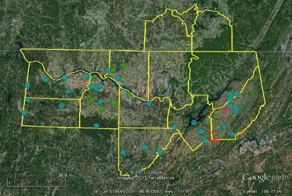
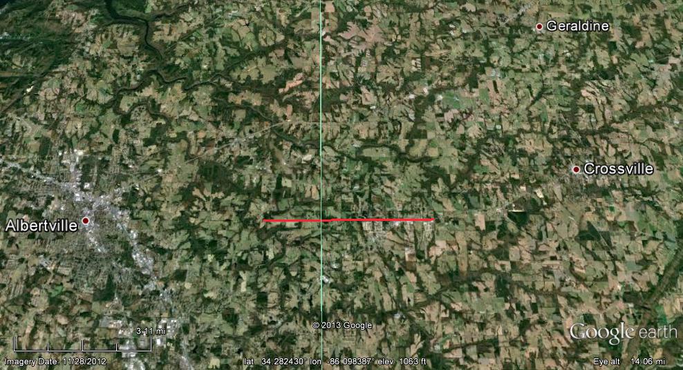
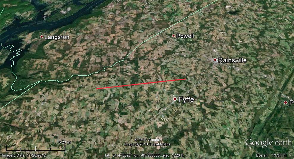
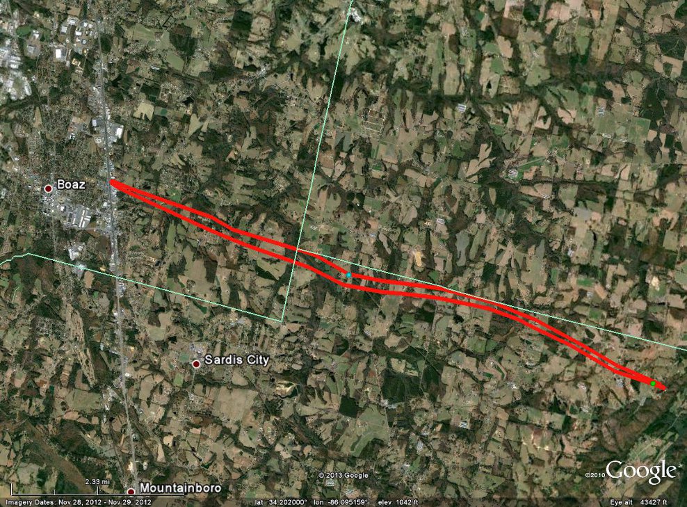
Summary: On March 18, 2013 showers and strong thunderstorms developed south of a frontal boundary that stretched from northern Tennessee west into northern Texas. Several disturbances moved along this frontal boundary during the day, producing several waves of thunderstorms, which became severe during the afternoon. During the morning, thunderstorms produced small hail and gusty winds across mainly northwest portions of Alabama. Around midday, surface heating (due to breaks in cloud cover) combined with an increase in dewpoint temperatures lead to an increase in instability across the region ahead of an impending cold front. As a result, a line of strong to severe thunderstorms developed during the early afternoon hours ahead of the front. Straight-line winds around 65-100 mph and large hail up to 1.5 inches in diameter were common with this line as it moved quickly across northern Alabama between 2 pm and 5 pm. The first tornado of the afternoon, an EF-0, formed northeast of the Leighton area with this line and tracked for approximately 1.6 miles. Storm surveys indicated that straight line winds reached 105 mph in the Fort Payne area during the mid-afternoon hours. As the line pushed into Marshall, Dekalb, and Jackson counties, enough low level shear was in place to produce two stronger EF-2 tornadoes. Click here for a summary of reports received during this event (this includes non-severe and severe reports). Below is a map of all tornado, severe hail and damaging wind reports received during the event. |
||||||||||||||||||||||||||||||||||||||||
 |
||||||||||||||||||||||||||||||||||||||||
|
Click below to see a larger image of the rotational signature associated with the tornadoes that affected Kilpatrick (bottom left) and Shiloh (bottom right). |
||||||||||||||||||||||||||||||||||||||||
|
||||||||||||||||||||||||||||||||||||||||
|
Tornado Surveys Completed (Click on the tornado locations below for detailed storm summary information and the EF-Scale for more detailed track information) |
||||||||||||||||||||||||||||||||||||||||
|
||||||||||||||||||||||||||||||||||||||||
|
Straight-Line Wind Damage Surveys Completed (If no link is present under Locations Affected column, not enough widespread damage was present to complete a survey write-up) |
||||||||||||||||||||||||||||||||||||||||
|


 Local Radar
 Weather Map
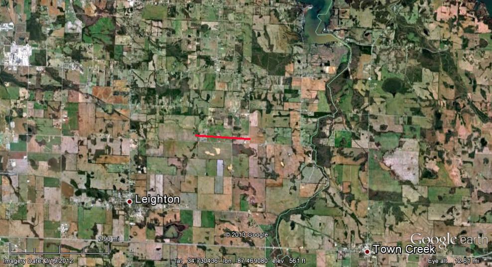