|
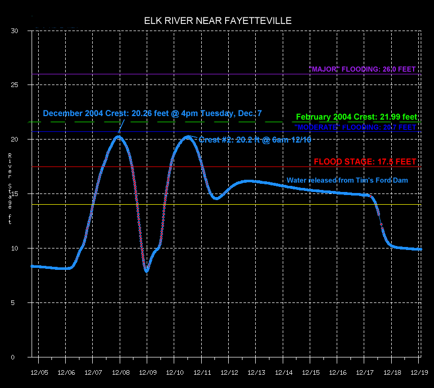
Between December 1 and December 9, 2004, much of the Tennessee Valley received between 8 and 10 inches of rainfall. When combined with a wet November, these heavy rain events caused creeks, streams, and rivers across the area to flood. The heaviest rain fell from December 5th through the 8th, with several locations receiving 6 to 7 inches of rain over the 3-day period (for comparison, 5.59 inches of rain is normal for the entire month of December at Huntsville airport!)
|
|
| Radar-derived precipitation estimates for December 1-9, 2004, courtesy the Lower Mississippi River Forecast Center (click to view a larger image). The darkest reds located in southeastern Franklin County, Alabama, correspond to 9-10 inches! Amounts along the Tennessee-Alabama line ranged from 6 to 8 inches. |
Public Information Statement - Issued on December 8 detailing rainfall totals and river stages from the 5th-8th flooding
| Pictures |
 |
|


 Local Radar
 Weather Map