
Prolonged and intense heat wave continues into Friday with relief expected by this weekend. Extreme Heat Warnings and Heat Advisories remain in effect for portions of the Ohio Valley and the Southeast. Unsettled weather could produce severe weather and excessive rainfall for parts of the Central and Eastern U.S. Read More >
|
|||||||||||||||||||||||||||||||||||||||||||||||||||||||||||||||||||||
| Mountain Rec Forecast Graphics
|
|||
|
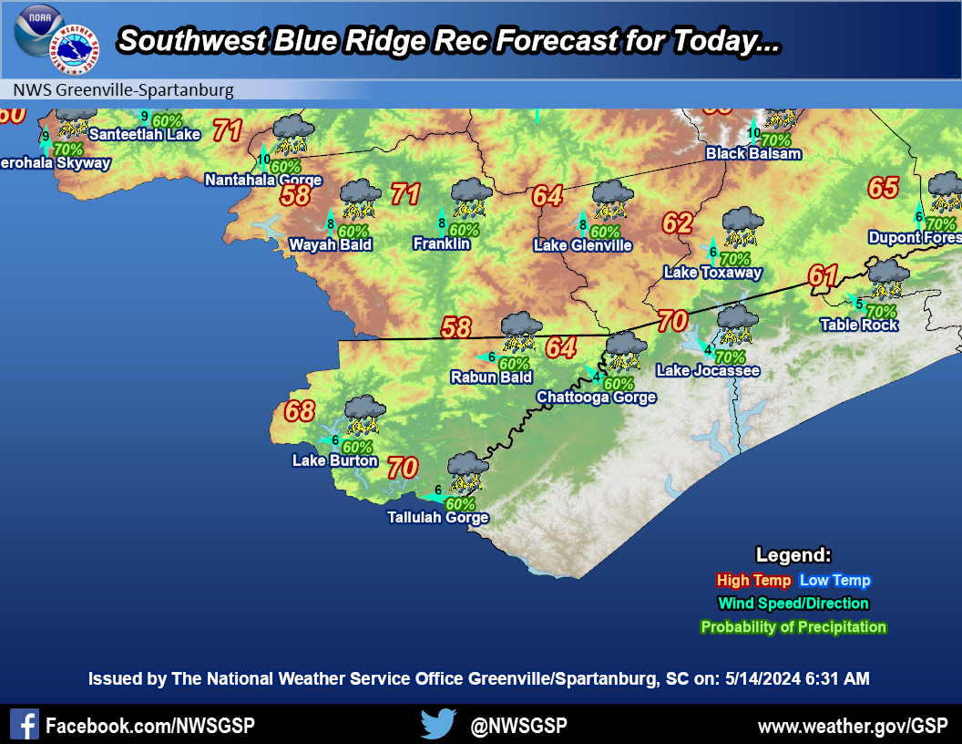
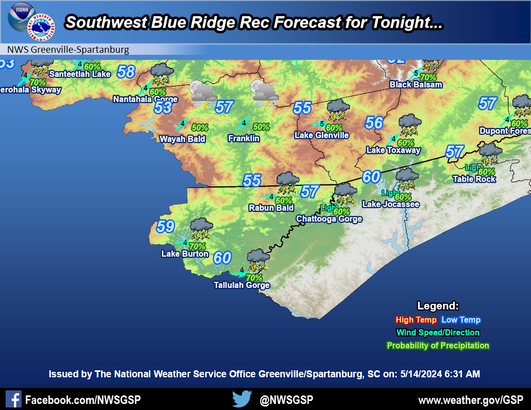
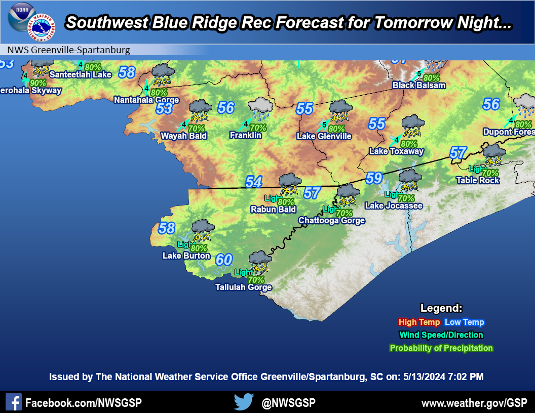
Southwest Blue Ridge
|
|||
|
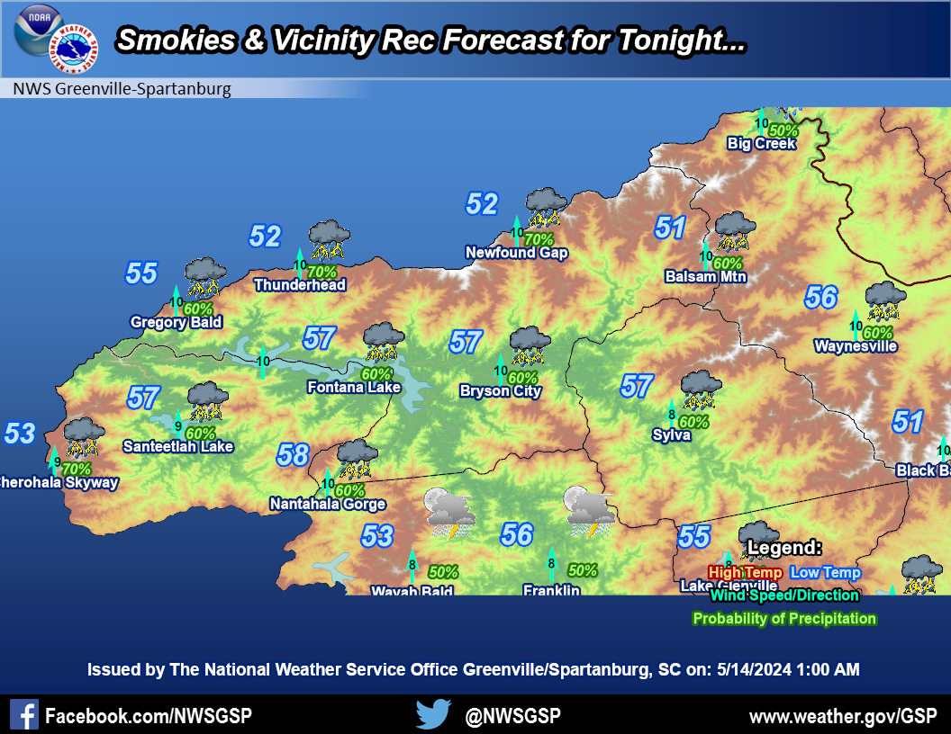
Smokies and Vicinity
|
|||
|
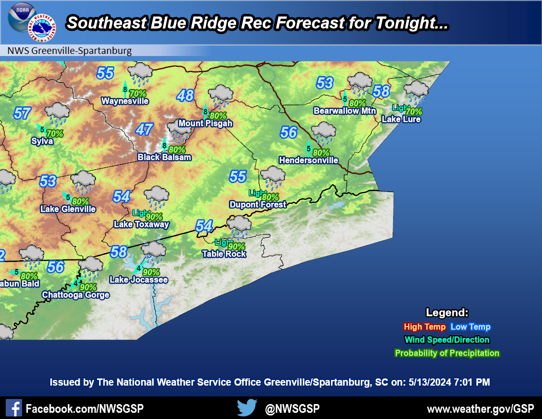
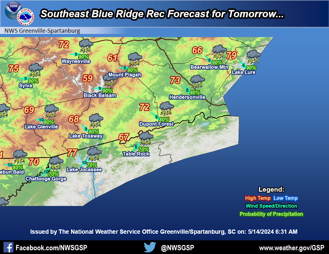
Southeast Blue Ridge
|
|||
|
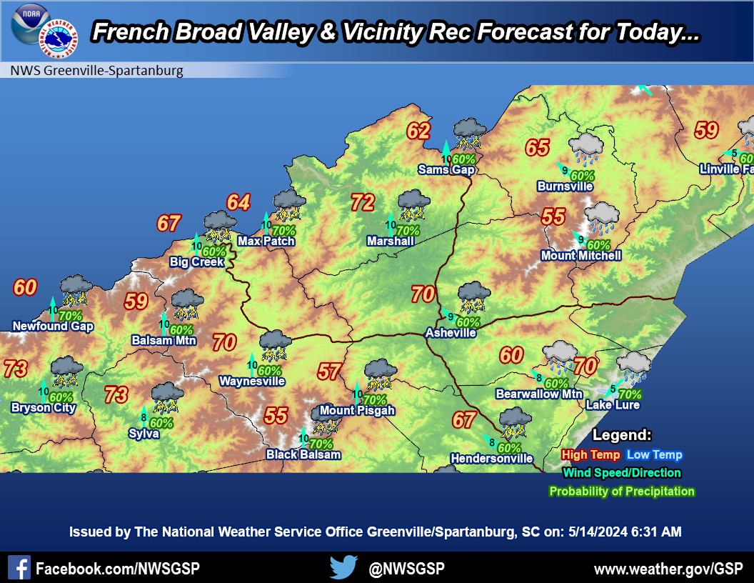
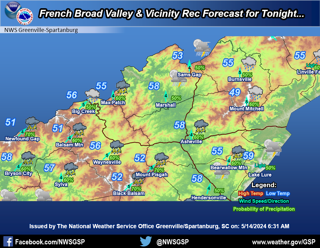
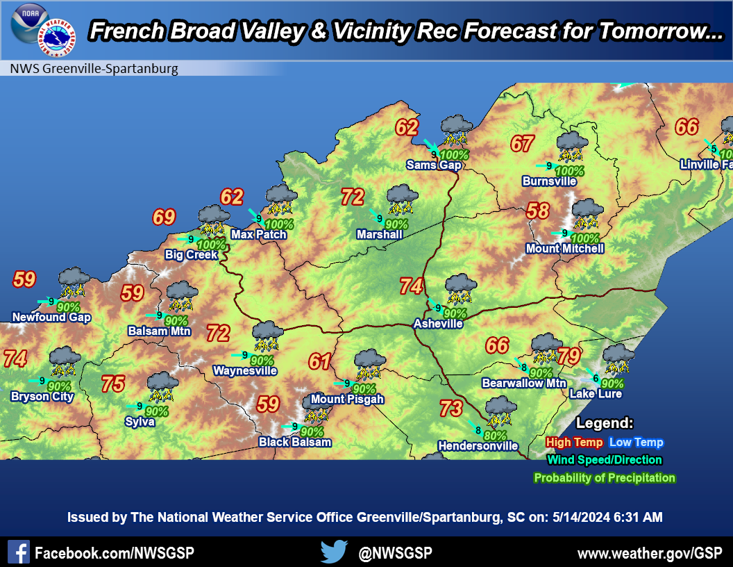
French Broad
Valley & Vicinity |
|||
|
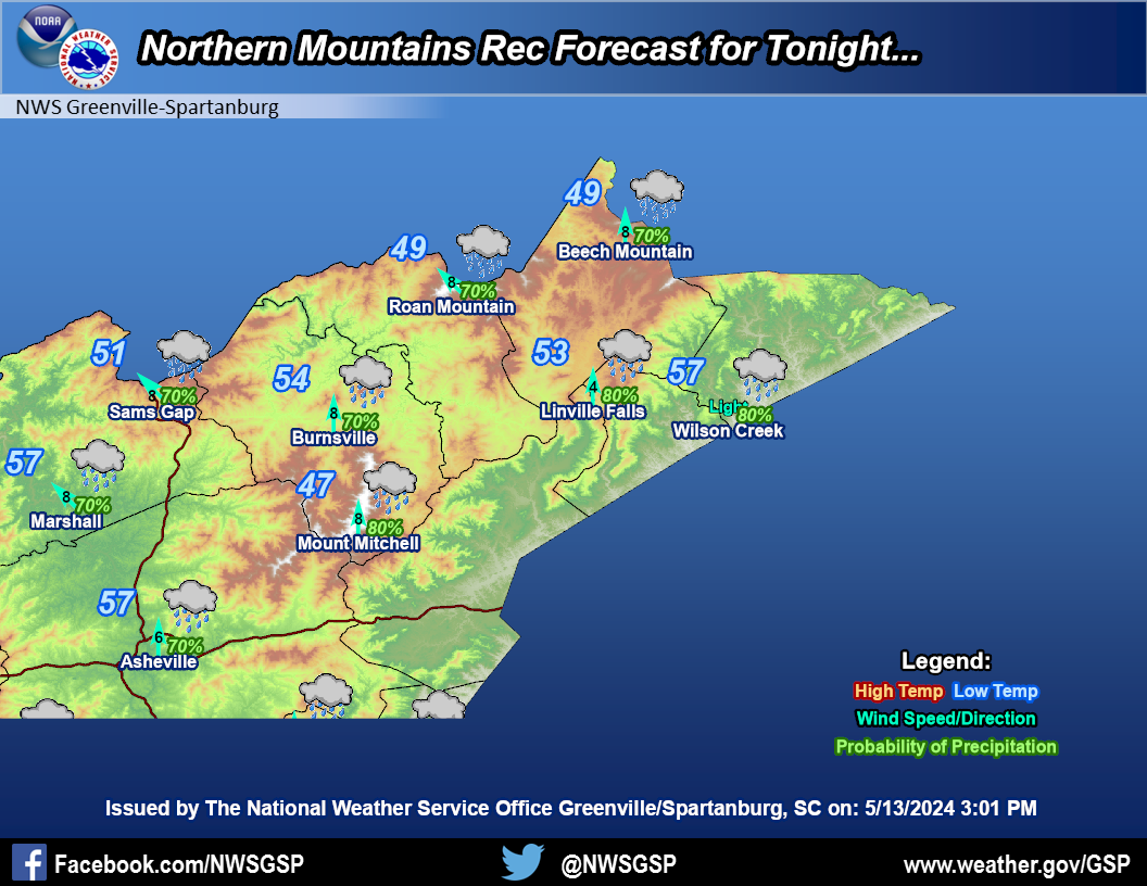
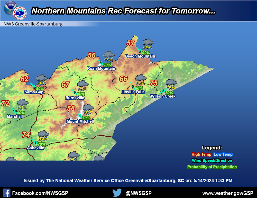
Northern Mountains
|
|||
|
Mountain Weather Observations
|
|
Recreational Forecast
|


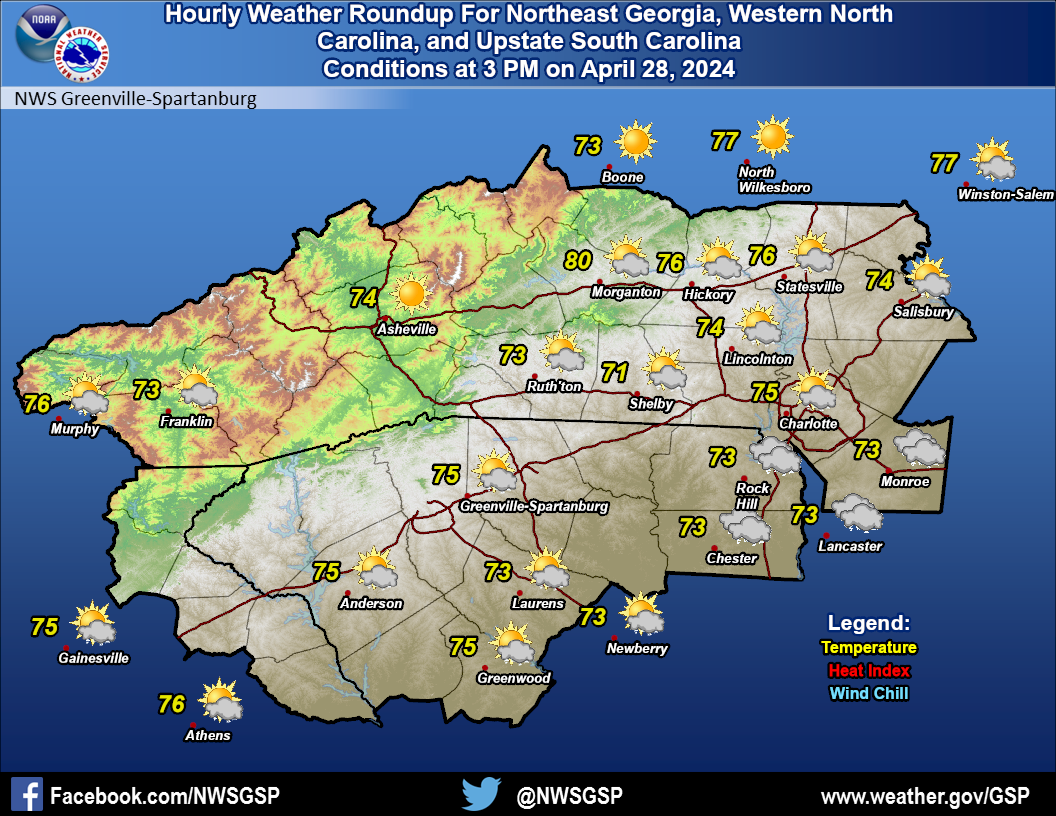 Current Conditions Map