
The storm system which brought excessive rainfall and lingering flooding over the mid-Mississippi River Valley this past weekend will progressively shift through the Southeast U.S. Monday. Scattered thunderstorms, some with heavy rainfall, severe winds, and perhaps a tornado are possible Monday afternoon across parts of northern Florida and the southern Atlantic Seaboard. Read More >
| Click on the icons below to access individual briefing pages |
|
|
|
***Click Here for Probabilistic Snowfall Products***
Snowfall Accumulation Forecast (click on thumbnails to display below)
Ice Accumulation Forecast (click on thumbnails to display below)
Probability of Precipitation (PoP) (click on thumbnails to display below)
Days 1-4 Max Temperatures(click on thumbnails to display below)
Nights 1-4 Min Temperatures(click on thumbnails to display below)
Days 1-4 Min Wind Chill(click on thumbnails to display below)
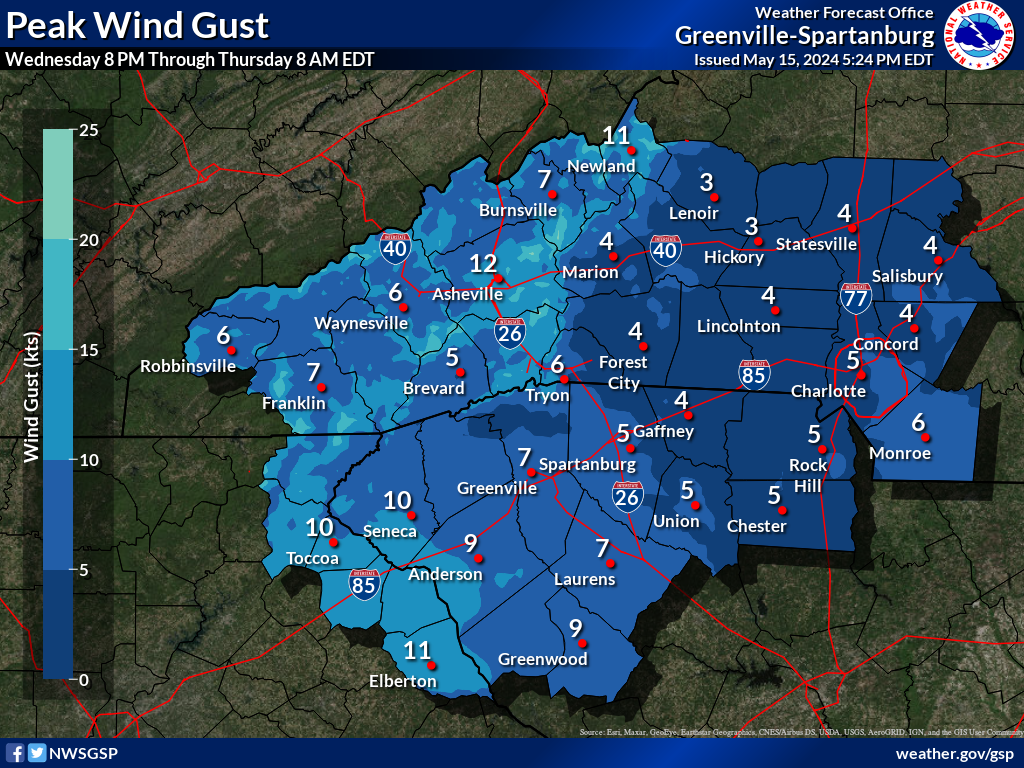
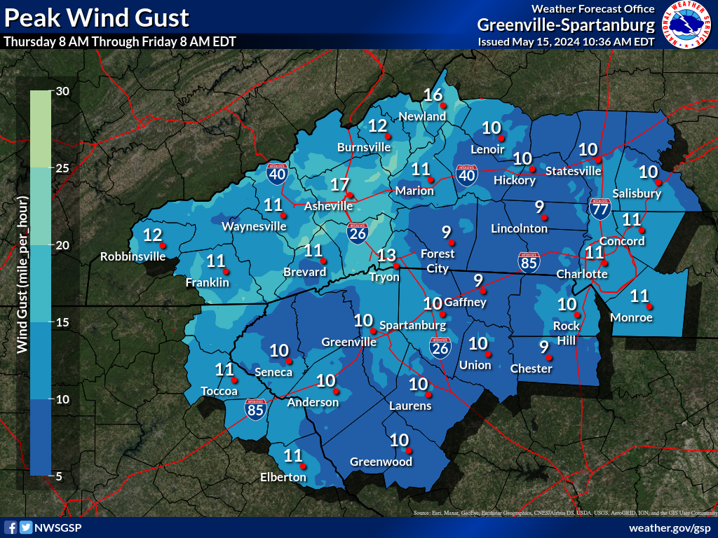
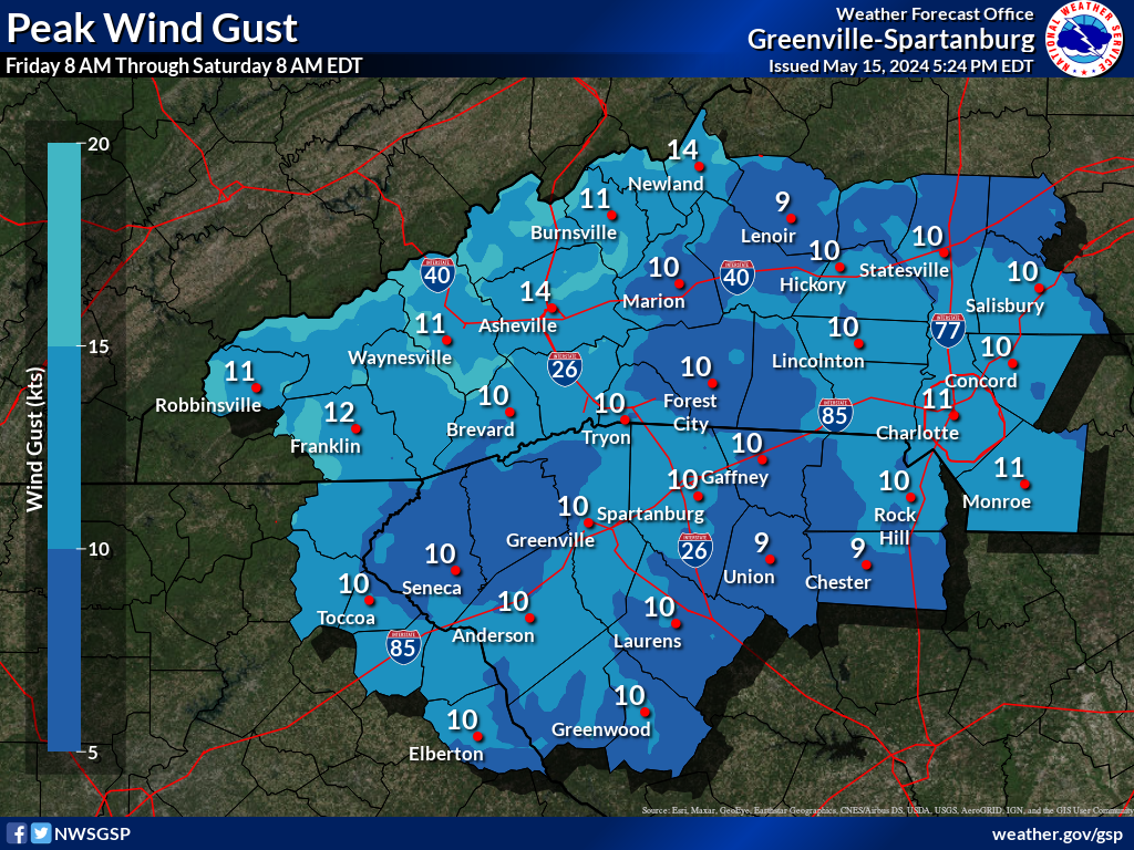
Days 1-4 Max Wind Gusts(click on thumbnails to display below)
|


 Tropical Weather
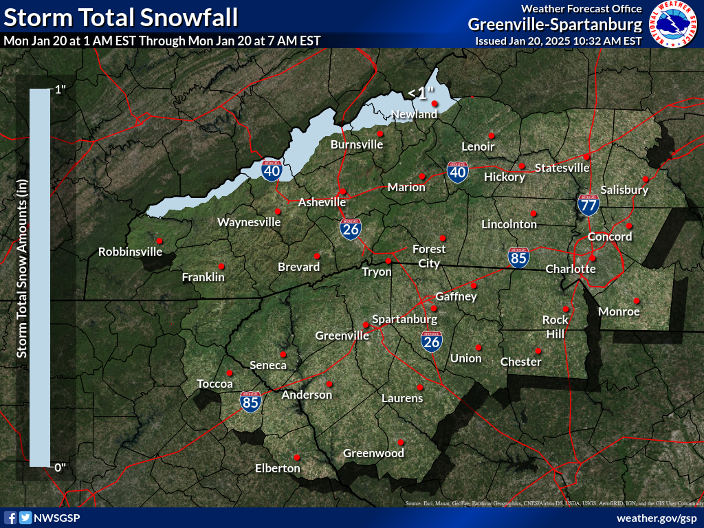


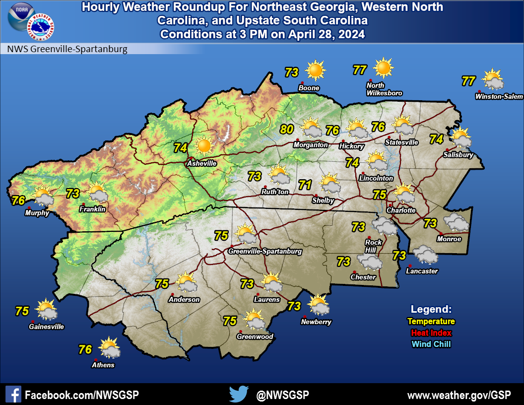 Current Conditions Map