Most of Monday's rainfall will be done by mid or late morning, then 30 to 40 mph gusts are expected the rest of the day. Temperatures will climb to 55 to 65 degrees across Lower Michigan during the morning, then drop about 10 degrees during the afternoon. Read More >
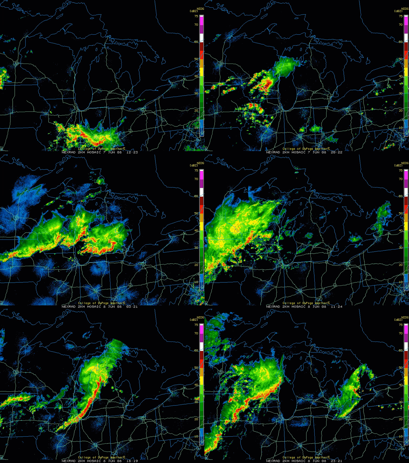
Two rounds of severe thunderstorms occurred within 24 hours on June 7 and 8, 2008. These storms produced flooding, strong winds, and tornadoes across Lower Michigan. Eight people died in Michigan as a result of these storms.

Radar animation from 8 AM EDT June 7 to 8 PM June 8, 2008. Radar data from the National Weather Service. Images mapped and displayed by the College of DuPage, and archived by UCAR.

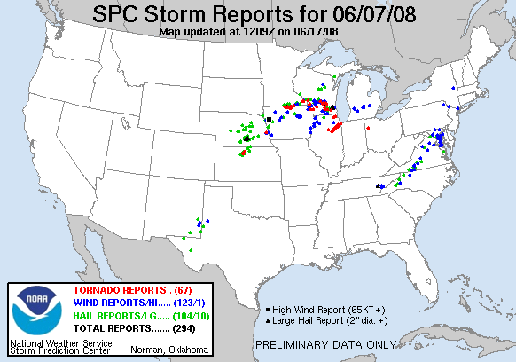
Above: Severe storm reports from 8 AM June 7 to 8 AM June 8, 2008. Red = tornado. Blue = wind damage or gust over 58 mph. Green = hail 1" diameter or larger.
Flash flooding occurred the night of June 7-8. Hardest hit was the Holland to Saugatuck area, where as much as 5 inches of rain fell in 6 hours. Cars were submerged to their roofs on US-31 in Holland. Several roadways in Allegan county were destroyed and washed away in the dark of night.

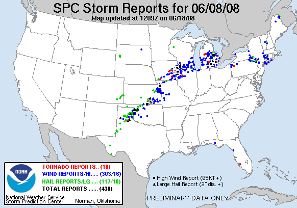
Above: Severe storm reports from 8 AM June 8 to 8 AM June 9, 2008. Red = tornado. Blue = wind damage or gust over 58 mph. Green = hail 1" diameter or larger.
A line of severe thunderstorms then moved through much of Lower Michigan the afternoon of June 8. The storms were moving at 50-60 mph and knocked down a number of trees with straight-line winds around 60-80 mph. Two tornadoes embedded in this storm line formed within the state, both rated EF1 (maximum winds between 86 and 110 mph). One tornado struck near Hersey to Evart in Osceola County, and the other tornado formed south of Grand Ledge in Eaton County, then moved into the west side of Lansing in Ingham County. The tornadoes were moving at 50-60 mph and were often times difficult or impossible to see amidst the heavy rain.
The storms killed a number of people in Michigan. Their stories remind us of the multiple dangers severe weather can pose.
Lakeshore Drive in Saugatuck Twp (Allegan County) was washed away by flash flooding after several inches of rain fell in a matter of hours the night of June 7-8, 2008. Flash flooding at night is especially dangerous and deadly, as washed-out roadways and deep swift-flowing water may not be visible.
Flooding in Holland at US-31 & E 40th St, the morning of June 8, 2008.
A destroyed barn south of Grand Ledge and west of Lansing in Eaton County, from the June 8, 2008 tornado.