
A late season winter storm will produce a combination of heavy snow and disruptive ice starting this evening in the Northern Plains and moving into the Upper Midwest and Great Lakes by tonight continuing through Thursday. Severe thunderstorms will likely produce severe wind gusts, large hail, a few tornadoes, and heavy rainfall across the southern and central Plains into the morning. Read More >
Grand Rapids, MI
Weather Forecast Office
Michigan Fire Weather |
| Watches & Warnings |
Observations | Planning Forecasts | Digital Forecasts | Outlooks | Fire Assessment |
Weather Map |
Radar |
VIS Satellite |
IR Satellite |
Day 1 Outlook |
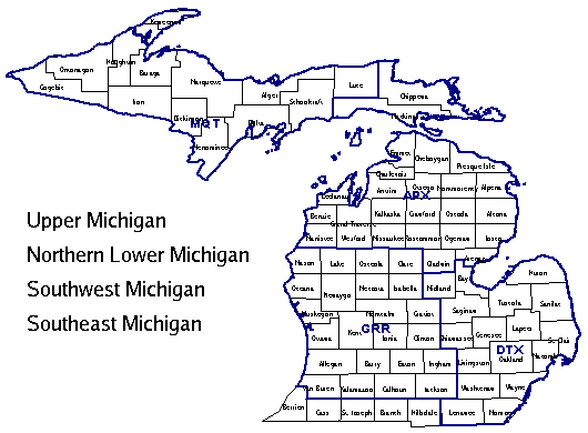
Northern MI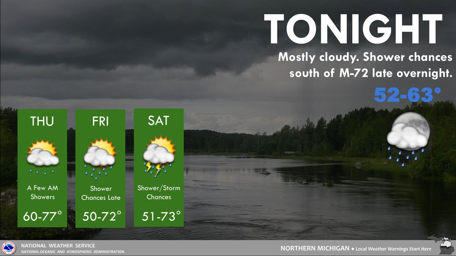 |
Southwest MI |
Southeast MI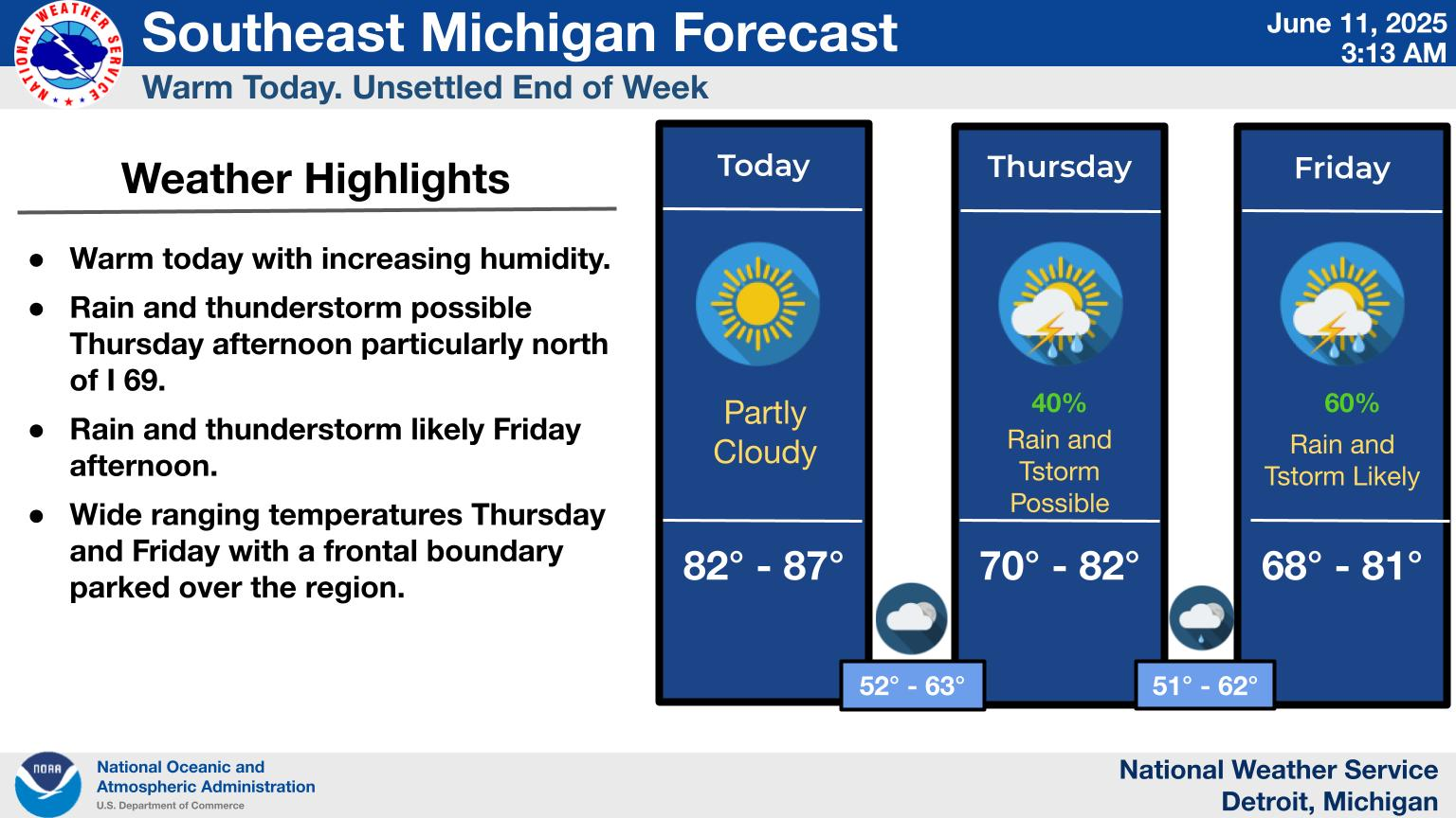 |
Northern IN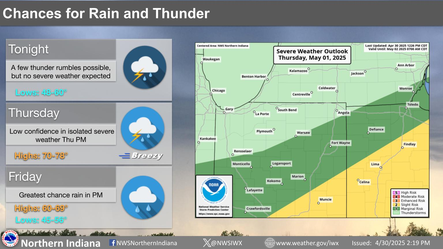 |
Upper Michigan |
US Dept of Commerce
National Oceanic and Atmospheric Administration
National Weather Service
Grand Rapids, MI
4899 Tim Dougherty Drive SE
Grand Rapids, MI 49512-4034
616-949-0643
Comments? Questions? Please Contact Us.

