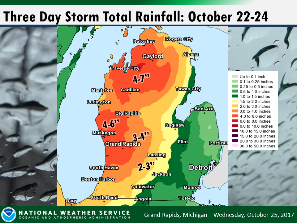
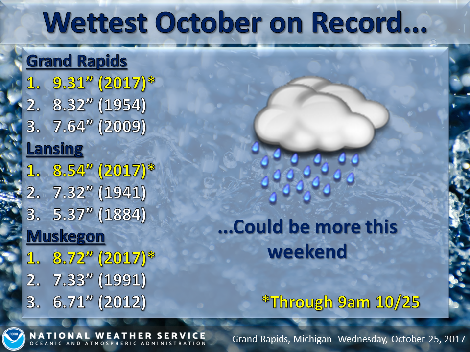
An active frontal boundary will set up across Michigan over the weekend, bringing rounds of showers and possible thunderstorms. Some of the storms on Sunday afternoon and evening could be severe. A sharp temperature contrast will exist across the front, with temperatures ranging from the 30 and 40s in northern Michigan to near 70 south. Read More >
Click here for the most recent flood warning bulletin.
Click here for the most recent flood advisory bulletin.
The blue curve on the left half of the chart is the measured river level over the past several days.
The purple curve on the right half of the chart is the forecast river level over the next week.
Forecasts take into account any expected precipitation over the next 48 hours.
Click on a chart for additional information about that river point, including flood impact levels and crest history.
Click here for current information on all river levels around the area. The river points below are only a partial selection.
![]() |
![]() |
![]() |
Muskegon River at Evart | Muskegon River near Croton Dam | Little Muskegon River at Morley |
![]() |
![]() |
![]() |
Chippewa River below Mt. Pleasant | White River above Whitehall | Rogue River at Rockford |
![]() |
![]() |
![]() |
Grand River at Ionia | Grand River at Lowell | Grand River at Grand Rapids |
![]() |
![]() |
![]() |
Grand River at Comstock Park | Grand River at Robinson Township | Thornapple River at Caledonia |
![]() |
![]() |
![]() |
Sycamore Creek at Holt | Looking Glass River at Eagle | Thornapple River at Hastings |
![]() |
![]() |
![]() |
Maple River at Maple Rapids | Flat River at Smyrna | Kalamazoo River near New Richmond |
![]() |
Media use of NWS Web News Stories is encouraged! |
![]() |