
Thunderstorms later in the day Sunday could produce locally strong or damaging wind gusts, isolated large hail, and a brief tornado or two within the southern half of Lower Michigan. Read More >
Grand Rapids, MI
Weather Forecast Office
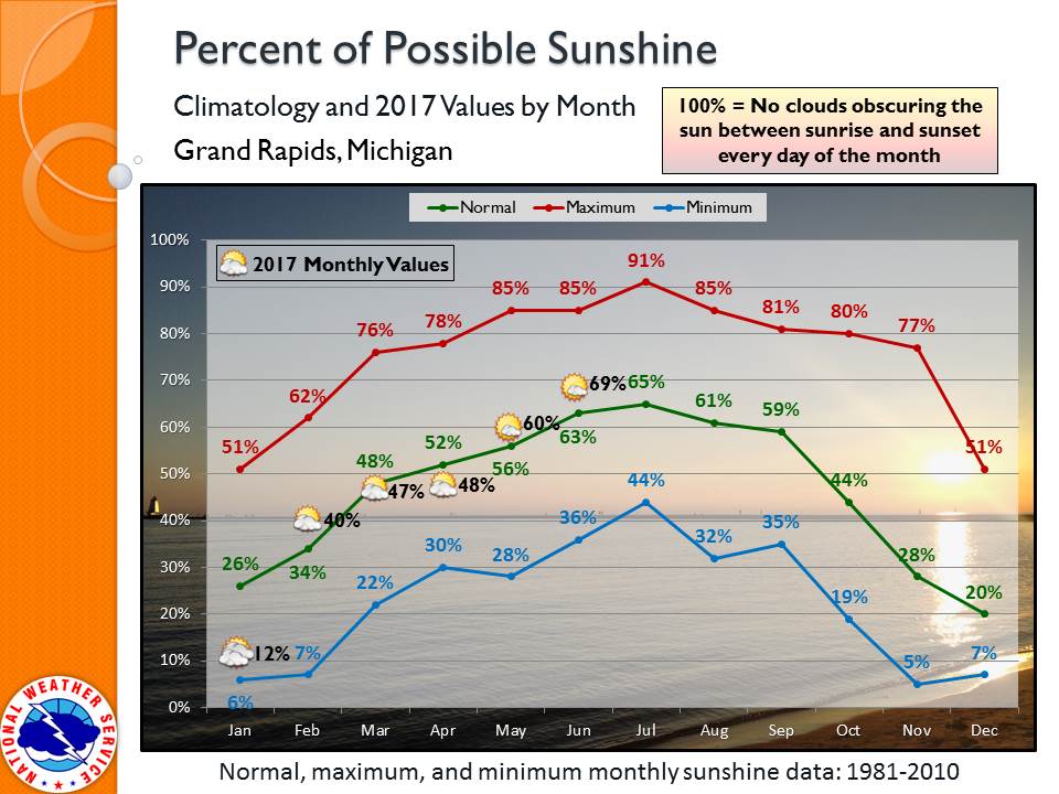
Minutes of direct sunshine recorded at the NWS Grand Rapids office were slightly above average for June, with 69% of maximum possible sunshine counted.
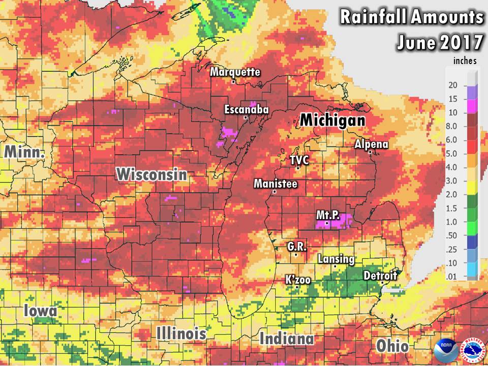
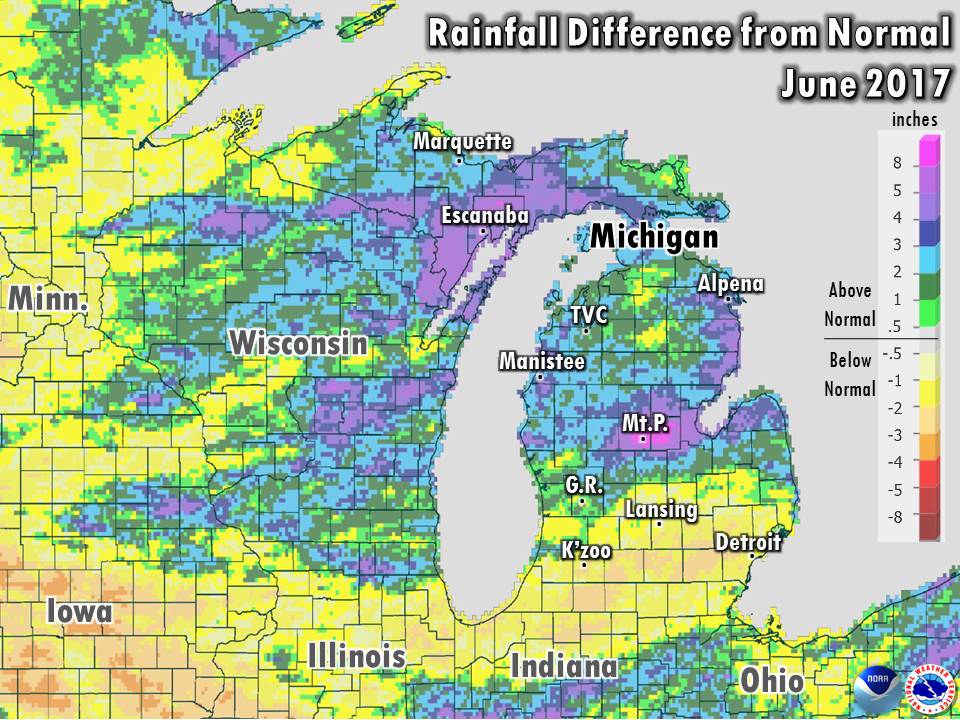
Precipitation ranged from below normal in Southern Michigan to much above normal in Central Michigan. Occasional thunderstorms focused mainly in Central Michigan over a 2-week period in the middle of the month culminated with a final blow of 3 to 6 inches of rain falling overnight June 22-23. The heaviest rain was focused in Isabella and Midland counties, in the Chippewa and Tittabawassee river basins. Flooding destroyed a number of roadways in the counties, and the rivers running through Mount Pleasant and Midland rose to major flood stage, just short of the record flooding of September 1986.
Severe weather was rather minimal in Central to Southwest Lower Michigan, with only a few isolated incidents of damaging thunderstorm winds. On June 17, an isolated severe thunderstorm in southeast Gratiot county and southwest Saginaw county laid a swath of wind gusts over 70 mph, knocking down trees and damaging a few structures. The month ended with a weak and short-lived "landspout" tornado near Grand Junction at the Allegan / Van Buren county border on June 30 (more info).
 |
Media use of NWS Web News Stories is encouraged! |
|
US Dept of Commerce
National Oceanic and Atmospheric Administration
National Weather Service
Grand Rapids, MI
4899 Tim Dougherty Drive SE
Grand Rapids, MI 49512-4034
616-949-0643
Comments? Questions? Please Contact Us.

