
Thunderstorms later in the day Sunday could produce locally strong or damaging wind gusts, isolated large hail, and a brief tornado or two within the southern half of Lower Michigan. Read More >
WELCOME TO THE MICHIGANSEVERE WEATHER AWARENESS WEEK WEBSITE |
 |
Severe Weather Awareness Week
|
|
| Severe Weather Awareness Week Information | |
|
|
|
|
| Governor's Proclamation |
|
|
|
|
|
|
|
|
|
Click here for the most recent flood warning bulletin.
Click here for the most recent flood advisory bulletin.
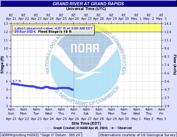
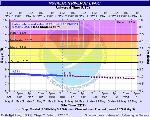
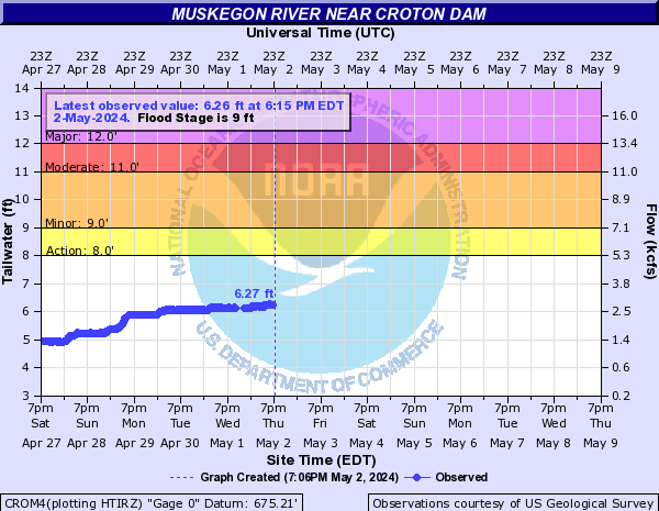
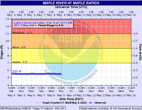
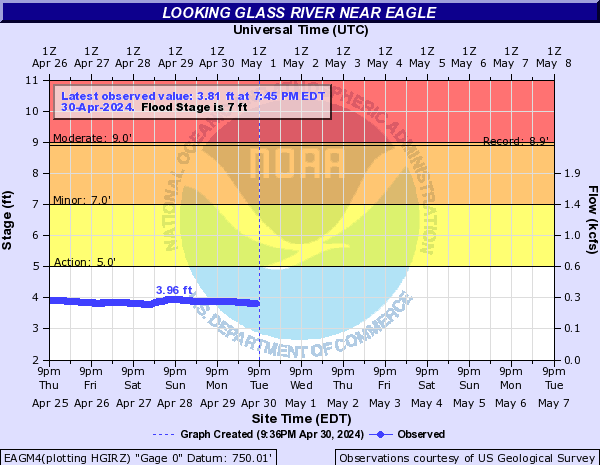
The blue curve on the left half of the chart is the measured river level over the past several days.
The purple curve on the right half of the chart is the forecast river level over the next week.
Forecasts take into account any expected precipitation over the next 24 hours.
Click on a chart for additional information about that river point, including flood impact levels and crest history.
Click here for current information on all river levels around the area. The river points below are only a partial selection.
 |
 |
 |
| Grand River at Grand Rapids | Grand River at Comstock Park | Grand River at Ionia |
 |
 |
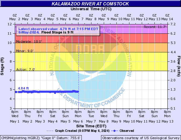 |
| Muskegon River at Evart | Muskegon River at Croton | Kalamazoo River at Comstock |
 |
 |
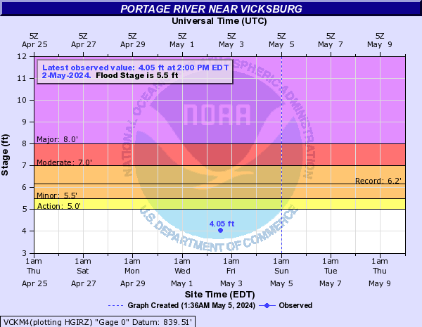 |
| Maple River at Maple Rapids | Looking Glass River near Eagle | Portage River at Vicksburg |
Five tornadoes have occurred in Michigan so far this year.
February 28: Four tornadoes in or near Niles, Dowagiac, Vandalia, and Centreville.
April 10: One tornado southeast of Alto / north of Freeport.
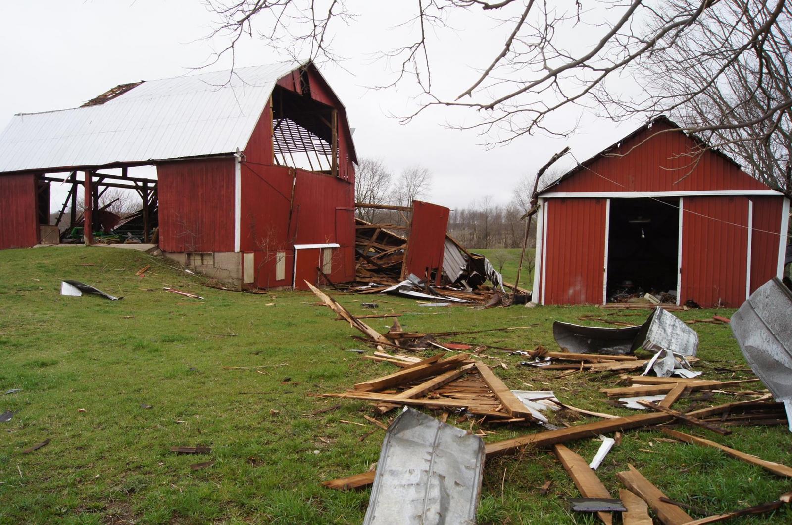
Damage to a barn on 92nd St (M-50) east of Wingeier Ave southeast of Alto, MI. (NWS, picture taken Apr 11, 2017)
Only a few weather spotter training opportunities are left this spring: weather.gov/grr/spottertraining

 |
Media use of NWS Web News Stories is encouraged! |
|


