
Thunderstorms later in the day Sunday could produce locally strong or damaging wind gusts, isolated large hail, and a brief tornado or two within the southern half of Lower Michigan. Read More >
Grand Rapids, MI
Weather Forecast Office
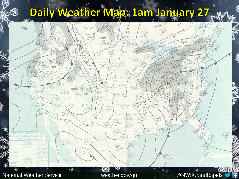
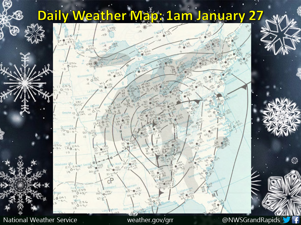
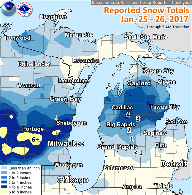
Public Information Statement
National Weather Service Grand Rapids MI
1019 AM EST Thu Jan 26 2017

...Snowfall Reports...

Location                     Amount    Time/Date       Lat/Lon

...Michigan...

...Clare County...
Leota                        4.0 in    0638 AM 01/26   44.14N/84.89W
8 SW Skeels                  3.5 in    0800 AM 01/26   43.99N/84.70W

...Clinton County...
Laingsburg 5.0 SW            0.5 in    0800 AM 01/26   42.84N/84.42W

...Isabella County...
4 SSE Shepherd               0.5 in    0600 AM 01/26   43.47N/84.67W

...Kent County...
2 N Cannonsburg              0.8 in    0730 AM 01/26   43.09N/85.47W

...Mason County...
6 NW Scottville              2.5 in    0500 AM 01/26   44.04N/86.34W

...Mecosta County...
2 NW Sylvester               2.6 in    0800 AM 01/26   43.56N/85.28W
3 NNW Stanwood               1.4 in    0700 AM 01/26   43.63N/85.48W

...Montcalm County...
3 ESE Mcbride                1.5 in    0700 AM 01/26   43.31N/84.99W

...Newaygo County...
4 WSW Fremont                1.0 in    0700 AM 01/26   43.45N/86.03W

...Oceana County...
4 SSE Stony Lake             0.8 in    0700 AM 01/26   43.50N/86.47W

...Osceola County...
Reed City Wwtp               3.8 in    0700 AM 01/26   43.87N/85.50W
Marion                       3.0 in    0638 AM 01/26   44.11N/85.15W

Observations are collected from a variety of sources with varying
equipment and exposures. Not all data listed are considered official.
 |
Media use of NWS Web News Stories is encouraged! |
|
US Dept of Commerce
National Oceanic and Atmospheric Administration
National Weather Service
Grand Rapids, MI
4899 Tim Dougherty Drive SE
Grand Rapids, MI 49512-4034
616-949-0643
Comments? Questions? Please Contact Us.

