
Record setting heat is expected over the next several days from the Intermountain West through the northern Plains. Furthermore, fire weather concerns increase with dry and breezy conditions. Meanwhile, heavy rainfall and severe thunderstorm threats for the Ohio/Tennessee Valleys, central Appalachians and Southeast today. The threat shifts to central Gulf Coast and across central Texas this week. Read More >
.png)

Despite mild fall temperatures, the overall pattern is expected to trend cooler through the winter. The early portion of winter may not be as harsh as the latter half, when the probabilities for cooler than normal temperatures increases.
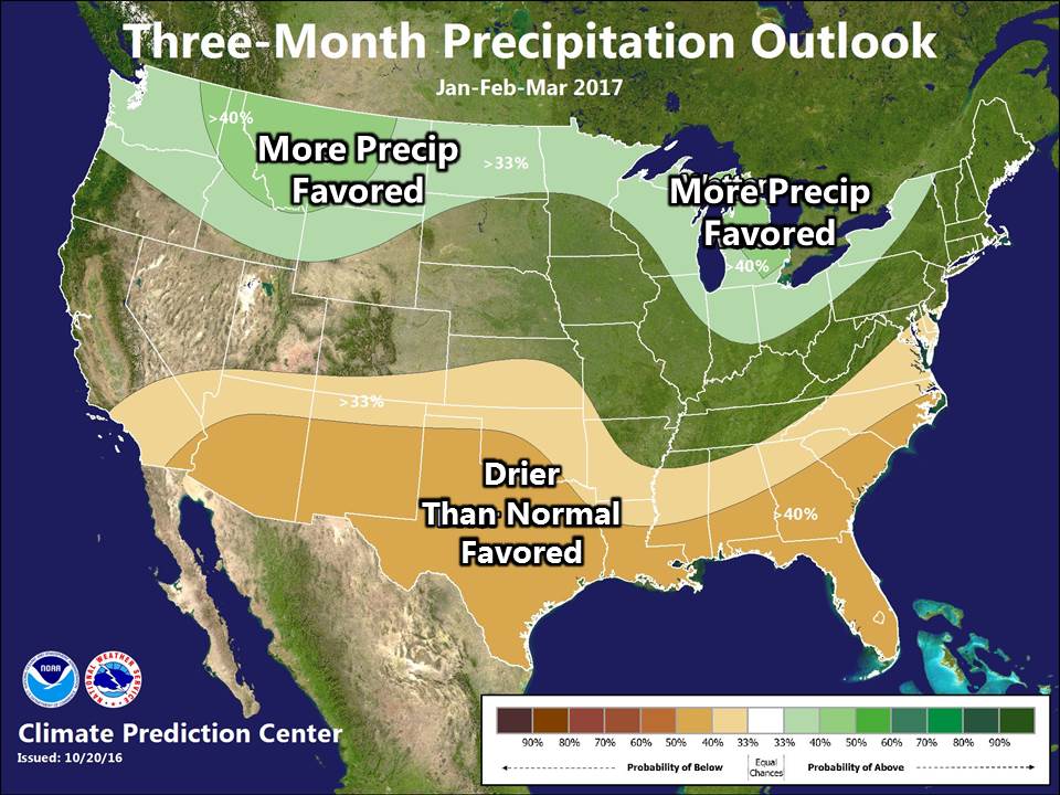
Chances depict that wetter than normal conditions could pan out over Lower Michigan. The result of cooler than normal temperatures and above normal precipitation may lead to snowfall amounts that also end up above normal.

