Excessive rainfall may produce locally considerable flash flooding over parts of South Texas, the western Gulf Coast, and Lower Mississippi River Valley through Thursday. Hot temperatures will persist over central and northern California and the Pacific Northwest through today. Read More >
​
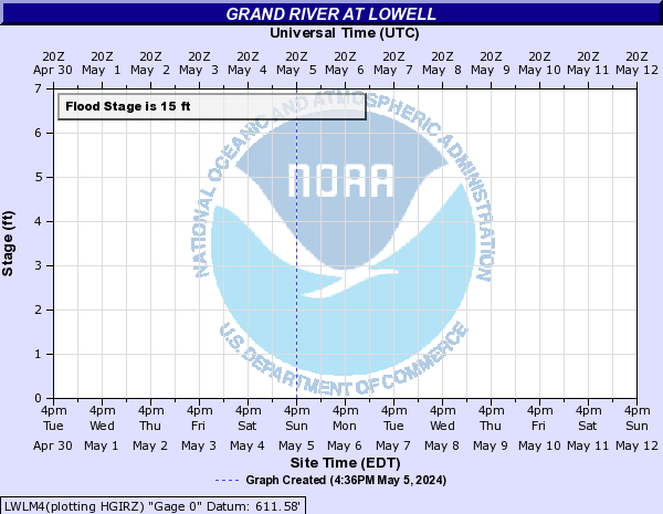
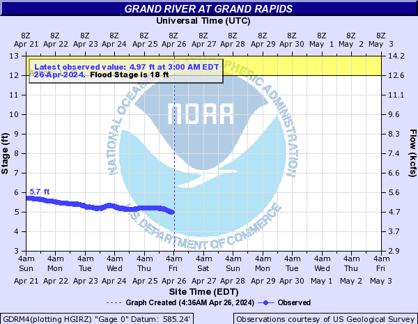
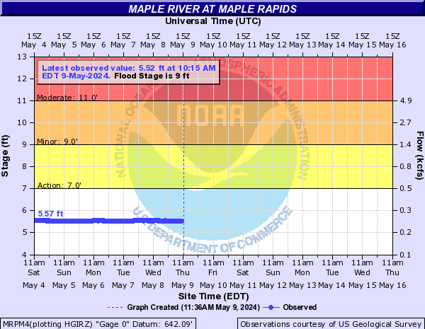
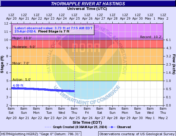
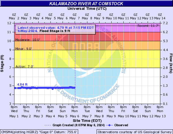
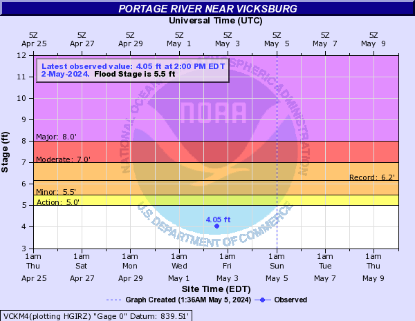
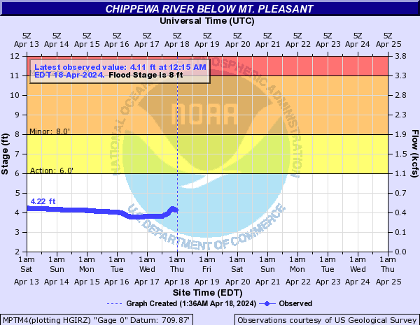
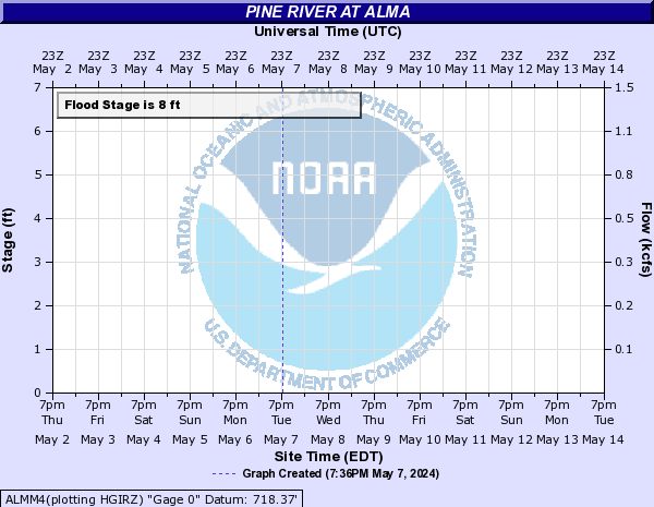
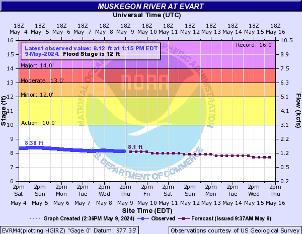
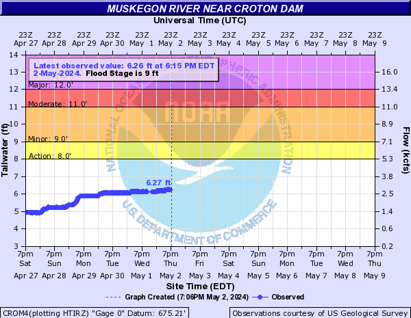
Much of Lower Michigan has had 3 to 7 inches of rain over the last week or so, which has caused widespread flooding across the area.
The blue curve on the left half of the chart is the measured river level over the past several days.
The purple curve on the right half of the chart is the forecast river level over the next week.
Forecasts take into account any expected precipitation over the next 24 hours.
Click on a chart for additional information about that river point, including flood impact levels and crest history.
Click here for current information on all river levels around the area. The river points below are only a partial selection.
Grand River Basin
|
|
|
|
|
|
|
|
|
|
|
Red Cedar River at East Lansing
|
|
|
|
|
|
|
Muskegon River, Kalamazoo River, Portage River, Chippewa River, Pine River
 |
 |
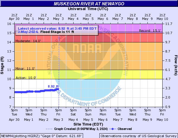 |
| Muskegon River at Evart | Muskegon River at Croton | Muskegon River at Newaygo |
|
|
|
|
|
Chippewa River below Mt. Pleasant
|
|
|