
A Moderate Risk of severe thunderstorms (level 4 of 5) is in the outlook across portions of the Midwest today. Damaging winds, a few tornadoes and frequent lightning with heavy rainfall are in the forecast. Meanwhile, dangerous heat across the southern Plains into the Great Lakes, mid-Atlantic and Northeast will expand into Friday. Risk for wildfires for the central Rockies and Sacramento Valley. Read More >

Forecasts and NWS Headlines:

Helpful Links:
West Michigan Snowfall Forecast
Scientific Forecast Discussion
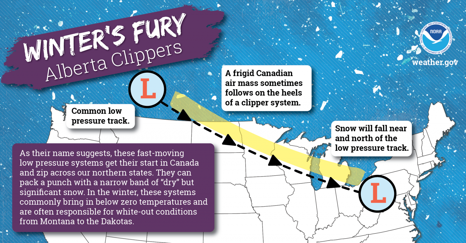
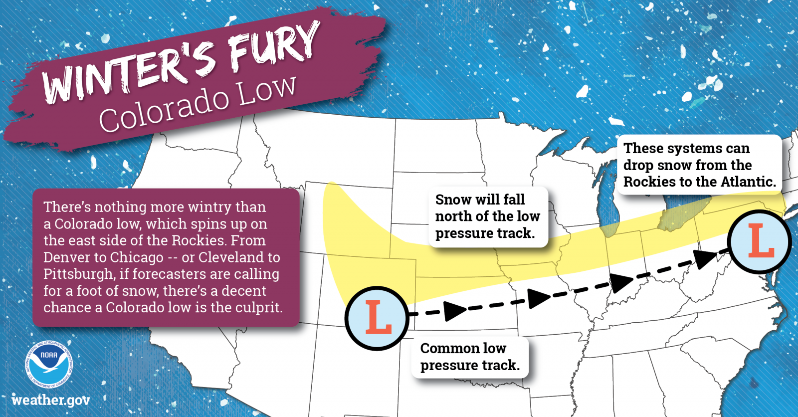
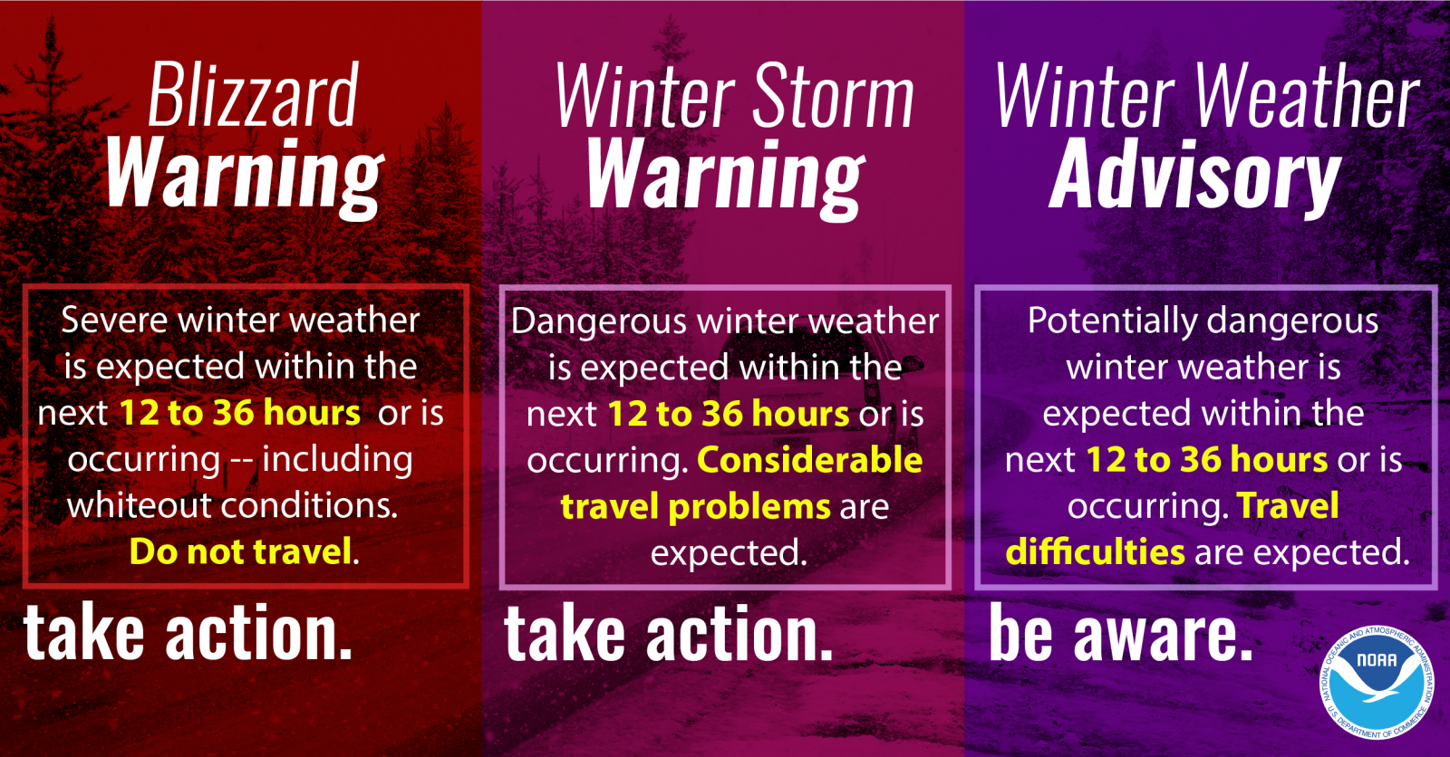
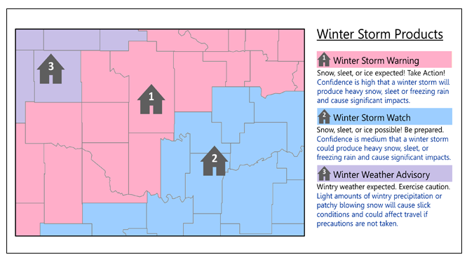
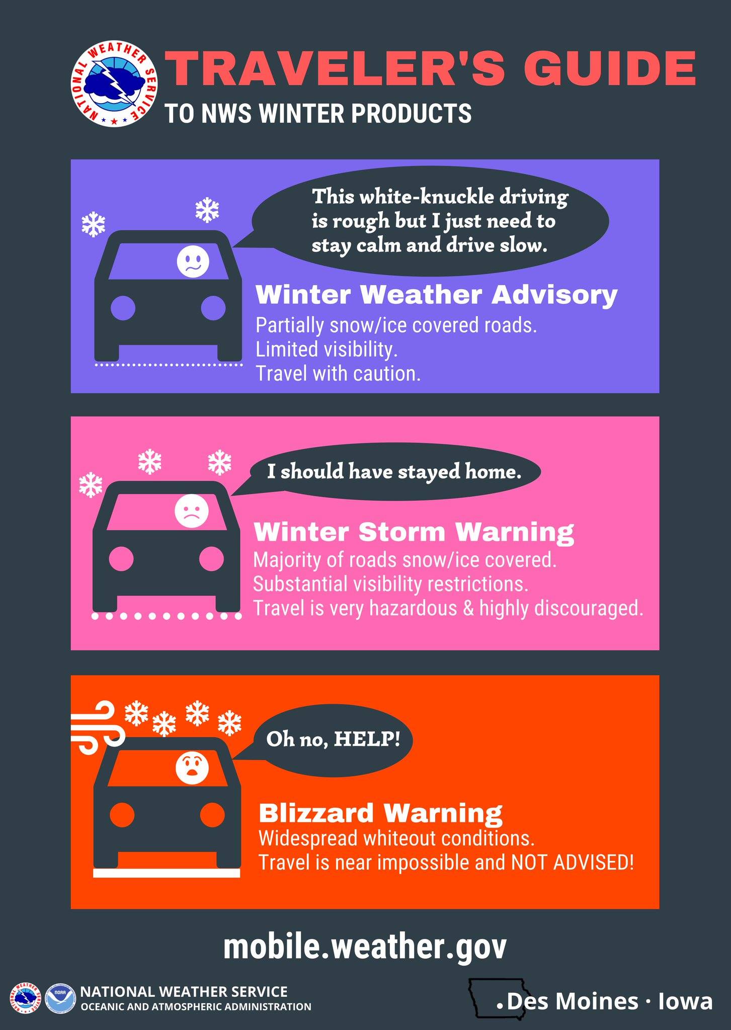
Hazards:
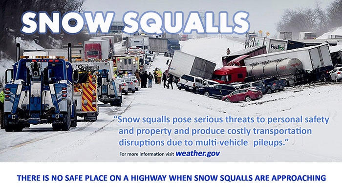
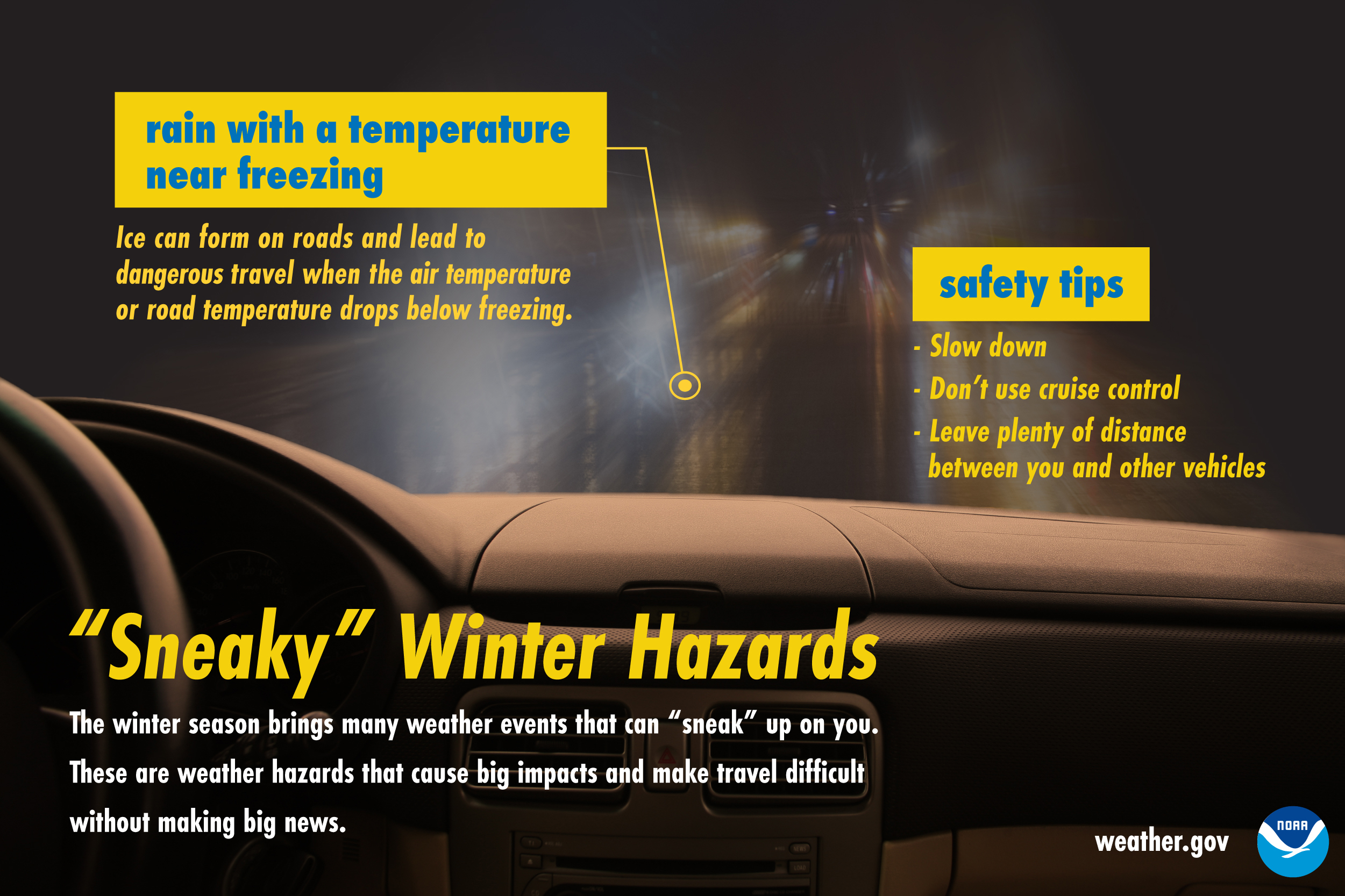
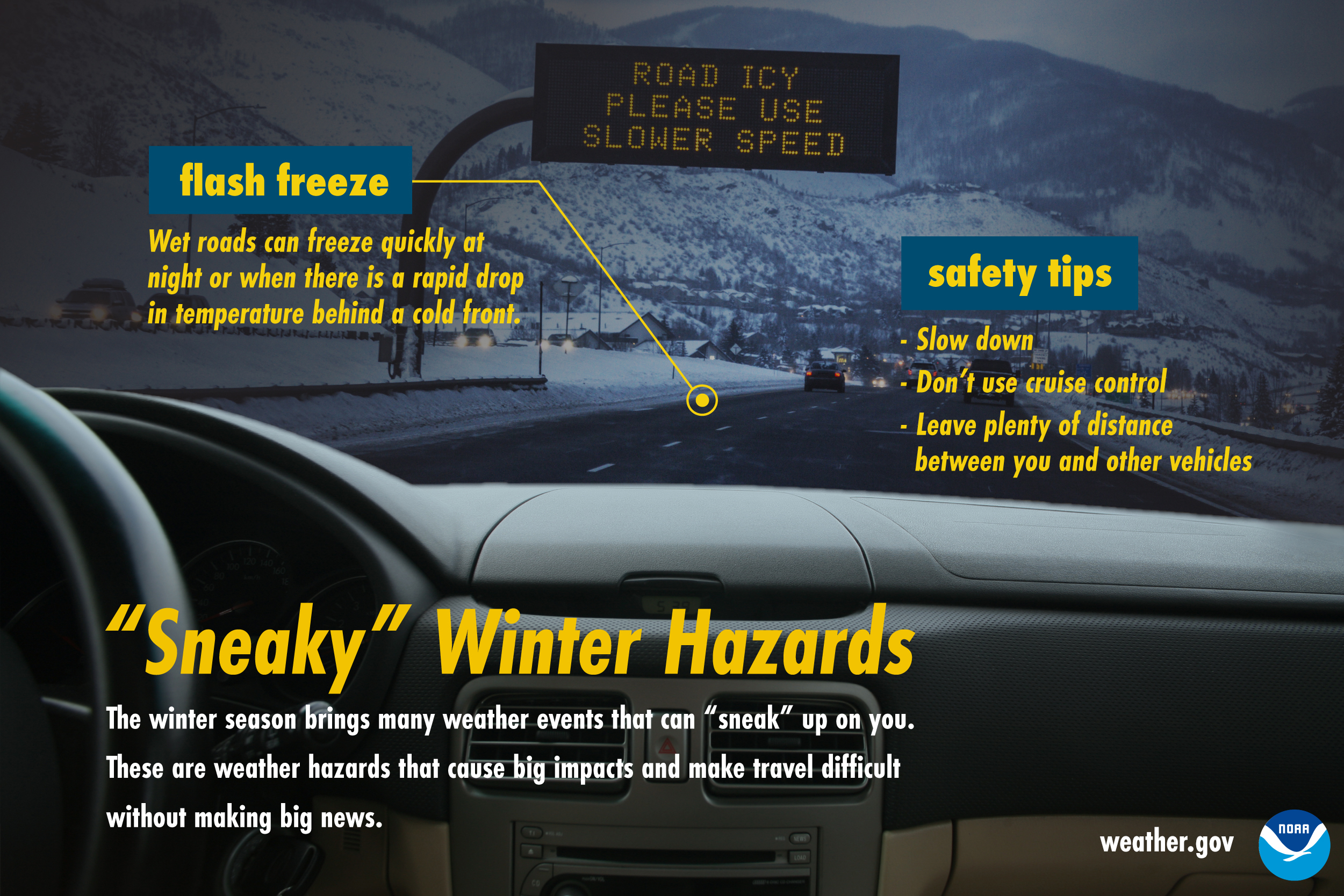
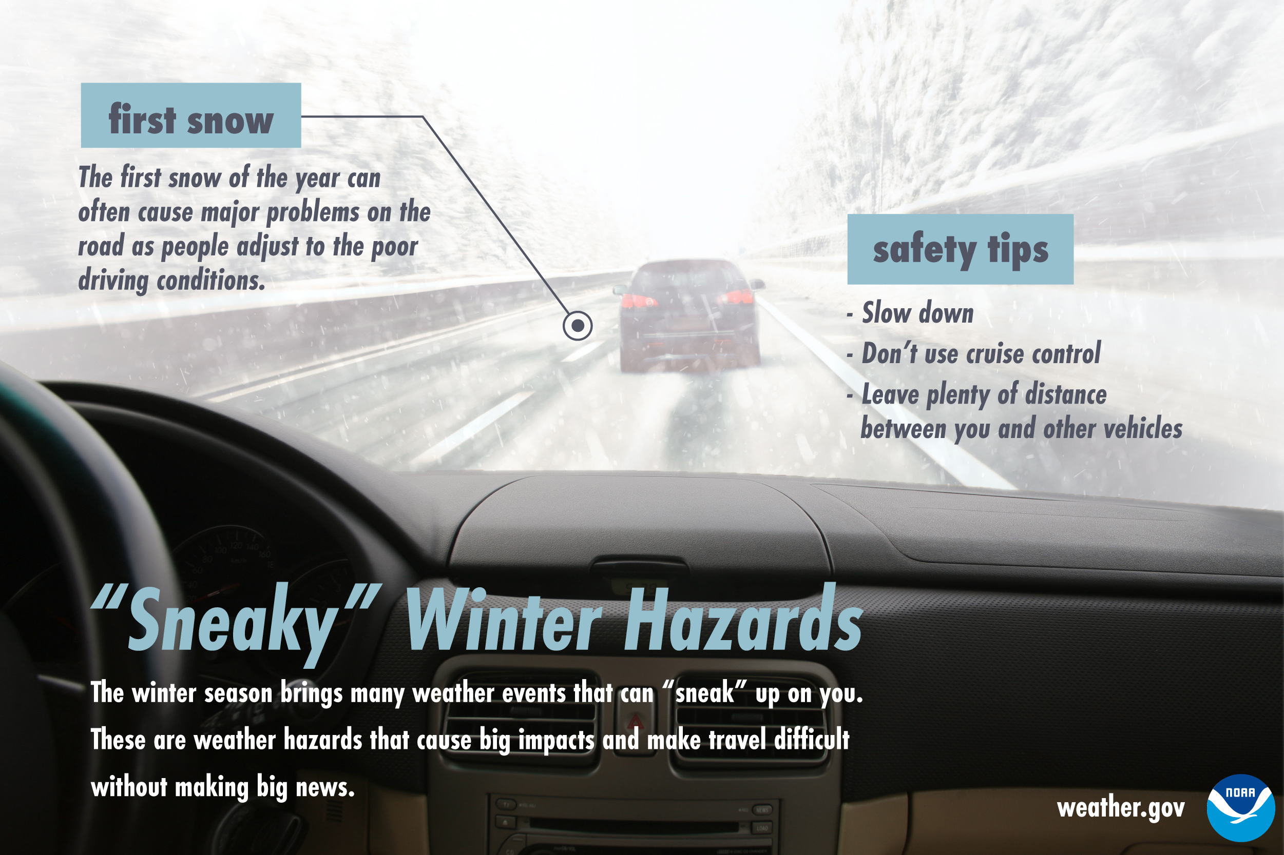
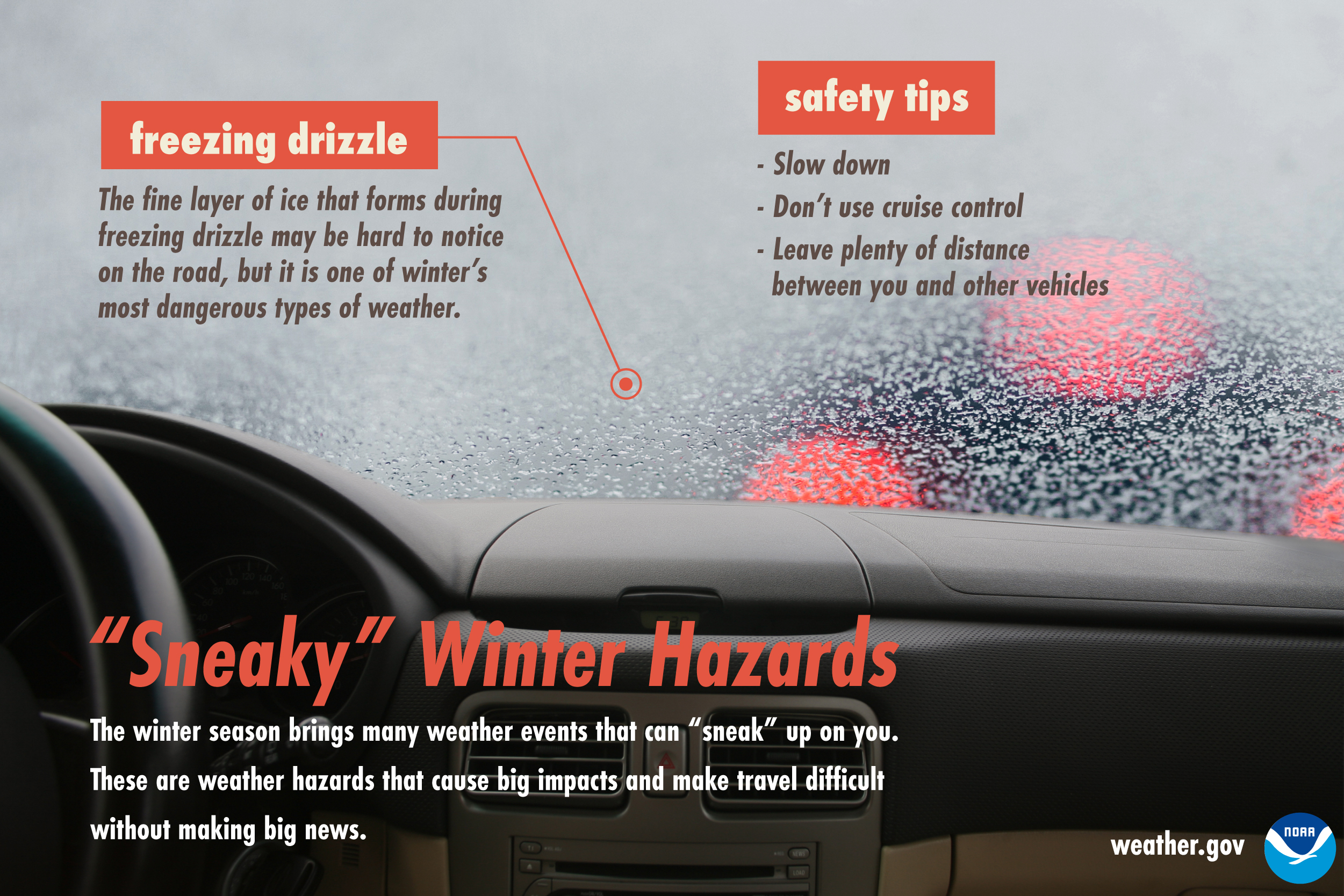
.jpg)
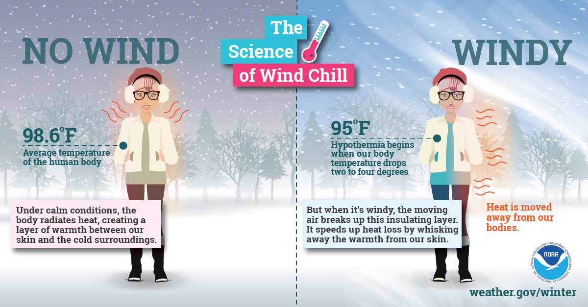
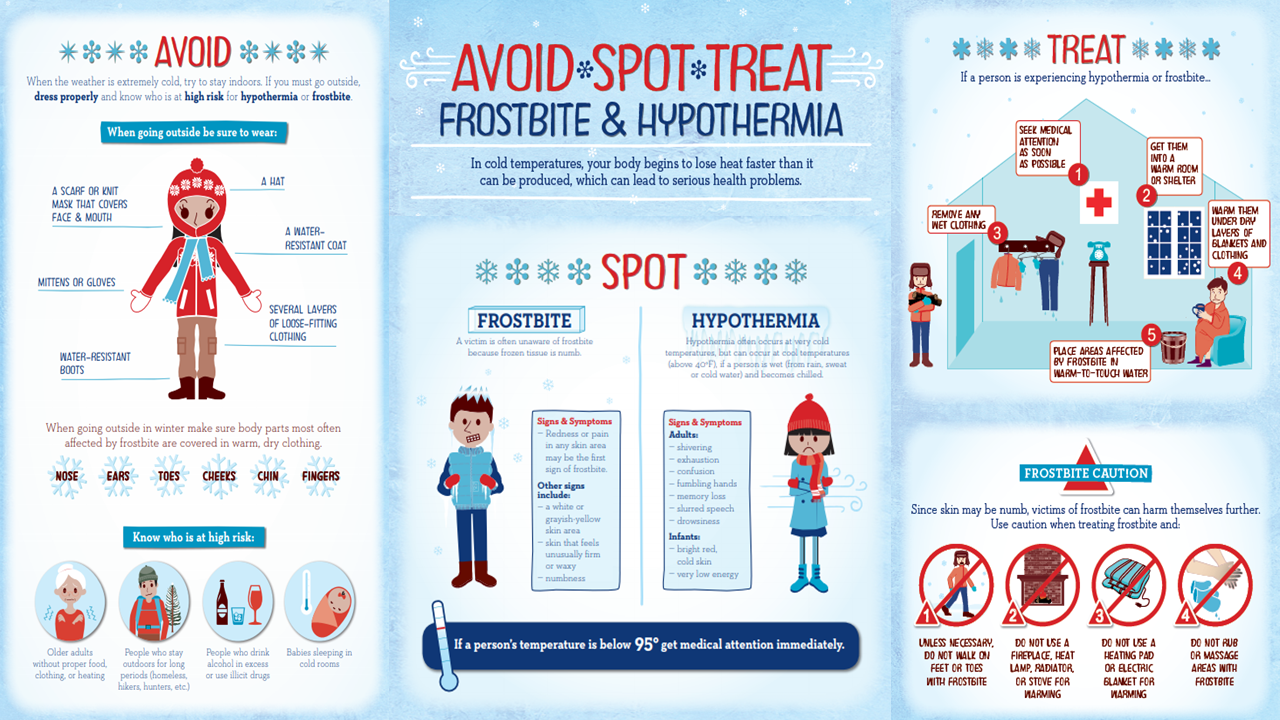
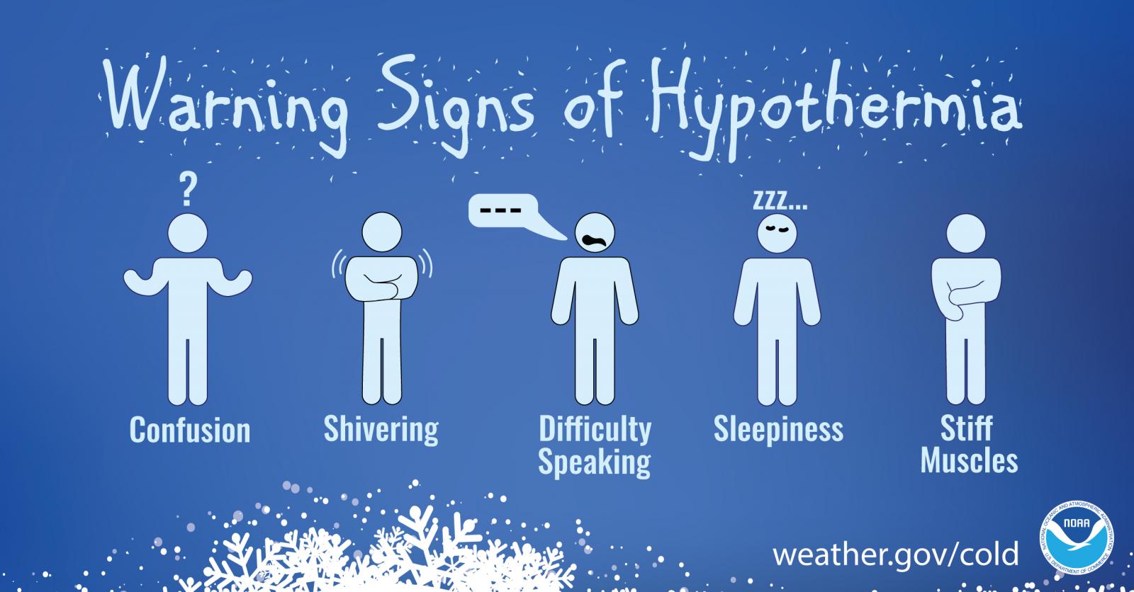
Outdoor Safety:
.png)


Home and Vehicle Prep:
.png)


.png)
.png)


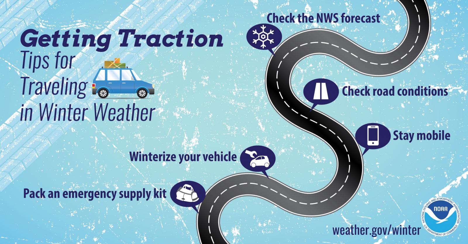
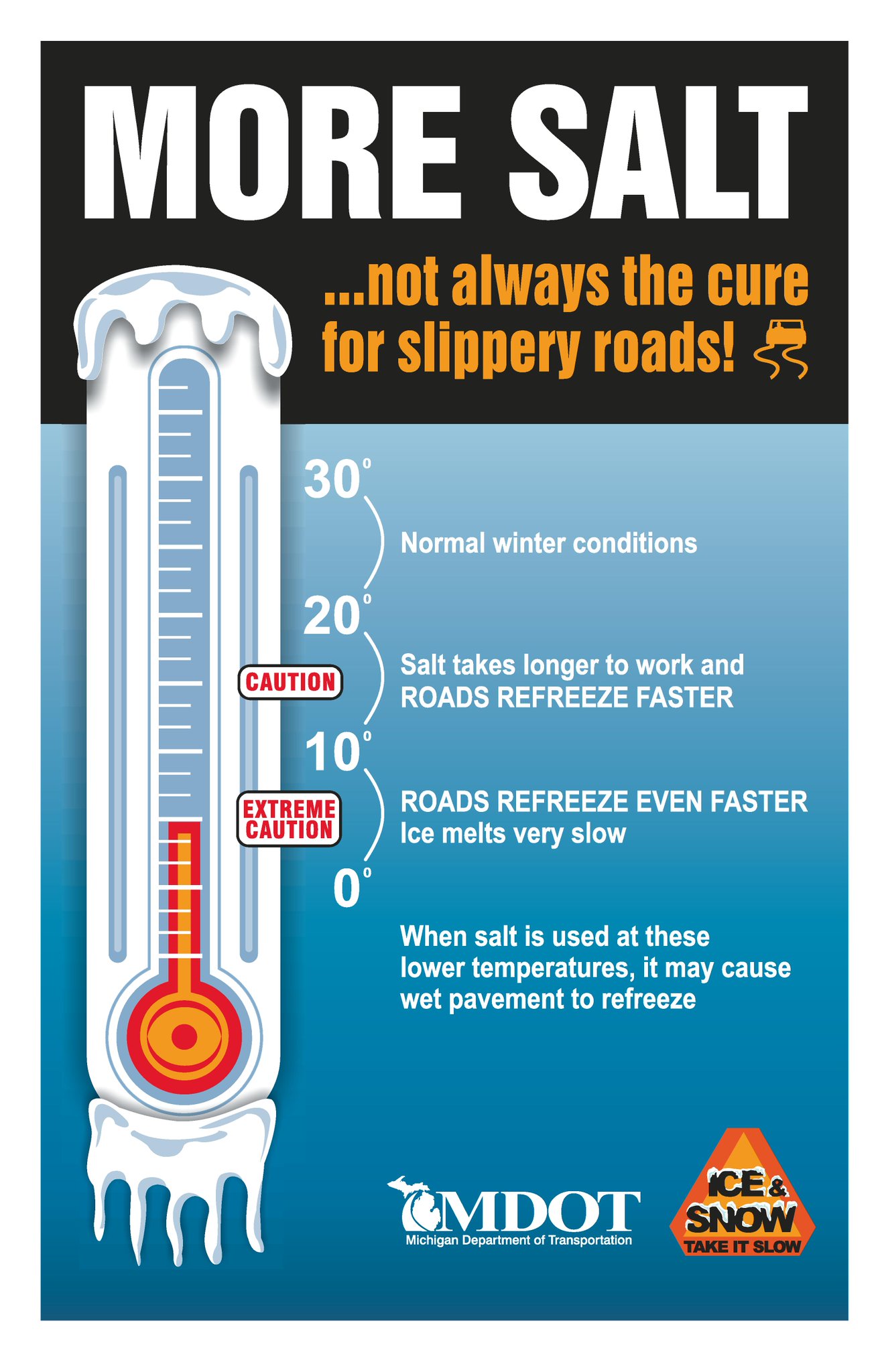
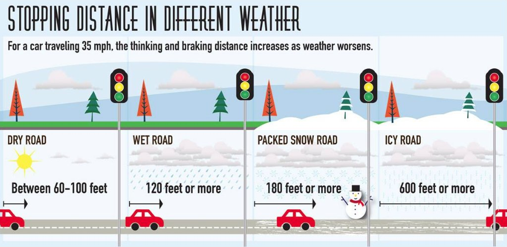
Travel:
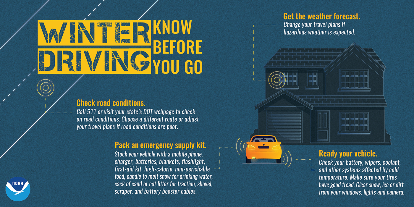
Know Before You Go!
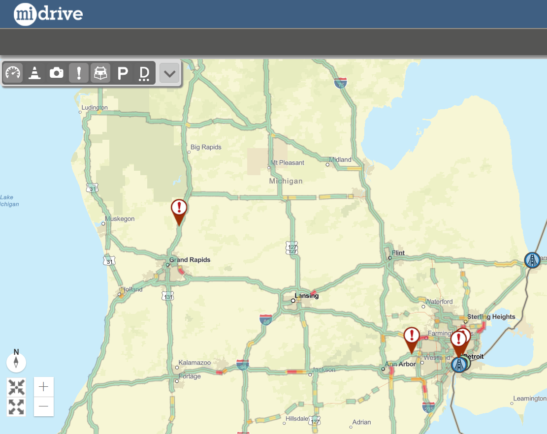
Visit MDOT's interactive MI Drive Map to see road conditions through travel speeds, webcams, snow plows, and more!
.jpg)

.png)
(1).png)

.jpg)
.jpg)
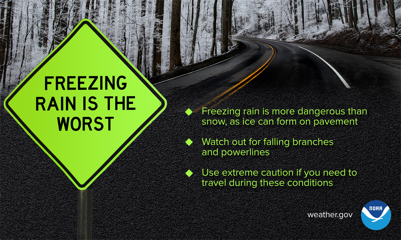
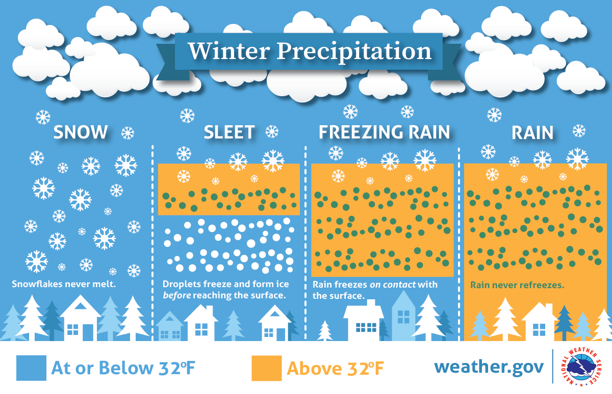
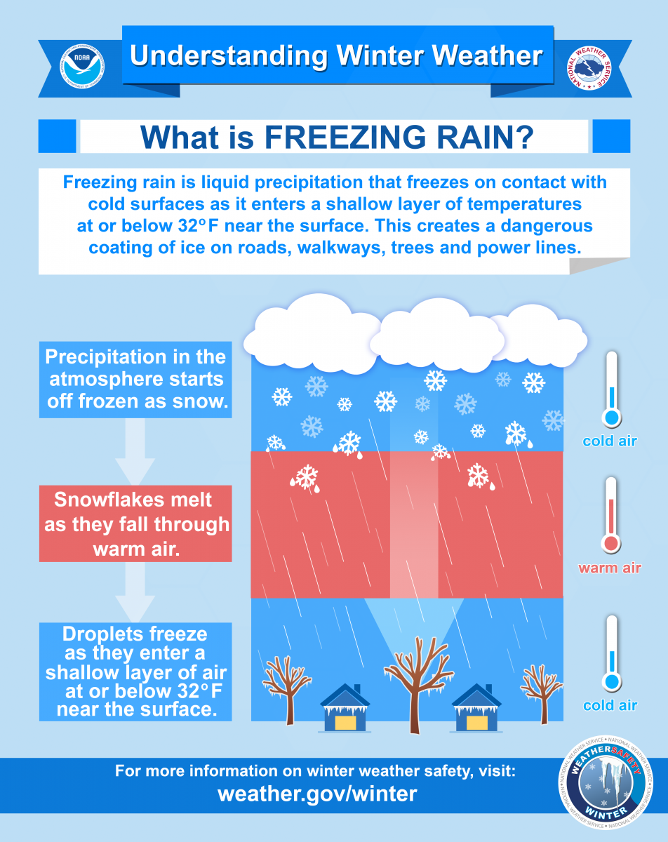
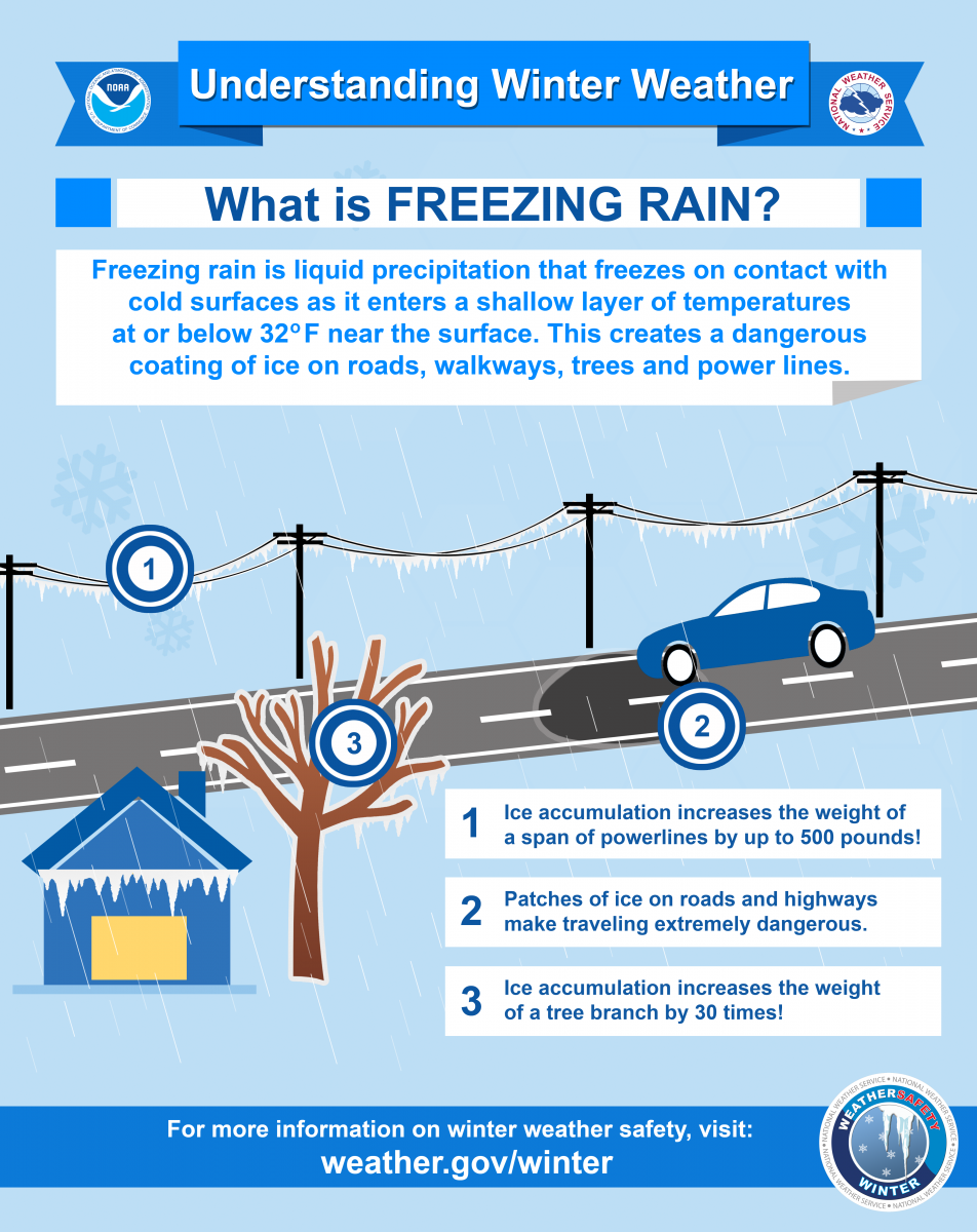
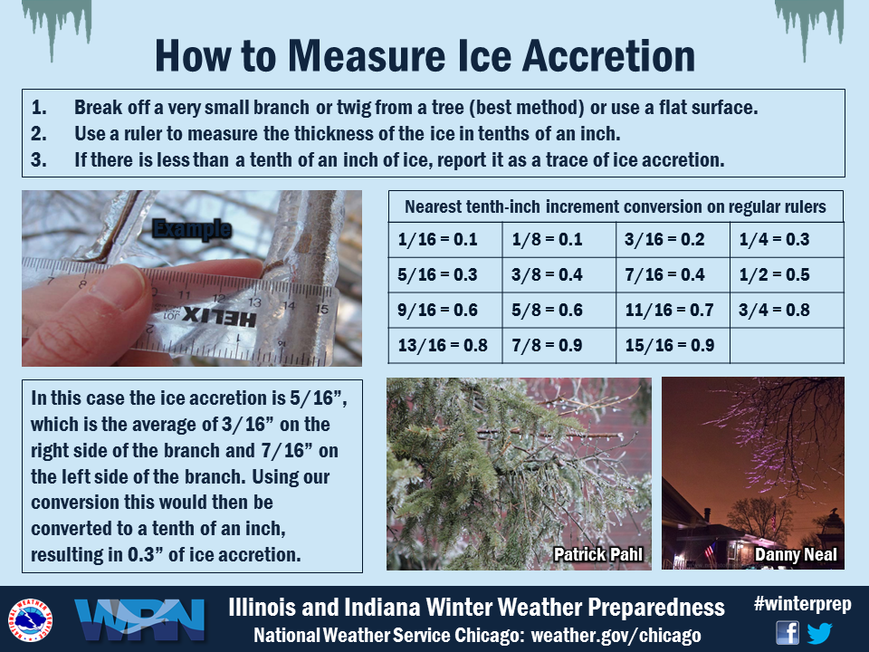
Precipitation Types:
.jpg)
Reporting:
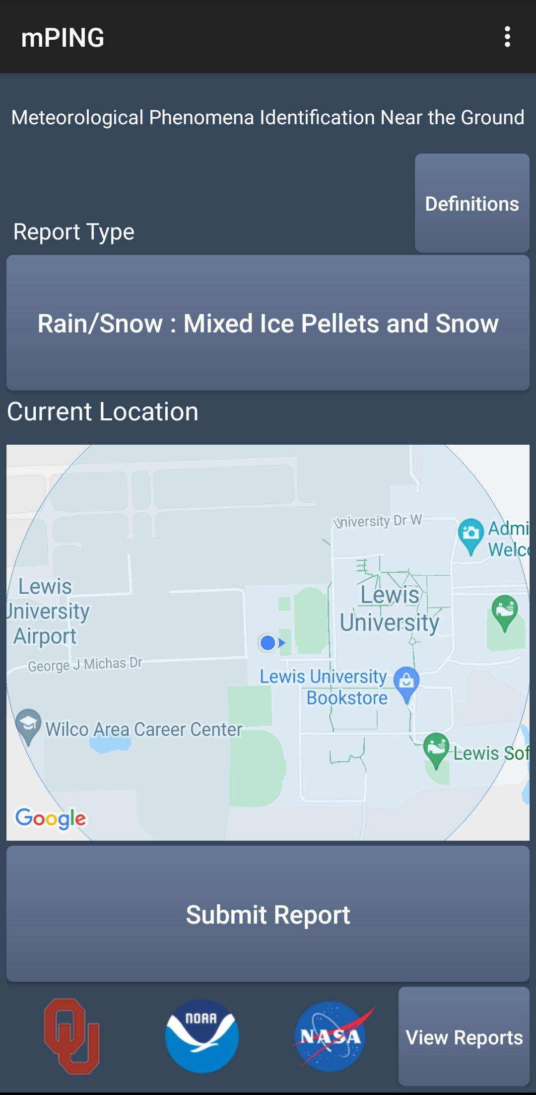
Send us your reports!
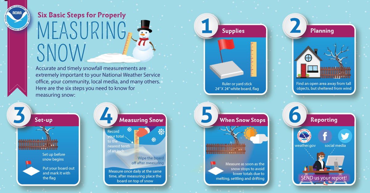
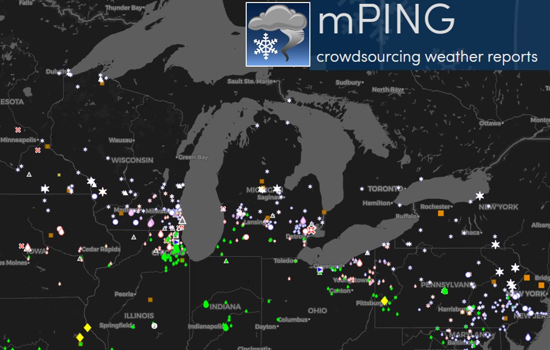
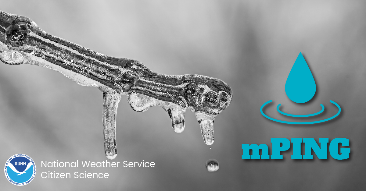
| Help us track what is happening by submitting precipitation reports through the mPing app! These observations of precipitation type plot directly on our workstations at the NWS offices, and we can use that to better assess the current state of the atmosphere and its impacts, and adapt our forecast and impact-based messaging as needed. |
Links:
Helpful Links:
West Michigan Snowfall Forecast
Scientific Forecast Discussion
Most Recent Hazardous Winter Weather Product
MDOT's interactive MI Drive Map
Submit precipitation type reports via the mPing app
Local Temperature and Precipitation Table issued twice daily at 7 am/pm EST or 8am/pm EDT
Local CoCoRaHS Precipitation Reports
National Weather Service Offices in Gaylord and Detroit.
 |
Media use of NWS Web News Stories is encouraged! Please acknowledge the NWS as the source of any news information accessed from this site. |
|

