
A cold front lingering over Florida will continue to bring showers and thunderstorms to the state over the next couple of days. Heavy rainfall and flash flooding are possible along the east coast of Florida. A Kona Low is expected to bring strong winds, widespread heavy rainfall, and flooding concerns to the Hawaiian Islands Tuesday through the weekend. Read More >
.PNG)
.PNG)
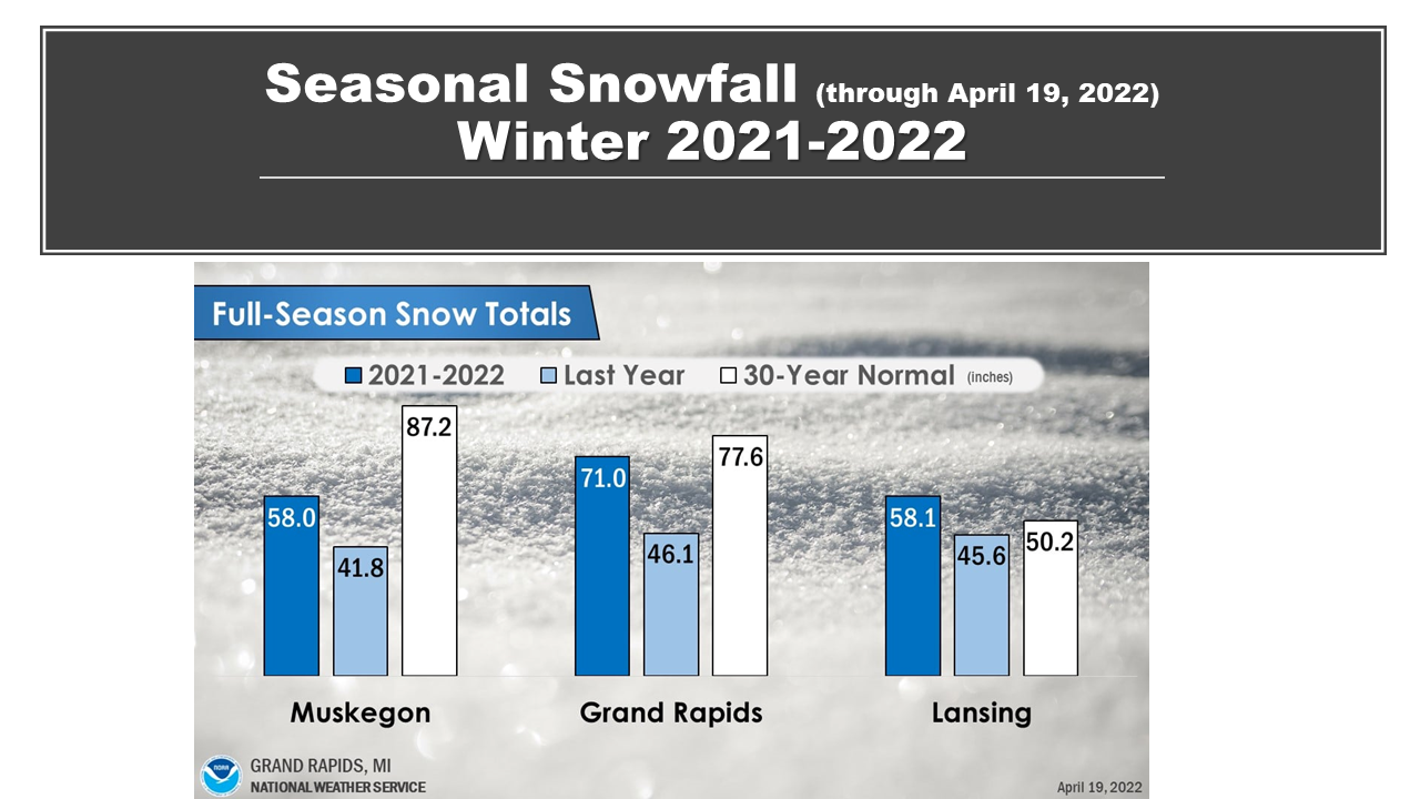
Temperatures were more or less near normal, precipitation also near normal but slightly below normal at Muskegon. Snowfall was below normal near the lake shore but above normal near I-69.
.PNG)
.PNG)
The 10 year running mean winter temperature showed a steady warming from around 1980 till around 2005. Since then the mean winter temperature has not changed significantly.
.PNG)
The mean winter precipitation was around 5 inches in the early part of the 20th century, as we got closer to the beginning of the 21st century, winters began to get wetter. As of 2020, the mean winter precipitation has increased to around 7 inches, a 2 inch increase over the past century.
.PNG)
For southwest Michigan, using the 1991 to 2020 normals, all of the southern 1/2 of Lower Michigan had near normal precipitation and temperatures.
.PNG)
However, if you compare this last winter to the entire period of record, 1895 to 2022, then this winter was on the warm side of normal, precipitation remains near normal.
.PNG)
Looking at seasonal snowfall, we did see the typical pattern of snowy by the lake shore and significantly less snowy inland of Lake Michigan.
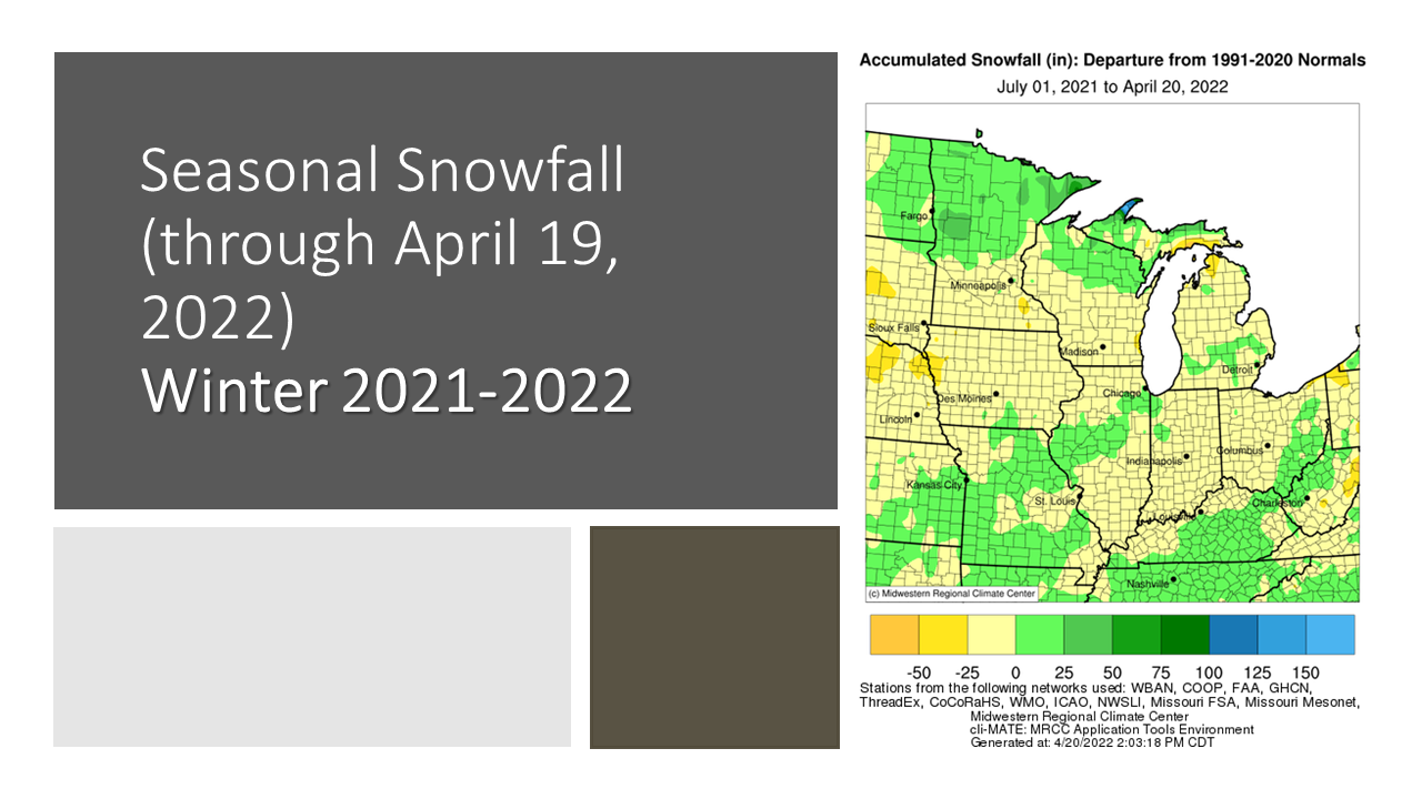
Looking at snowfall for the 2021 to 2022 Winter, using the 1991 to 2020 normals, here we see snowfall was actually around 25% below normal over a good part our area.
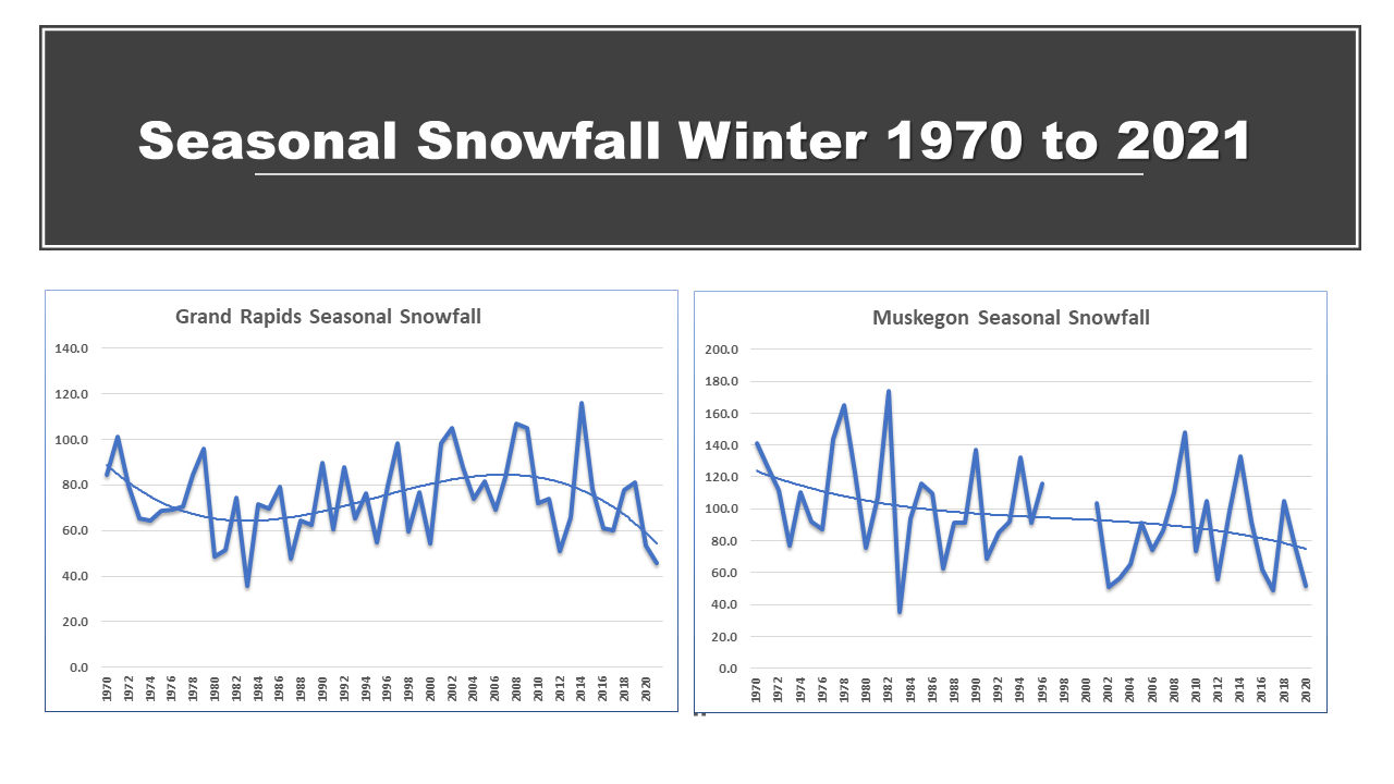
The trend, since 1970 has been for more snow at Grand Rapids till around 2015, then there has been a slow downward trend in snowfall. Muskegon has had a downward trend in snowfall since the 1970. The break in the snowfall record at Muskegon was the result of ASOS taking the observations instead of human observers. It took a few years to find a replacement observer.
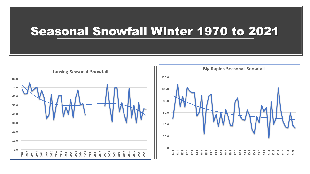
Snowfall has largely seen a downward trend since 1970 at Lansing and Big Rapids. The break in the Lansing snowfall record, like the break in the Muskegon record was the result of ASOS taking the observations instead of human observers. It took a few years to find a replacement observer.

