Scattered strong to severe storms capable of sporadic large hail and severe winds are expected this afternoon and evening across portions of western Texas. Widespread showers and thunderstorms may produce isolated flash flooding across the Ozarks today and the Southeast into next week. Read More >
During Sunday night's thunderstorms, an EF-1 tornado developed rapidly near 64th Street and Burlingame Avenue in Byron Center and tracked northeast for 6.25 miles through Wyoming and Kentwood. The tornado, on the ground for about 10 minutes, produced significant damage with estimated wind speeds up to 100-110 mph. Numerous trees, structures, and power lines were downed or damaged along a damage path 300-400 yards wide across southern Kent County. There were six injuries and no fatalities with Kent County's first tornado since an EF-0 struck Caledonia in 2006. Sunday night's tornado was the first EF-1 in Kent County since May 21, 2001. Below is a map of the tornado track along with a couple radar loops.

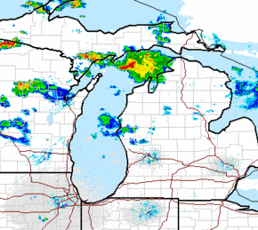
Here is a radar animation of Sunday night's thunderstorms through 2 am EDT
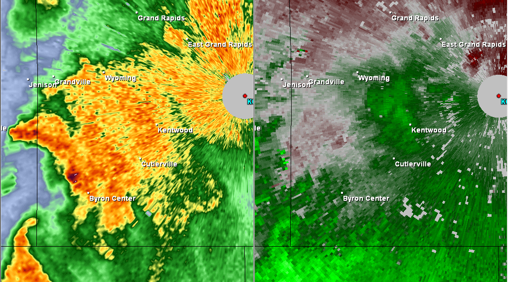
Below is a two-pane animation showing radar reflectivity on the left and radar velocity data on the right. In the reflectivity data, in the next-to-last frame, an area of higher reflectivity appears over Kentwood, likely indicative of lofted debris. In the velocity data, bright greens/blues represent the area of strongest winds associated with the southern Kent County storm.
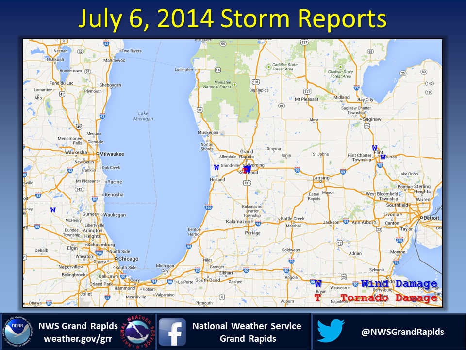
Below is a map of tornado and wind damage reports from the evening of July 6th. Severe reports were very isolated. Other than a tree down in Port Sheldon, the tornado damage was the only damage in Southwest Lower Michigan.
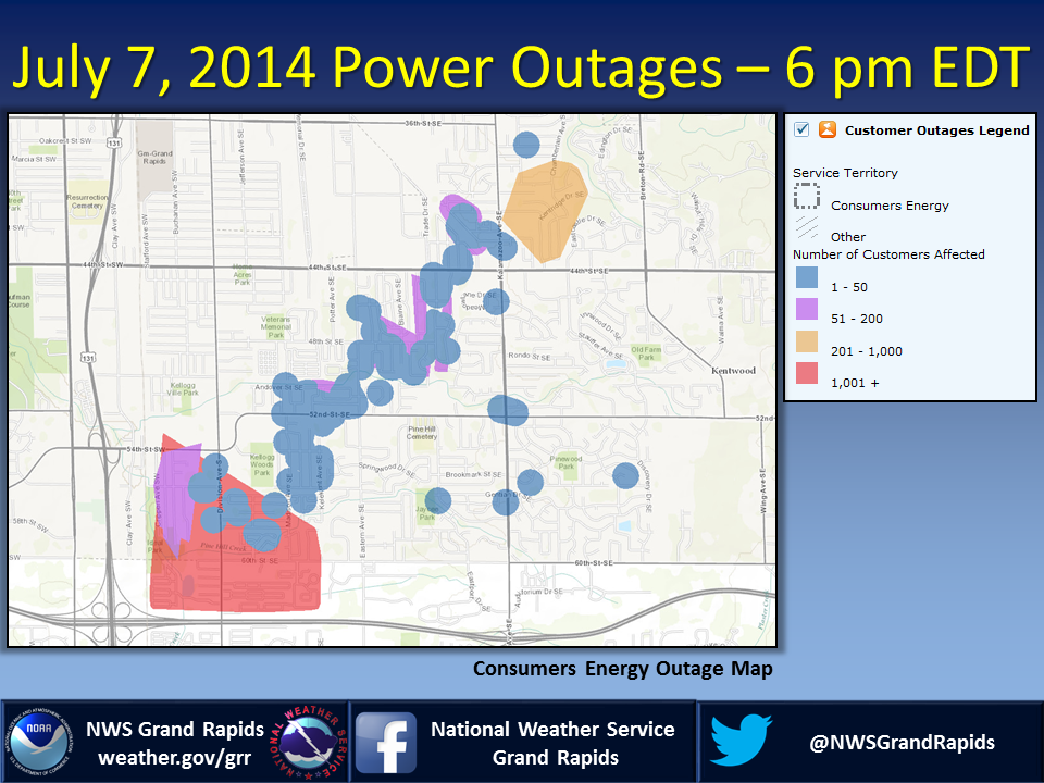
Below is the Consumers Energy Outage Map as of 6 pm on July 7, 2014, the day after the tornado. There were still thousands without power in southern Kent County.
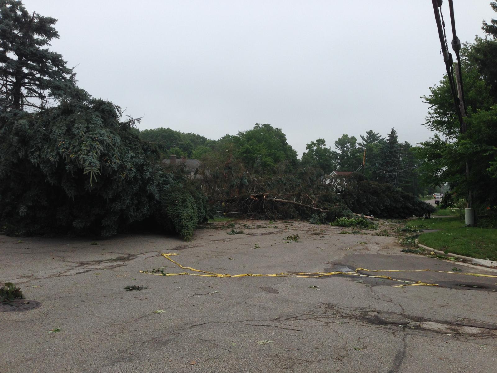
Damage Photos


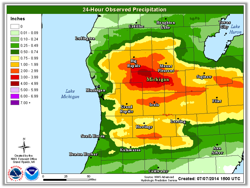
Flooding was also certainly an impact with the thunderstorms on the night of July 6, 2014, with some areas in Montcalm and Gratiot counties receiving in excess of 4 inches. Rainfall rates were 1-2 inches per hour at times. There were reports of up to 6-8 inches of water over the road, washed out roads, and closed roads in multiple communities in these two counties. The heavy rain also caused the Pine River at Alma to spike above minor flood stage.