
A cold front lingering over Florida will continue to bring showers and thunderstorms to the state and a flash flooding threat to the east coast over the next couple of days. Fire weather concerns are expected in portions of the Florida panhandle into southeastern Georgia. A Kona Low is expected to bring strong winds, widespread heavy rainfall, and flooding concerns to Hawaii through the weekend. Read More >
Event Overview
This was Southwest Michigan's heaviest snow fall event of the 2019 to 2020 winter season. Storm total snowfall amounts in 6 to 10 inch range were widespread across most of Southwest Michigan. There was 3 to 6 inches in the I-69 areas, which had the least amount of snow from this storm. Most of the pure storm system snow fell from the evening of the 17th into morning of the 18th. Southern and central sections of Lower Michigan saw the precipitation change to sleet and freezing rain during the mid to late morning hours of the 18th. Once the surface low moved east of the area, by early afternoon on the 18th, lake enhanced snow fell from the afternoon of the 18th into the morning of the mid morning of the 19th. The lake enhanced part of the storm featured wind gusts as high as 54 mph at Battle Creek but most areas had winds gusting to around 45 mph. Temperatures fell from the mid to upper 30s around noon on the 18th to the lower 20s by late evening and into the teens by the morning of the 19th. The combination of gusty west to southwest winds, snow showers that were heavy at times and temperatures well below freezing resulted in considerable blowing and drifting of the snow.
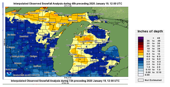
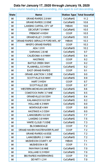
Snowfall Reports from the storm
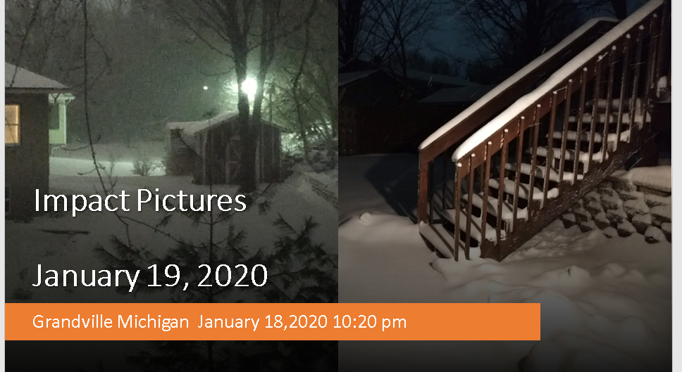
Thank you to everyone who submitted damage reports, photos, and videos!
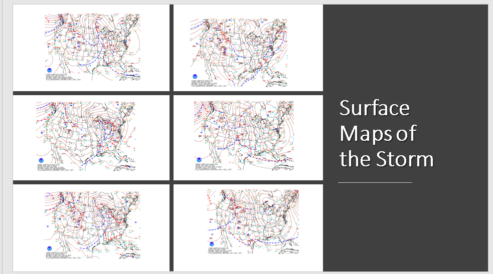
Surface Maps
Below are the surface maps, 12 hours apart, showing the history of the the storm at the surface. This was one of those classic deep storms that brings heavy synoptic snow fall as the storm moves in, then lake effect snow with gusty winds once the storm moves out of the area bringing in the cold air from Canada.
Radar
 |
Media use of NWS Web News Stories is encouraged! |
|
Page Last Updated: May 5th, 2020

