
An active frontal boundary will set up across Michigan over the weekend, bringing rounds of showers and possible thunderstorms. Some of the storms on Sunday afternoon and evening could be severe. A sharp temperature contrast will exist across the front, with temperatures ranging from the 30 and 40s in northern Michigan to near 70 south. Read More >
Grand Rapids, MI
Weather Forecast Office
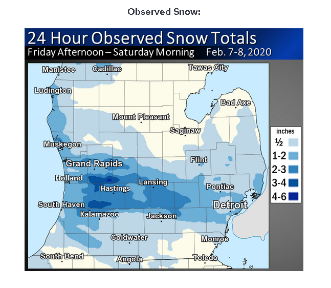
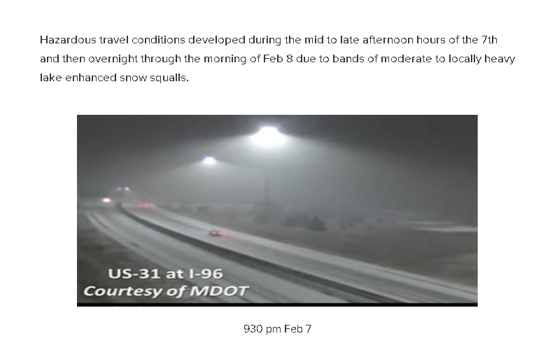
Strong areas of 1000-850 mb convergence combined with an upper level disturbance and moisture from Lake Michigan to bring a brief convective burst of heavy snow near to south of I-96 during the mid to late afternoon hours of the 7th of February 2020. Another upper air disturbance and stronger 1000-850 mb convergence brought a swath of heavy snow near to south of I-96 overnight, with up to 4 to 5 inches of snow reported at Byron Center.

US Dept of Commerce
National Oceanic and Atmospheric Administration
National Weather Service
Grand Rapids, MI
4899 Tim Dougherty Drive SE
Grand Rapids, MI 49512-4034
616-949-0643
Comments? Questions? Please Contact Us.

