
Partly cloudy and cold today with temperatures holding in the 30s for highs. Normal highs are in the lower to middle 50s. A clipper system moving through the Southern Great Lakes on Wednesday will bring some rain and snow to the area with accumulating light snow possible along and south of I-96. Accumulations of an inch or two of wet snow are possible Wednesday near I-94. Read More >
Grand Rapids, MI
Weather Forecast Office
Overview
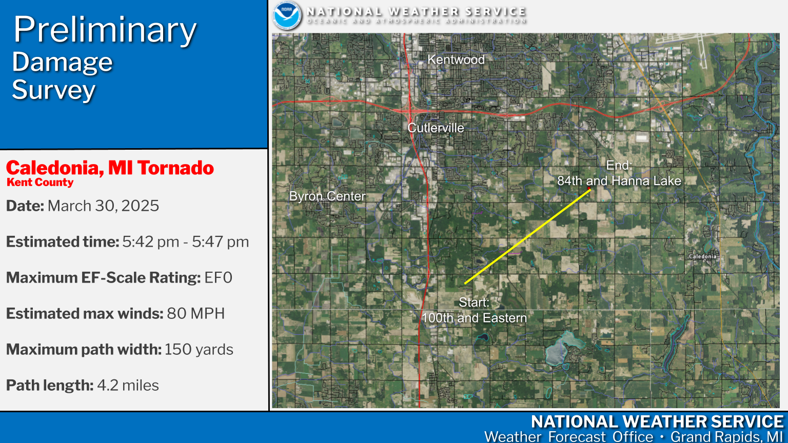
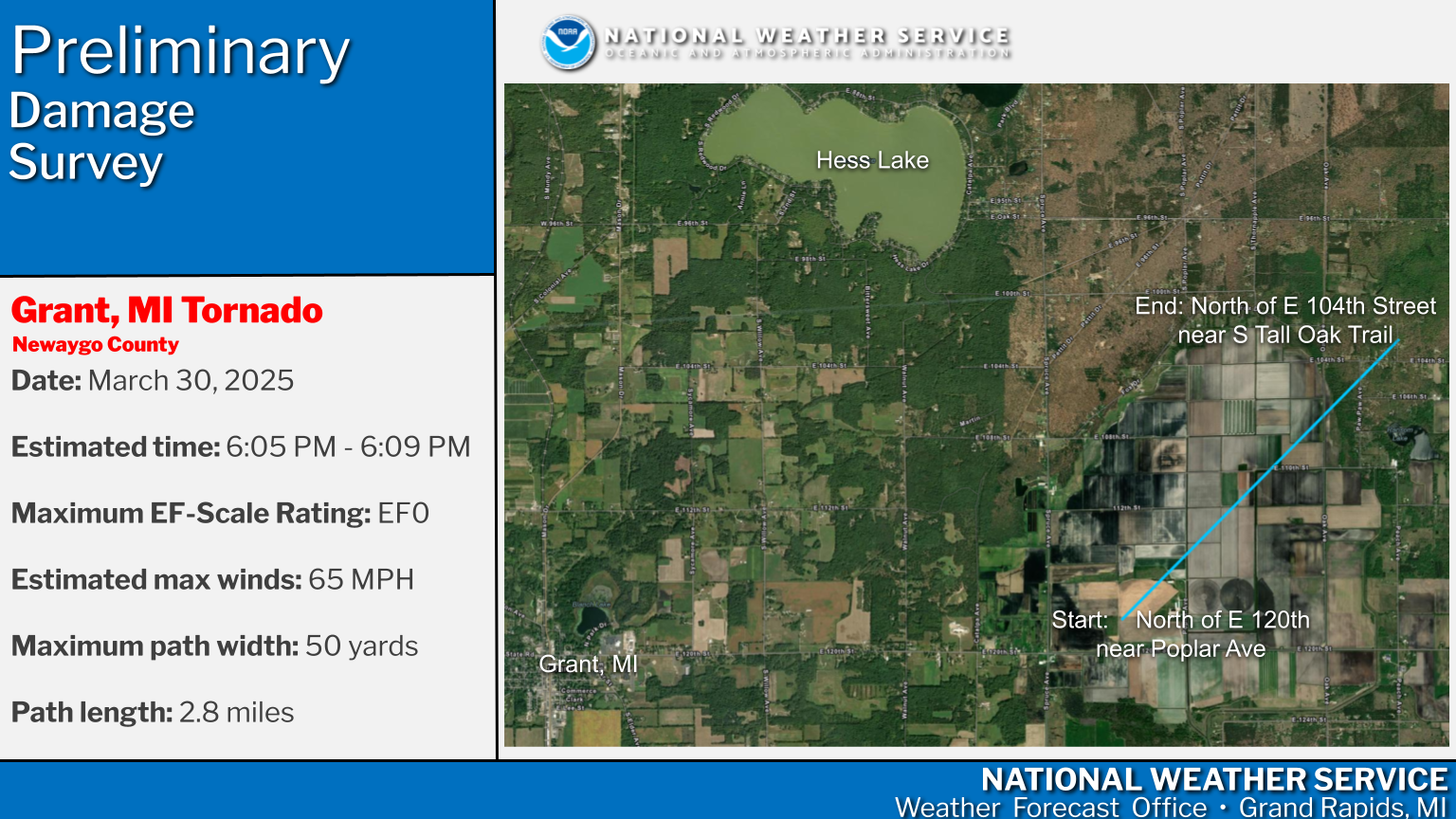
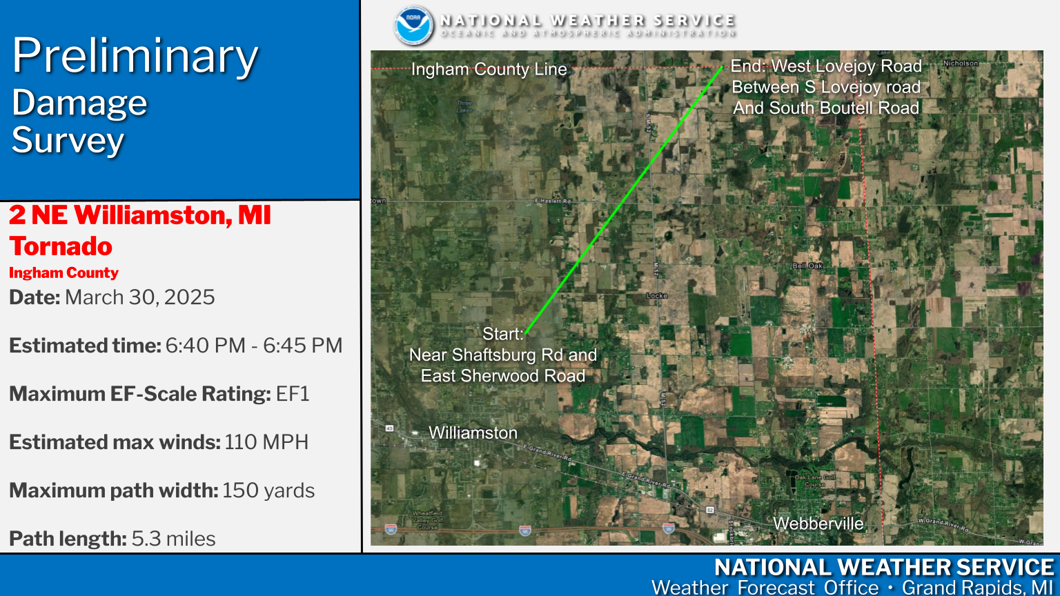
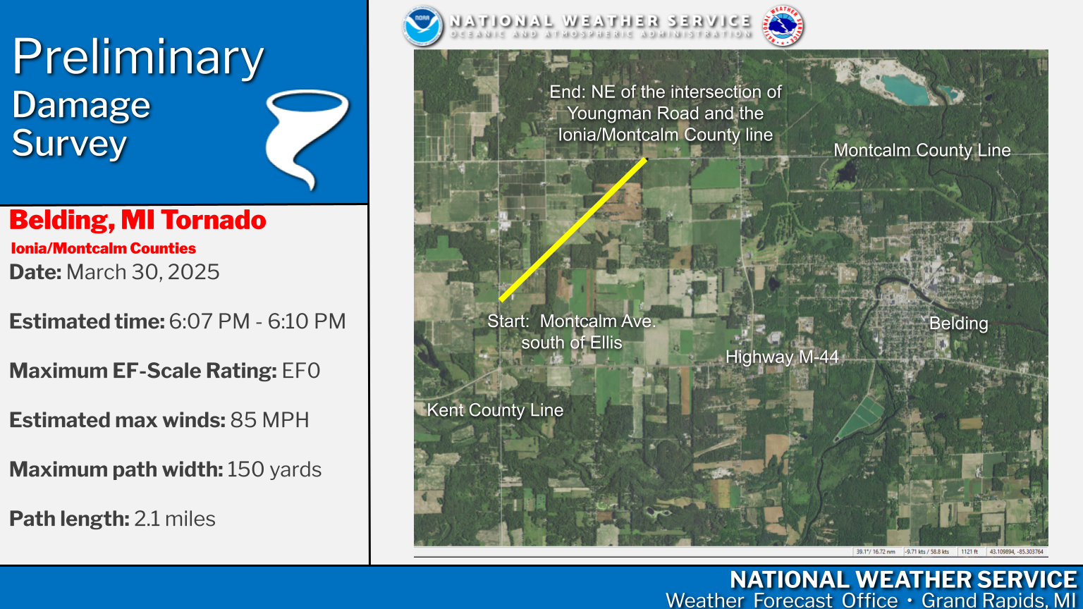
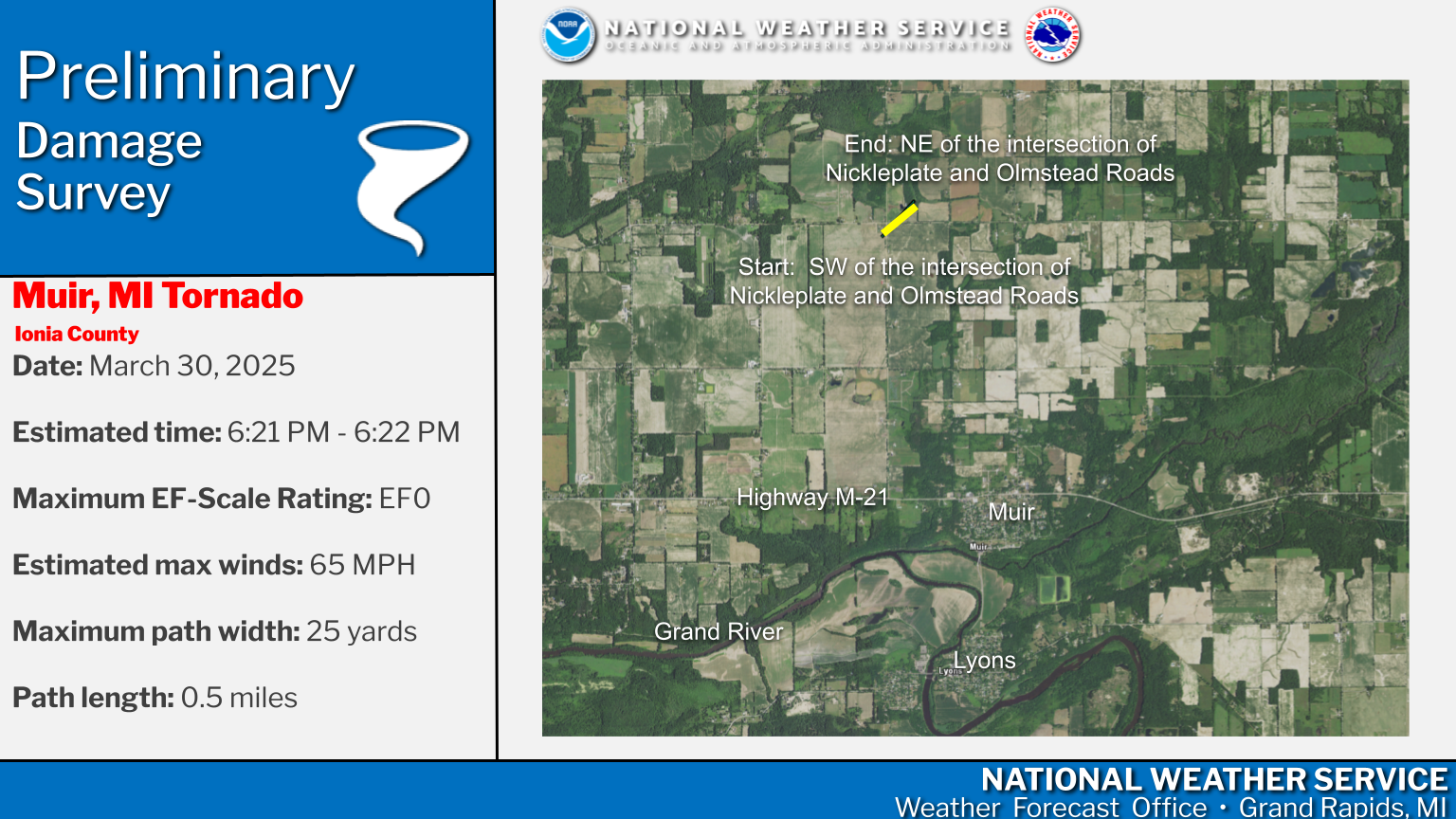
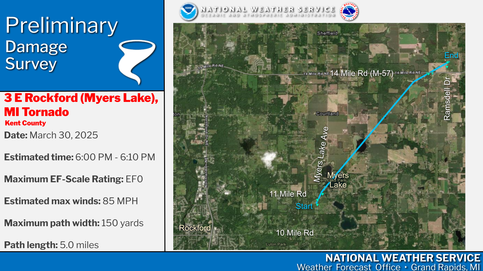
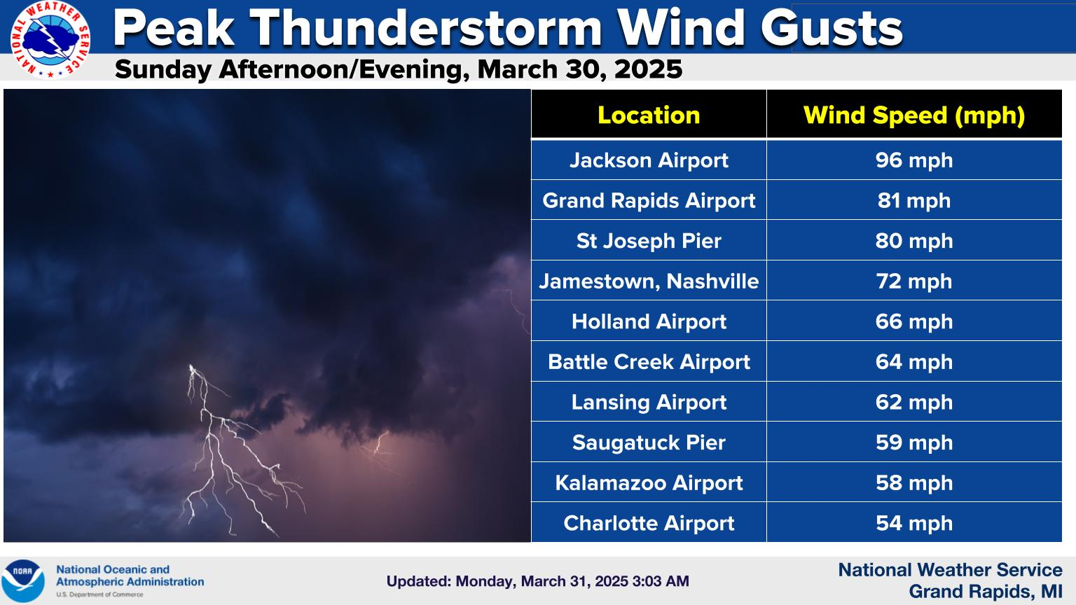
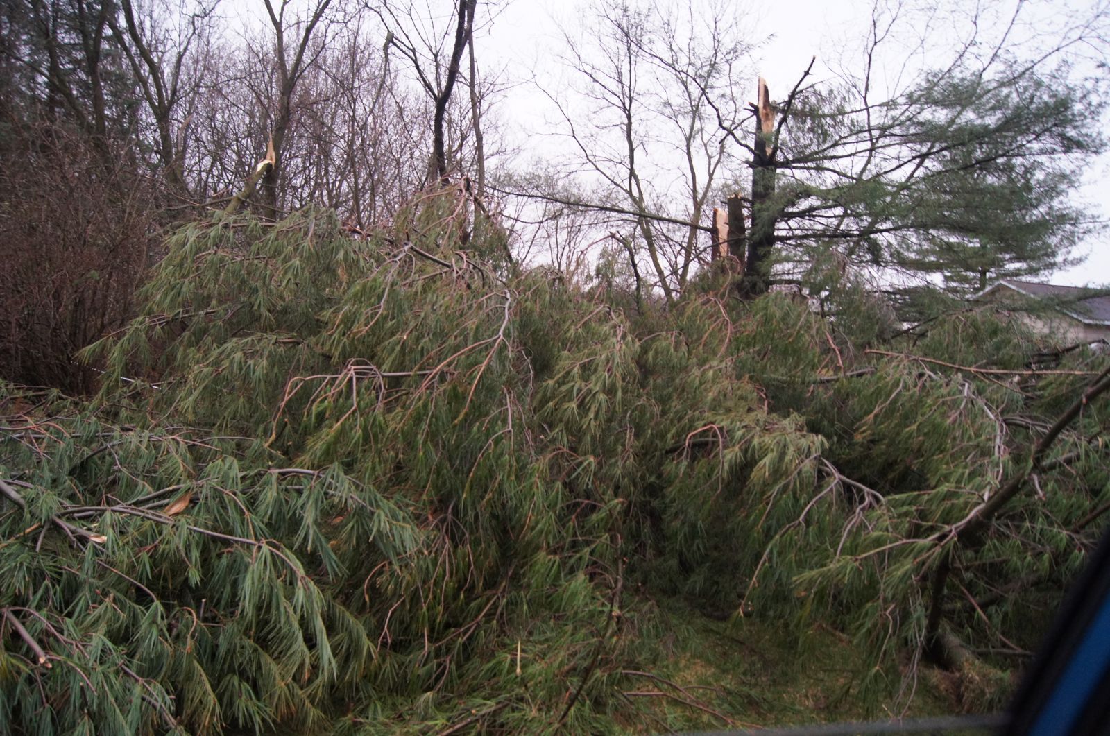
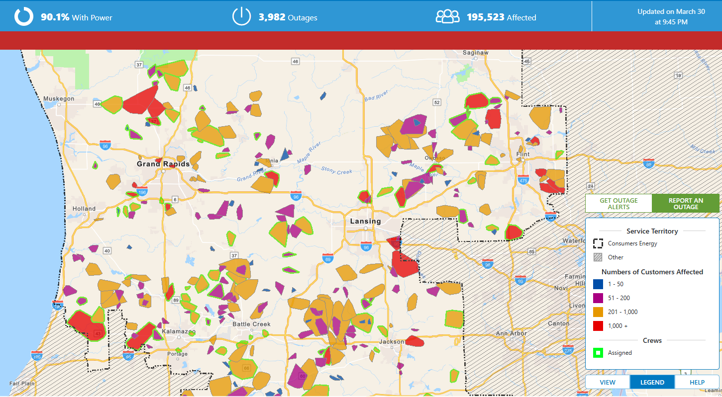
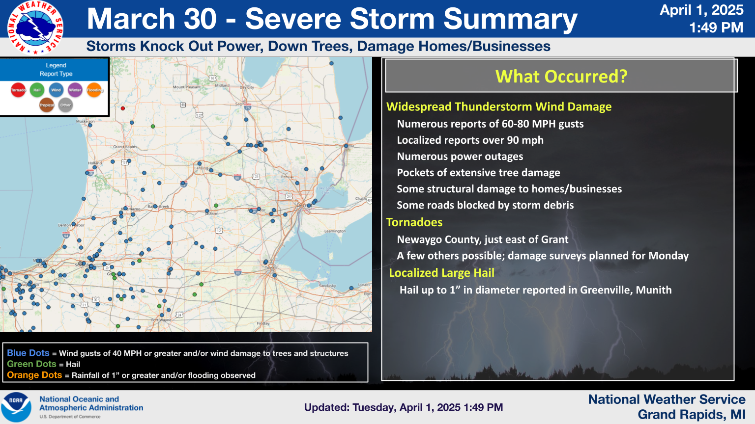
Between roughly 4 PM and 8 PM EDT on March 30, 2025, unusually severe thunderstorm wind gusts brought damage to much of Southwest Lower Michigan. The Grand Rapids International Airport reported a peak gust of 81 mph and Jackson Airport reported a 96 mph gust. Seven tornadoes had been confirmed in the Grand Rapids forecast area.
Tornadoes
Seven tornadoes had been confirmed as of April 4, 2025

The Enhanced Fujita (EF) Scale classifies tornadoes into the following categories:
| EF0 Weak 65-85 mph |
EF1 Moderate 86-110 mph |
EF2 Significant 111-135 mph |
EF3 Severe 136-165 mph |
EF4 Extreme 166-200 mph |
EF5 Catastrophic 200+ mph |
 |
|||||
Wind
These are reported peak winds. Many other non-official locations not listed here experienced wind gusts well above 60 mph.
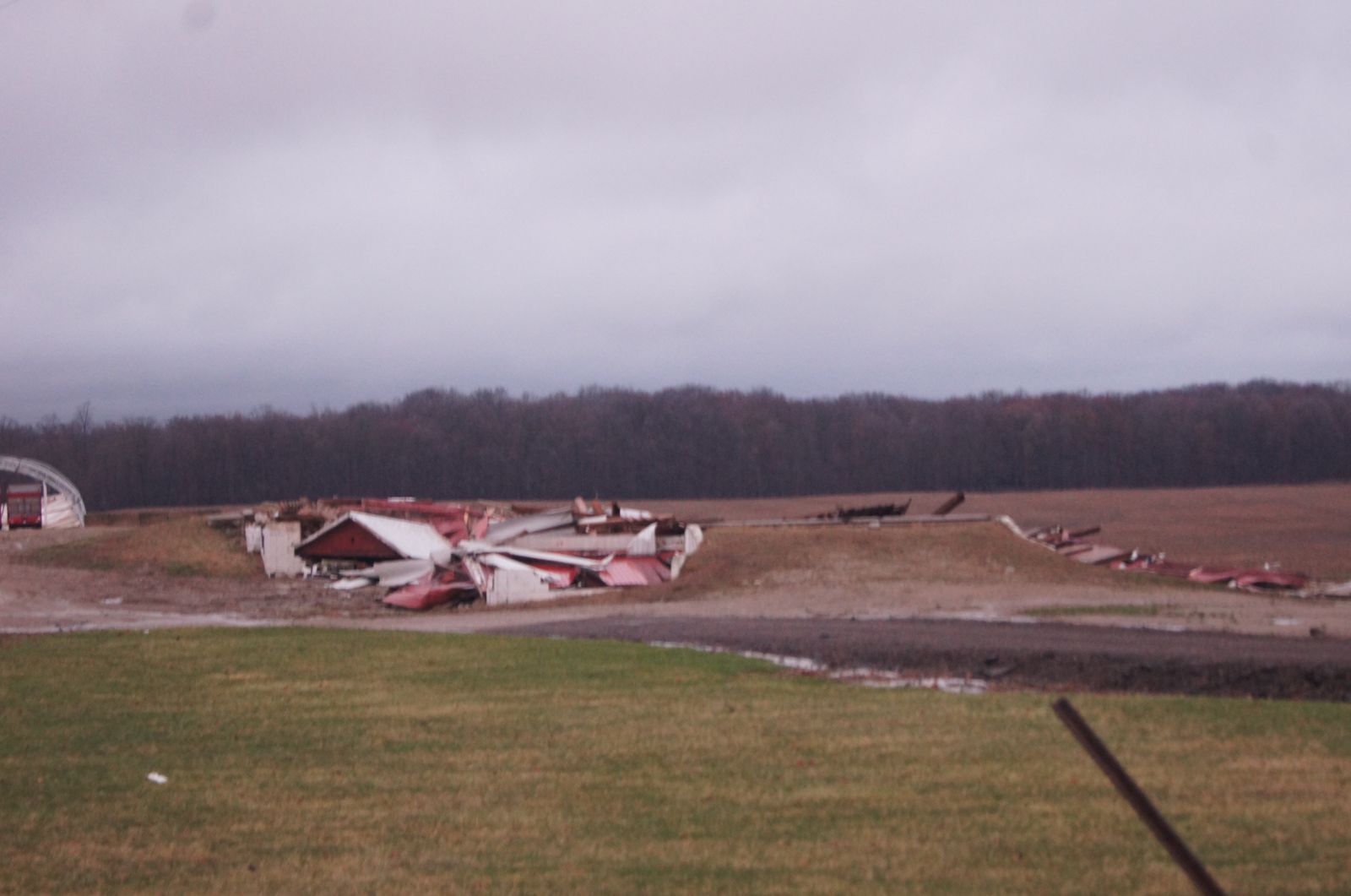
Photos
.PNG)


Radar
Storm Reports
 |
Media use of NWS Web News Stories is encouraged! Please acknowledge the NWS as the source of any news information accessed from this site. |
|
US Dept of Commerce
National Oceanic and Atmospheric Administration
National Weather Service
Grand Rapids, MI
4899 Tim Dougherty Drive SE
Grand Rapids, MI 49512-4034
616-949-0643
Comments? Questions? Please Contact Us.

