
Most of Monday's rainfall will be done by mid or late morning, then 30 to 40 mph gusts are expected the rest of the day. Temperatures will climb to 55 to 65 degrees across Lower Michigan during the morning, then drop about 10 degrees during the afternoon. Read More >
Grand Rapids, MI
Weather Forecast Office
Overview
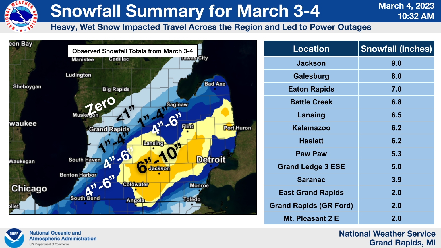
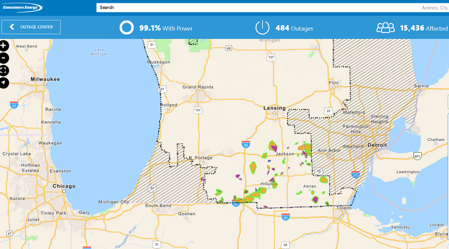
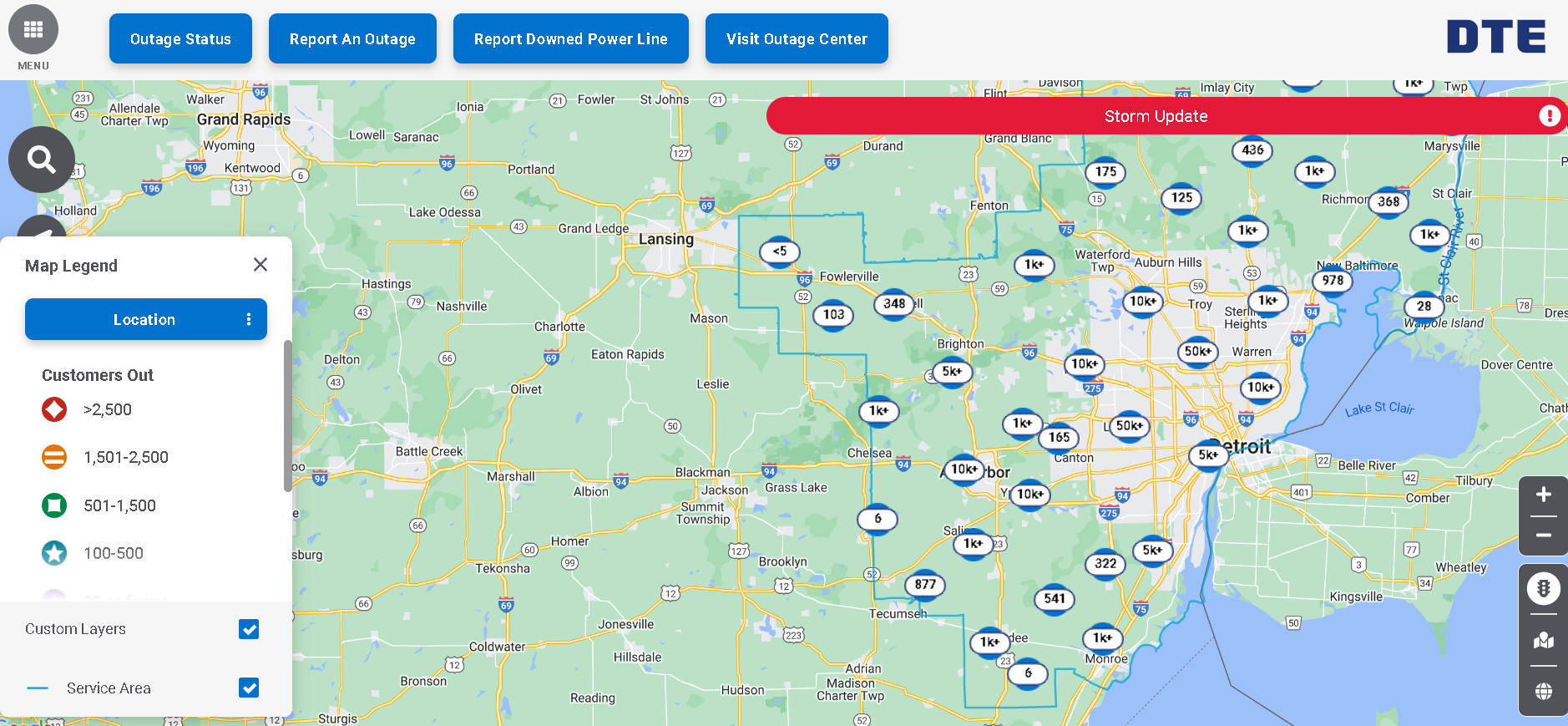
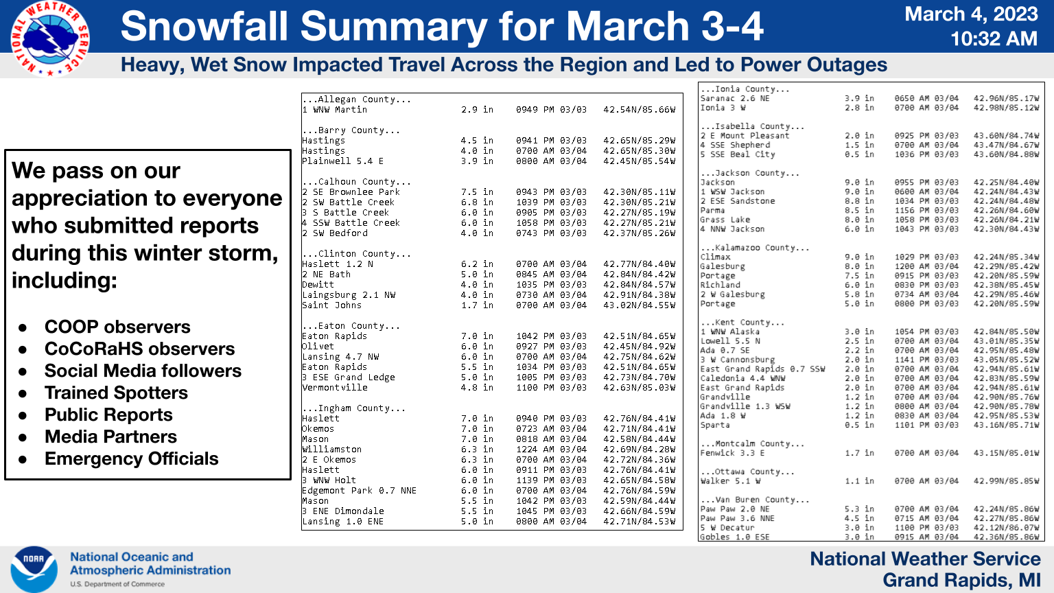
A winter storm brought heavy, wet snow to southern Lower Michigan from the afternoon of March 3 into early March 4, 2023. This storm produced a swath of 6"-10" from Kalamazoo/Battle Creek east toward Lansing and Jackson, then extending into the Thumb Region. The weight of the snow on trees and power lines led to around 350,000 power outages across southeast sections of the state.Snow/Ice
Photos & Video
Snowfall and Power Outages
 |
 |
 |
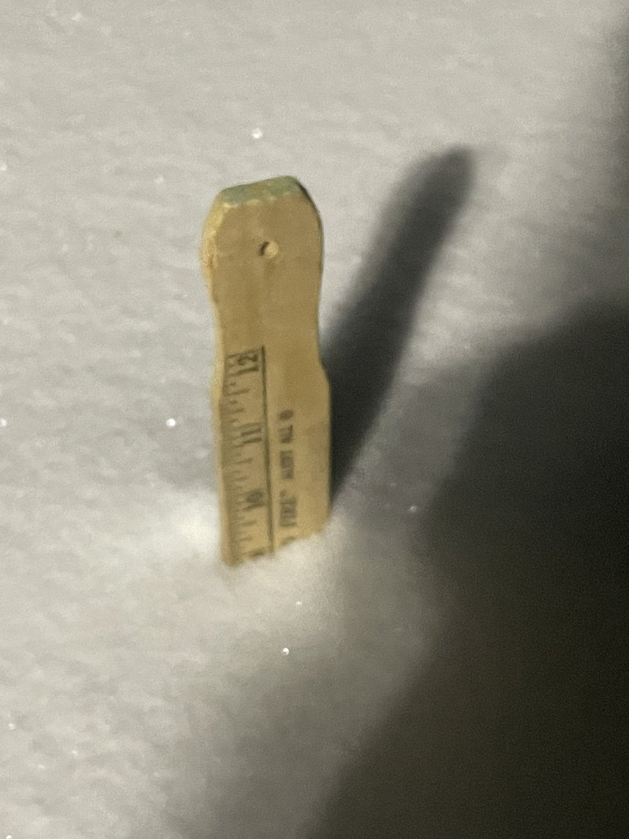
| Jackson @pdbowen55 |
Consumers Energy Outages, March 4 |
DTE Outage Map, March 4 |
Radar
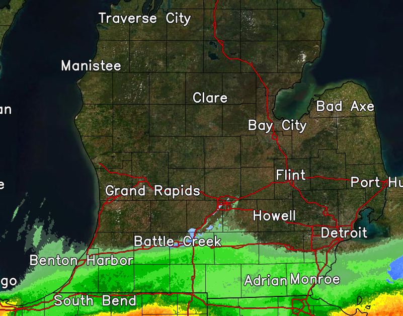
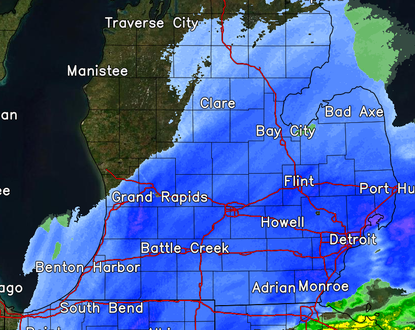
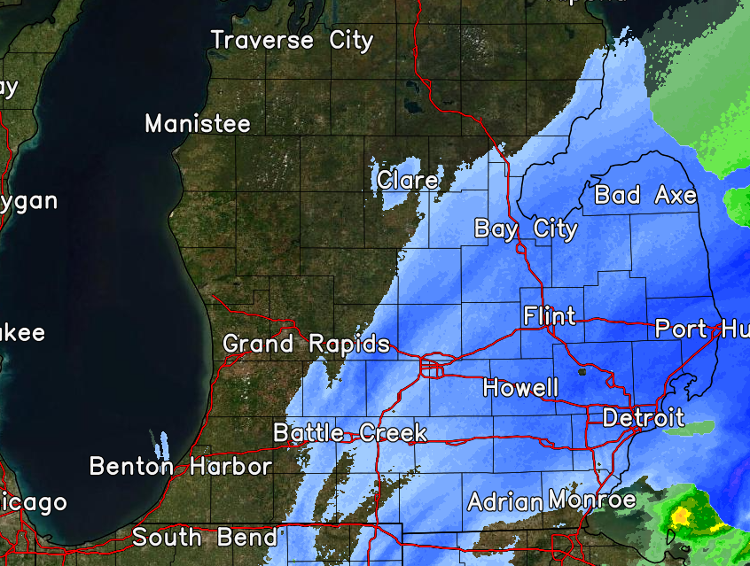
A rain/snow mix moved in from northern Indiana early in the afternoon on March 3 before turning over to all snow across southern Lower Michigan.
Early Afternoon - March 3 Mid Evening - March 3 Late Evening - March 3
Storm Reports
 |
Media use of NWS Web News Stories is encouraged! Please acknowledge the NWS as the source of any news information accessed from this site. |
|
US Dept of Commerce
National Oceanic and Atmospheric Administration
National Weather Service
Grand Rapids, MI
4899 Tim Dougherty Drive SE
Grand Rapids, MI 49512-4034
616-949-0643
Comments? Questions? Please Contact Us.

