
Excessive rainfall may produce locally considerable flash flooding over parts of South Texas, the western Gulf Coast, and lower Mississippi River Valley today into Thursday. Rainfall totals of 5 to 10 inches are expected. Hot temperatures may cause heat illnesses over central and northern California and the Pacific Northwest through Tuesday. Read More >
October 22th, 2019: Large Waves, High Winds, and Beach Erosion (Again)
|
|
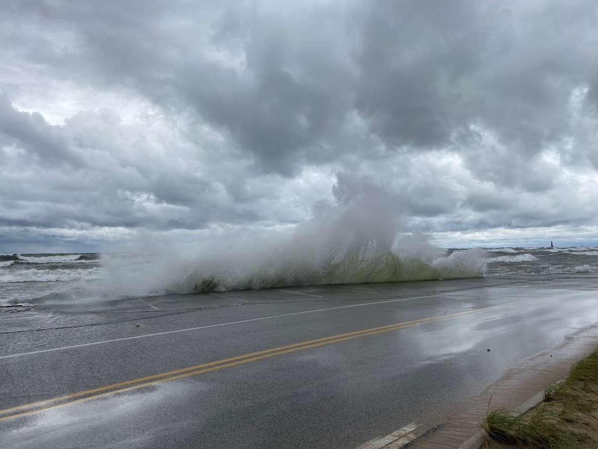
| Large wave hitting Beach Street in Muskegon on October 22nd, 2019 |
On Tuesday, October 22th, 2019, a storm system brought high winds and large waves to the West Michigan lakeshore for the second time in the span of a week. Wind gusts topped 50 mph and waves grew to more than 10 feet in height downing trees along the lakeshore and causing significant beach and sand dune erosion, respectively. Unlike during the October 16th, 2019 event which hit areas roughly from Grand Haven southward hard, this storm was worst from Grand Haven northward where more than 10 feet of dune bluff was eroded in a 24 hour period due to the combination of near-record Lake Michigan water levels and large waves. Any fall storms that bring a period of high waves will continue to cause bluff erosion and lakeshore flooding.
This storm also impacted northern Lower Michigan. See a summary created by NWS Gaylord.
Large Waves:
Large waves developed on Lake Michigan within a southwesterly to westerly fetch. Wave heights of 10 to 12 feet were common, with a maximum wave height of over 16 feet measured just offshore of Muskegon. The largest waves stretched roughly from Grand Haven northward and lasted for nearly 24 hours.
 |
| Time series of wave heights measured by the buoy near Holland, Michigan on October 22nd, 2019. Note the duration of highest wave heights lasted more than 24 hours. |
 |
| Time series of wave heights measured by the buoy near South Haven, Michigan on October 22nd, 2019. Note the duration of highest wave heights lasted more than 24 hours. |
The average water level on Lake Michigan was roughly 2.7 feet (~32 inches) above normal when the storm hit, which is near-record level. The combination of the near-record high water levels and large waves for 24 hours led to significant erosion.
High Winds:
Wind gusts above 45 mph were common especially along the lakeshore. The strongest measured wind gust was 55 MPH at Muskegon County Airport. The strength of the winds downed tree limbs - and in a few cases whole trees - leading to power outages along the lakeshore.
Here is a list of measured wind gusts from trusted sources:
...SELECTED HIGHEST WIND REPORTS... Location Speed Muskegon County Airport 55 MPH 1016 AM 10/22 Grand Haven Light 54 MPH 0948 AM 10/22 Muskegon North Breakwater 54 MPH 1018 AM 10/22 Saugatuck Pier 53 MPH 1055 AM 10/22 W Mich Regional Airport 52 MPH 1109 AM 10/22 Holland Harbor 51 MPH 0248 PM 10/22 South Haven 51 MPH 0810 PM 10/22 St. Joseph Pier 50 MPH 0101 PM 10/22 Ludington 48 MPH 0830 AM 10/22 3 WNW Roosevelt Park 48 MPH 0430 PM 10/22 Battle Creek 47 MPH 0230 PM 10/22 Lansing 46 MPH 1211 PM 10/22 38 E Wind Point 45 MPH 0750 PM 10/22 3 W Port Sheldon 45 MPH 0150 PM 10/22 Ludington 44 MPH 0815 AM 10/22 Gerald R Ford Airport 43 MPH 1230 PM 10/22 2 W South Haven 40 MPH 0800 PM 10/22 Alma 40 MPH 1256 PM 10/22 Kalamazoo 40 MPH 0437 PM 10/22 Fremont Municipal Airport 40 MPH 0820 AM 10/22 Jackson 40 MPH 0407 PM 10/22 South Haven Airport 40 MPH 0817 PM 10/22 Observations are collected from a variety of sources with varying equipment and exposures. We thank all volunteer weather observers for their dedication. Not all data listed are considered official. |
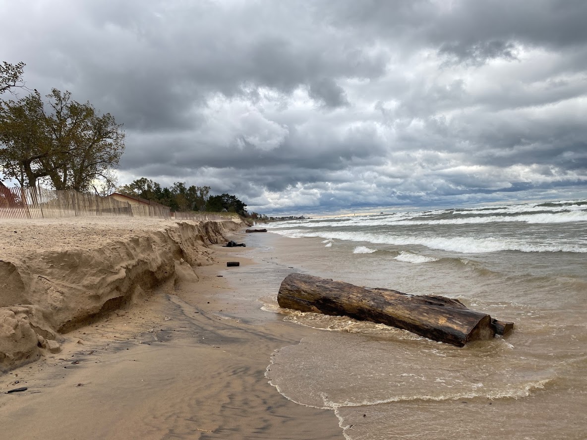
Lakeshore Erosion and Flooding:
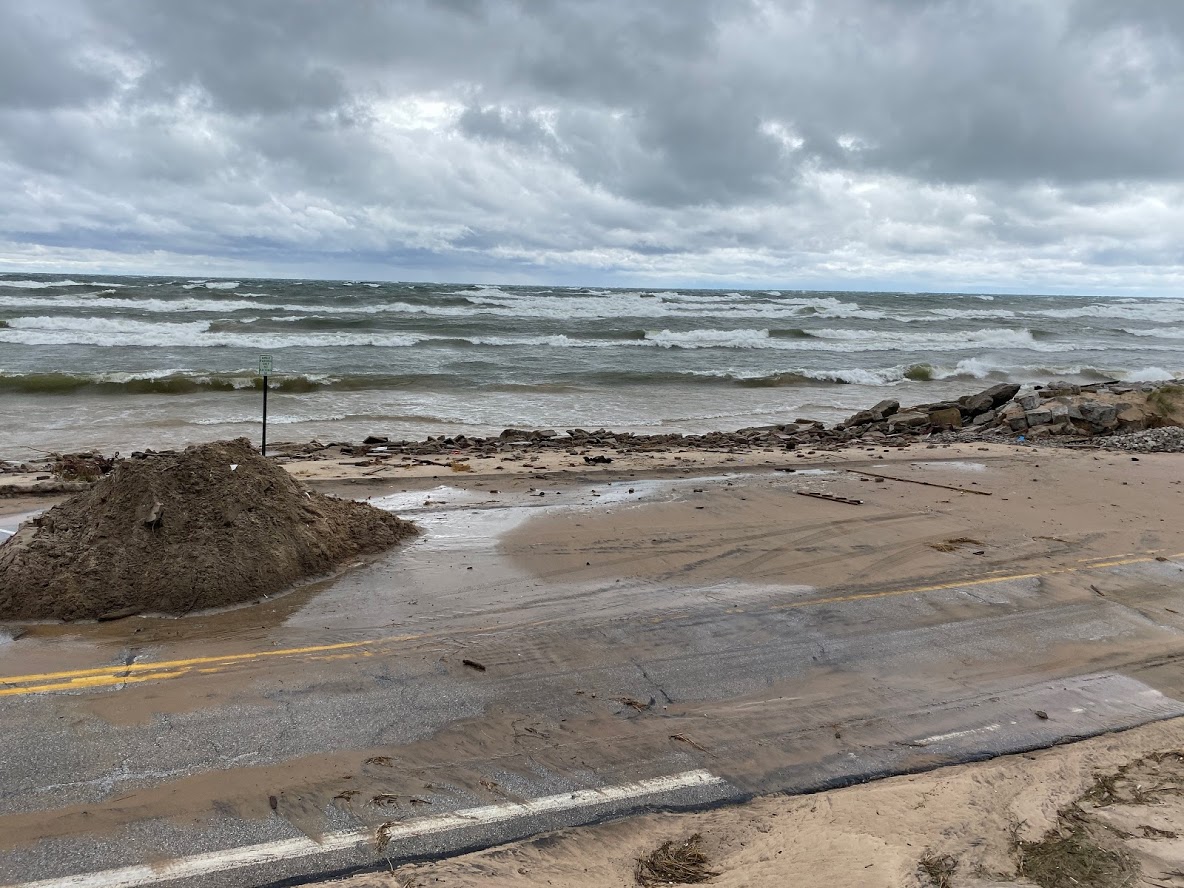
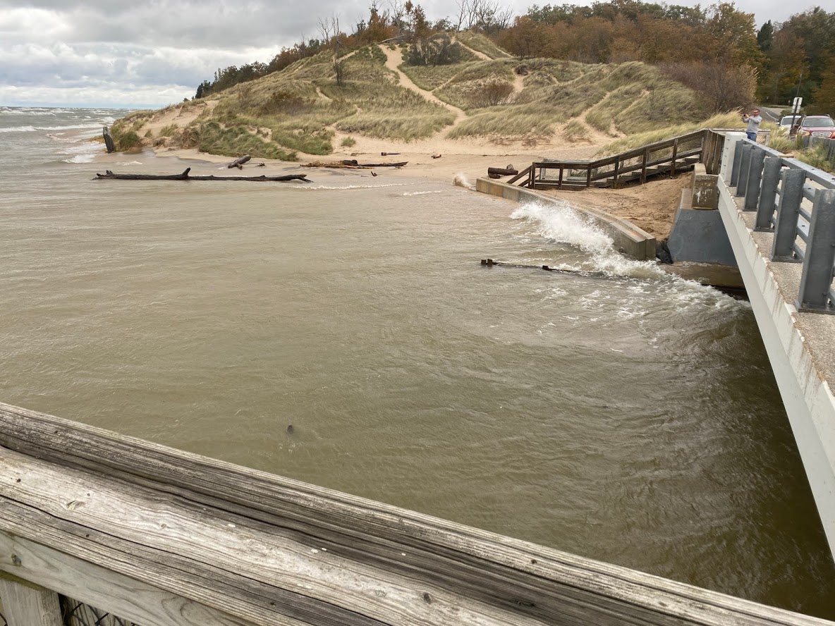
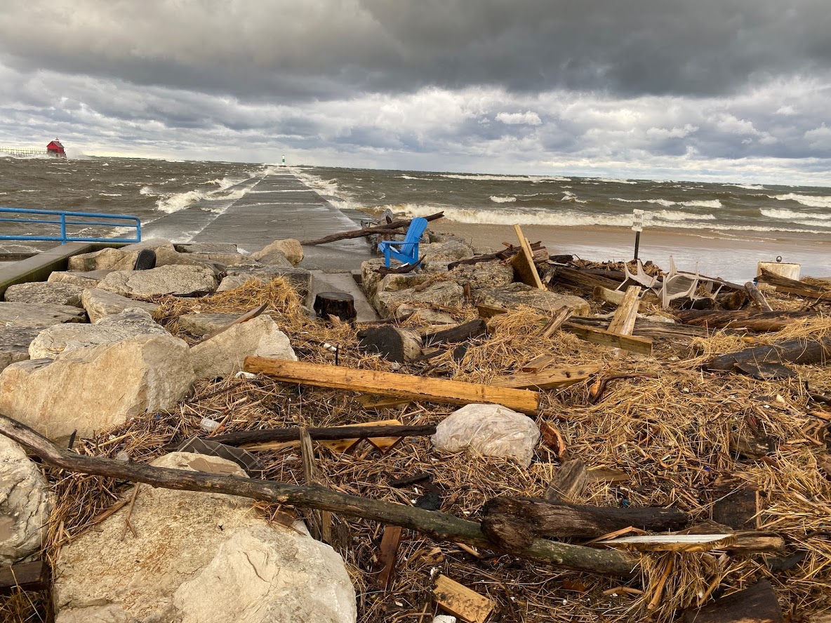
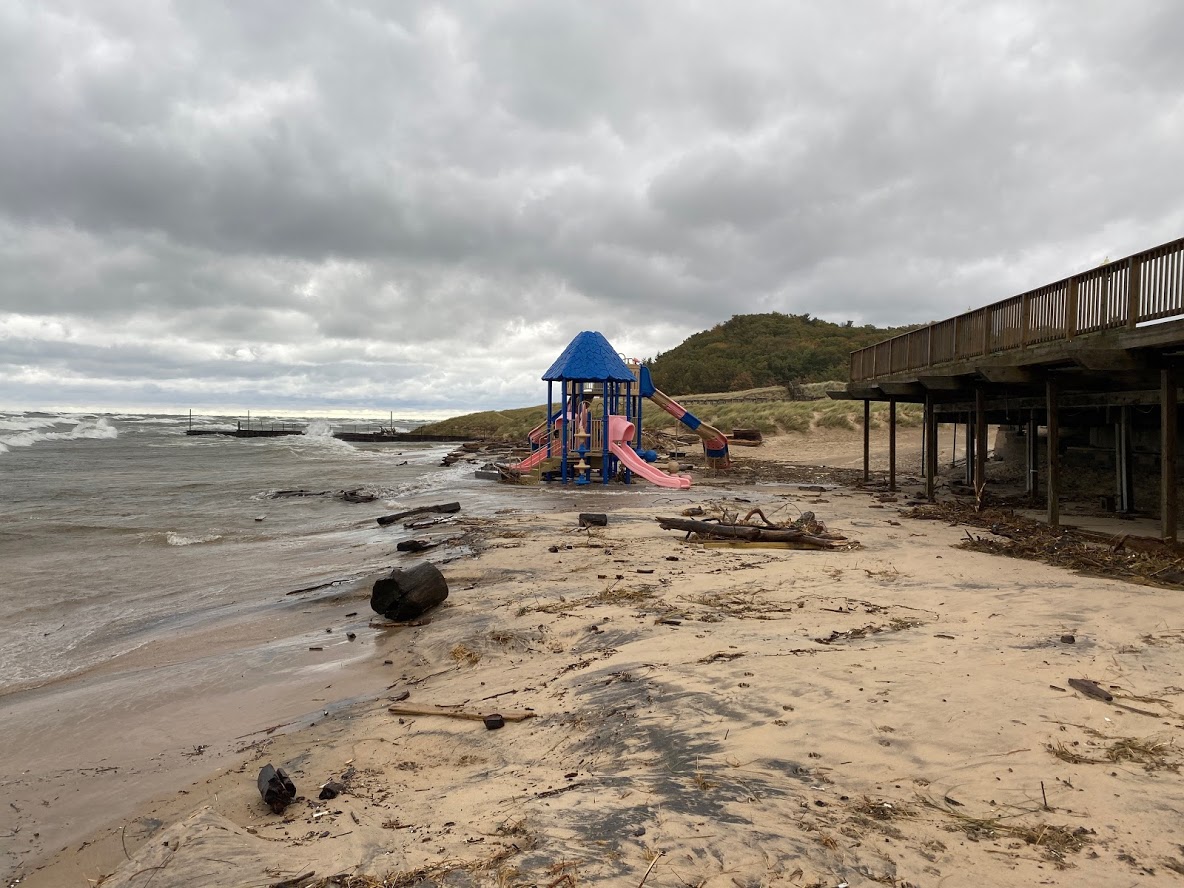
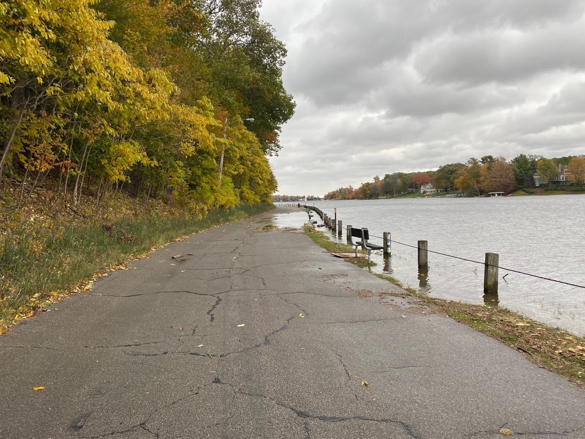
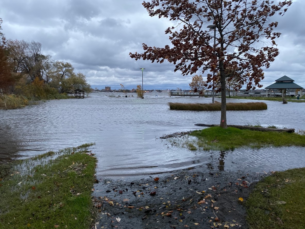
Significant beach and sand dune erosion occurred due to the large waves and near-record high Lake Michigan water levels. In the hardest hit areas, more than 10 feet of dune bluff was eroded during a 24 hour period. These last two storms have been the most impactful to our lakeshore since 1986 when Lake Michigan water levels were at record high levels (see summary from October 16th, 2019 event).
NWS Grand Rapids sent staff to survey the beach and sand dune erosion as it was happening. A few pictures taken by the survey crew are shown below.
(click on any image to enlarge)
 |
 |
 |
| Beach street in Muskegon (NWS Survey) | Beach street in Muskegon (NWS Survey) | Duck Lake State Park |
 |
 |
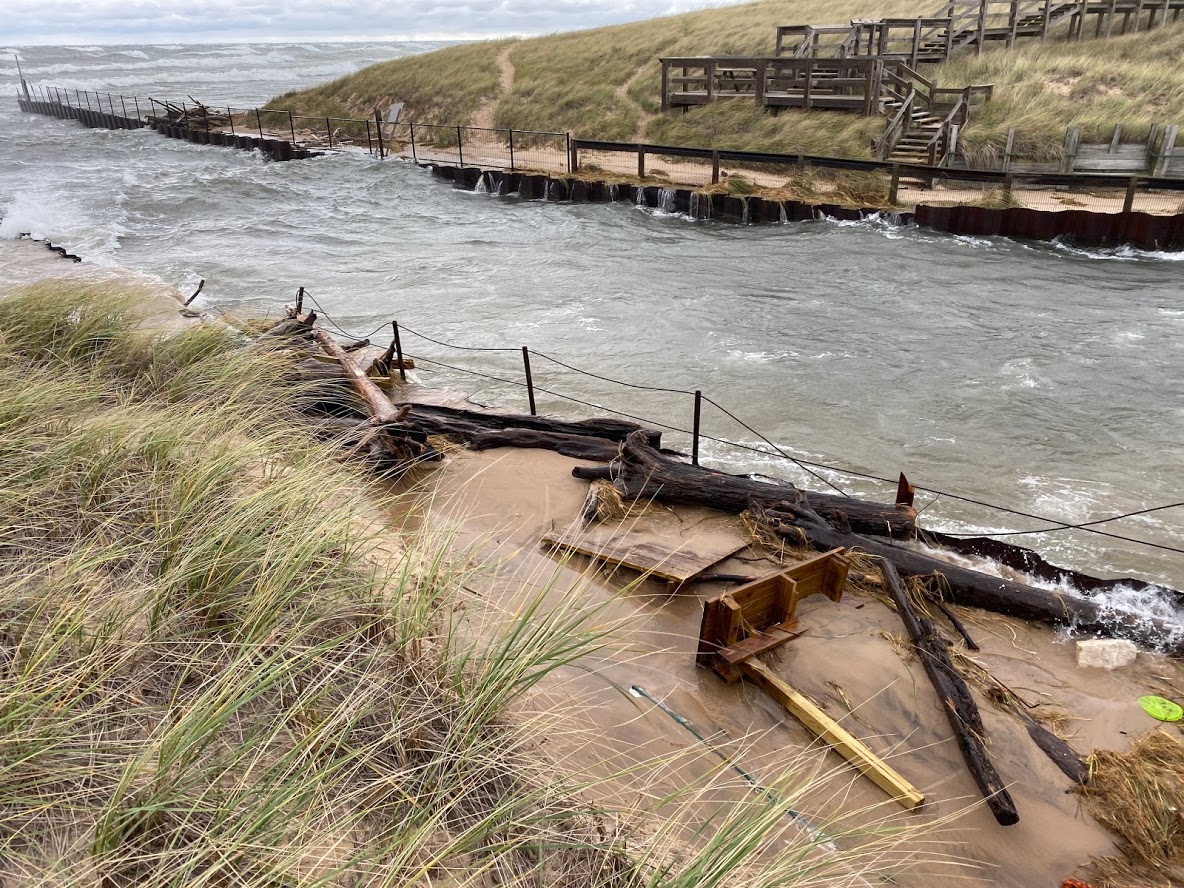 |
| Grand Haven (NWS Survey) | Near Lake Harbor Park south of Muskegon (NWS Survey) | Lake Harbor Park south of Muskegon (NWS Survey) |
 |
 |
 |
| Mona Lake near Muskegon (NWS Survey) | Muskegon Lake at North Muskegon Waterfront Sports Park (NWS Survey) | North Park Beach near Grand Haven (NWS Survey) |
The pictures above only hint at the scope of the beach erosion and flooding that occurred along the lakeshore. Many homes along the lake are at risk of damage as waves continue to erode dunes beneath foundations. With Lake Michigan water levels forecast to remain high through at least the winter months, the risk of lakeshore flooding and dune erosion will continue for the foreseeable future.
 |
Media use of NWS Web News Stories is encouraged! Please acknowledge the NWS as the source of any news information accessed from this site. |
|

