National Weather Service United States Department of Commerce

Severe Thunderstorms and Heavy Rain in the Southern Plains; Fire Weather Threat in the Southwest U.S.

Thunderstorms, some severe, may produce heavy to excessive rainfall and isolated flooding over portions of the Southern Plains today and Saturday. Dry conditions, combined with gusty winds and low relative humidities will continue to support an elevated to critical fire weather threat in the Desert Southwest into to early next week. Read More >


National DSS Page

Current Watches and Warnings

 
   Hazardous Weather Outlook  

   Flash Flood Watch  
   Flash Flood Warning  
   Flash Flood Statement  
   Areal Flood Warning  

   Hydrologic Outlook  
   Flood Watch  
   Flood Warning  
   Flood Statement  

For additional information on the types of products issued for flooding, please see our NWS Flood Products page.


Additional Links

 Local AHPS River Gauges
USGS Utah Streamflow Conditions
USGS Colorado Streamflow Conditions
USACE River Gages
USGS Water Watch
U.S. Water Monitor
Utah Road Conditions
Colorado Road Conditions


Current and Forecast River Stages

Current River Stages


CLICK HERE to view Interactive Map

Forecast River Stages


CLICK HERE to view Interactive Map


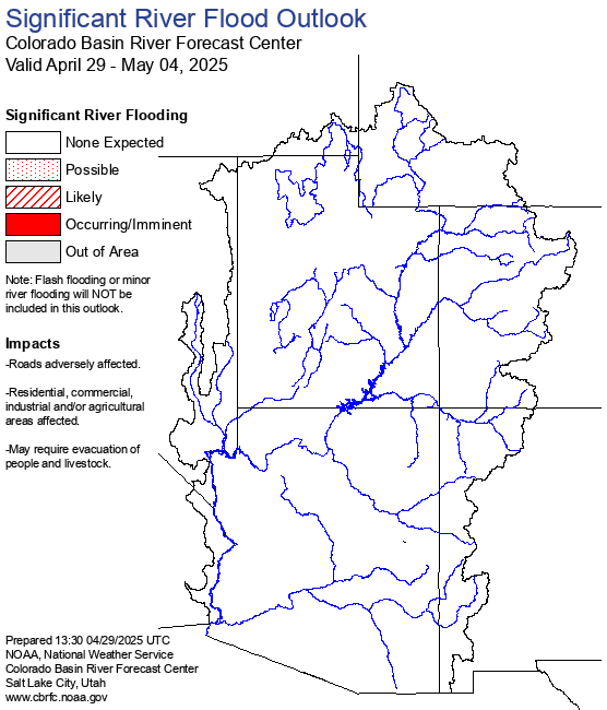
Eastern Utah and Western Colorado River Flood Outlook


Current Radar Imagery

1 Hour Precipitation Storm Total Precipitation
 
National Radar Map

Rainfall Forecasts

Today
 
Tomorrow
 
Day 3
 
Days 4-5
 
Excessive Rainfall Outlook
Today
Excessive Rainfall Outlook
Tomorrow
Excessive Rainfall Outlook
Day 3
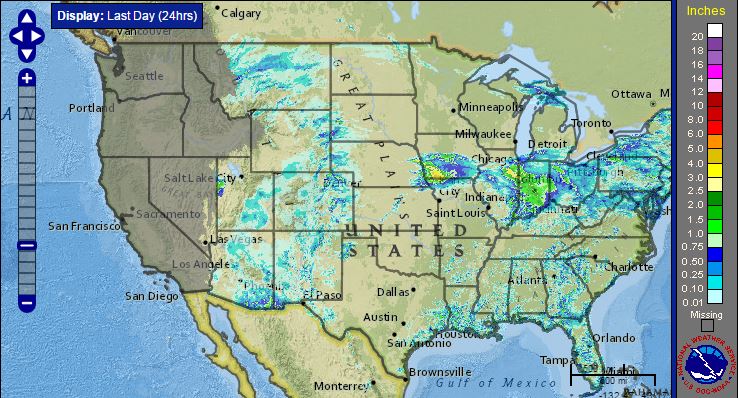
Antecedent Conditions - Past Rainfall, Snow Cover, and Soil Moisture

Click each image to view an interactive map for that element.
 
Past Rainfall Snow Cover and Water Content Soil Moisture

Drought Information

Current Drought Conditions - Click for more Information Drought Outlook - Click for more Information