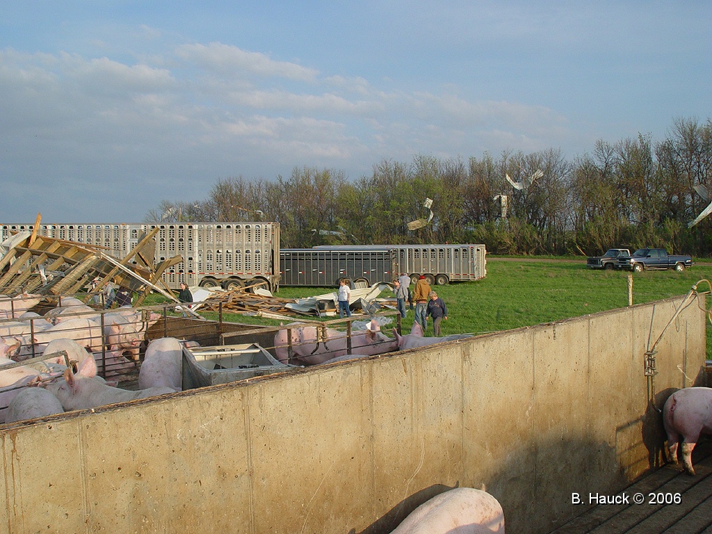
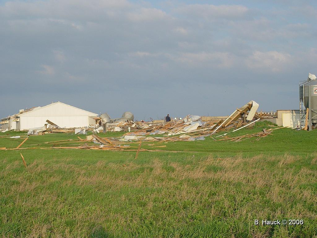
A tornado touched down in northeastern Kingsbury County South Dakota. The tornado was on the ground for approximately 7 minutes and had a path of 2.1 miles. It hit a hog operation 4 miles north of Lake Preston, destroying two hog confinement buildings and downing several trees. However, the farmhouse was undamaged by the tornado. No injuries were reported with the tornado as it moved along 204th St in Kingsbury County. However, numerous hogs were killed by the tornado.
The following photos were taken by Brad Hauck, a volunteer with the Lake Preston Fire Department which responded to the scene after the tornado passed by. Click on any of the images for a larger view.
Left picture - Taken looking east at the destroyed hog confinement building (foreground) and a partially destroyed hog confinement building (background).
Right picture - Also taken looking east at the destroyed hog confinement building. Note the two bins which were tipped by the strong winds as the tornado passed.
Based on these photos, it appears that the tornado passed just north of this building so that the west winds south of the tornado tipped the bins.
 |
 |
Left picture - Another picture looking east shows damage to two buildings and several tipped bins.
Right picture - Taken "inside" one hog confinement building which was total destroyed (this is the building in the foreground on the left picture). In the background, are the tipped bins.
 |
 |
Left picture - looking south from the hog confinement building to a shelter belt. Tin from the building and roof are strewn in the branches of the trees.
Right picture - Looking southeast from the destroyed hog confinement building. Notice the rafter sitting on the ground and stripped of aluminum roofing material on the left side of the picture.
 |
 |
Left picture - Looking southeast toward the damaged buildings. Debris from the building extends north and west of the destroyed hog confinement building. According to Mr. Hauck, there was also a rafter located behind him from this building. This is approximately 100 feet from the building.
Right picture - Looking southeast toward the destroyed hog confinement building. Provides more detail on the debris extending north and west of this building.
 |
 |
Left picture - Looking east toward the hog confinement buildings. While much of the debris is lying on the ground, notice that a few 2x4's were speared into the ground.
Right picture - Looking east toward the hog confinement buildings. In the foreground are two 2x4 stuck in the ground. You may need to click on the photo to enlarge it in order to see both boards.
 |
 |
Left picture - Part of a rafter speared into the ground.
Right picture - Rafter thrown into the trees of a shelter belt.
 |
 |


 Weather Story
 Weather Map
 Local Radar