 |
Continue to the East |
The following photos were taken by Todd Heitkamp, Warning Coordination Meteorologist at NWS Sioux Falls, and Greg Harmon, Meteorologist-in-Charge at NWS Sioux Falls, SD. Click on any of the images for a larger view.
 This is one of five metal trusses that were toppled by the tornado. The location is approximately five miles southeast of Wessington, SD. This is one of five metal trusses that were toppled by the tornado. The location is approximately five miles southeast of Wessington, SD. |
 This aerial view shows both the toppled towers and the track of the tornado. Note the toppled towers pointing to different directions and the scouring marks on the ground, which serve as an indicator of the tornado’s path. |
 This pick-up was rolled a total of 25 yards from its original location. This damage was approximately thee miles southwest of Wolsey, SD. |
 This pick-up was rolled end over end a total of 50 yards before coming to rest. This damage was also approximately three miles southwest of Wolsey, SD. |
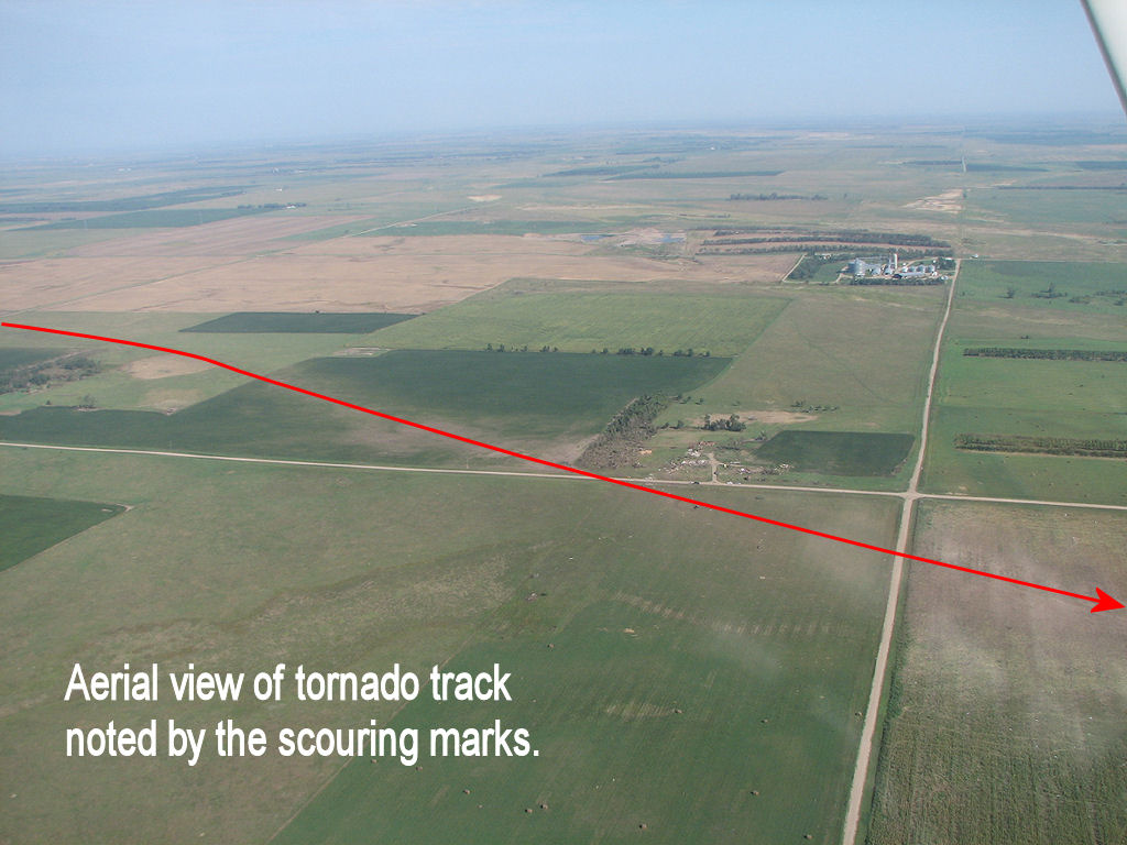 This aerial view shows very well the path of the strengthening tornado. |
 This pick-up was rolled into this tree and ended up being wrapped around it. This was the site of the F3 damage. The limited debarking of the tree, along with many other smaller branches remaining attached to the tree, helped in determining the Fujita scale rating. This was approximately 2.5 miles south-southwest of Wolsey, SD. |
 This is a closer view of the pick-up and the tree. You can see the debarking of the tree, which served as an indicator of where the pick-up impacted the tree. Again, this was approximately 2.5 miles south-southwest of Wolsey, SD. |
 This aerial view shows the track of the F3 tornado. This was the location of where damage indicated the winds reached up to 200 mph. |
|


 Weather Story
 Weather Map
 Local Radar