Overview
|
A dynamic and complex low pressure moved through much of the Plains on Saturday, March 5 into early Sunday, March 6. Across our forecast area, this system brought everything from thunderstorms and small hail in northwestern IA, rain and freezing rain, sleet and graupel, before transitioning to snow from South Dakota into southwestern MN and northwestern IA through the afternoon and evening. Ice accumulations were generally a tenth of an inch or less.
Some areas across south central into southeastern SD reported heavy snow, with isolated reports of over 6 inches. Breezy northwesterly winds gusting up to 45 mph at times created plenty of blowing and drifting snow through the night. |
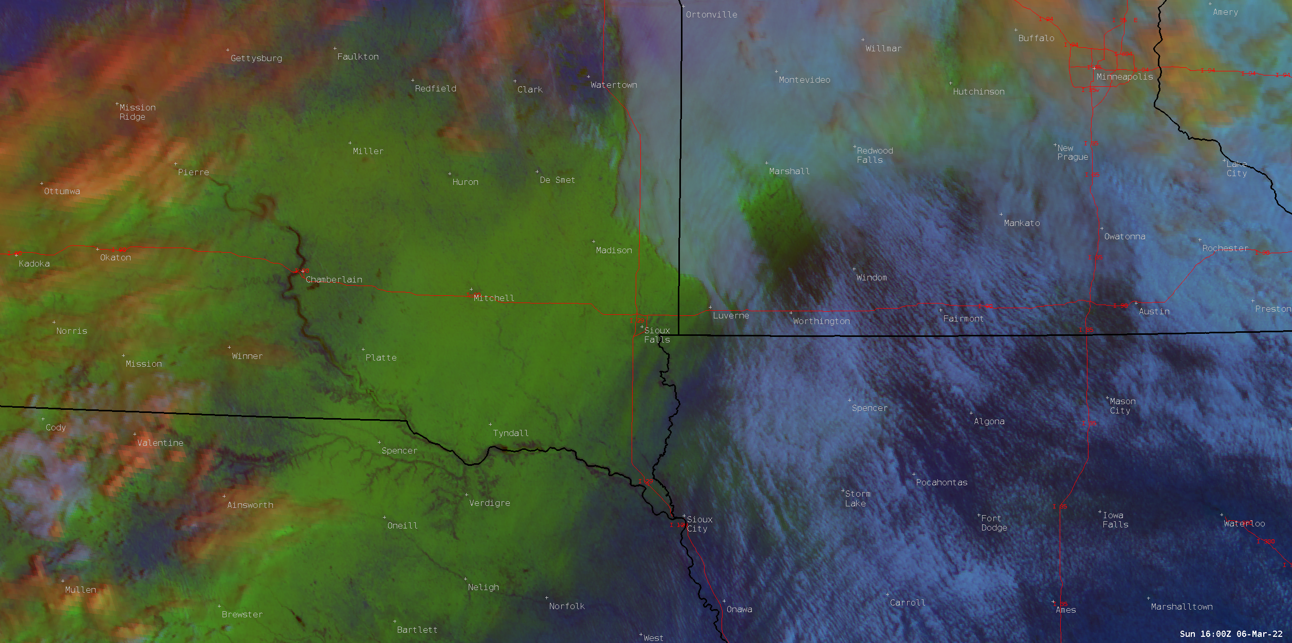 Satellite image from 10 AM Sunday, Mar. 6 shows the new snowfall across the area, with brighter green tones highlighting where the heaviest snow fell. |
Snow/Ice
 |
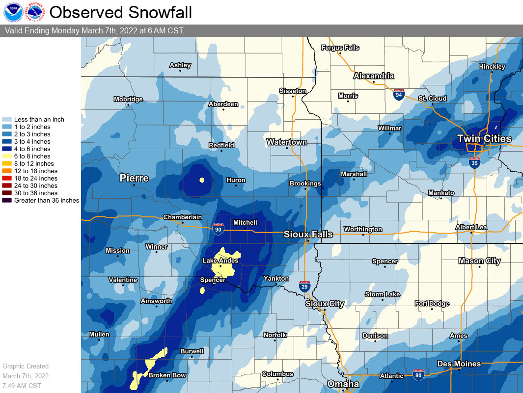 |
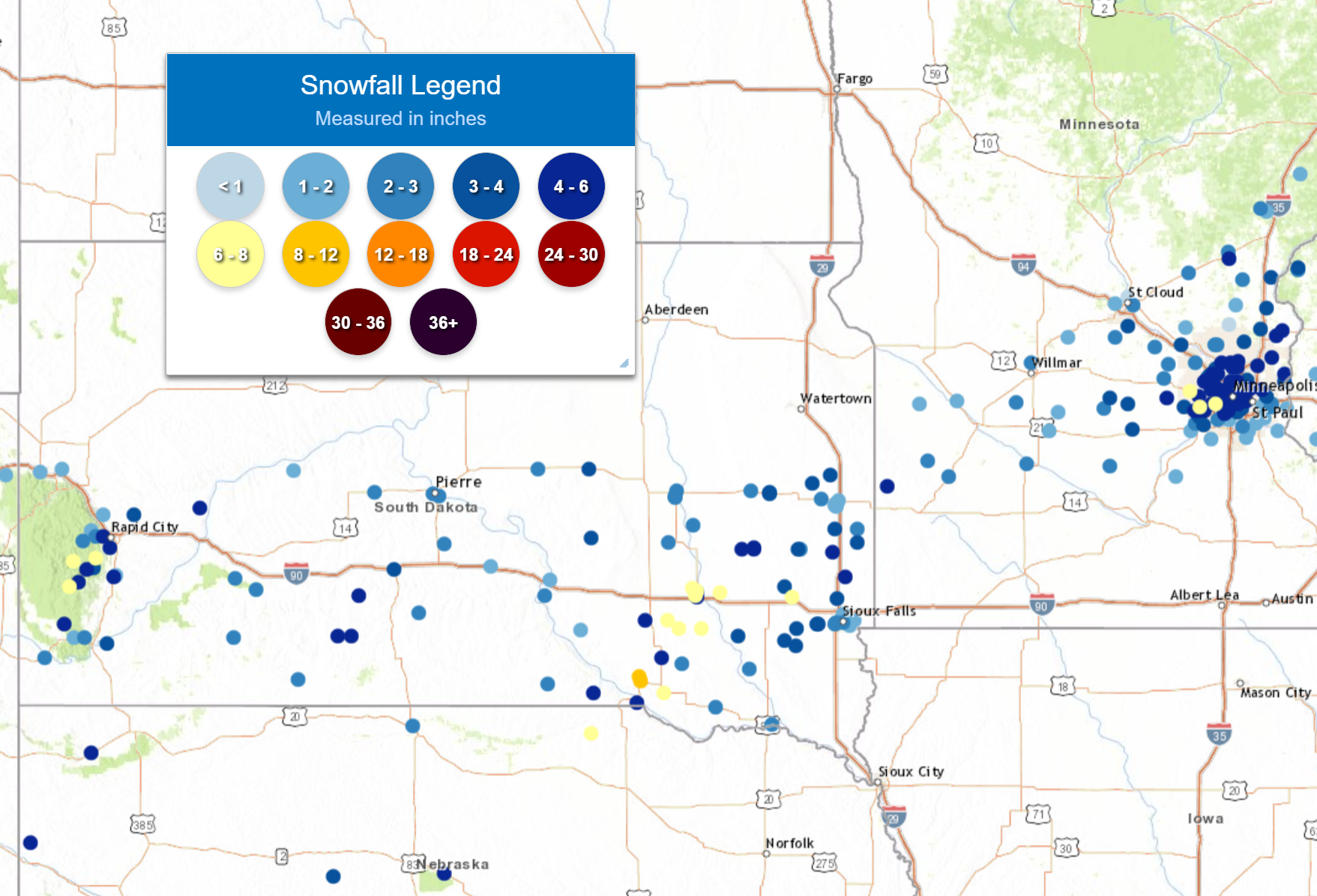
| Total Event Snowfall - Saturday, March 5 through Sunday, March 6. | Total Event Snowfall - Saturday, March 5 through Sunday, March 6. |
Photos & Video
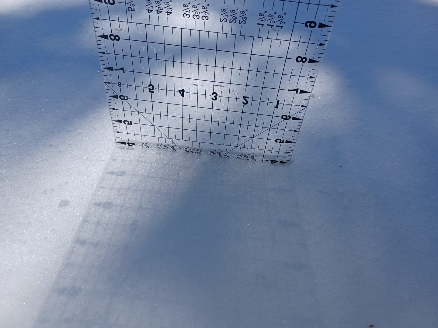
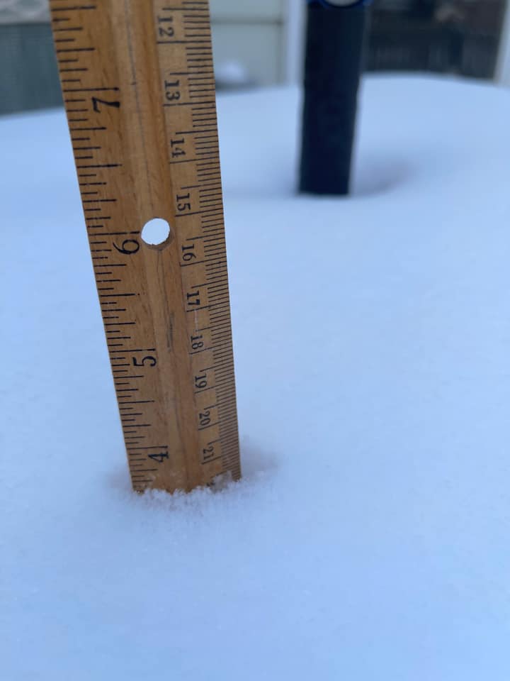
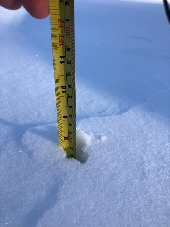
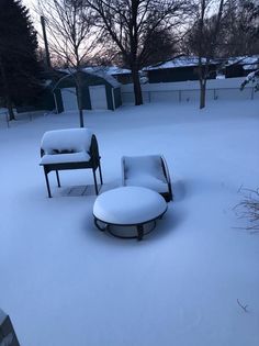
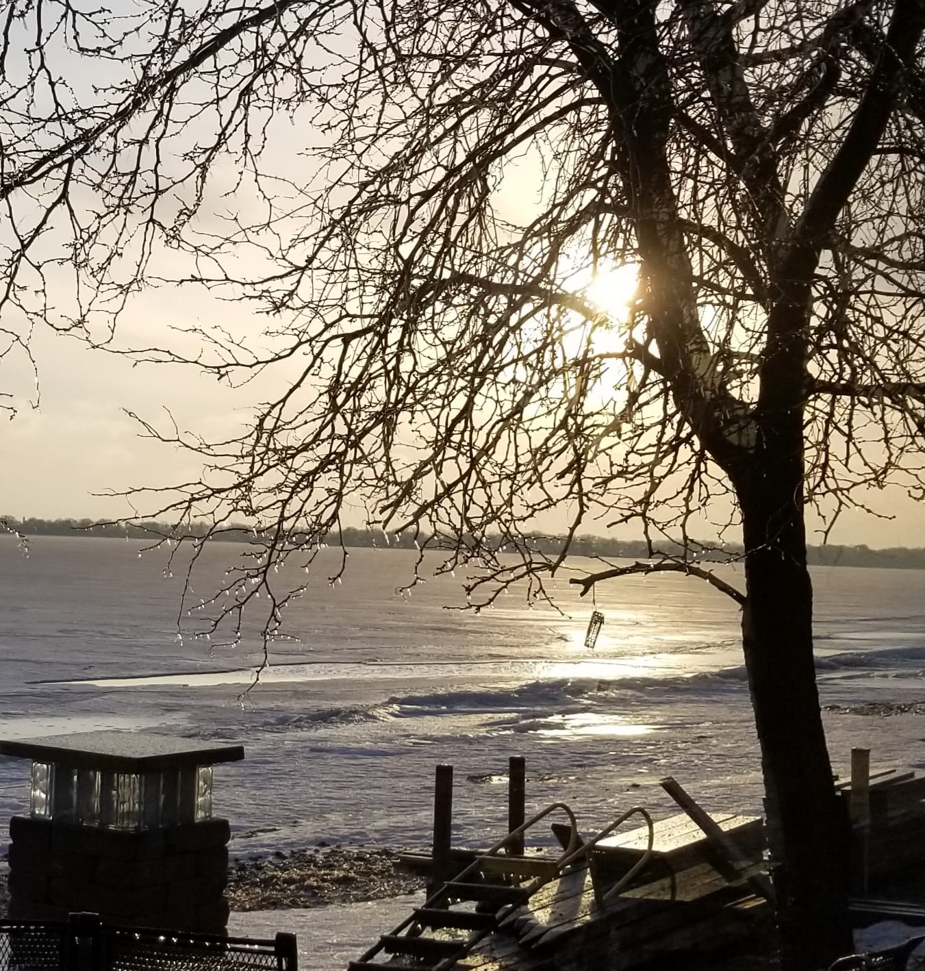
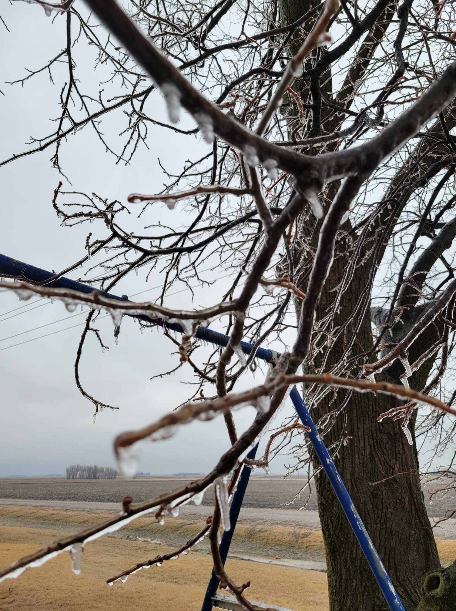
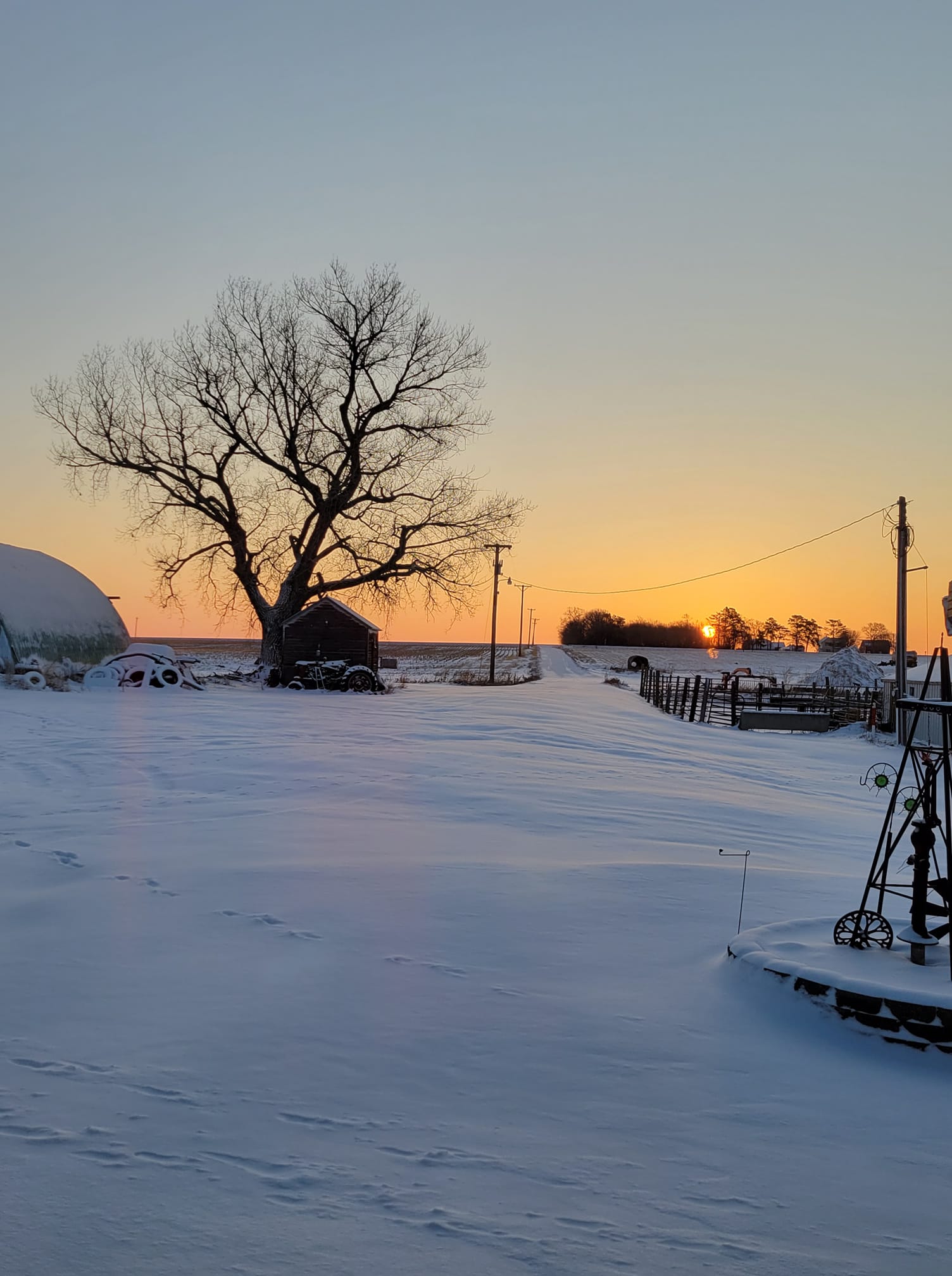
Photos from around the area of snow accumulations, drifts, and ice.
 |
 |
 |
 |
| Snowfall from Colman, SD (Credit: Dakota Koenecke) |
Snowfall from Flandreau, SD (Credit: Kay Christensen) |
Snowfall from Mitchell, SD (Credit: Dani Hansen) |
Snowfall from Mitchell, SD (Credit: Dani Hansen) |
 |
 |
 |
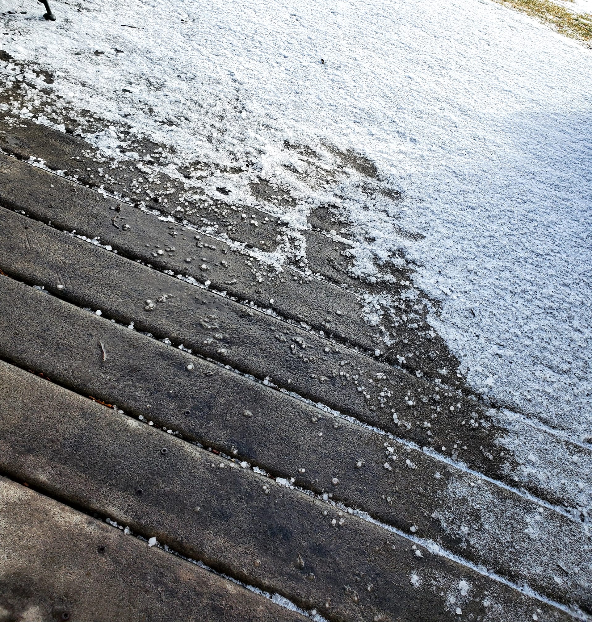 |
| Ice from Spirit Lake, IA (credit: Gayle Mayer) |
Ice from Brewster, MN (credit: Julie Rusche Obermoller) |
Snow Drifts from Avon, SD (credit: Shannon Hagen Wiebenga) |
Variety of Precipitation in Fairmont, MN (credit: Nikki Hector) |
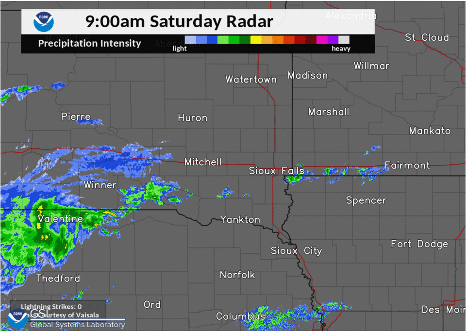
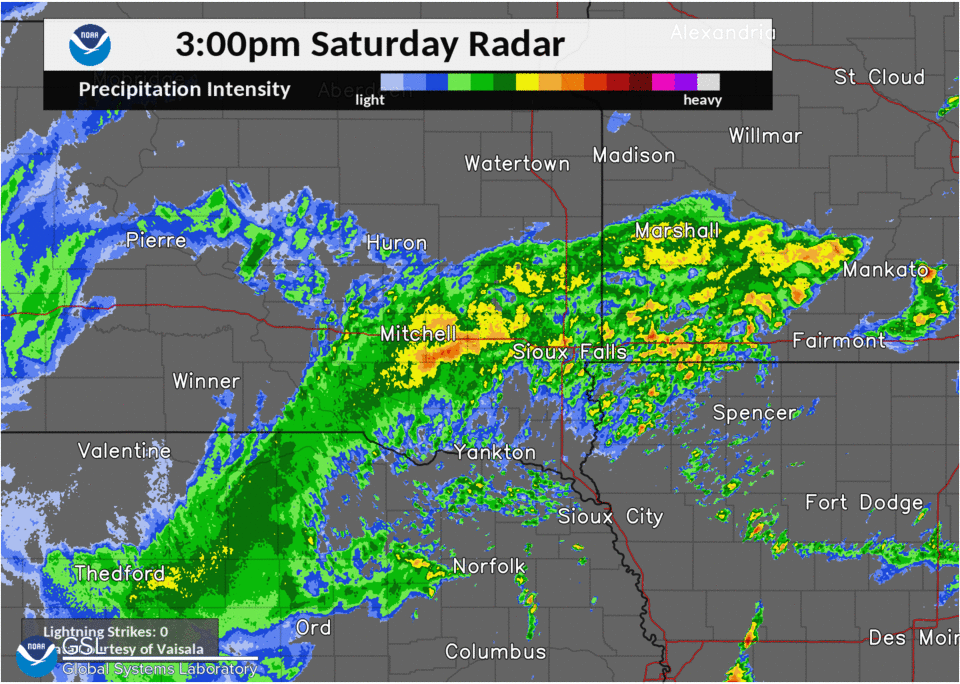
Radar
Here's a look at radar through the event, from Saturday, March 5 at 9 AM CST to Sunday, March 6 at 3 AM CST.
 |
 |
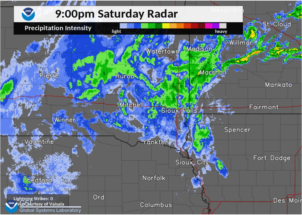 |
| Radar Loop Saturday 9 AM CST to 3 PM CST. Lightning data from NLDN. | Radar Loop Saturday 3 PM CST to 9 PM CST. Lightning data from NLDN. | Radar Loop Saturday 9 PM CST to Sunday 3 AM CST. Lightning data from NLDN. |
Storm Reports
PRELIMINARY LOCAL STORM REPORT...SUMMARY
NATIONAL WEATHER SERVICE SIOUX FALLS SD
157 PM CST SUN MAR 6 2022
..TIME... ...EVENT... ...CITY LOCATION... ...LAT.LON...
..DATE... ....MAG.... ..COUNTY LOCATION..ST.. ...SOURCE....
..REMARKS..
0700 AM FREEZING RAIN CHEROKEE 42.75N 95.55W
03/06/2022 E0.10 INCH CHEROKEE IA PUBLIC
SOCIAL MEDIA REPORT.
0700 AM FREEZING RAIN 6 S AVON 42.92N 98.06W
03/06/2022 E0.10 INCH BON HOMME SD PUBLIC
SOCIAL MEDIA REPORT.
0700 AM FREEZING RAIN HERON LAKE 43.80N 95.32W
03/06/2022 E0.10 INCH JACKSON MN PUBLIC
SOCIAL MEDIA REPORT.
0700 AM FREEZING RAIN WINDOM 43.87N 95.12W
03/06/2022 E0.10 INCH COTTONWOOD MN PUBLIC
SOCIAL MEDIA REPORT.
0700 AM FREEZING RAIN SPIRIT LAKE 43.43N 95.11W
03/06/2022 E0.10 INCH DICKINSON IA PUBLIC
SOCIAL MEDIA REPORT.
0700 AM FREEZING RAIN LE MARS 42.79N 96.17W
03/06/2022 E0.10 INCH PLYMOUTH IA PUBLIC
SOCIAL MEDIA REPORT.
0808 AM FREEZING RAIN LARCHWOOD 43.46N 96.44W
03/06/2022 E0.10 INCH LYON IA PUBLIC
SOCIAL MEDIA REPORT.
0824 AM FREEZING RAIN MADISON 44.01N 97.11W
03/06/2022 E0.10 INCH LAKE SD PUBLIC
SOCIAL MEDIA REPORT.
0932 AM FREEZING RAIN BREWSTER 43.70N 95.47W
03/06/2022 E0.12 INCH NOBLES MN PUBLIC
SOCIAL MEDIA REPORT.
0212 PM HAIL JACKSON 43.63N 94.99W
03/05/2022 E0.75 INCH JACKSON MN PUBLIC
SOCIAL MEDIA REPORT WITH PICTURE OF PENNY
SIZED HAIL.
1100 PM HEAVY SNOW 3 SE LOOMIS 43.76N 98.07W
03/05/2022 M6.4 INCH DAVISON SD CO-OP OBSERVER
TOTAL SNOWFALL AS OF 11 PM. LIQUID
EQUIVALENT 0.44 INCHES.
0820 PM SNOW SIOUX FALLS 43.54N 96.73W
03/05/2022 M1.6 INCH MINNEHAHA SD BROADCAST MEDIA
KELO STUDIO MEASUREMENT.
0821 PM SNOW FLANDREAU 44.05N 96.60W
03/05/2022 E2.3 INCH MOODY SD PUBLIC
0824 PM SNOW MITCHELL 43.73N 98.03W
03/05/2022 E5.0 INCH DAVISON SD PUBLIC
CORRECTS PREVIOUS HEAVY SNOW REPORT FROM
MITCHELL.
0827 PM SNOW HOWARD 44.01N 97.52W
03/05/2022 M4.5 INCH MINER SD PUBLIC
CORRECTS PREVIOUS HEAVY SNOW REPORT FROM
HOWARD.
0829 PM SNOW LAKE PRESTON 44.36N 97.38W
03/05/2022 E3.0 INCH KINGSBURY SD PUBLIC
1100 PM SNOW 1 SSW MITCHELL 43.71N 98.04W
03/05/2022 M6.4 INCH DAVISON SD CO-OP OBSERVER
CO-OP OBSERVER STATION MCLS2 MITCHELL.
1200 AM SNOW 2 S HURON 44.34N 98.22W
03/06/2022 M2.8 INCH BEADLE SD OFFICIAL NWS OBS
TOTAL SNOWFALL AS OF MIDNIGHT.
1200 AM SNOW 3 N SIOUX FALLS 43.59N 96.73W
03/06/2022 M1.8 INCH MINNEHAHA SD OFFICIAL NWS OBS
AS OF 12 AM.
0500 AM SNOW 8 SSW CHAMBERLAIN 43.71N 99.38W
03/06/2022 M2.0 INCH BRULE SD COCORAHS
COCORAHS STATION SD-BL-10 CHAMBERLAIN 7.5
SSW.
0530 AM SNOW CHAMBERLAIN 43.81N 99.33W
03/06/2022 M1.3 INCH BRULE SD COCORAHS
COCORAHS STATION SD-BL-1 CHAMBERLAIN 0.3 W.
0600 AM SNOW CLAYTON 43.45N 97.66W
03/06/2022 M3.5 INCH HUTCHINSON SD COCORAHS
COCORAHS STATION SD-HT-16 EMERY 10.8 S.
0600 AM SNOW 3 N SIOUX FALLS 43.59N 96.73W
03/06/2022 M1.8 INCH MINNEHAHA SD CO-OP OBSERVER
CO-OP OBSERVER STATION FSDS2 SIOUX FALLS
NWS.
0630 AM SNOW 2 ESE YANKTON 42.88N 97.36W
03/06/2022 M2.0 INCH YANKTON SD CO-OP OBSERVER
CO-OP OBSERVER STATION YTNS2 YANKTON 2 E.
0700 AM SNOW MARION 43.42N 97.25W
03/06/2022 M3.6 INCH TURNER SD CO-OP OBSERVER
CO-OP OBSERVER STATION MARS2 MARION.
0700 AM SNOW 11 N COLMAN 44.14N 96.80W
03/06/2022 M3.0 INCH MOODY SD COCORAHS
COCORAHS STATION SD-MY-11 COLMAN 10.6 N.
0700 AM SNOW 3 ESE SIOUX FALLS 43.52N 96.67W
03/06/2022 M1.9 INCH MINNEHAHA SD COCORAHS
COCORAHS STATION SD-MH-1 SIOUX FALLS 5.0 SE
ARPT.
0700 AM SNOW 3 NE CROOKS 43.69N 96.78W
03/06/2022 M3.2 INCH MINNEHAHA SD COCORAHS
COCORAHS STATION SD-MH-71 RENNER 4.1 NW.
0700 AM SNOW 4 WNW ROWENA 43.55N 96.63W
03/06/2022 M1.3 INCH MINNEHAHA SD COCORAHS
COCORAHS STATION SD-MH-82 SIOUX FALLS 5.2 E.
0700 AM SNOW 2 W VILAS 44.01N 97.63W
03/06/2022 M4.0 INCH MINER SD COCORAHS
COCORAHS STATION SD-MN-11 HOWARD 5.3 W.
0700 AM SNOW MONTROSE 43.70N 97.18W
03/06/2022 M6.8 INCH MCCOOK SD CO-OP OBSERVER
CO-OP OBSERVER STATION MONS2 MONTROSE.
0700 AM SNOW 6 NW MONTROSE 43.77N 97.25W
03/06/2022 M3.0 INCH MCCOOK SD COCORAHS
COCORAHS STATION SD-MC-1 MONTROSE 5.8 NW.
0700 AM SNOW MADISON 44.01N 97.11W
03/06/2022 M2.9 INCH LAKE SD COCORAHS
COCORAHS STATION SD-LK-9 MADISON 0.2 NW.
0700 AM SNOW DE SMET 44.38N 97.55W
03/06/2022 M2.0 INCH KINGSBURY SD COCORAHS
COCORAHS STATION SD-KY-5 DE SMET 0.2 SSE.
0700 AM SNOW 4 SSW PICKSTOWN 43.02N 98.56W
03/06/2022 M4.0 INCH GREGORY SD CO-OP OBSERVER
CO-OP OBSERVER STATION PCKS2 PICKSTOWN 4
SSW.
0700 AM SNOW 4 SW BURKE 43.14N 99.35W
03/06/2022 M2.0 INCH GREGORY SD COCORAHS
COCORAHS STATION SD-GY-15 BURKE 4.2 SW.
0700 AM SNOW 10 W DIMOCK 43.50N 98.19W
03/06/2022 M6.0 INCH DOUGLAS SD COCORAHS
COCORAHS STATION SD-DG-1 DIMOCK 10.2 W.
0700 AM SNOW 2 S MITCHELL 43.70N 98.03W
03/06/2022 M4.5 INCH DAVISON SD COCORAHS
COCORAHS STATION SD-DV-33 2 S MITCHELL.
0700 AM SNOW 1 S BROOKINGS 44.29N 96.79W
03/06/2022 M1.2 INCH BROOKINGS SD COCORAHS
COCORAHS STATION SD-BK-43 BROOKINGS 1.0 S.
0700 AM SNOW 2 S BROOKINGS 44.28N 96.79W
03/06/2022 M1.5 INCH BROOKINGS SD COCORAHS
COCORAHS STATION SD-BK-57 BROOKINGS 1.6 S.
0700 AM SNOW BROOKINGS 44.30N 96.79W
03/06/2022 M1.5 INCH BROOKINGS SD COCORAHS
COCORAHS STATION SD-BK-7 BROOKINGS 0.2 SSW.
0700 AM SNOW 4 NE BRUCE 44.48N 96.84W
03/06/2022 M3.0 INCH BROOKINGS SD COCORAHS
COCORAHS STATION SD-BK-9 BRUCE 4.1 NE.
0700 AM SNOW 4 SW STICKNEY 43.55N 98.49W
03/06/2022 M5.0 INCH AURORA SD COCORAHS
COCORAHS STATION SD-AR-8 STICKNEY 3.8 SW.
0700 AM SNOW 1 NW WAGNER 43.08N 98.32W
03/06/2022 M7.5 INCH CHARLES MIX SD COCORAHS
COCORAHS STATION SD-CM-14 WAGNER 0.8 NW.
0700 AM SNOW MADISON 44.01N 97.11W
03/06/2022 E2.5 INCH LAKE SD PUBLIC
SOCIAL MEDIA REPORT OF 2 - 3 INCHES.
0700 AM SNOW WALL LAKE 43.53N 96.96W
03/06/2022 E3.0 INCH MINNEHAHA SD PUBLIC
SOCIAL MEDIA REPORT.
0700 AM SNOW FLANDREAU 44.05N 96.60W
03/06/2022 E3.9 INCH MOODY SD PUBLIC
SOCIAL MEDIA REPORT.
0700 AM SNOW COLMAN 43.99N 96.82W
03/06/2022 E4.0 INCH MOODY SD PUBLIC
SOCIAL MEDIA REPORT.
0700 AM SNOW 1 WSW PARKER 43.39N 97.15W
03/06/2022 E3.0 INCH TURNER SD PUBLIC
SOCIAL MEDIA REPORT WITH PICTURE.
0700 AM SNOW HOWARD 44.01N 97.52W
03/06/2022 E5.5 INCH MINER SD PUBLIC
SOCIAL MEDIA REPORT WITH PICTURE.
0700 AM SNOW MINNEOTA 44.57N 95.98W
03/06/2022 E2.6 INCH LYON MN PUBLIC
SOCIAL MEDIA REPORT.
0700 AM SNOW 4 ENE MONROE 43.50N 97.14W
03/06/2022 M3.0 INCH MCCOOK SD COCORAHS
COCORAHS STATION SD-MC-13 PARKER 7.2 N.
0700 AM SNOW 2 N LAKE ANDES 43.19N 98.54W
03/06/2022 M10.0 INCH CHARLES MIX SD COCORAHS
COCORAHS STATION SD-CM-21 LAKE ANDES 2.4 N.
0700 AM SNOW 6 SW IVANHOE 44.41N 96.34W
03/06/2022 M4.0 INCH LINCOLN MN COCORAHS
COCORAHS STATION MN-LN-4 HENDRICKS 8.0 SE.
0700 AM SNOW HOWARD 44.02N 97.52W
03/06/2022 E4.5 INCH MINER SD PUBLIC
SOCIAL MEDIA REPORT WITH PICTURE.
0700 AM SNOW SIOUX FALLS 43.54N 96.73W
03/06/2022 E2.0 INCH MINNEHAHA SD BROADCAST MEDIA
MEDIA REPORT.
0700 AM SNOW MITCHELL 43.74N 98.03W
03/06/2022 M7.5 INCH DAVISON SD PUBLIC
SOCIAL MEDIA REPORT WITH PICTURE.
0700 AM SNOW 1 N DIMOCK 43.50N 97.99W
03/06/2022 E6.0 INCH HUTCHINSON SD PUBLIC
SOCIAL MEDIA REPORT.
0700 AM SNOW DELMONT 43.27N 98.16W
03/06/2022 E2.0 INCH DOUGLAS SD PUBLIC
SOCIAL MEDIA REPORT.
0700 AM SNOW LAKE PRESTON 44.37N 97.38W
03/06/2022 E3.0 INCH KINGSBURY SD PUBLIC
SOCIAL MEDIA REPORT.
0700 AM SNOW 3 W SIOUX FALLS 43.54N 96.79W
03/06/2022 E2.0 INCH MINNEHAHA SD PUBLIC
SOCIAL MEDIA REPORT.
0700 AM SNOW DELL RAPIDS 43.83N 96.71W
03/06/2022 E4.0 INCH MINNEHAHA SD PUBLIC
SOCIAL MEDIA REPORT.
0700 AM SNOW FULTON 43.73N 97.82W
03/06/2022 E7.5 INCH HANSON SD PUBLIC
SOCIAL MEDIA REPORT.
0700 AM SNOW FLANDREAU 44.05N 96.60W
03/06/2022 E3.5 INCH MOODY SD PUBLIC
SOCIAL MEDIA REPORT.
0700 AM SNOW 6 N FLANDREAU 44.14N 96.60W
03/06/2022 E2.5 INCH MOODY SD PUBLIC
SOCIAL MEDIA REPORT.
0700 AM SNOW 8 ESE STICKNEY 43.55N 98.29W
03/06/2022 E7.0 INCH DAVISON SD PUBLIC
SOCIAL MEDIA REPORT.
0700 AM SNOW 1 S ARMOUR 43.31N 98.34W
03/06/2022 E5.5 INCH DOUGLAS SD EMERGENCY MNGR
DOUGLAS COUNTY EM REPORTED 5.5 INCHES.
0730 AM SNOW 1 S HURON 44.35N 98.22W
03/06/2022 M2.7 INCH BEADLE SD COCORAHS
COCORAHS STATION SD-BD-20 HURON 1.3 S.
0800 AM SNOW 1 ENE WALL LAKE 43.53N 96.95W
03/06/2022 M3.0 INCH MINNEHAHA SD COCORAHS
COCORAHS STATION SD-MH-8 HARTFORD 6.4 S.
0800 AM SNOW 1 NE BROOKINGS 44.32N 96.77W
03/06/2022 M1.1 INCH BROOKINGS SD CO-OP OBSERVER
CO-OP OBSERVER STATION BROS2 BROOKINGS 2 NE.
0800 AM SNOW 1 SW BROOKINGS 44.29N 96.80W
03/06/2022 M1.0 INCH BROOKINGS SD COCORAHS
COCORAHS STATION SD-BK-3 BROOKINGS 1.4 SW.
0800 AM SNOW 5 W BRUCE 44.43N 97.00W
03/06/2022 M3.0 INCH BROOKINGS SD COCORAHS
COCORAHS STATION SD-BK-45 BRUCE 5.3 W.
0800 AM SNOW TYNDALL 42.99N 97.86W
03/06/2022 M2.6 INCH BON HOMME SD CO-OP OBSERVER
CO-OP OBSERVER STATION TYNS2 TYNDALL.
0800 AM SNOW 1 NNE HURON 44.38N 98.21W
03/06/2022 M2.4 INCH BEADLE SD COCORAHS
COCORAHS STATION SD-BD-24 HURON 1.1 NNE.
0800 AM SNOW 1 N MARSHALL 44.47N 95.79W
03/06/2022 M2.5 INCH LYON MN CO-OP OBSERVER
CO-OP OBSERVER STATION MMLM5 MARSHALL.
0800 AM SNOW BONESTEEL 43.08N 98.95W
03/06/2022 M4.0 INCH GREGORY SD COCORAHS
COCORAHS STATION SD-GY-21 BONESTEEL 0.1 S.
0832 AM SNOW LAKE ANDES 43.16N 98.53W
03/06/2022 E10.0 INCH CHARLES MIX SD PUBLIC
SOCIAL MEDIA REPORT OF 8 - 10 INCHES OF
SNOW.
0900 AM SNOW 10 NNE FORESTBURG 44.16N 98.06W
03/06/2022 M2.0 INCH SANBORN SD CO-OP OBSERVER
CO-OP OBSERVER STATION WSKS2 WOONSOCKET 13
NE.
0900 AM SNOW 4 WSW SIOUX FALLS 43.53N 96.80W
03/06/2022 M2.6 INCH MINNEHAHA SD COCORAHS
COCORAHS STATION SD-MH-35 SIOUX FALLS 3.7
WSW.
0900 AM SNOW 13 WNW PLATTE 43.49N 99.06W
03/06/2022 M1.0 INCH CHARLES MIX SD CO-OP OBSERVER
CO-OP OBSERVER STATION ACYS2 ACADEMY 2 NE.
0904 AM SNOW 1 WNW MADISON 44.01N 97.13W
03/06/2022 E3.0 INCH LAKE SD PUBLIC
SOCIAL MEDIA REPORT.
0917 AM SNOW VOLGA 44.33N 96.92W
03/06/2022 E2.0 INCH BROOKINGS SD PUBLIC
PUBLIC REPORT.
0939 AM SNOW 1 ENE MENNO 43.24N 97.56W
03/06/2022 E2.8 INCH HUTCHINSON SD PUBLIC
SOCIAL MEDIA REPORT.
0100 PM SNOW WOONSOCKET 44.05N 98.28W
03/06/2022 M2.5 INCH SANBORN SD COCORAHS
COCORAHS STATION SD-SB-3 WOONSOCKET 0.2 WSW.
 |
Media use of NWS Web News Stories is encouraged! Please acknowledge the NWS as the source of any news information accessed from this site. |
|


 Weather Story
 Weather Map
 Local Radar