Sioux Falls, SD
Weather Forecast Office
Overview
|
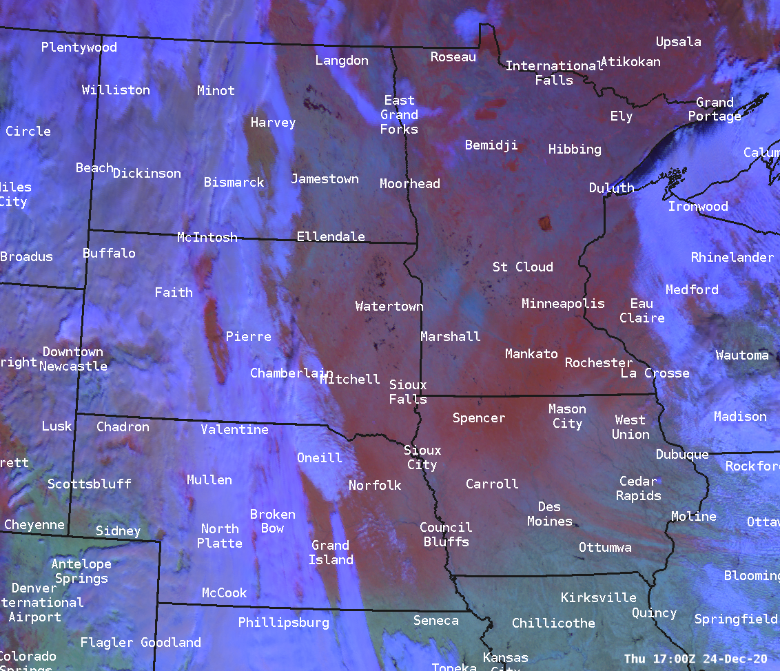
An arctic front and an intensifying storm system brought a dangerous combination of cold temperatures, high winds, and snowfall to the region prior to the Christmas holiday. As temperatures plummeted from the 50s on the 22nd of December to the teens on the 23rd, winds also intensified. The strongest reported wind gusts were observed between 60 and 70 mph. Snowfall totals between 2 and 6" were common through the region. The light and fluffy variety of snow made it easy for driving winds to reduce visibilities. Multiple hours of blizzard conditions were reported in the region, with blizzard warnings extending from Northern Minnesota through portions of the Dakotas, Iowa and Nebraska. |
 Radar Loop of the Blizzard |
 |
 |
 |
| Regional Snowfall Map | Regional Snow Cover After The Storm | Loop of Blizzard Winds |
Snow
Here is a map and listing of snowfall reports from this pre-Christmas Blizzard
Strong Winds
This late December storm brought significant winds to much of the region. Winds in some locations gusted over 60 mph and in a few spots over 70 mph. The images below show the peak winds observed across the region
.
Photos & Video
 |
 |
 |
| Vehicle In Ditch (Dickinson County EM) |
Blown Over Semi (Dickinson County EM) |
Damage to Siding |
 |
Media use of NWS Web News Stories is encouraged! Please acknowledge the NWS as the source of any news information accessed from this site. |
 |
Popular Pages
Past Weather Events
Regional Weather Roundup
Daily Temp/Precip
Hazardous Weather
Local Climate Archives
Climate Graphs and Data
Seasonal
EvapoTranspiration
Fire Weather
Grassland Fire Danger
Flooding (River)
Summer Weather
Travel Forecasts
Winter Weather
Winter Preparedness
Forecast Snowfall Graphic
Winter Temp Climatology
US Dept of Commerce
National Oceanic and Atmospheric Administration
National Weather Service
Sioux Falls, SD
26 Weather Lane
Sioux Falls, SD 57104-0198
605-330-4247
Comments? Questions? Please Contact Us.
Thank you for visiting a National Oceanic and Atmospheric Administration (NOAA) website. The link you have selected will take you to a non-U.S. Government website for additional information.
NOAA is not responsible for the content of any linked website not operated by NOAA. This link is provided solely for your information and convenience, and does not imply any endorsement by NOAA or the U.S. Department of Commerce of the linked website or any information, products, or services contained therein.
You will be redirected to:


 Weather Map
 Local Radar