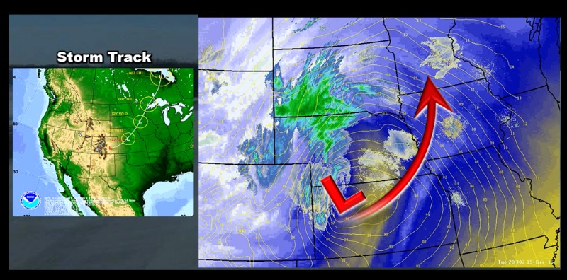
After another very warm stretch of December weather, a mid-month winter storm impacted the region over the 15th and 16th. This storm system brough a mixture of precipitation, from fog, to prolonged drizzle and freezing drizzle, and eventually heavy snows and strong winds. To make this event even more unique, numerous reports of thunder and lightning were common over the Tri-State region during the early morning hours of December 16th. This winter storm resulted in the closure of Interstate 90 from Chamberlain to Rapid City late on Tuesday continuing into Wednesday morning.
 |
Radar Imagery...
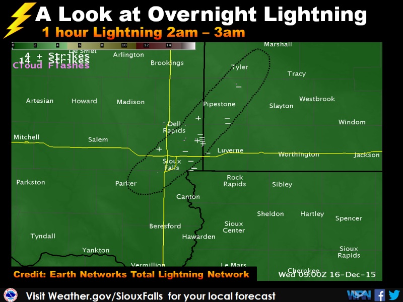
Here's a animated image showing the radar imagery for this winter storm. Take note of the very narrow band of snow that developed overnight in the Tri-State area as we moved into the morning hours of December 16th. This narrow corridor of precipitation produced nearly a foot of snow in only a few hours, with numerous reports of lightning.
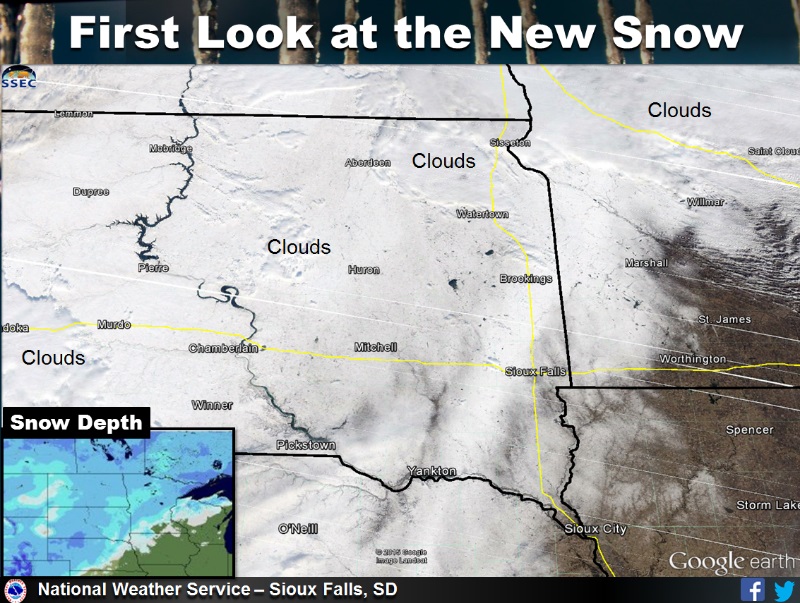
The heaviest snows were reported across the western portions of South Dakota and northwestern Nebraska where as much as a foot of snow was reported. Closer to home, Snowfall ranged from an inch or less across parts of southeastern South Dakota and adjacent areas of Nebraska and Iowa, to nearly 10 inches of snow north and west of Sioux Falls. This narrow corridor of heavy snow north and west of Sioux Falls was due to a narrow convective band of snow, that featured as many as 30 or more lightning strikes per hour. The snow gradient was very narrow with this system, with just over 1 inch of snow at the airport in Sioux Falls, but over 6 inches of snow fell in Hartford, SD less than 15 miles to the west.
 |
 |
 |
 |
Prior to the snow falling, nearly 24 hours of drizzle was reported over the Tri-State area. With temperatures hovering near or slightly below the freezing mark, light icing was reported at many locations.
 |
While this system brought snow and mixed precipitation, it also brought some of the strongest winds associated with a winter storm this early winter season. Many peak wind gusts were above 30 to even 40 mph. Here's a map and listing of the highest winds from Wednesday.
 |
 |
If you have pictures of the snow or ice in your area, please email to w-fsd.webmaster@noaa.gov