Between 415 am and 445 am CDT this Sunday morning August 3rd, the city of Sioux Falls experienced a convective heat burst. Temperatures rose rapidly from the lower 70s to 101 degrees in a very short time. This rapid rise in temperature was also associated with wind gusts of 50 to 60 mph, as well as a rapid drop in dew points. The official high temperature will be 99 degrees as with automated weather stations, only the 5 minute mean temperature and dew point are used.
A heat burst occurs when warm air from 10,000 to 20,000 feet above the surface is forced to the ground. Typically when air comes down to the surface with thunderstorms, it is much colder than the air at the surface. However, especially during the late night and morning, very warm air can be forced to the surface if the air reaches the surface without rainfall occurring. When this happens, the temperature will rise as much as 30 degrees, and the dew point will drop by 20 to 30 degrees. Heat bursts are also accompanied by strong to damaging winds. However, unlike many cases with damaging thunderstorm winds, little to no rain will fall when the heat burst occurs. This is because if it were to rain, the air would rapidly cool and moisten due to evaporation.
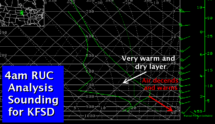
Here is an analysis sounding for Sioux Falls from the 09z Rapid Update Cycle model. Note the presence of the warm and dry layer aloft.
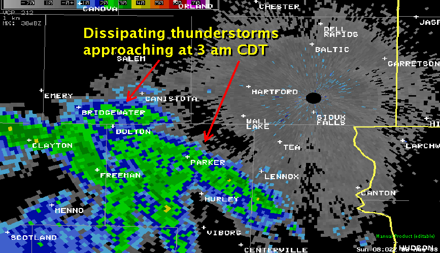
At this time, a dissipating thunderstorm complex which originated late evening across northern Nebraska was approaching from the southwest. The image below is the Sioux Falls base reflectivity scan, intercepting the returns at around 16,000 ft above ground level (AGL). While not shown, the returns weakened considerably below this level, and continued to weaken after this 3 a.m. CDT image.
As this rain evaporated into the warm and dry layer shown in the sounding above, the air cooled a bit and continued to subside. However, the evaporation cooling was not significant enough to offset the warming which occurs when an air parcel sinks, therefore, the parcel warms and dries on its continued decent to the surface. The red arrow on the analysis sounding above represents the necessary parcel trajectory to reach a temperature of 101 F, which occurred at 426 am CDT.
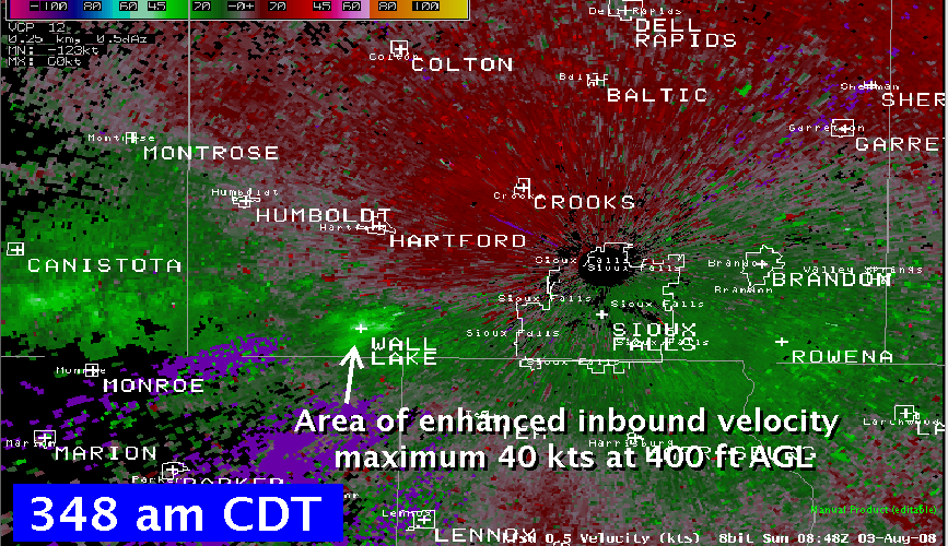
The first report of this phenomenon was received at around 345 am, when campers at Wall Lake called to report strong winds, and unsually warm temperature. Here is a radar velocity image from around this time. Note the area of bright green around Wall Lake, which represents the strong inbound winds reaching the surface, or here indicated at an altitude of 400 feet AGL.
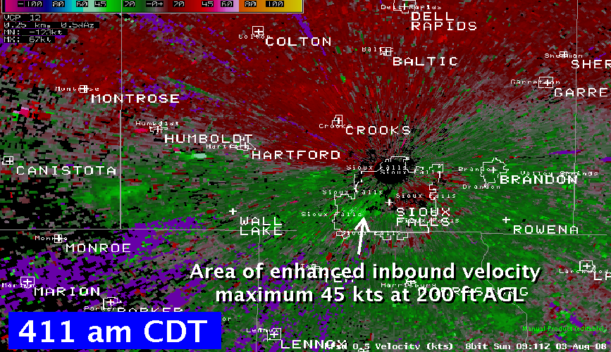
The area of enhanced velocity was noted to be moving toward Sioux Falls after this time. The first report of the heat burst around Sioux Falls was some tree damage in central Sioux Falls at around 415 am CDT.
The heat burst was sampled by the automated surface observation system (ASOS) at Joe Foss Field. Below is a trace of the one-minute temperature and dewpoint data. The change from the background values of temperatures at 74 F and dew point of 66 F still present at 410 am CDT was quite sudden, reaching the peak change to 101 F / 44 F at 426 am CDT.
.jpg)
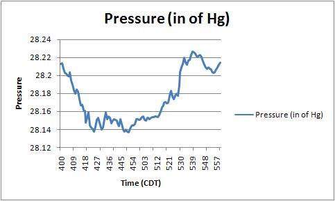
The measured station pressure also changed rapidly with time. The plot below shows the precipitous drop in pressure as the heat burst moved through, followed by a rapid rise once the system had passed.


 Weather Story
 Weather Map
 Local Radar