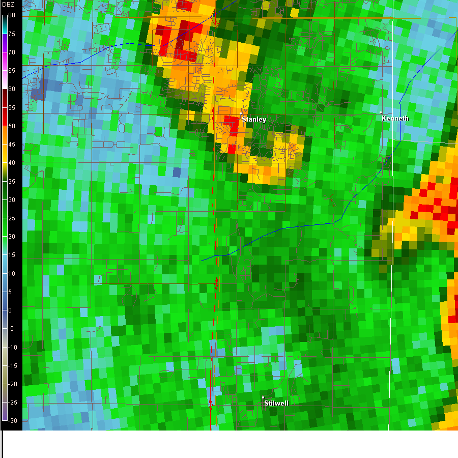
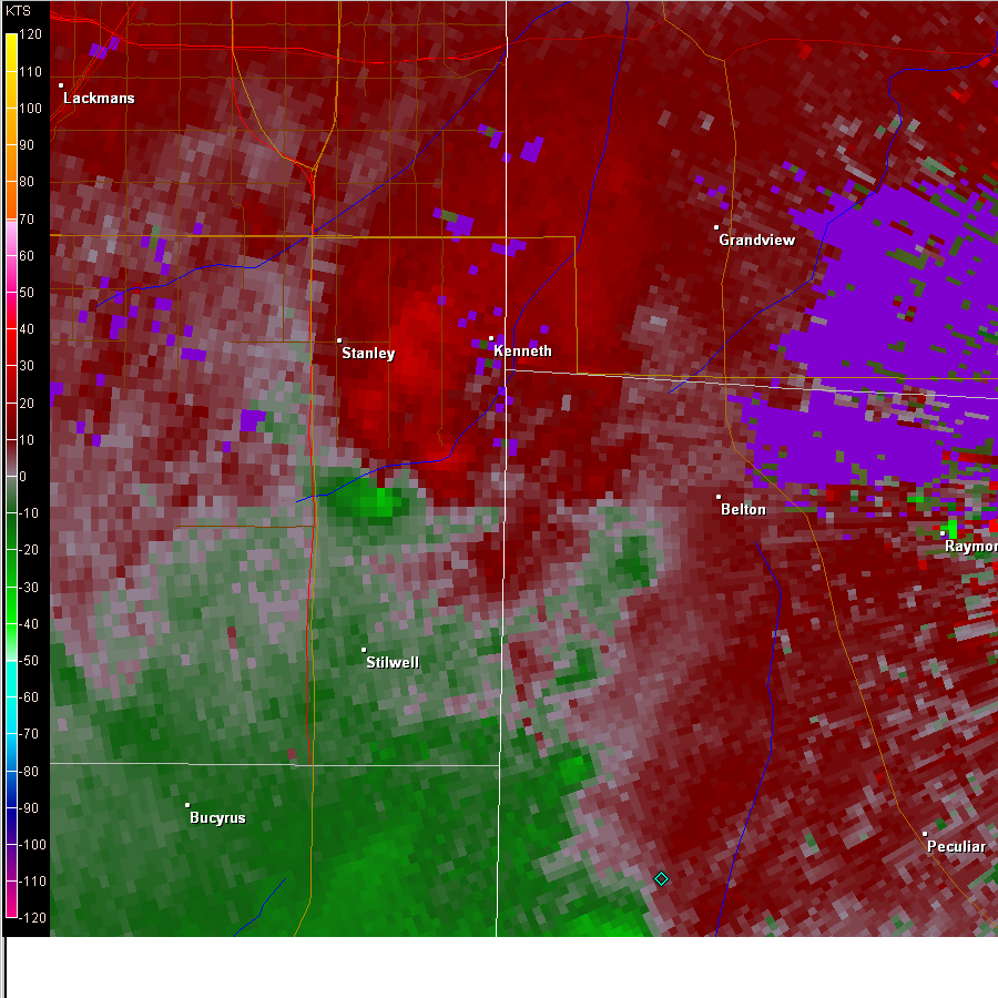
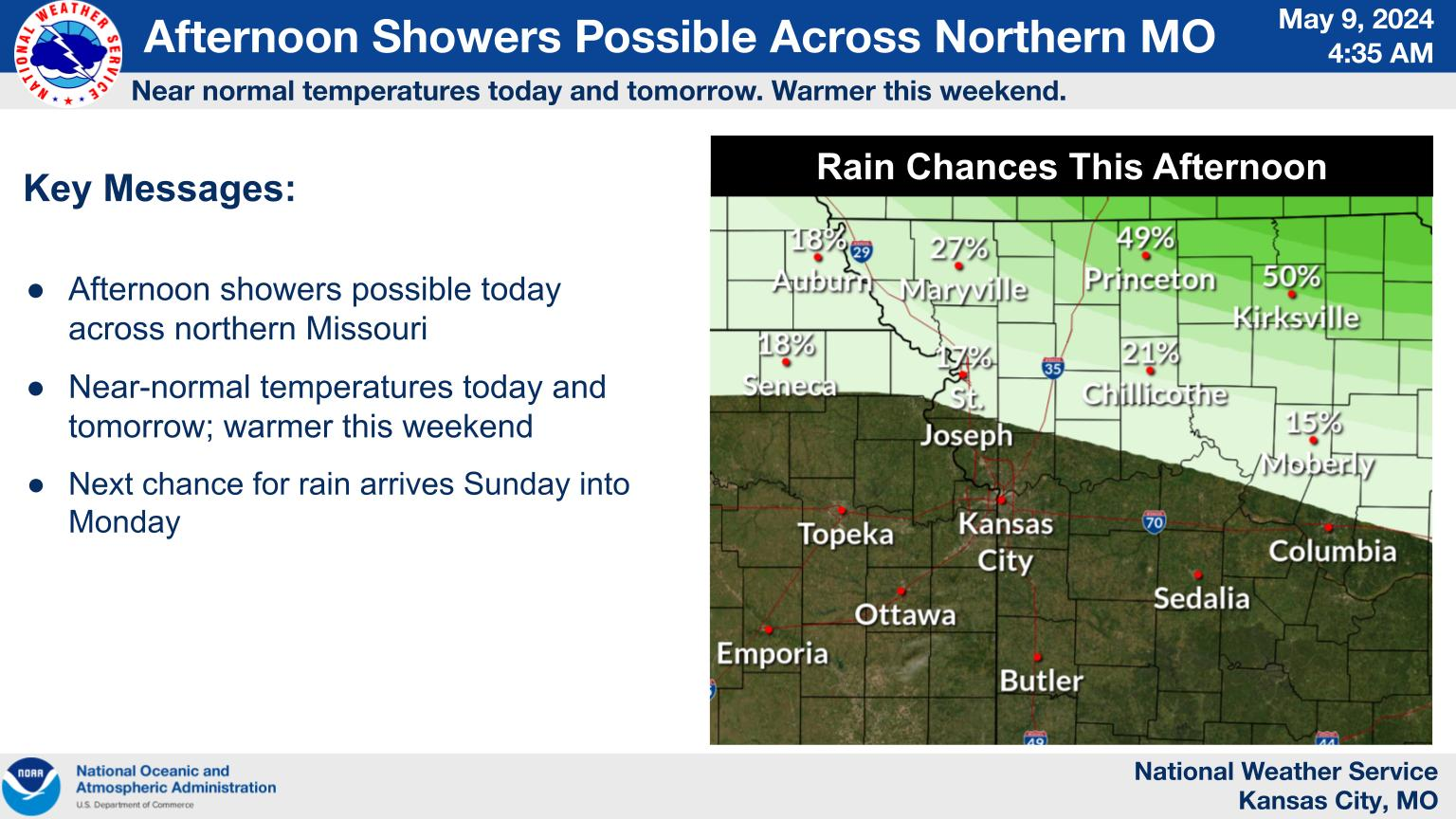
An EF-2 tornado, associated with winds up to 135 mph, damaged or destroyed numerous single family homes and businesses, severely damaged a mobile home park, blew over several tanker trucks, and injured nearly two dozen people as it roared through the southern part of Sedalia, Missouri. In addition, several school buses, located in the school district bus barn, were damaged by the tornado. The tornado was nearly one quarter of a mile wide and was on the ground for one and three-quarters of a mile, touching down on the southwest side of Sedalia along highway 65. The tornado struck at approximately 12:20 pm and was only on the ground for a couple minutes. Below are radar images captured at the approximate time that the tornado was on the ground.
 |
 |
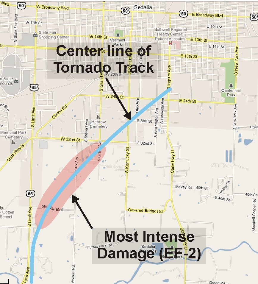 |
| Figure 1: Classic Hooked Shape Reflectivity Signature of near Sedalia, MO ~ 12:22 pm | Figure 2: Velocity Signature of tornado vortex just east of highway 65 at approximately 12:22 pm | Figure 3: Damage path of Sedalia tornado |
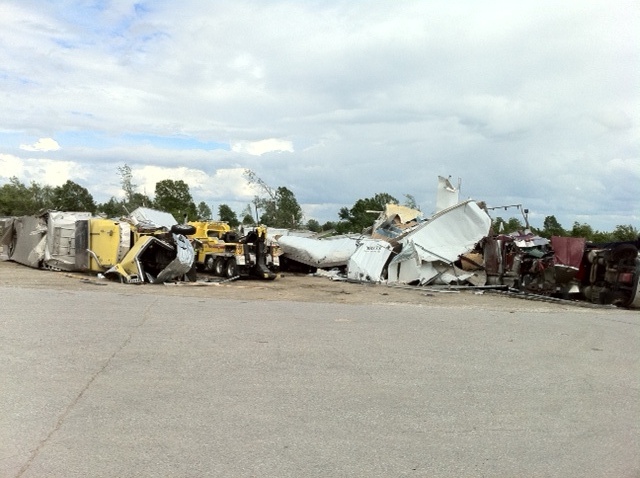
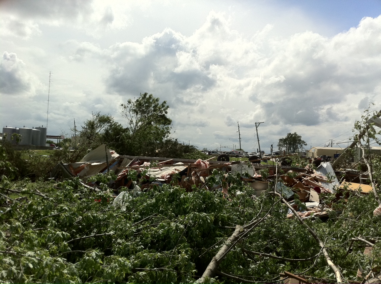
A damage survey crew took several photos of damage that resulted from the tornado, a few which are shown below:
 |
 |
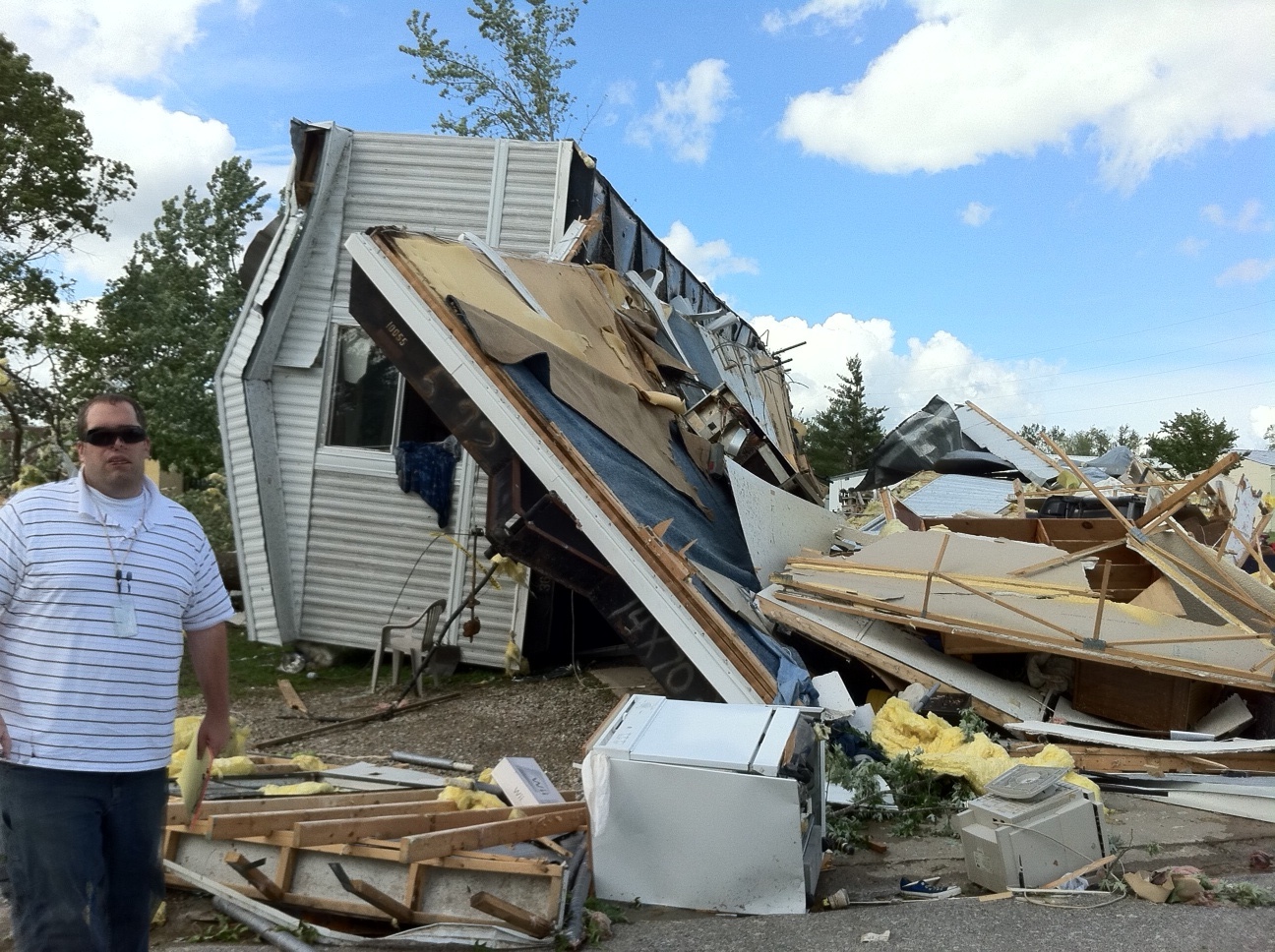 |
| Figure 4: Tractor trailers damage | Figure 5: Home and tree damage | Figure 6: Meteorologist Chris Bowman standing by damaged mobile home |
The tornado that struck Sedalia was the most significant tornado that occurred in the NWS Pleasant Hill forecast area on 25 May, but it wasn't the only tornado. Several EF-0 tornadoes, with winds up to 85 mph, touched down in the Kansas City metropolitan area during the late morning and early afternoon hours. The images below depict the radar signatures associated with brief tornadoes that touched down near Louisburg, rolling a pickup truck on highway 69, and another brief tornado that damaged several trees just north of 159th Street between Nall and Roe in Johnson County Kansas.
 |
 |
| Figure 7: Reflectivity image associated with tornado near Louisburg, KS ~ 10:45 am CDT | Figure 8: Velocity signature associated with tornado near Louisburg, KS |
 |
 |
| Figure 9: Hooked-shaped reflectivity signature of tornado near southeast of Overland Park ~ 11:15 am CDT | Figure 10: Velocity signature associated with tornado vortex southeast of Overland Park, KS. |
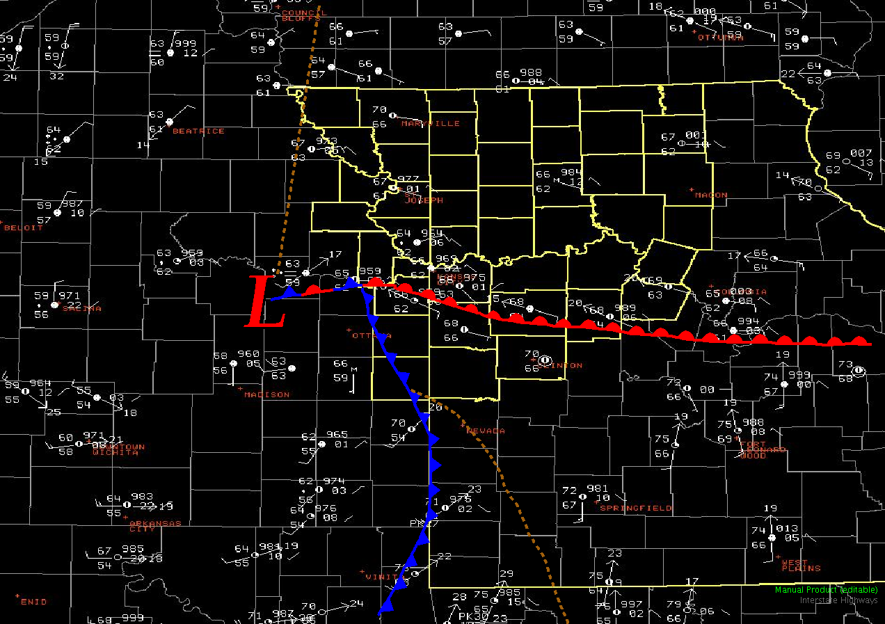
There were nearly two dozen reports of either funnel clouds or tornadoes,with only six of the tornado reports being confirmed by NWS damage survey crews and/or law enforcement. The tornadoes that occurred today were associated with the smaller cousin of the classic central plains supercell thunderstorm, called a mini- or low-topped supercell thunderstorm.Mini-supercells typically occur in association with a cold-core upper level low pressure system, and are much smaller in height and areal expanse than the classic supercell storm. But regardless of their size, mini-supercells still possess the mechanics to produce brief, and as was seen in Sedalia, violent tornadoes. Below is a composite map depicting surface and upper level conditions conducive to low-top or mini-supercell formation from noted tornado researcher Jon Davies.
 |
| Figure 11: Composite map of surface and upper level conditions associated with mini-supercell thunderstorms |
The surface setup on May 25th, found itself to be very similar to the conceptual model shown above in figure 11. The images below represent observations and fronts at the beginning of the event as well as at the height of the event at 12pm. A very warm and most airmass had advected northwest into the area during the morning hours with the development of an intensifying warm front near the Highway 50 corridor. Due to ample lift provided by the strong upper level storm system just west of Kansas City, a little bit of clearing made the rapid development of thunderstorms along and ahead of the cold front possible as early as 10 am. As these storms lifted northward and rotated around the surface area of low pressure, they would rapidly begin to rotate as they reached the enhanced winds near the warm front. Once thunderstorm activity crossed over the warm front into northern Missouri and into a slightly cooler and more stable airmass, they would still indicate rotation, but the environment prevented further tornadic activity.
 |
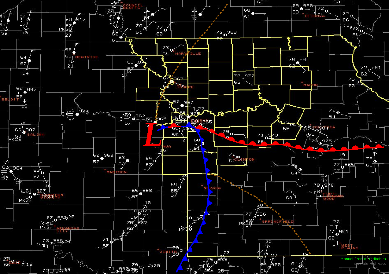 |
| 10AM May 25, 2011 Surface and Fronts | 12PM May 25, 2011 Surface and Fronts |


 Weather Story
 Weather Map
 Local Radar