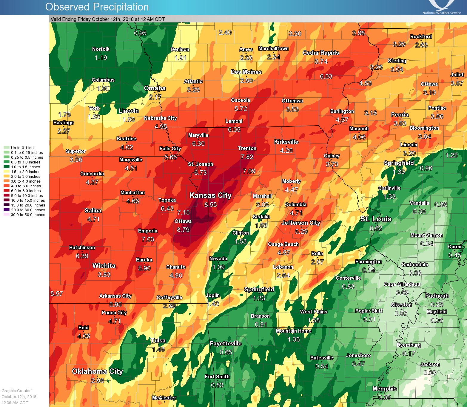
Storm total precipitation from October 6 through October 9
(click image for larger)
Starting on October 6th, the atmosphere set itself up in a pattern conducive to bring a prolonged period of heavy rain to portions of northeastern Kansas and northwestern Missouri. On the 6th of October a cold front pushed into the area and stalled in southern Missouri and Kansas. Moisture continued to stream into the area, bringing several rounds of moderate to heavy rain. The heaviest rain occurred Saturday and Sunday (Oct 6-7). By Tuesday night (October 9th) more than 11 inches of rain fell in and around the Kansas City Metro. Local drought conditions were still in the Extreme to Exceptional category going into the event, so flash flooding was relatively low impact, relegated mostly to several road closures. The bigger impact from this prolonged rainfall event came from local river and stream flooding. Several streams entered the moderate to major flooding category.
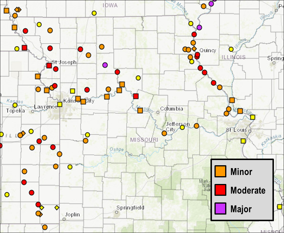
River points in flood on October 10
(click image for larger)
The 4 day event spanning Oct 6-9 resulted in the greatest 4 day rain total in recorded Kansas City History. At Kansas City International Airport 9.79 inches were recorded for the Oct 6-9 time period, beating out Sept 12-15, 1977, which had 9.48" over the 4 day span. While more rain fell during the month of October than what fell during this month, the 9.79" contributed to an October precipitation total reaching 10.33" (as of October 14), which would put October 2018 as the second wettest October in Kansas City history, behind October 1941 (11.94"). Should the remainder of October bring another 1.61" it will result in the greatest October precipitation total in Kansas City History.


 Weather Story
 Weather Map
 Local Radar