Overview
A double dose of winter weather impacted the area on Tuesday December 29, 2020 and again on the first day of the new year. The first round was not quite as wide stretching, as a narrow area generally along the HWY 36 corridor in far northwest Missouri saw around a half inch of ice, with some isolated higher amounts. Light snow fell across the area, but overall did not accumulate much. The ice in the St. Joseph area resulted in numerous power outages and a lot of damaged trees and power lines.
The second storm moved in shortly after midnight and rang in the New Year with widespread quarter to half inch ice amounts before it switched over to snow. There was a narrow band of around 4-5 inches of snow arcing from NE Kansas, stretching east, northeast toward north central Missouri. Areas along and south of I-70 saw the highest ice amounts, with some areas getting a half inch or more. Snow fall across this area was pretty minimal, however, with around an inch of new snow before the system moved out Friday evening.
Snow/Ice
While widespread heavy snow didn't occur on December 29, there was a narrow corridor, generally along the HWY 36 corridor of significant ice accumulation approaching a quarter to a half inch. The more formidable storm moved in New Year's Day, bringing widespread quarter to half inch of ice during the nighttime hours, with some moderate snow through the day time.
Photos & Video
Header
 |
 |
 |
 |
|
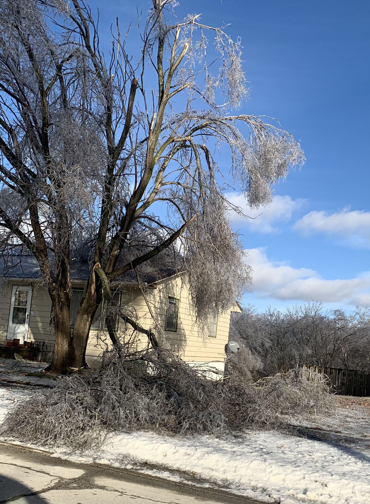
On December 29, 2020 over a quarter inch of freezing rain fell, causing widespread tree damage along the HWY 36 corridor; this in Stewartsville, Missouri Image: @wxpickman91 |
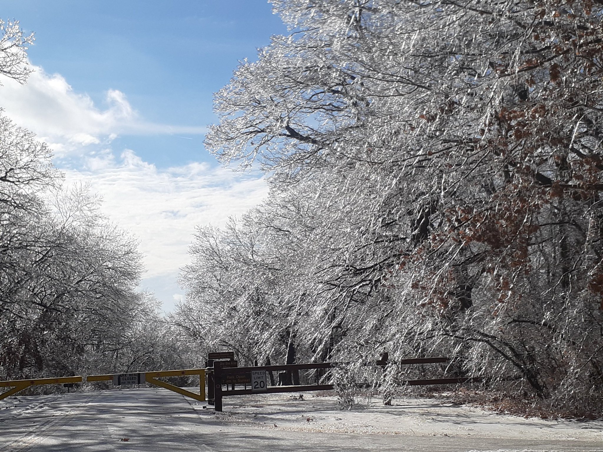
On December 29, 2020 over a quarter inch of freezing rain fell, causing widespread tree damage along the HWY 36 corridor; this in Wallace State Park just south of Cameron. Image: @tcookmedia |
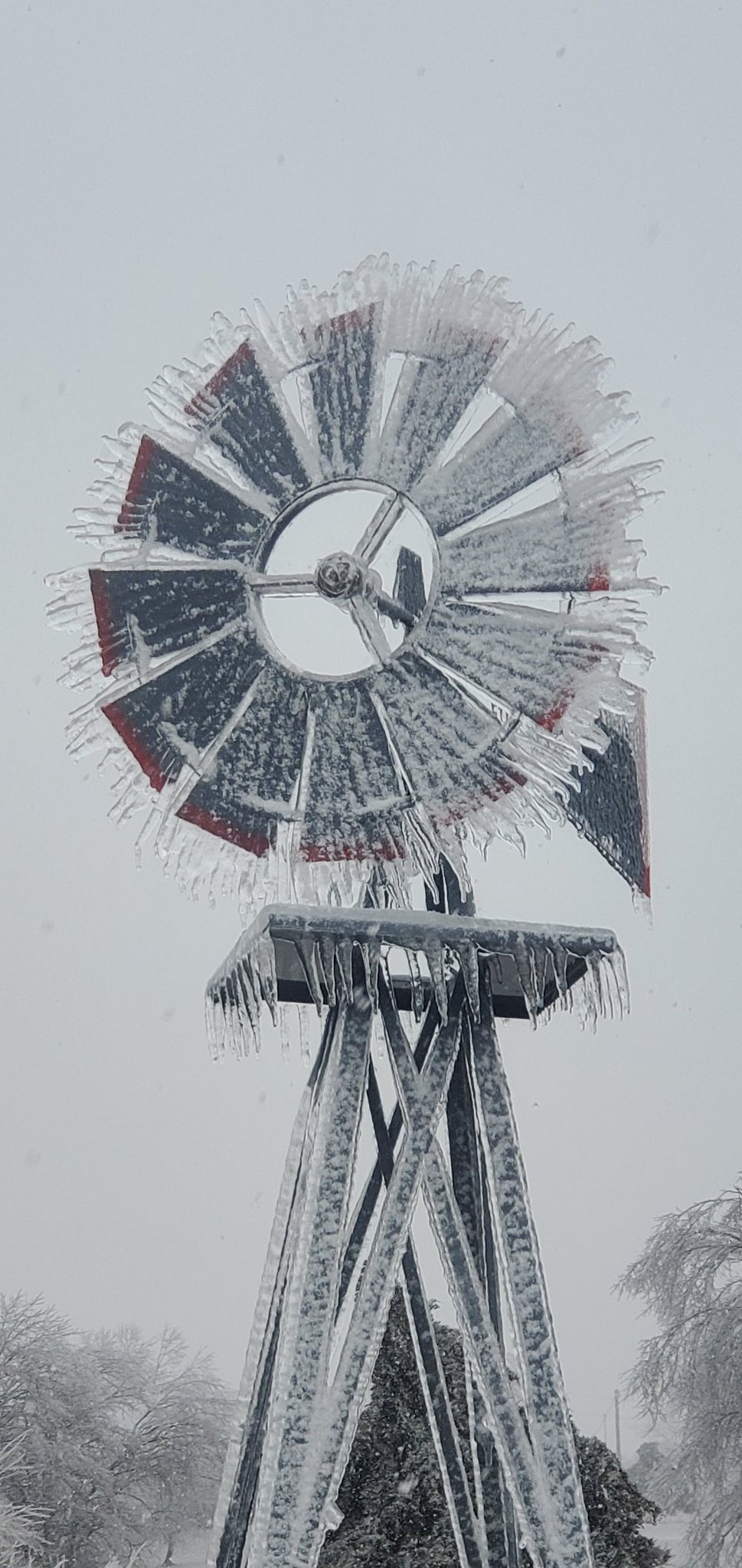
Windmill just south of Warrensburg sports a very thick glaze of ice from an ice storm that moved through the morning of January 1, 2021 Image: @kyliesdaddy18x |
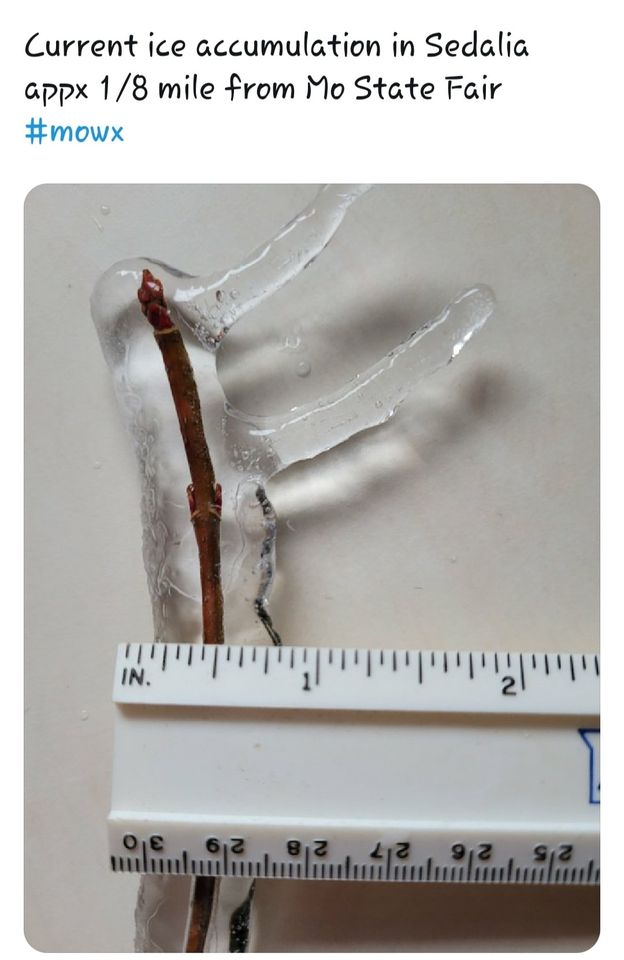
Nearly a quarter to a half inch of ice formed near Sedalia Image: Cyndi Doyal |
 |
Media use of NWS Web News Stories is encouraged! Please acknowledge the NWS as the source of any news information accessed from this site. |
|


 Weather Story
 Weather Map
 Local Radar