Overview
|
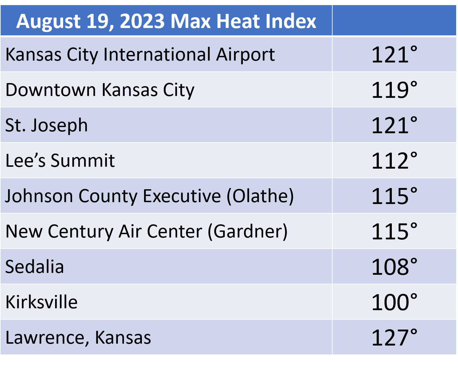
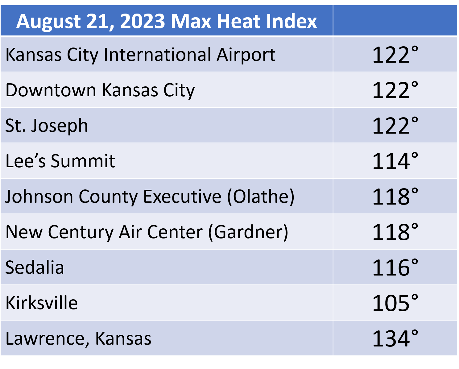
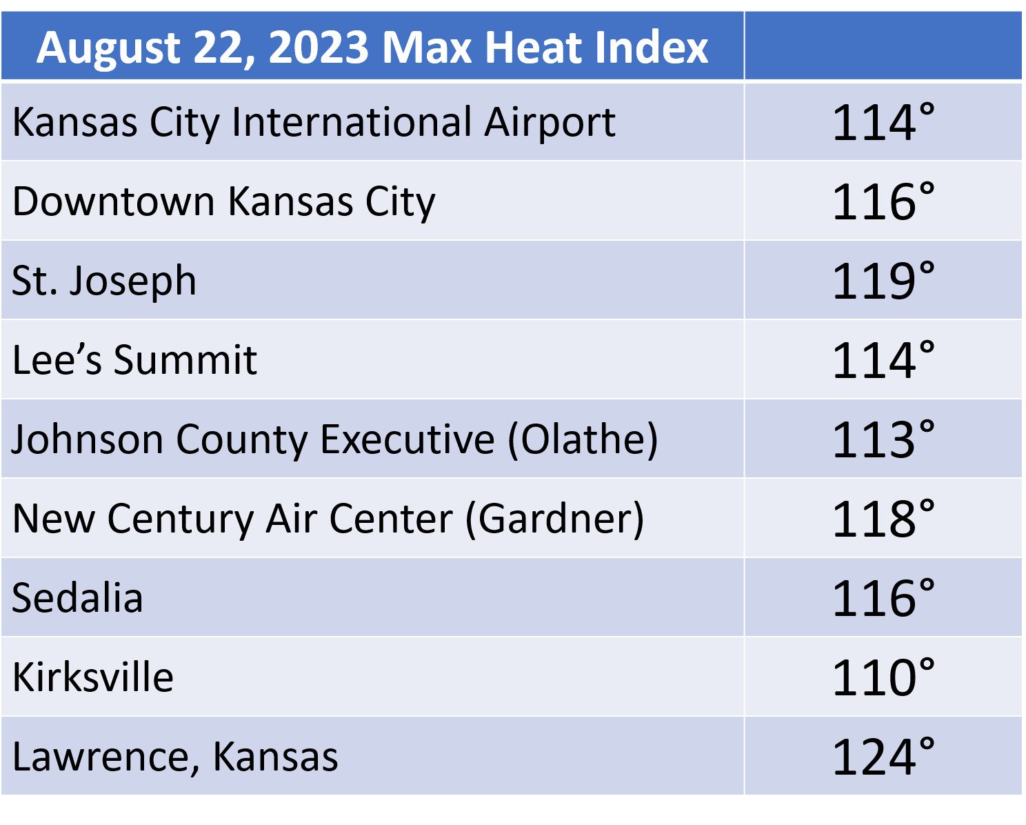
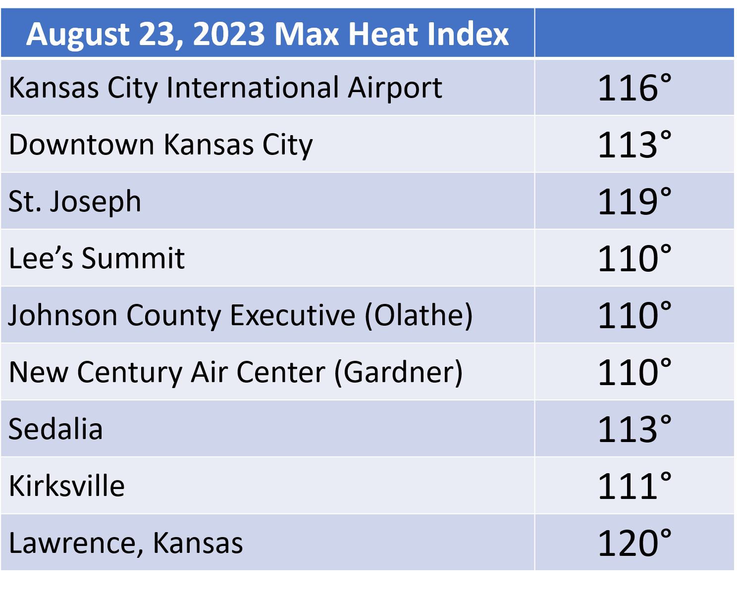
Starting on August 19, 2023 well-above normal temperatures impacted the central part of the United States, kicking off a heatwave that has not been experienced in the region in recent history. Kansas City International Airport reached high temperatures not recorded in the area since August of 2012. In contrast to the 2012 heatwave, this stretch of hot weather was accompanied by extremely high dewpoints, with frequently reached the upper 70s to middle 80s across the entire area. The combination of the extreme heat and the excessively high dewpoints led to heat indices from August 19 through August 25 to rise to 120-130 degrees. The hottest heat index in the area occurred in Lawrence, Kansas on the 20th and 21st, when it rose to 134 degrees.
Perhaps of note, the Topeka upper air program, which has sent radiosondes into the atmosphere twice per day since 1955 had only measured 6000 meters to the 500 millibar level two times in its history. During this heatwave Topeka measured 6000 meters to 500 mb on six straight launches, spanning three days. The highest 500 mb level measured out of Topeka for this stretch was 6030 meters, a testiment to the extreme nature of this mid level ridge. |
 Caption |
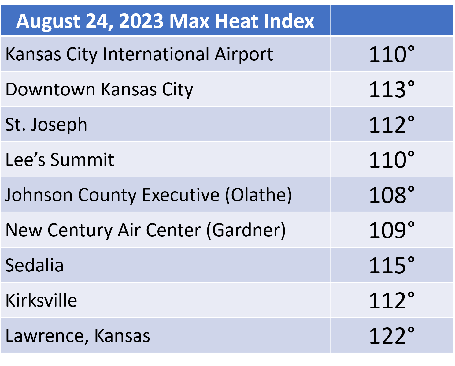
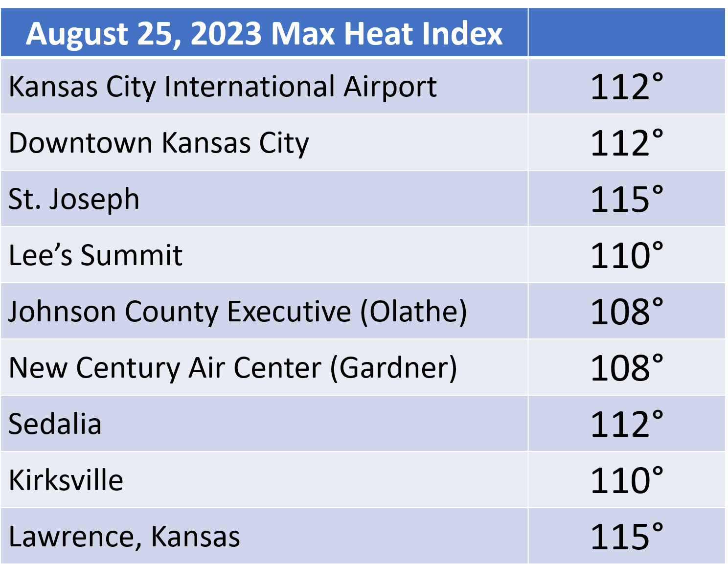
Recorded Heat Indices
|
|

Downloadable KMZ File |
|
|
|
|
|
Excessive Heat Warning
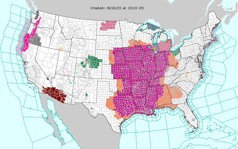
The Excessive Heat Warning was expansive across most of the Midwest during the peak of the event.
 |
Media use of NWS Web News Stories is encouraged! Please acknowledge the NWS as the source of any news information accessed from this site. |
|


 Weather Story
 Weather Map
 Local Radar