Overview
|
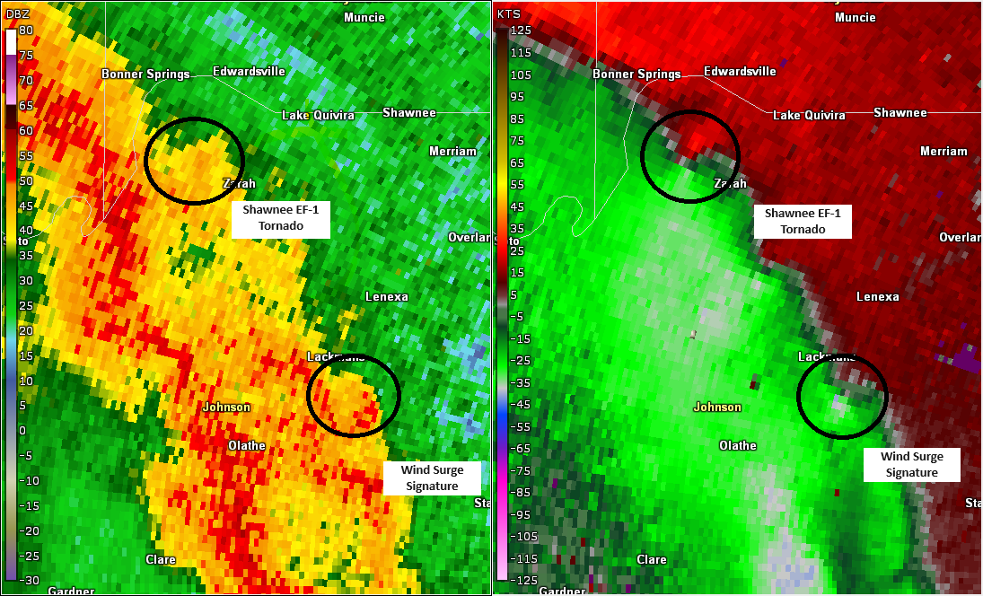
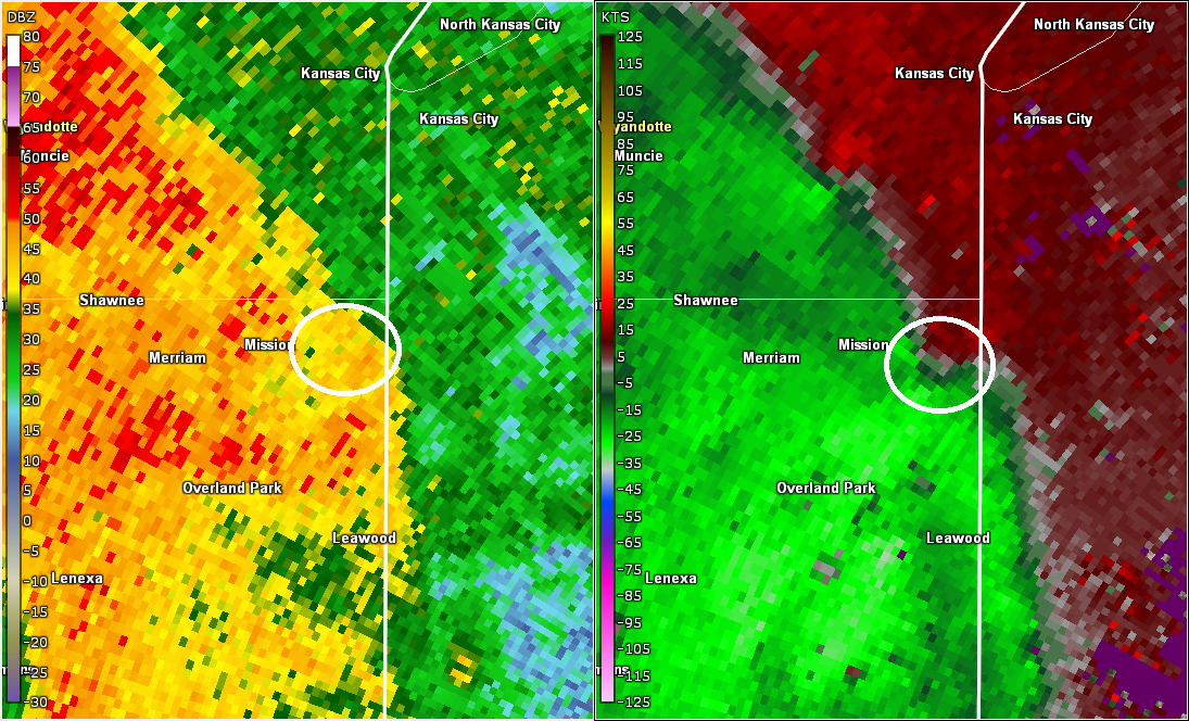
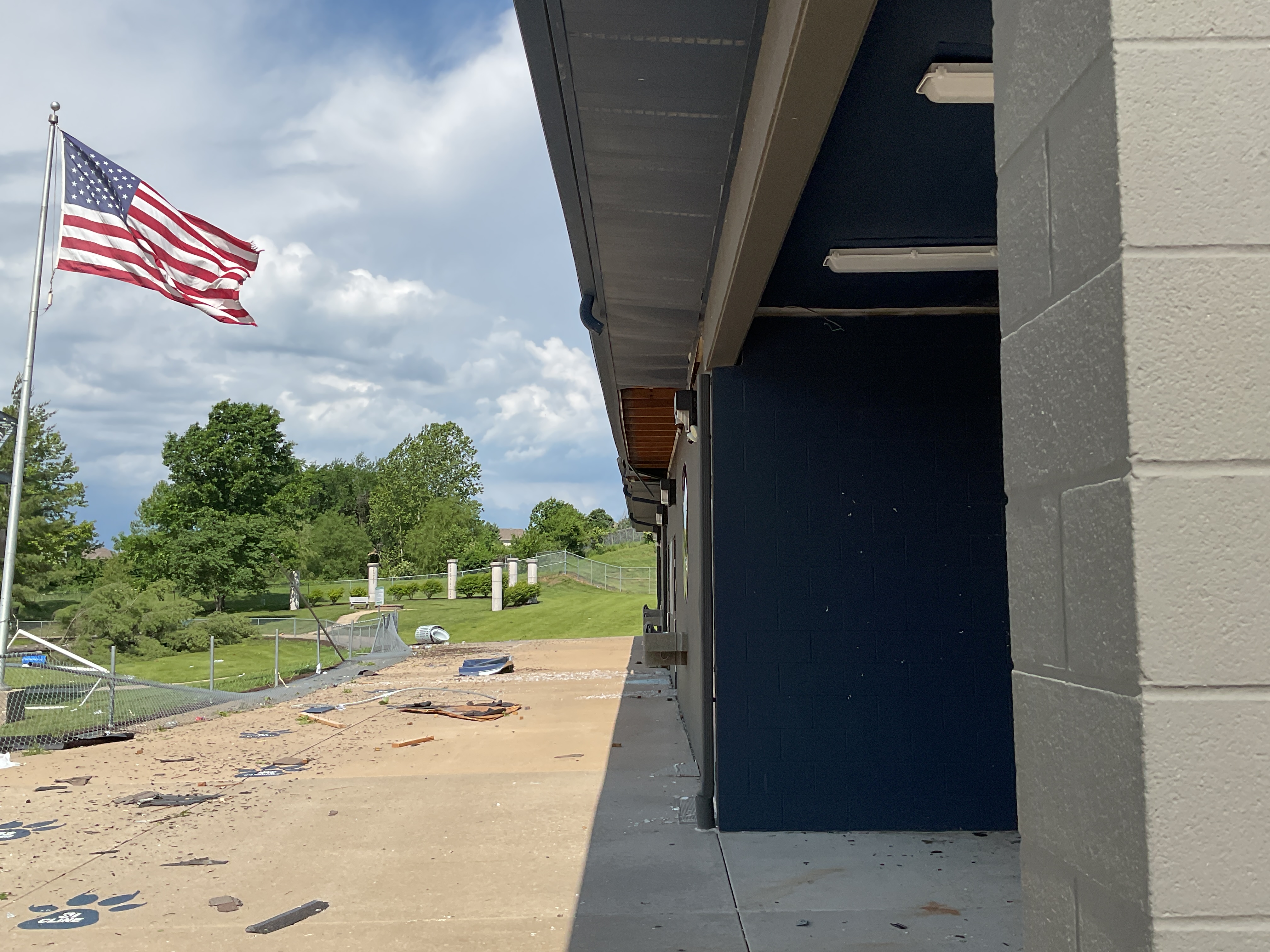
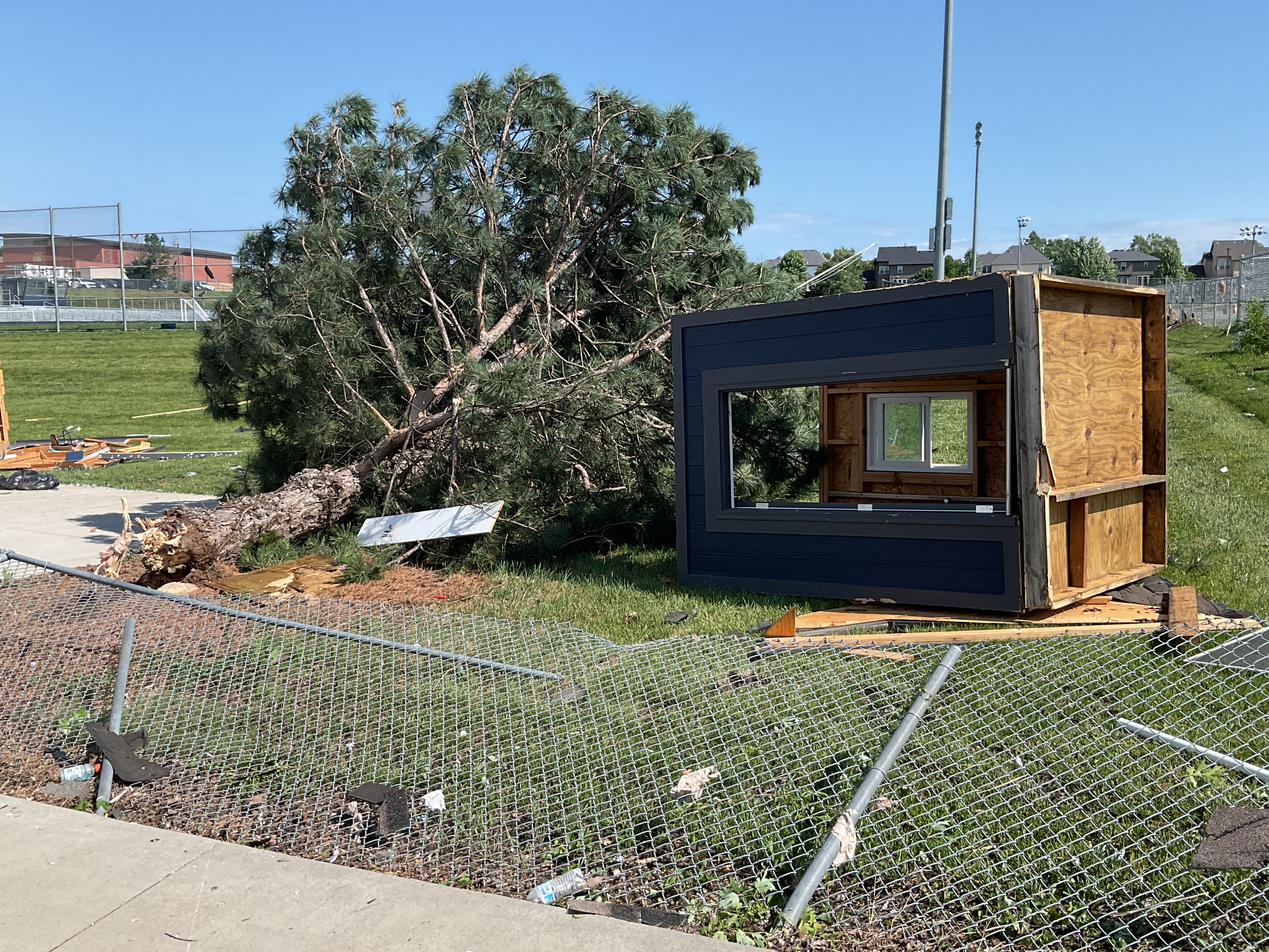
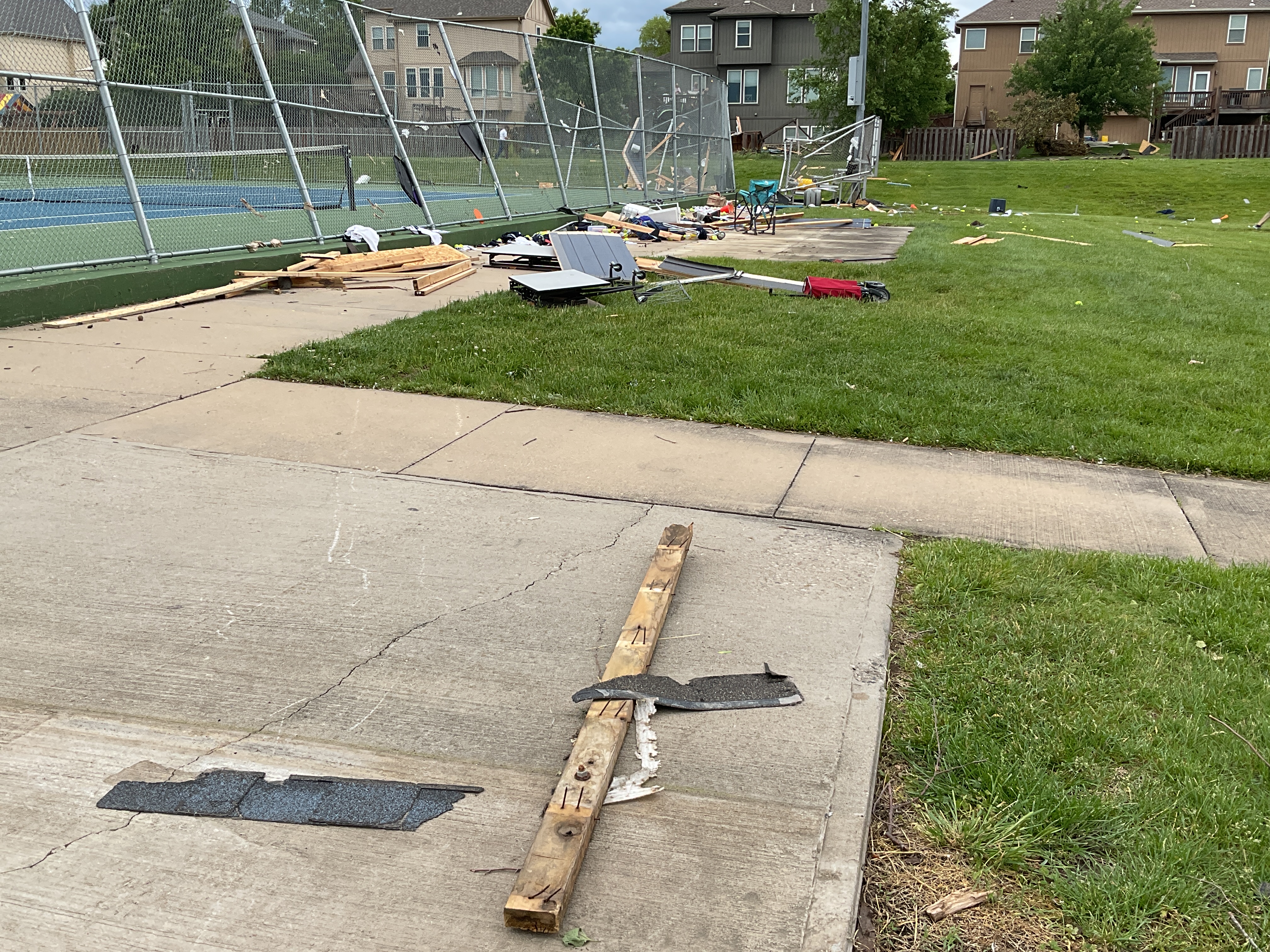
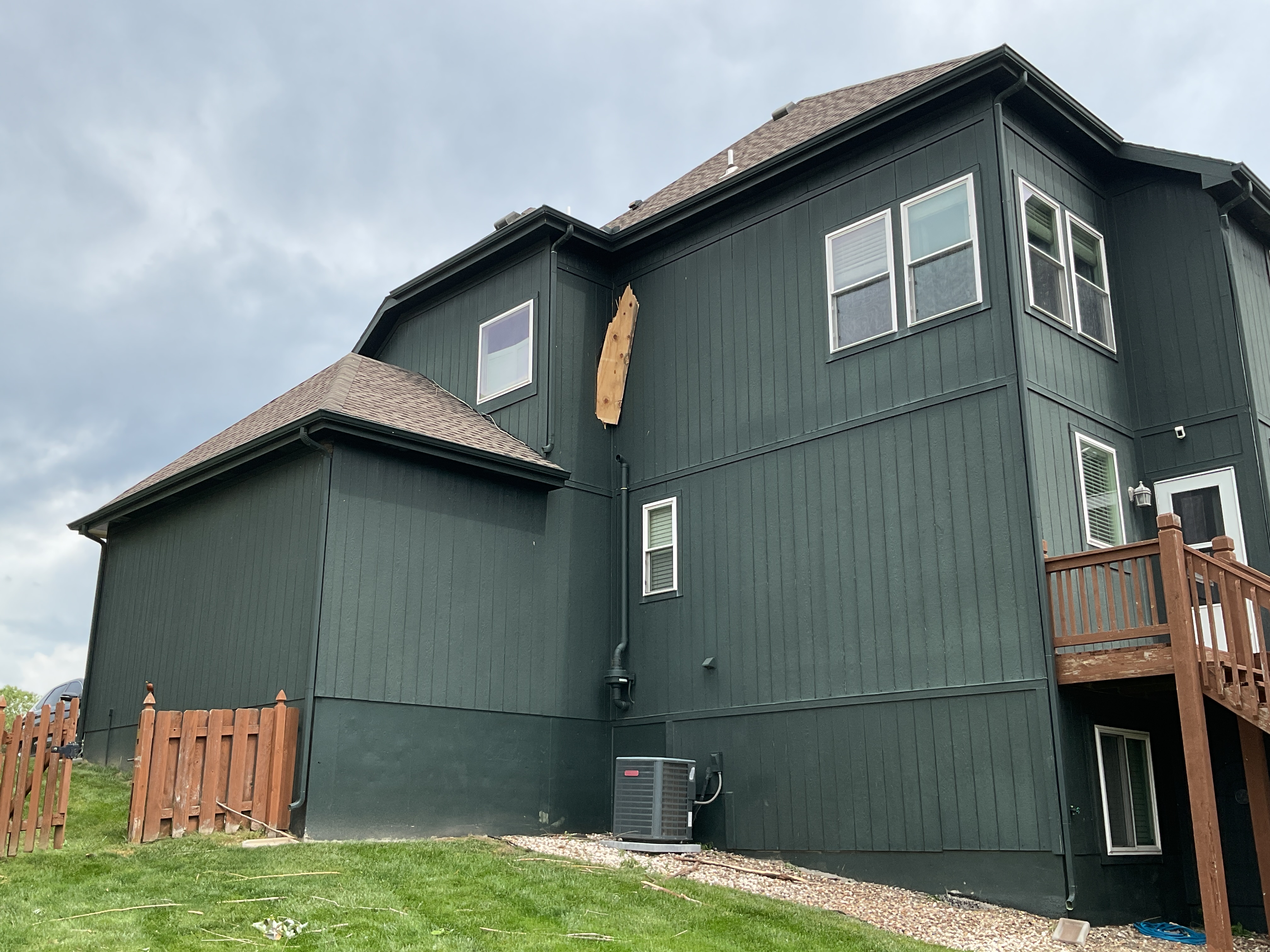
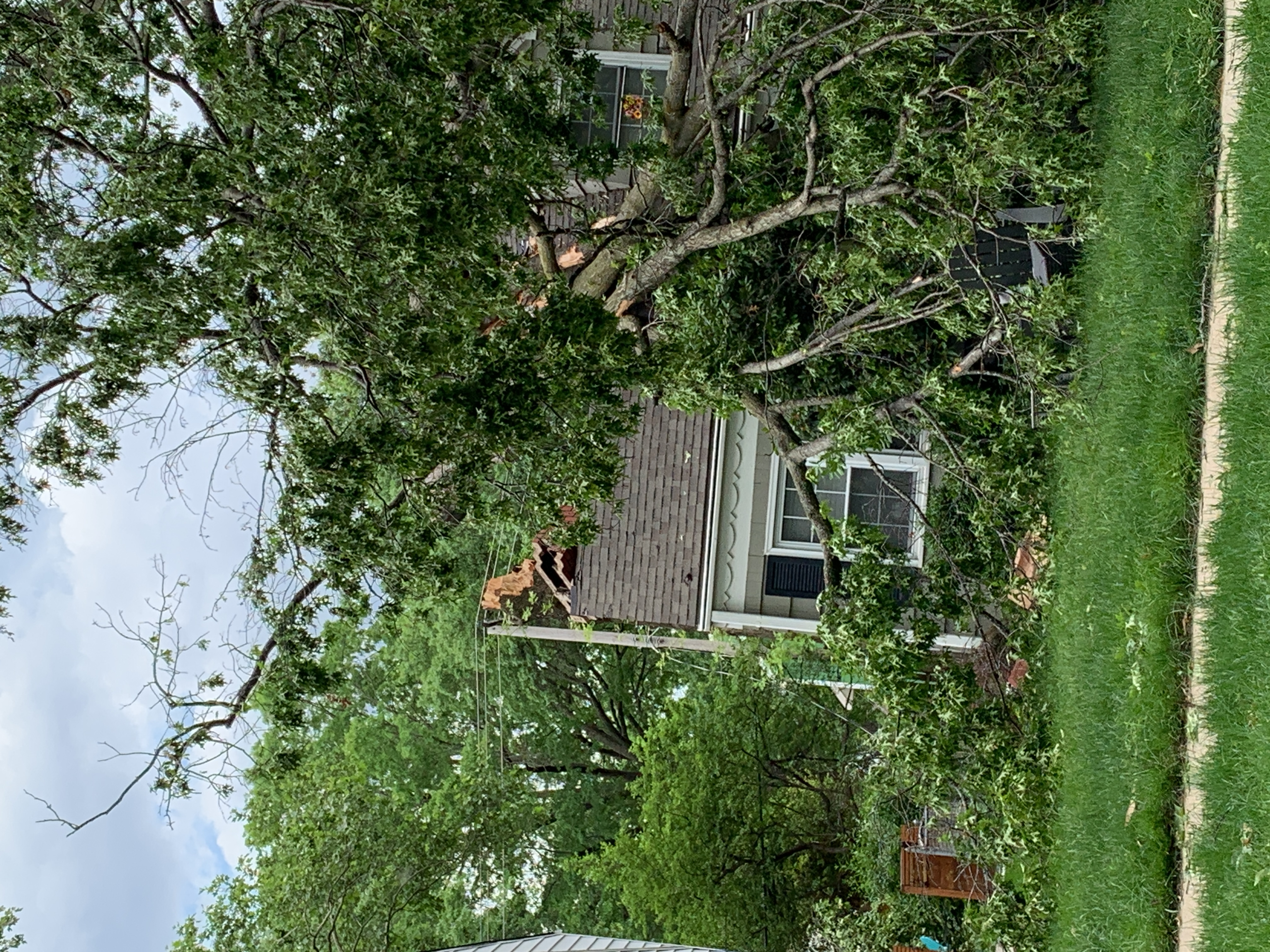
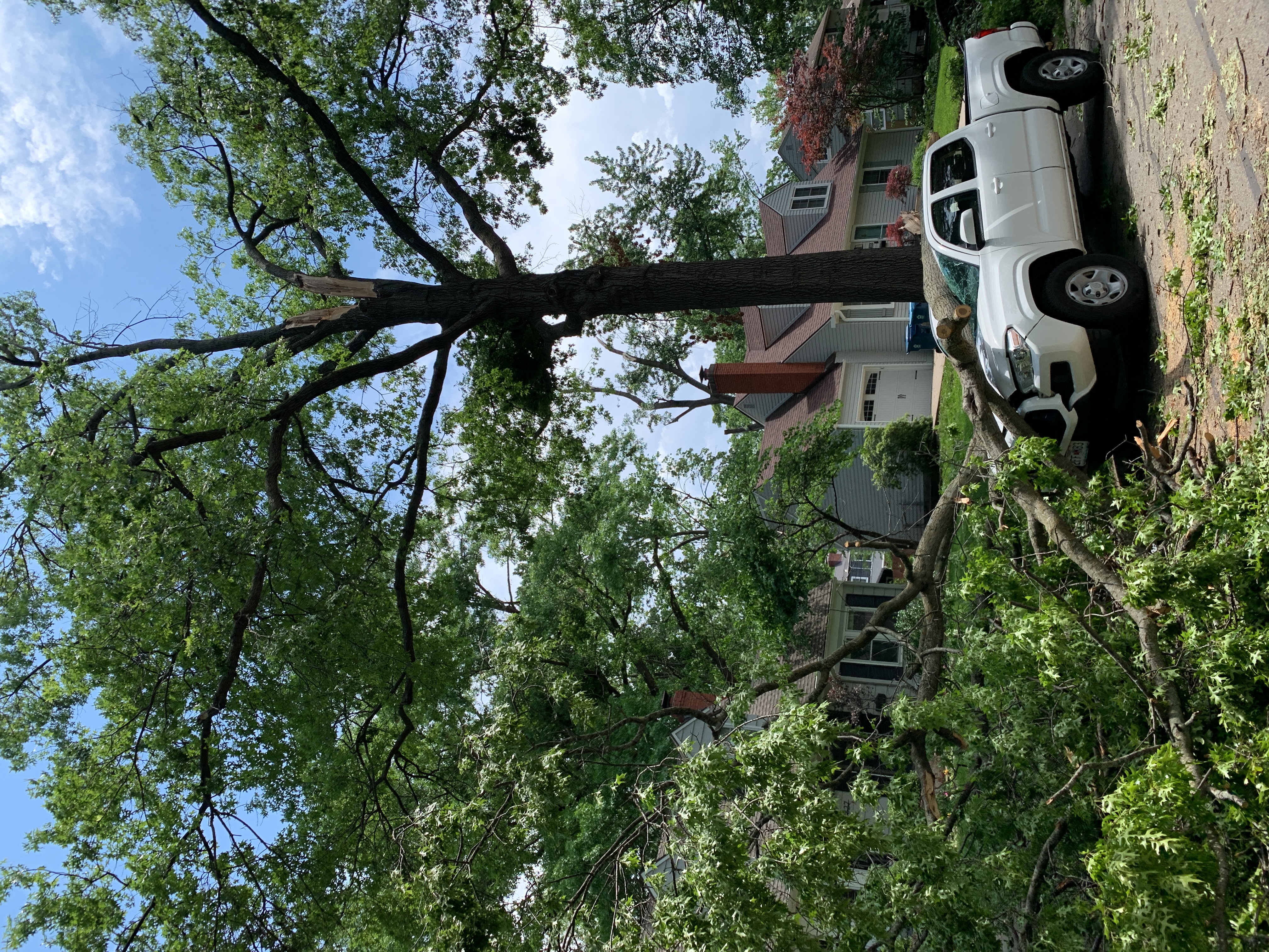
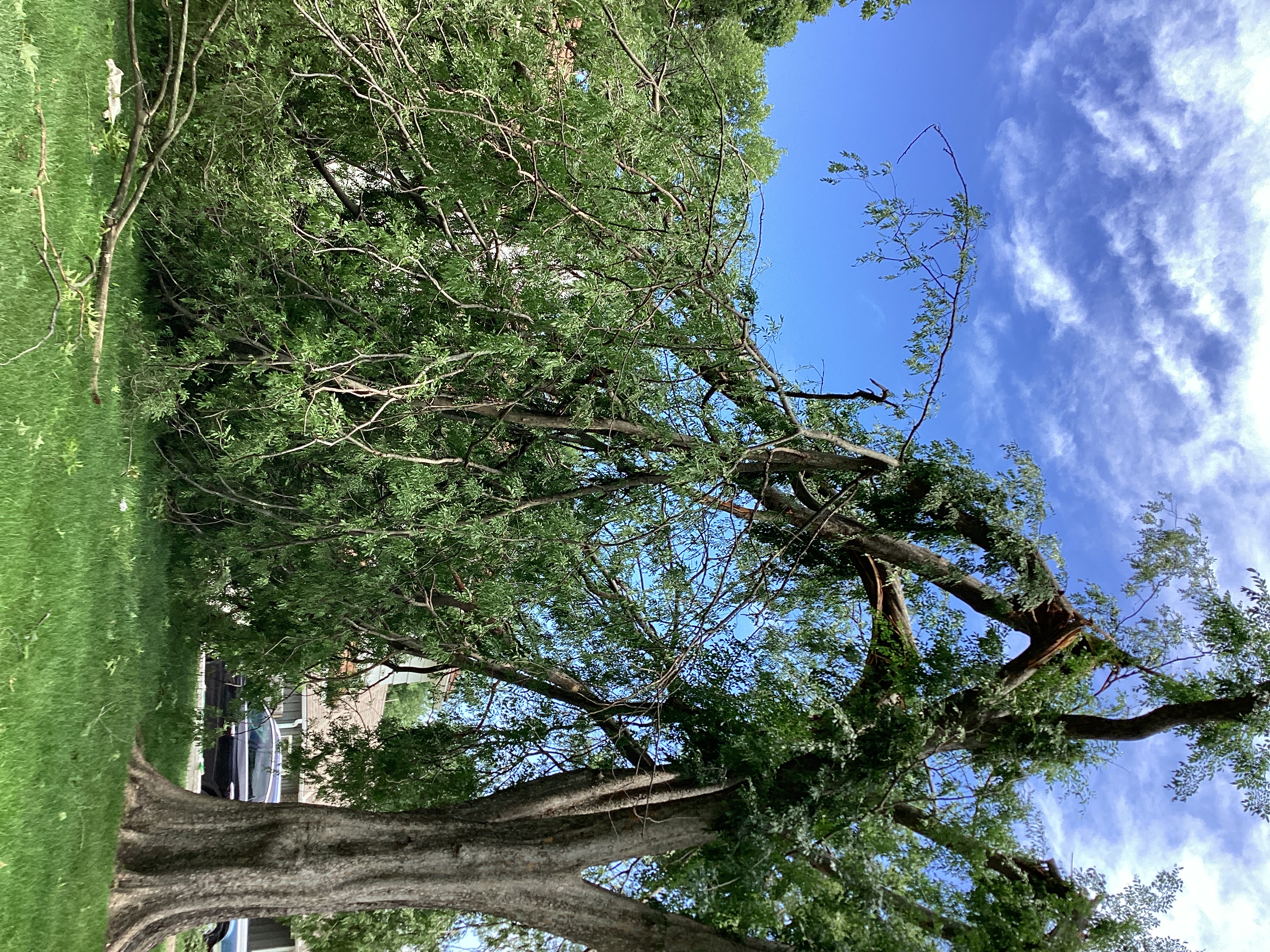
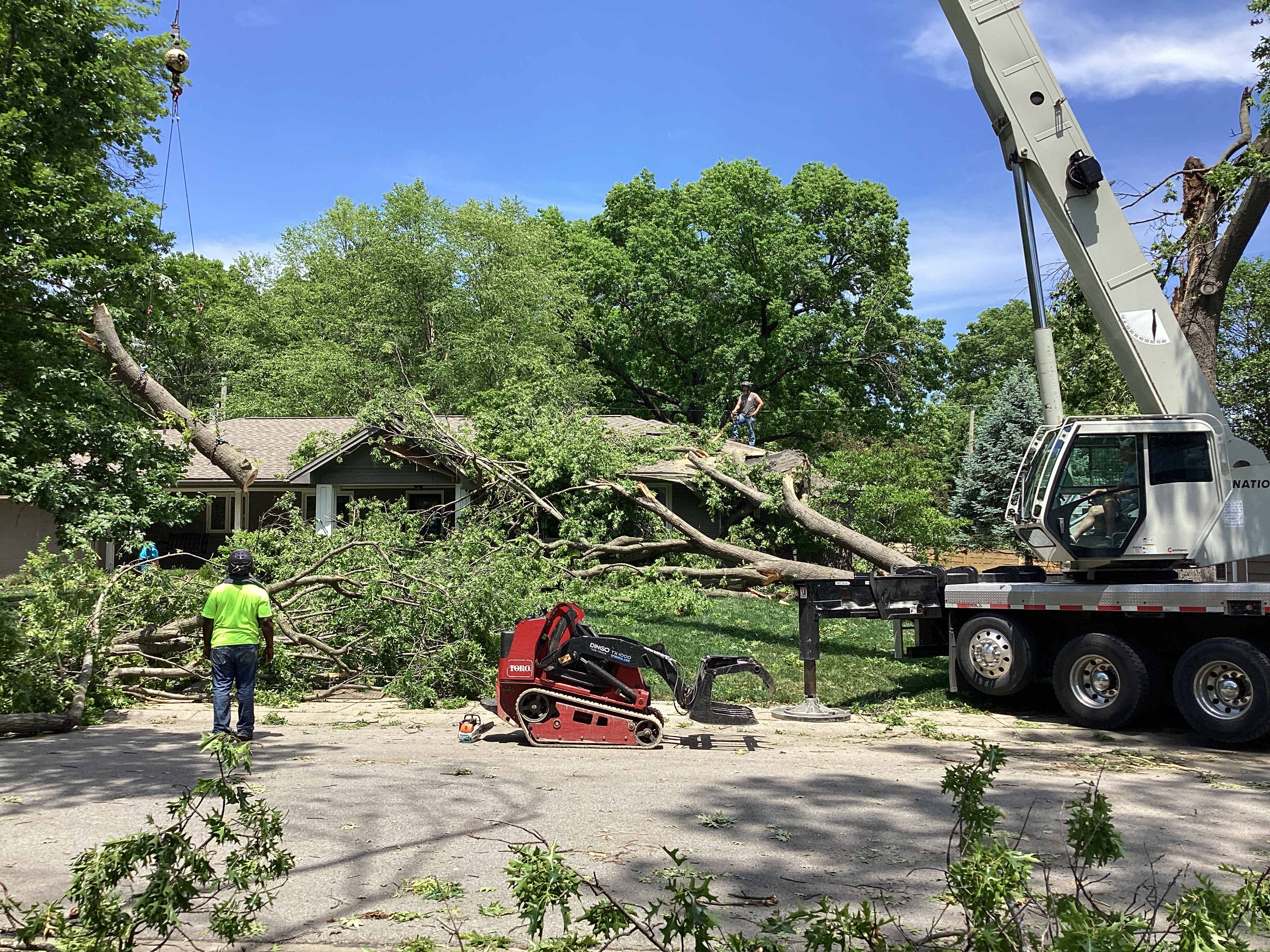
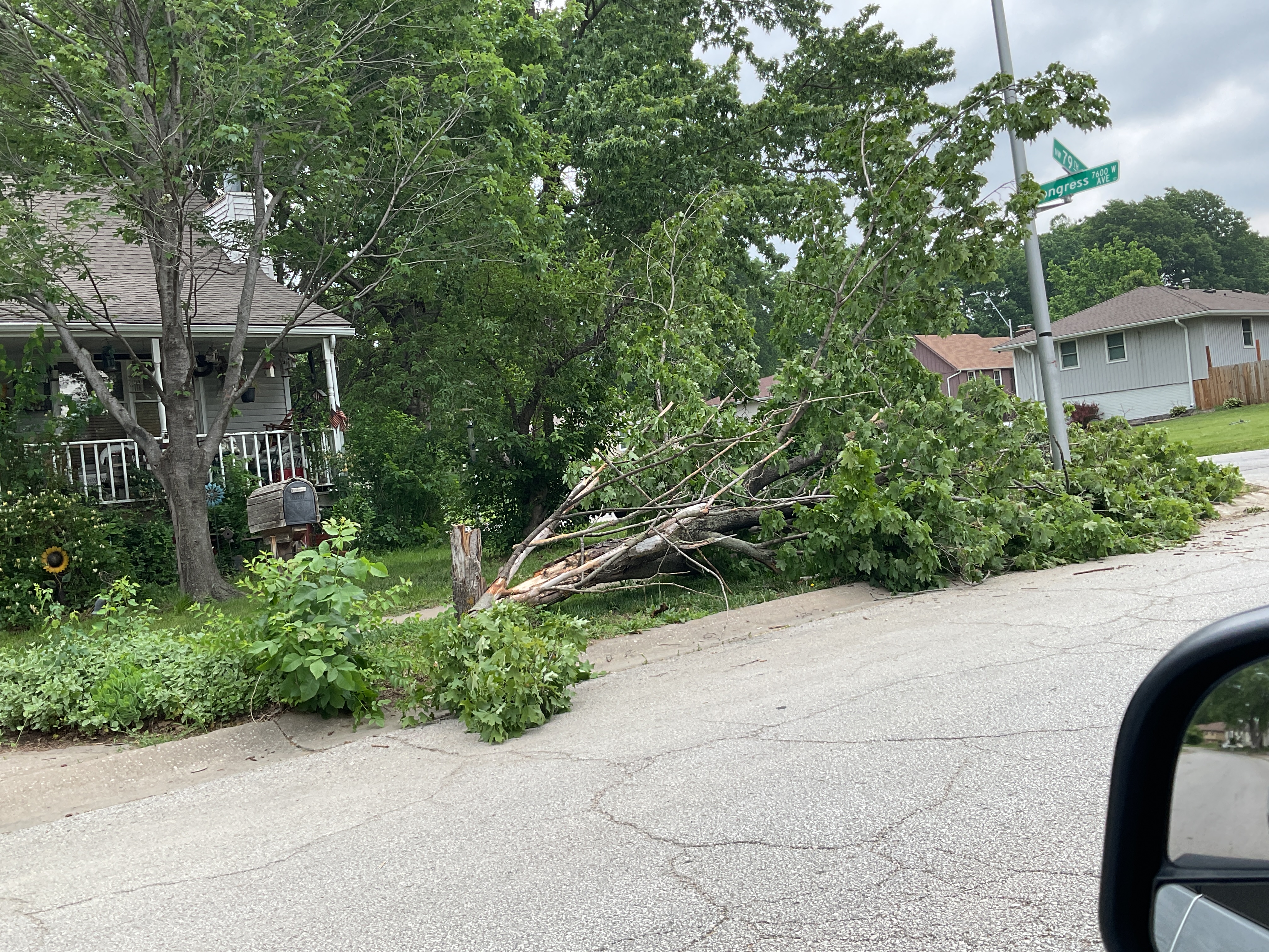
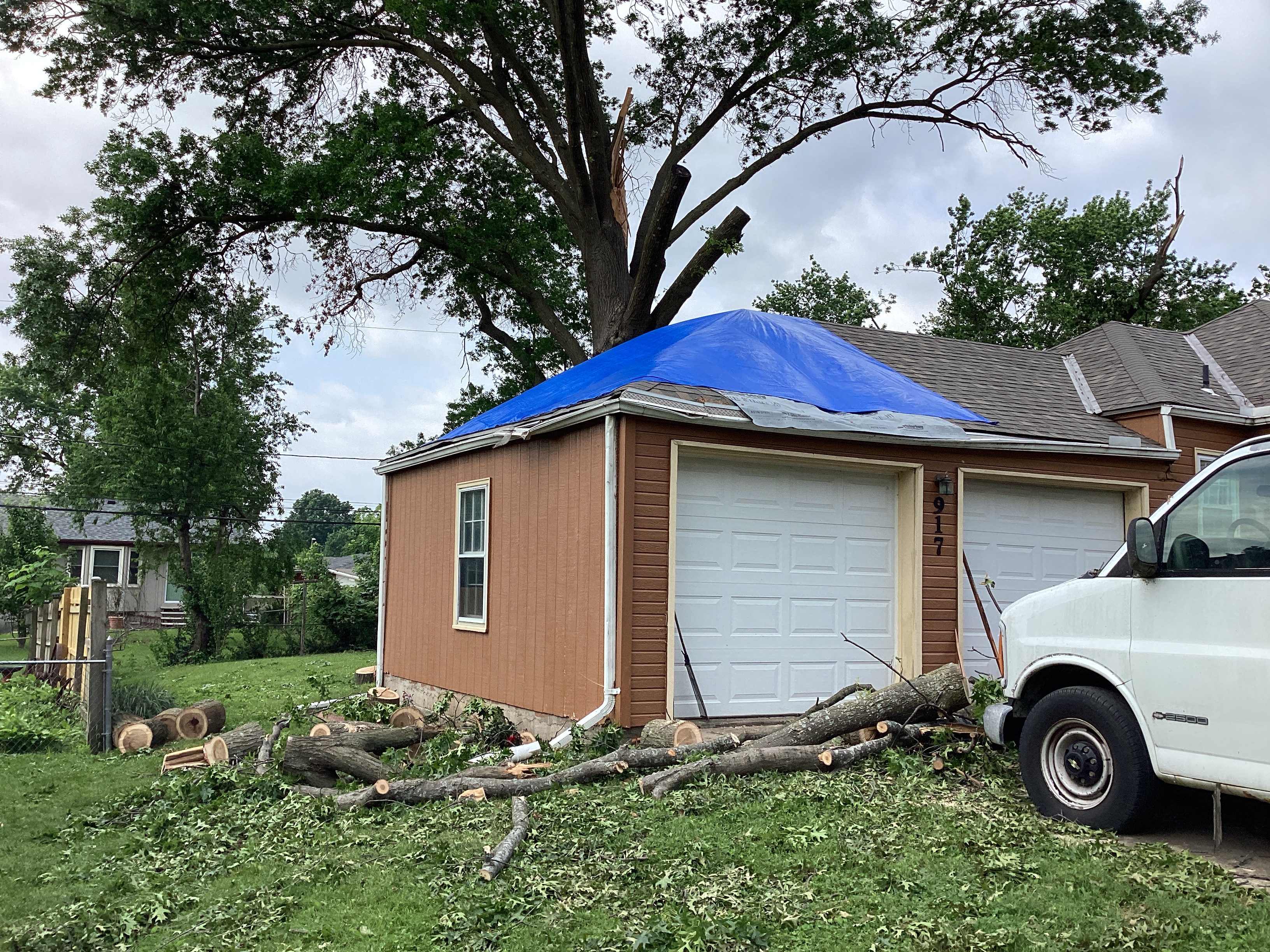
Shortly after 10 PM CDT, Sunday, May 19, 2024, a severe squall line, with a history of producing damaging wind gusts, began to move into the western side of the Kansas City Metro. As this line advanced and lifted east-northeast across Johnson County Kansas and into Leavenworth, Platte, Jackson, and Clay counties, several embedded circulations developed. The majority of these resulted in isolated and brief paths of enhanced straight line winds and wind damage. Four of these brief circulations resulted in brief, short-lived tornadoes. The first tornado occurred in central Johnson County KS, near Gardner, a brief EF-1. The second in northwestern Johnson County, in far western Shawnee, KS, resulted in a path of enhanced straight line winds and a brief EF-1 tornado. The second circulation began south of I-435 near Johnson County Community College and resulted in a sporadic path of straight line wind damage before organizing and developing a brief EF-1 tornado as it crossed through the west and northwest side of Prairie Village, KS. The fourth tornado was a very brief EF- 1 in rural portions of southern Leavenworth County Kansas. |
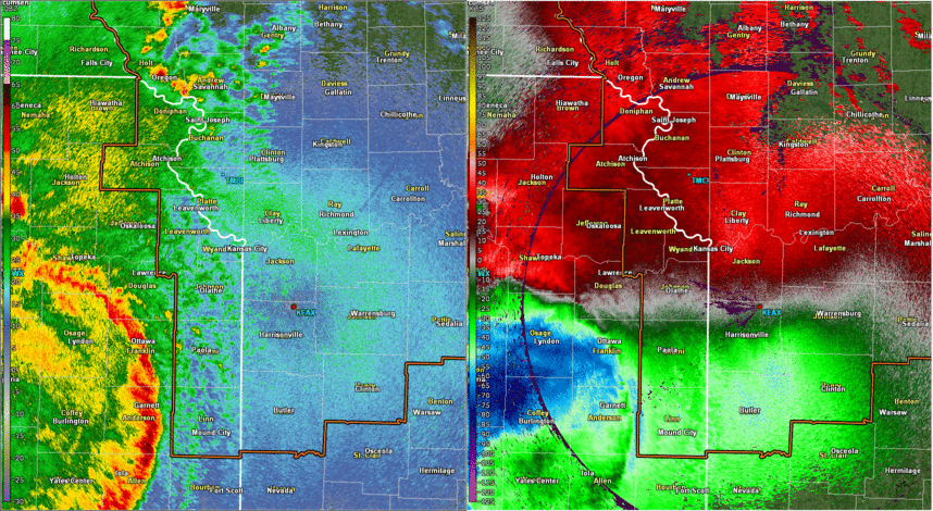 Radar Loop From 9:00 PM to 11:30 PM (Base Reflectivity and Base Velocity) |
Tornadoes and Straight Line Wind Damage
|
Tornado - Gardner Kansas
Track Map 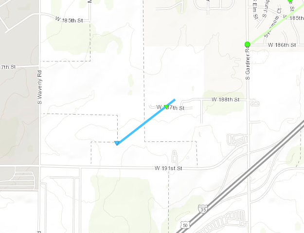 
|
||||||||||||||||
|
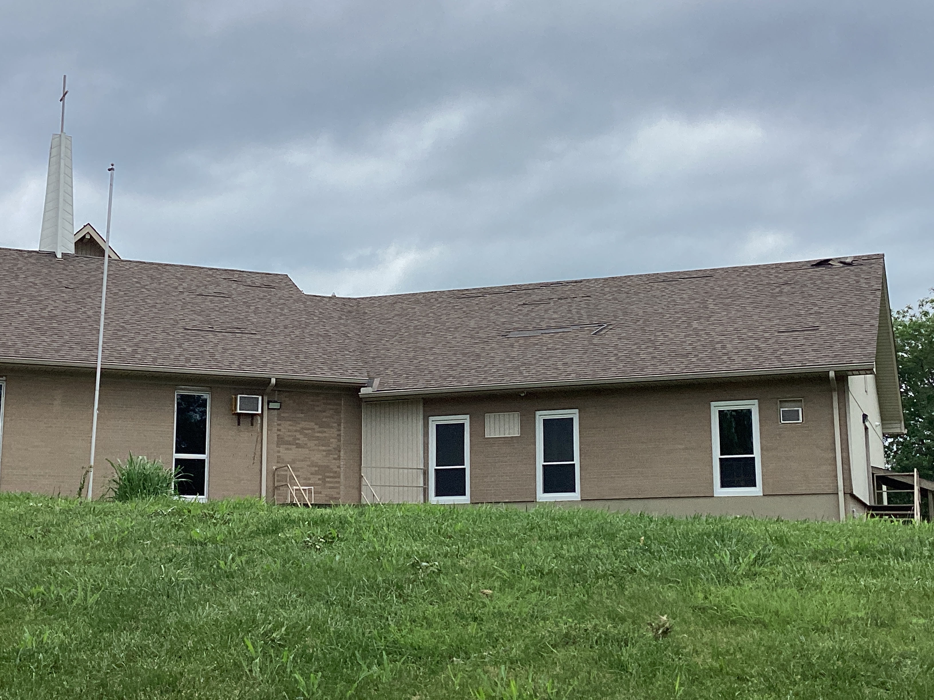
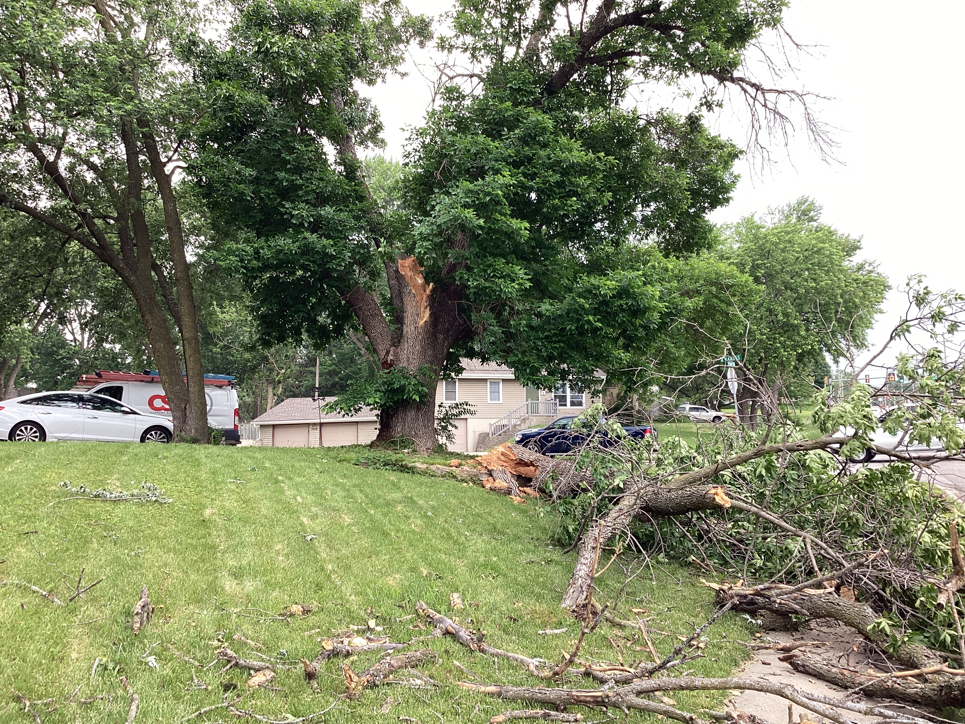
Wind Damage - Gardner Kansas
Track Map 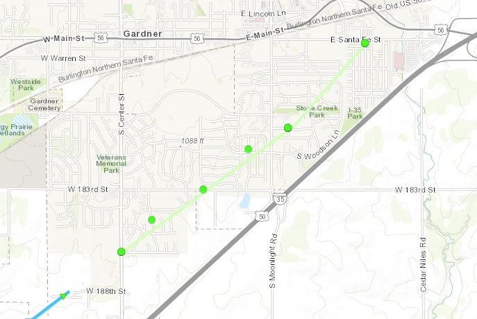
|
||||||||||
|
Tornado - Southern Leavenworth Co.
Track Map 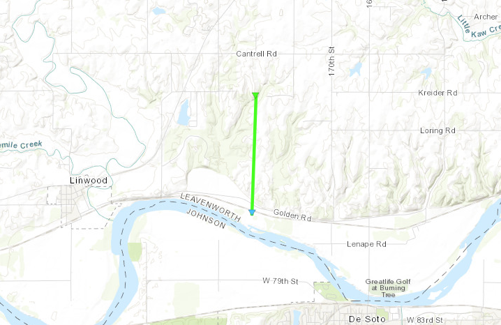
|
||||||||||||||||
|
Tornado - Shawnee, KS
Track Map 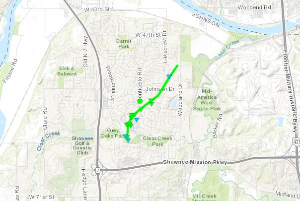
|
||||||||||||||||
|
||||||||||||||||
|
Wind Damage - N. Olathe to Overland Park
Track Map 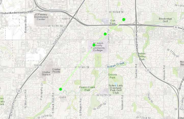
|
||||||||||
|
Wind Damage - Shawnee, KS
Track Map 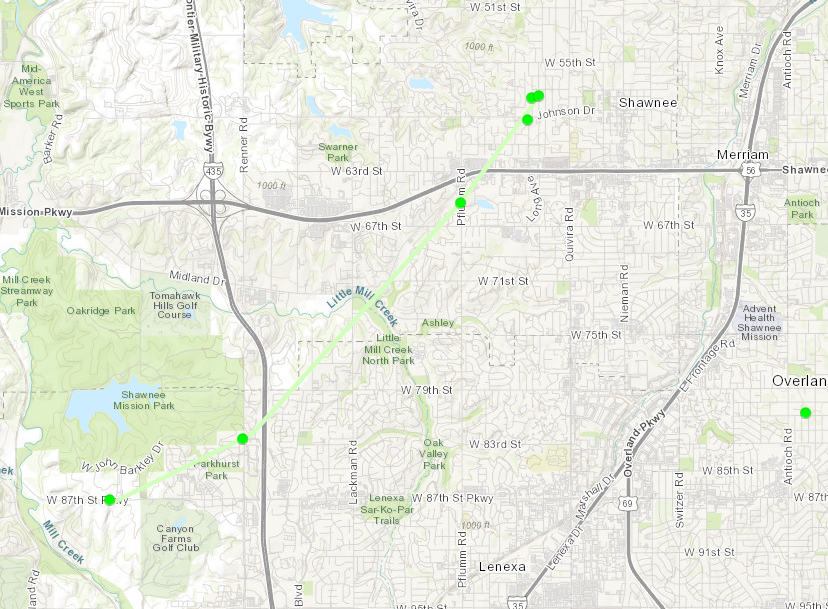
|
||||||||||
|
Tornado - Prairie Village - Mission Hills
Track Map 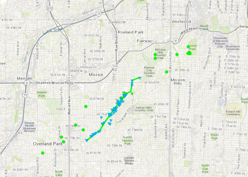
|
||||||||||||||||
|
||||||||||||||||
|
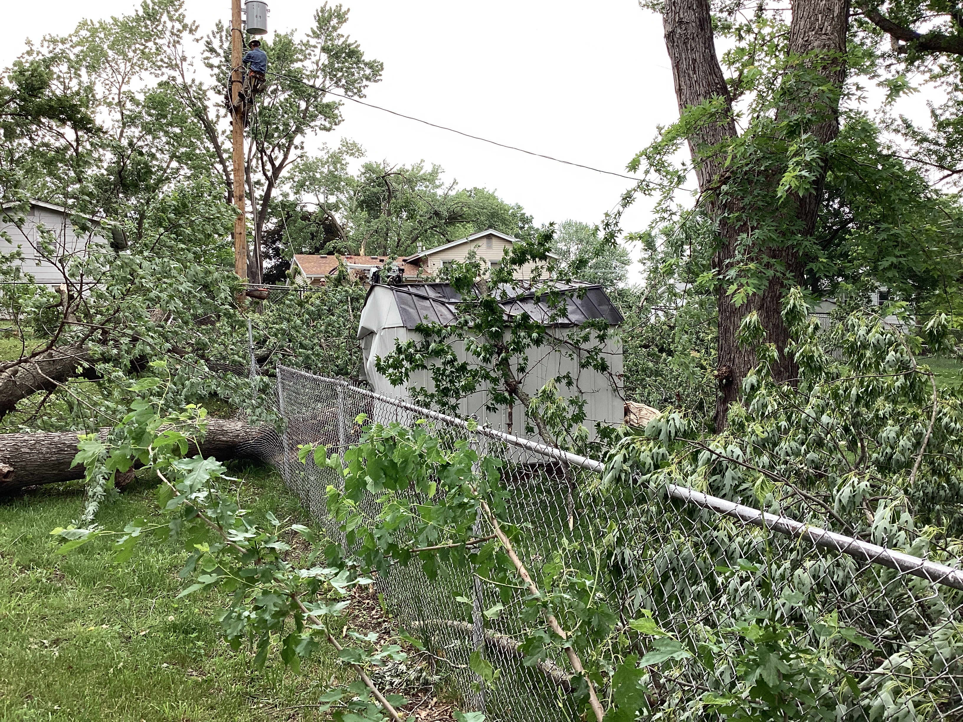
Wind Damage - Parkville, MO
Track Map 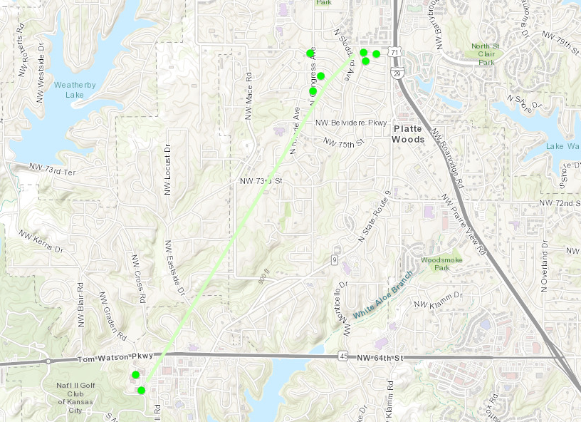 |
||||||||||
|
||||||||||
|
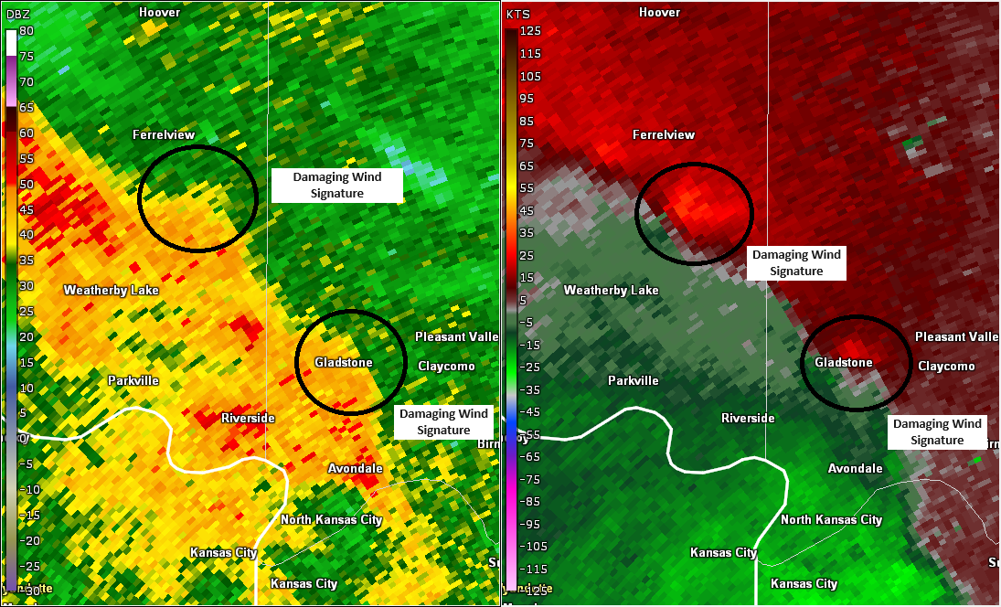
Wind Damage - Gladstone, MO
Track Map 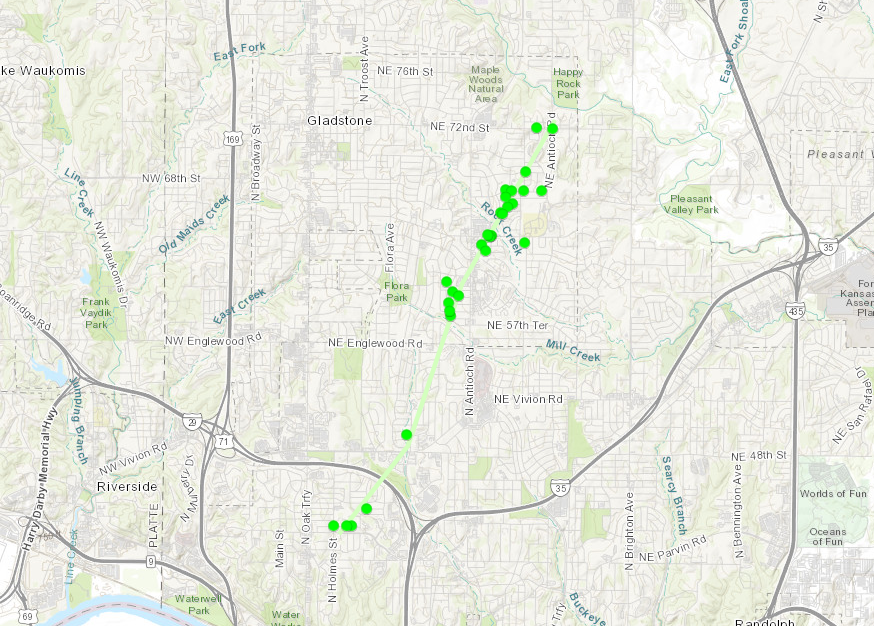 |
||||||||||
|
||||||||||
The Enhanced Fujita (EF) Scale classifies tornadoes into the following categories:
| EF0 Weak 65-85 mph |
EF1 Moderate 86-110 mph |
EF2 Significant 111-135 mph |
EF3 Severe 136-165 mph |
EF4 Extreme 166-200 mph |
EF5 Catastrophic 200+ mph |
 |
|||||
Radar
Header
 |
 |
 |
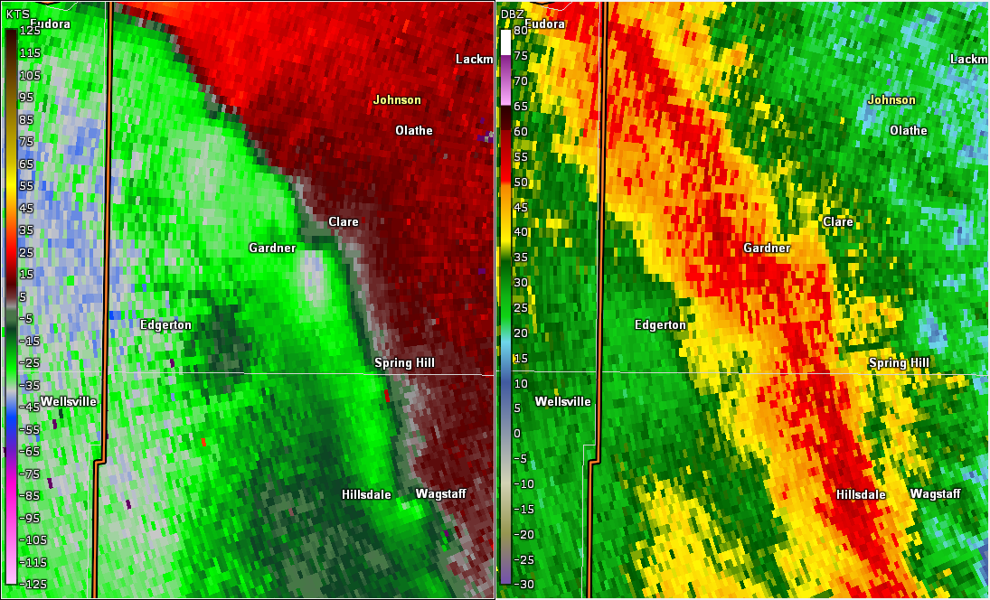 |
| Shawnee EF-1 Tornado and Damaging Wind Signature | Radar circulation associated with the Prairie Village-Mission Hills EF-1 | Damaging Wind Signatures in Platte and Clay Counties (NWS Damage Survey) | Damaging Wind Signature in Gardner KS |
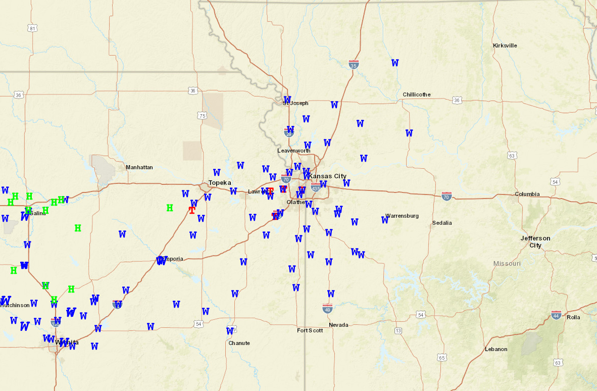
Storm Reports
https://www.spc.noaa.gov/climo/gmf.php?rpt=240519_rpts_filtered
 |
Media use of NWS Web News Stories is encouraged! Please acknowledge the NWS as the source of any news information accessed from this site. |
|


 Weather Story
 Weather Map
 Local Radar