Overview
|
On the evening of May 6th, a line of strong to severe thunderstorms moved through the region from west to east, ending early the morning of May 7th. Numerous reports of damaging wind gusts, between 60 and 75 mph were reported. Additionally, a preliminary five total tornadoes were confirmed, each associated with embedded circulations within the larger line of thunderstorms. |
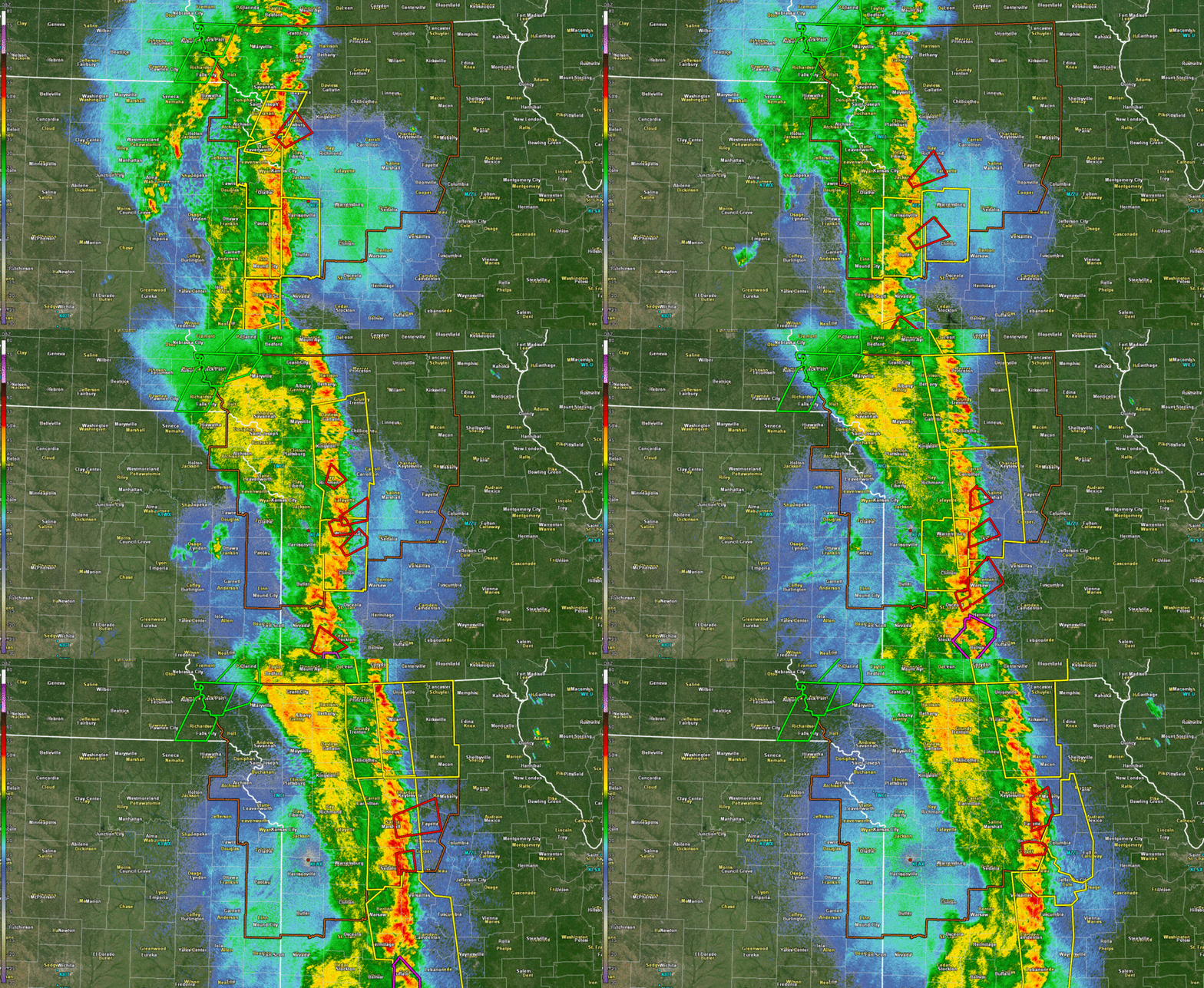 KEAX Radar 11:00 PM to 1:00 AM CDT |
Tornadoes:
|
Tornado - Northeastern Platte Co.
Track Map 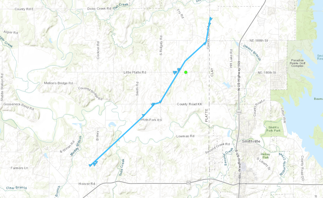 
|
|||||||||||||||||||||||||||||||||
|
Tornado - NW-N Sedalia, MO
Track Map 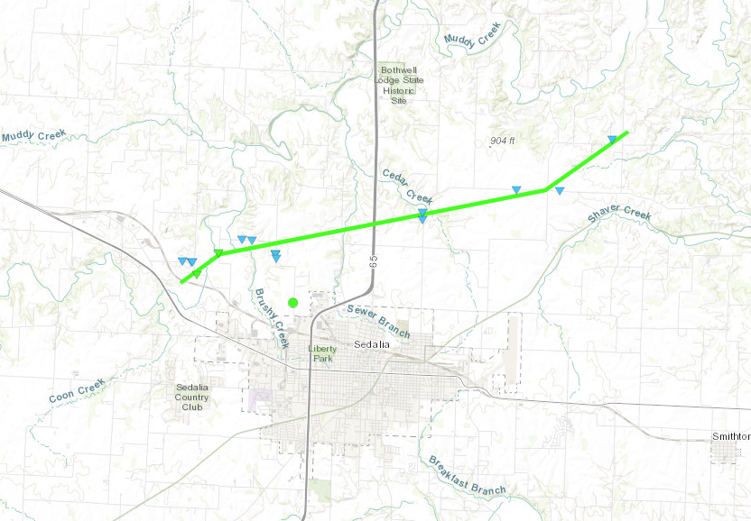 
|
|||||||||||||||||||||||||||||||||
|
Tornado - Higbee, MO
Track Map 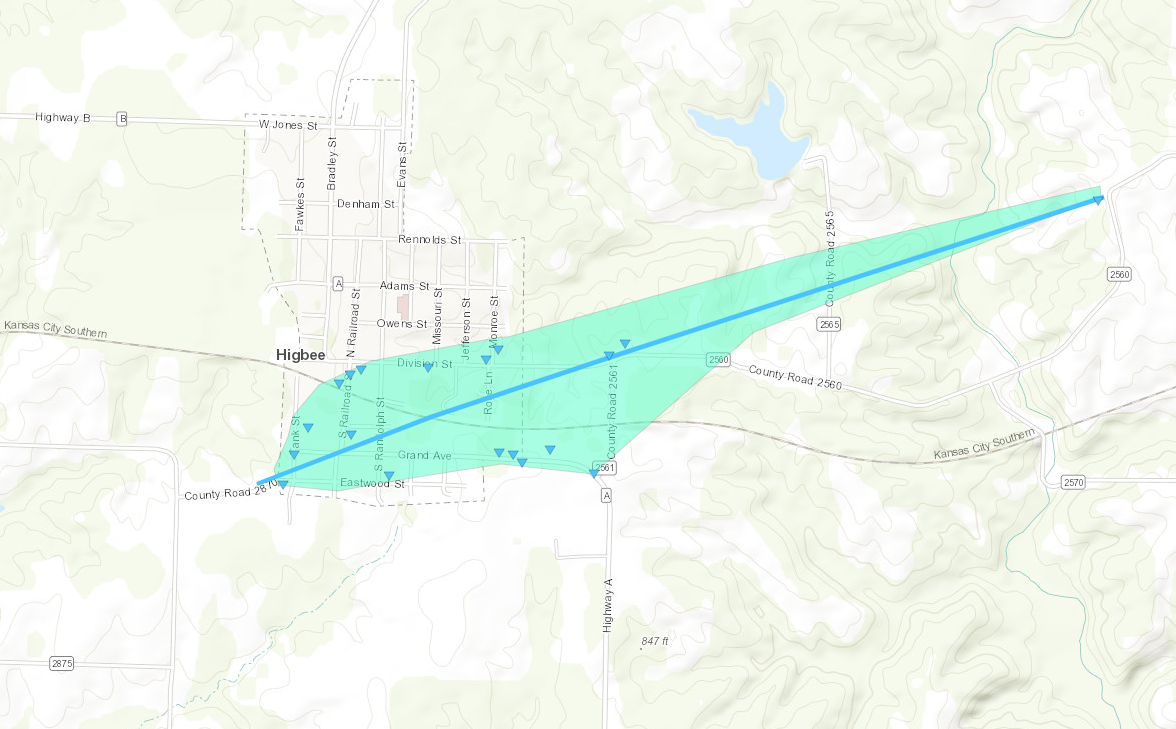  |
||||||||||||||||
The Enhanced Fujita (EF) Scale classifies tornadoes into the following categories:
| EF0 Weak 65-85 mph |
EF1 Moderate 86-110 mph |
EF2 Significant 111-135 mph |
EF3 Severe 136-165 mph |
EF4 Extreme 166-200 mph |
EF5 Catastrophic 200+ mph |
 |
|||||
Photos & Video
Header
 |
 |
 |
 |
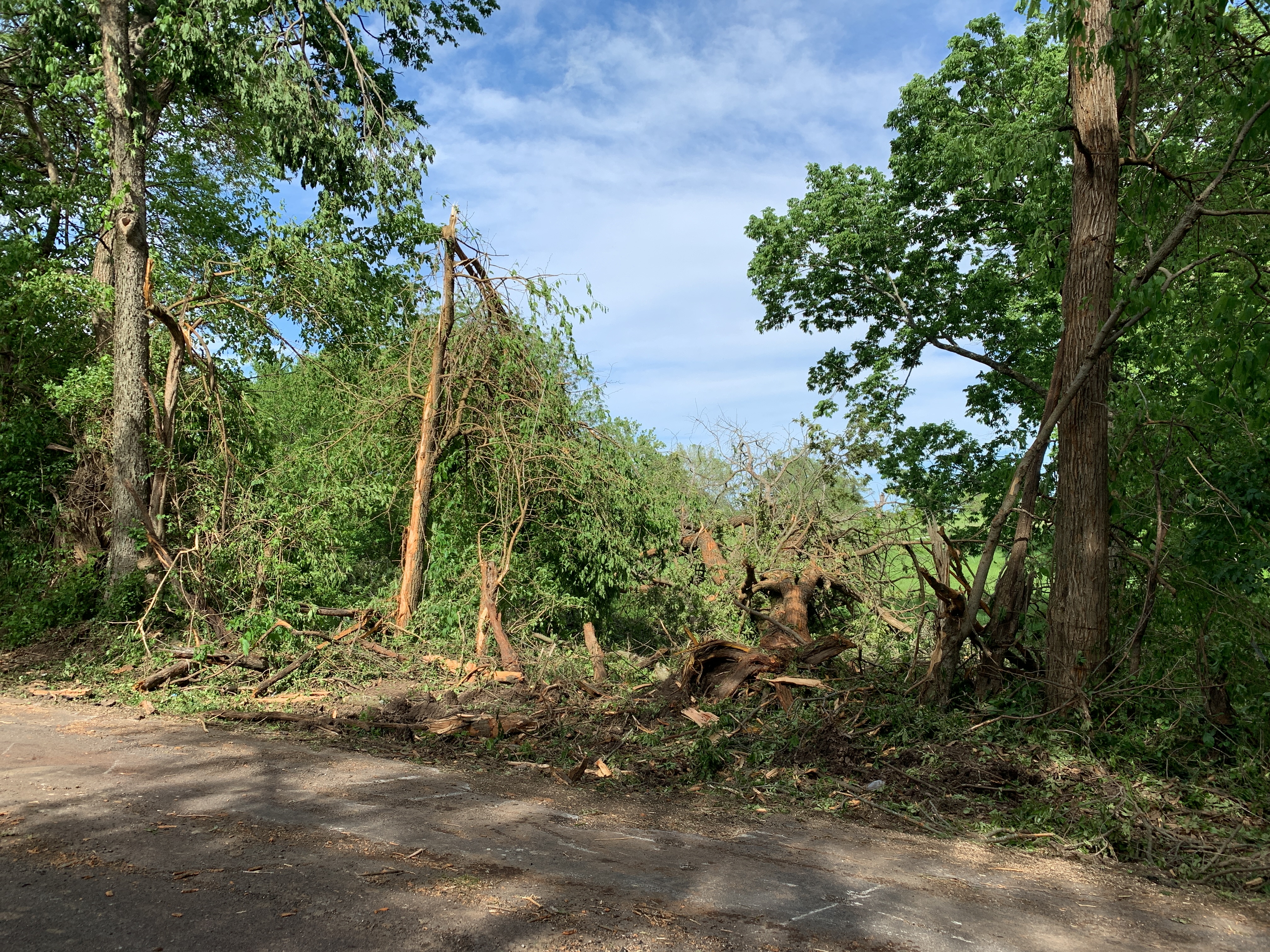
| Tree Damage North of Sedalia, MO (NWS Damage Survey) |
Minor Damage to Home north of Sedalia (NWS Damage Survey) |
Travel Trailer Flipped at Dealership in Grain Valley, MO (NWS Damage Survey) |
Building Damage in Grain Valley, MO (NWS Damage Survey) |
Radar
Header
 |
 |
 |
 |
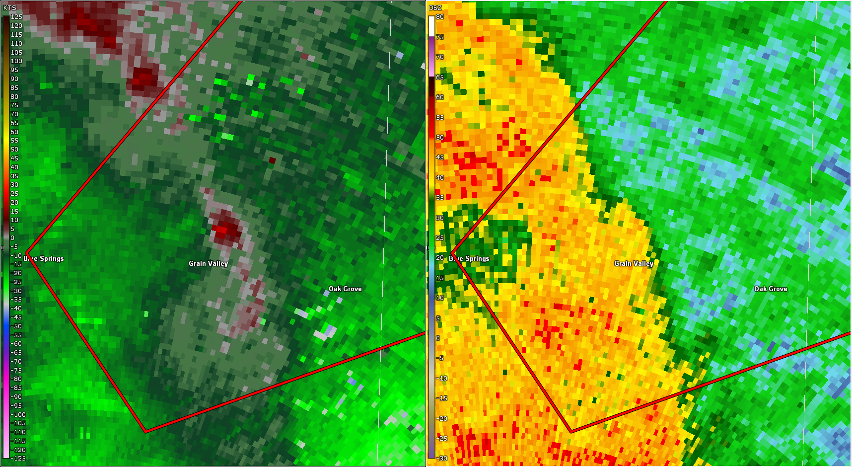
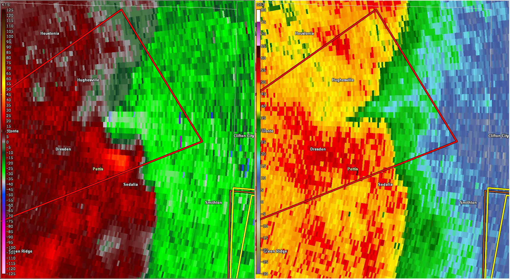
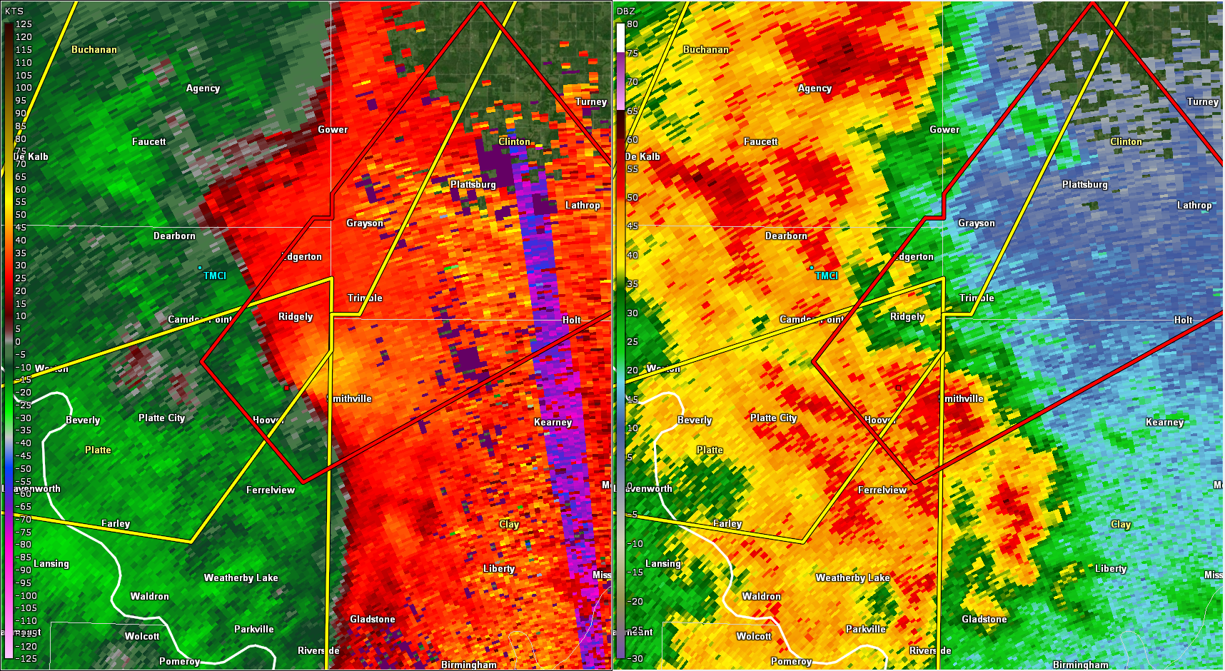
| Blue Springs/Grain Valley Tornado on KEAX Radar (SRM and Reflectivity) | Sedalia Tornado on KEAX Radar (SRM and Reflectivity) | Platte Co. Tornado - Weak signature on KEAX Radar | 11:00 PM to 1:00 AM Radar Loop |
Storm Reports
Still to Come
Rain Reports
Still to Come
 |
Media use of NWS Web News Stories is encouraged! Please acknowledge the NWS as the source of any news information accessed from this site. |
 |