
Widespread life-threatening flash and urban flooding continues in south-central Texas, with considerable flooding impacts possible across central Texas. Wildfire smoke is impacting air quality across much of the Great Lakes region into southern New England and the Mid-Atlantic. Monsoonal thunderstorms may produce isolated to scattered flash flooding across the Southwest into the Great Basin. Read More >
|
An extremely early season blizzard impacted most of northern and central Missouri on November 25, 2018. The snowstorm was more indicative of a storm that would affect the area in the deep winter, as opposed to the middle to late part of autumn. The storm brought between 6 and 8 inches of snow across far northern Missouri, with 4 to 6 inches across the Kansas City Metro area, and along a good portion of the I-70 corridor through western and central Missouri. Further separating this storm from other typical winter storms was the strong winds that accompanied the heavy snow. Most locations through the region experienced winds in excess of 35 mph at times during the storm. The strongest wind gusts came across northeast Kansas and northwest Missouri, where 50-60 mph winds were recorded in Wyandotte and Leavenworth Co (Kansas) and at Kansas City International Airport, where winds gusted to 55 mph.
Historical Perspective: This snowstorm came exceptionally early in the winter season. Just how historical was this event? Here is some perspective.
|
 Radar loop of the Thanksgiving Weekend Blizzard, spanning most of the day on November 25, 2018
(Click image to expand)
|
.png) |
 |
 |
|
Total snowfall reported during the November 25, 2018 Thanksgiving Weekend Blizzard
(Click image to expand)
|
Peak wind gusts during the heavy snow on November 25, 2018 created blizzard conditions across the region
(Click image to expand)
|
The orange area depicts the spatial area of blizzard conditions across the Midwest during the Thanksgiving Weekend Blizzard November 25, 2018.
(Click image to expand)
|
Photos & Video:
Video of blizzard conditions in the Kansas City Metro November 25, 2018
 |
 |
 |
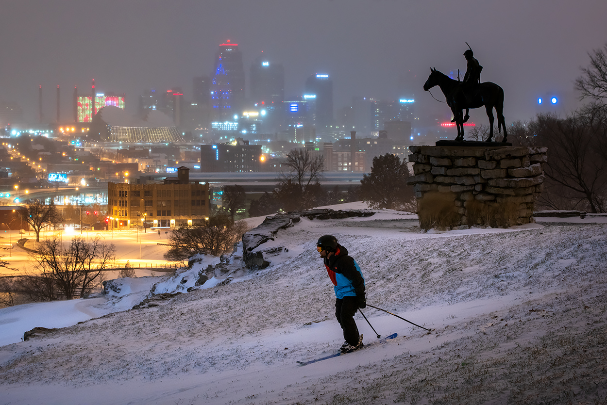 |
| Visibility dropped to around 1/4 mile as 40 to 50 mph winds whipped through the heavy snow through the KC Metro. | Snow piled up in Lee's Summit, Missouri to around 4-5 inches. | Winter conditions deteriorated near downtown Kansas City as strong winds and heavy snow moved through the area. | A skier took advantage of the new snow near Union Station. Photo: @scottblairphoto (Instagram) |
 |
Media use of NWS Web News Stories is encouraged! Please acknowledge the NWS as the source of any news information accessed from this site. |
|


 Weather Story
 Weather Map
 Local Radar