Severe Weather Preparedness Week in Southern New England: April 20 - 24, 20256For more information, please visit our efforts at making a Weather-Ready Nation.
Also please consult additional Severe Weather Safety Tips than those below including Ready.gov information.
The National Weather Service in Norton will feature a different Severe Weather related topic each day during the Severe Weather Awareness Week.
A severe thunderstorm is defined as a thunderstorm that produces wind gusts of at least 58 mph and/or hail 1.00 inches in diameter or larger, the size of a quarter. Severe thunderstorms can and occasionally do spawn tornadoes.
A Severe Thunderstorm Watch is issued by the Storm Prediction Center in Norman Oklahoma for large portions of the region when the potential exists for severe thunderstorms. A severe thunderstorm warning is issued by the local National Weather Service forecast office, such as in Norton, when severe thunderstorms are imminent based on radar or already occurring based on spotter observations.
Note that torrential downpours of rain that cause flooding are not part of the definition of severe weather. They would prompt the issuance of Flood or Flash Flood Warnings, but not Severe Thunderstorm Warnings. It is important to note that frequent lightning also is not a criterion for what is termed severe weather. Of course, lightning can be extremely dangerous, but every thunderstorm has lightning. That is what causes the thunder. It is not practical to issue a warning for every thunderstorm, thus we issue Severe Thunderstorm Warnings for those storms that could produce large hail and/or damaging winds.
NOAA Weather radios, with warning alarm tones, will alert you when a Severe Thunderstorm Warning is issued. However, they will not sound an alarm for non-severe thunderstorms, which still can produce deadly lightning. We recommend that lifeguards at beaches and pools have hand-held lightning detectors. The same is true for athletic coaches, camp directors, and parks and recreation workers. Even without equipment, you can protect yourself by moving indoors to a place of safety at the first rumble of thunder. If you can hear the thunder, the storm is usually close enough for you to have the potential to be struck by lightning.
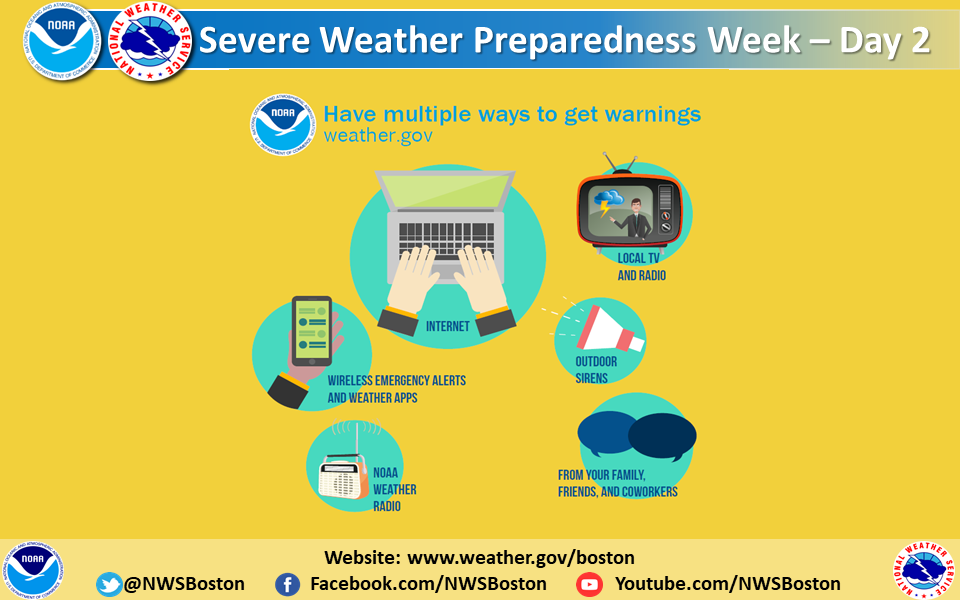
One of the keys to staying safe during the severe weather season is making sure that you have a way to receive life saving severe weather watches and warnings. There are many methods and tools, some of which are available with no cost or fees, that you can use to receive these important lifesaving alerts no matter where you are - at home, at school, or at work. Here is a partial list of these methods and tools.
NOAA Weather Radio (NWR): NWR is a nationwide network of radio stations broadcasting continuous weather information from the nearest National Weather Service office. Specially built receivers receive the NWR broadcast 24 hours a day, 7 days a week, and sound an audible alert when official watches and warnings are issued for your area. Think of these radios as a smoke detector for severe weather alerts.
Wireless Emergency Alerts (WEA): In addition to other alert types such as AMBER Alerts, this free service transmits extreme weather warnings such as Tornado and Flash Flood warnings to your cell phone. Beginning on or about July 15, 2021, the wireless alerts will also include ultra-severe thunderstorms - those that might produce baseball size hail and/or 80 mph wind gusts. The alerts look like a text message and show the type and time of the alert, and any action you should take. WEA messages include a special tone and vibration. If you receive a WEA message, you should follow any action advised by the emergency message. Seek more details from your favorite TV or radio station, NOAA Weather Radio, news website, desktop application, mobile application, or other trusted source of information.
Cell phone apps: There are many great cell phone apps that provide real-time NWS warnings and alerts, some of which are free to download and use, and others that may charge a small fee. A simple search of your app provider will reveal many of these apps.
Emergency Alert System (EAS) and your favorite TV and radio stations: EAS is the message dissemination pathway that sends warnings via broadcast, cable, satellite, and wireline services. EAS may be used by state and local authorities, including the National Weather Service, in cooperation with the broadcast community, to deliver important emergency information such as severe weather information, AMBER alerts, and local incident information targeted to specific areas. In short, when severe weather strikes, it's a good idea to tune to your favorite local TV or radio station or website for detailed information about the severe weather threat.
In addition to the aforementioned alerting system, many communities also offer free emergency alert notifications through their own systems, such as reverse 911 phone systems. Be sure to check with your local emergency management agency to learn what is available in your area.
Be sure to take some time this week to learn more about severe weather safety. Learning and practicing severe weather safety when the weather is good will allow you to react more quickly when the weather turns bad.
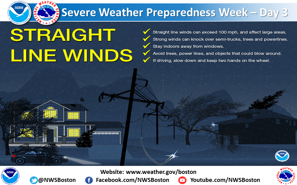
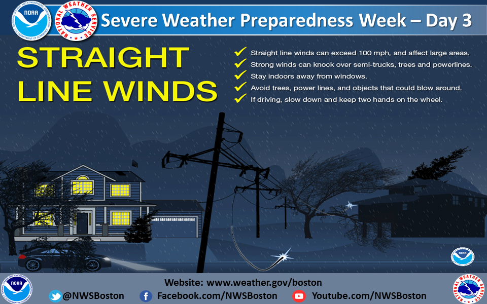
While hail and straight-line winds generally do not garner the same attention or respect as tornadoes, they can be just as deadly! Hail can exceed the size of softballs and fall at speeds of over 100 mph, seriously injuring or killing anyone in its path. Straight-line winds can topple trees onto cars, houses, and power lines. Many deaths from straight-line winds are the result of trees falling onto the person, whether they are outside, in their house, or driving in their car. Strong straight-line wind events can even destroy buildings, especially mobile homes and manufactured homes.
When damaging straight-line thunderstorm winds or large hail is expected, the National Weather Service will issue a Severe Thunderstorm Warning. When a Severe Thunderstorm Warning is issued for your area, or when threatening thunderstorms approach your area, you should seek shelter immediately! To stay safe during high winds, the same safety rules that are used for tornadoes also apply during straight-line wind events, namely, you should seek shelter in an interior room on the lowest floor of a sturdy building or shelter, get away from windows, and get down low to protect yourself from possible flying debris and falling trees. During large hail situations, you should move indoors and stay away from windows. Wind-blown hail can shatter windows. If you are driving during a large hail episode, pullover into a parking lot or gas station and use blankets or coats to cover yourself in case the windshield shatters and hail enters the vehicle.
While not as notorious, or perhaps as spectacular to witness as a tornado, straight-line winds are responsible for most thunderstorm wind damage, especially across southern New England.
A downburst is a strong, relatively small, area of rapidly descending air beneath a thunderstorm. It can result from stronger winds aloft being transported downward to the surface, or it can result as air within the downburst is cooled significantly as rain evaporates into initially drier air. This cool, thus dense, air sinks rapidly to the surface. A downburst is differentiated from common thunderstorm winds because the downburst winds have the potential to cause damage near the ground. Surface damage patterns have shown that whether the winds are straight or even a little bit curved, they tend to spread out, or diverge, considerably as they reach the surface. Conversely, damage patterns resulting from a tornado generally converge toward a narrow central track.
Intense downbursts can be phenomenal. Speeds have been clocked as high as 175 mph near Morehead City North Carolina and at 158 mph at Andrews Air Force Base in Maryland. Closer to home, 104 mph downburst winds were measured at both Worcester Massachusetts on May 31 1998 and Whitman Massachusetts on May 21 1996. Strong downbursts will definitely cause roaring sounds and people may often refer to a sound like a freight train, terms typically associated with tornadoes. Although downbursts are not tornadoes, they can cause damage equivalent to that of a small to medium tornado. After all, wind is wind.
Downbursts are classified as either macrobursts or microbursts, depending on the areal extent of the damaging wind swath. A macroburst's damage extends horizontally for more than 2.5 miles. A microburst is a small downburst with its damaging winds extending 2.5 miles or less. The small horizontal scale and short time span of a microburst makes it particularly hazardous to aviation.
The National Weather Service issues Severe Thunderstorm Warnings for thunderstorms that are expected to produce damaging wind gusts of 58 mph or greater, or hail that is one inch or greater in diameter.
DAY 4 - TORNADO SAFETY AND MAKING A PLAN
We know that tornadoes do occur here, even stronger ones such as the EF3 in Monson and Springfield, Massachusetts in 2011, the EF2 in Revere, Massachusetts in 2014. The question is, are people prepared? Take these steps to ensure that you and your family are safe during a Tornado Warning.
When your area is under a Tornado Warning, or if you see a tornado approaching, you should seek shelter immediately! Most injuries associated with high winds are from flying debris, so remember to protect your head. The following are safety tips for seeking shelter during high winds and tornadoes.
If you are in a structure such as a residence, small building, school, nursing home, hospital, factory, shopping center, or high-rise building:
If you are in a manufactured home or office:
If you are outside with no shelter available, there is no single research-based recommendation for what last-resort action to take, because many factors can affect your decision. Possible actions include:
Make sure that you know the difference between a Tornado Watch and a Tornado Warning. A Tornado Watch means that you should be prepared because conditions are such that a tornado could form, somewhere within the large Watch area. However, a Tornado Warning means that you need to take action! A tornado is either occurring, or is imminent, based on radar or spotter observations!
During a Tornado Watch, check for forecast updates, keep an eye to the sky, and know where to take shelter. During a Tornado Warning, take shelter immediately! Seek further forecast information on NOAA Weather Radio, the NWS website, or local media outlets for the latest updates.
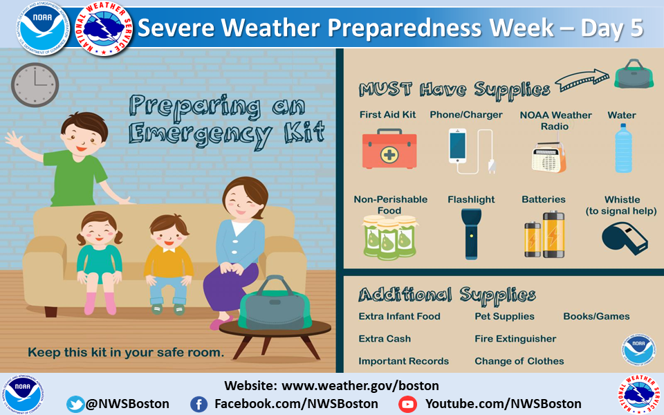
The first step in making sure that you and your family are prepared for severe weather is pledging to prepare. This includes developing a family emergency and communications plan. In short, know what to do before severe weather strikes by creating an emergency plan today.
Your family may not be together when a disaster strikes, so it is important to plan in advance: how you will get to a safe place; how you will contact one another; how you will get back together; and what you will do in different situations.
Planning for severe weather also includes: Ensure that you and your family members know about your surroundings and severe weather risks specific to your area. Have an emergency plan in place, and know what to do before severe weather strikes. Stay informed by having multiple sources for weather alerts. Exercise the plan with your family.
History teaches that a lack of awareness and preparation are common threads among all major weather disasters. Knowing your vulnerability and what actions you should take can save your life and others. During this preparedness week, we ask you to be a force of nature. Know your risk, take action and be an example by sharing what you have done to prepare, with your friends, family, neighbors, and co-workers, and encourage them to do the same.
In a typical summer season, southern New England averages 2 or 3 tornadoes. Last year was a bit above normal with five tornadoes in NWS Boston's jurisdiction. All were on the weak side with EF-0 and EF-1 ratings on the Enhanced Fujita Damage Scale, which ranges from 0 to 5.
September 06, 2025 -A tornado briefly touched down near Arrowhead drive in Paxton, crossing Richards Ave and likely lifting after causing significant tree damage in its path. Several softwood trees snapped at the trunk or uprooted.
September 06, 2025 - A tornado briefly touched down near a section of South Rd in Holden, MA. Damage was limited to several softwood trees being uprooted.
September 06, 2025 - EF1 tornado briefly touched down over Willow Brook Rd in Holden causing significant tree damage.
September 06, 2025 - EF1 tornado touched down west of Barnes Hill Road in Berlin, MA and traveled ENE crossing Derby road and West street. Many soft or hardwood trees snapped at the trunk or uprooted.
September 06, 2025 - An EF1 tornado touched down in Stow, MA near Maple street and continued ENE over Bose Avenue causing significant tree damage. The tornado lifted somewhere near Harvest Drive and touched down again about 1.25 miles ENE just west of Packard road and continued across Carriage lane before lifting again. This tornado caused significant tree damage with several hard and softwood trees uprooted or snapped at the trunk.