National Weather Service United States Department of Commerce


The National Weather Service (NWS) Weather Forecast Office (WFO) based in Boston, MA manages and maintains six NOAA Weather Radio (NWR) transmitters across Southern New England (CT / RI / MA). Because their coverage does not encompass all of Southern New England, there are an additional twelve NWR transmitters managed and maintained by other WFOs within and surrounding the three-state region. The following tabs and tables, maps and FAQs provide NWS Boston, MA operations in detail while giving a broader overview of surrounding NWR transmitter coverage operated by neighboring WFOs.

An all-hazards radio network, NWR transmitters broadcast the latest weather forecasts and up-to-date weather information including watches, warnings, and other hazard information 24-hours a day, 7 days a week. As a single source for comprehensive weather and emergency information, NWR broadcasts warnings for all types of hazards including natural events, environmental accidents, and public safety issues.

While special radios are made specifically for NWR weather broadcasts, any radio that receives very high frequency (VHF) broadcasts is also required to listen to NWR. In addition, some receivers such as police scanners also include the "weather band".

Transmitter Name Location State Call Sign Frequency Channel Number Managing WFO
BostonBlue HillMAKHB35162.4754BOX
GloucesterEssexMAWNG574162.4252BOX
WorcesterPaxtonMAWXL93162.5507BOX
HyannisCamp EdwardsMAKEC73162.5507BOX
ProvidenceJohnstonRIWXJ39162.4001BOX
HartfordSoapstone MountainCTWXJ41162.4754BOX
MeridenMeridenCTWXJ42162.4001OKX
New LondonMontvilleCTKHB47162.5507OKX
RiverheadRiverheadNYWXM80162.4754OKX
LeydenLeydenMAWXM68162.4252ALY
HighlandHighlandNYWXL37162.4754ALY
CornwallCornwallCTWWH33162.5005ALY
EgremontEgremontMAWXM82162.4503ALY
Mt. GreylockAdamsMAWXM82162.4503ALY
AlbanyAlbanyNYWXL34162.5507ALY
Stratham HillDeerfieldNHKZZ40162.4503GYX
Pack MonadnockPeterboroughNHWNG575162.5256GYX
WindsorWindsorVTWXM44162.4754BTV

<em>FIPS Code:</em> 073271 <hr> <em>Zone ID:</em> ANZ271 <em>FIPS Code:</em> 073270 <hr> <em>Zone ID:</em> ANZ270 <em>FIPS Code:</em> 073254 <hr> <em>Zone ID:</em> ANZ254 <em>FIPS Code:</em> 073231 <hr> <em>Zone ID:</em> ANZ231 <em>FIPS Code:</em> 073250 <hr> <em>Zone ID:</em> ANZ250 <em>FIPS Code:</em> 073230 <hr> <em>Zone ID:</em> ANZ271 <em>FIPS Code:</em> 073251 <hr> <em>Zone ID:</em> ANZ251 <em>FIPS Code:</em> 025023 <hr> <em>Zone ID:</em> MAZ018 <em>FIPS Code:</em> 025023 <hr> <em>Zone ID:</em> MAZ021 <em>FIPS Code:</em> 025023 <hr> <em>Zone ID:</em> MAZ019 <em>FIPS Code:</em> 025005 <hr> <em>Zone ID:</em> MAZ020 <em>FIPS Code:</em> 025005 <hr> <em>Zone ID:</em> MAZ017 <em>FIPS Code:</em> 025025 <hr> <em>Zone ID:</em> MAZ015 <em>FIPS Code:</em> 025009 <hr> <em>Zone ID:</em> MAZ007 <em>FIPS Code:</em> 025009 <hr> <em>Zone ID:</em> MAZ006 <em>FIPS Code:</em> 025017 <hr> <em>Zone ID:</em> MAZ026 <em>FIPS Code:</em> 025017 <hr> <em>Zone ID:</em> MAZ005 <em>FIPS Code:</em> 025017 <hr> <em>Zone ID:</em> MAZ014 <em>FIPS Code:</em> 025021 <hr> <em>Zone ID:</em> MAZ013 <em>FIPS Code:</em> 025021 <hr> <em>Zone ID:</em> MAZ016
Frequency
162.475
Channel Number
4
Coverage Table
County OR Description State OR Waters FIPS Code
BristolMA025005
EssexMA025009
MiddlesexMA025017
NorfolkMA025021
PlymouthMA025023
SuffolkMA025025
Ocean Waters 20 to 35 NM East from Provincetown to NantucketWaters073271
Cape Cod BayWaters073231
Ocean Waters 40 to 60 NM East from the Merrimack River to PlmouthWaters073270
Stellwagen and Tillies BankWaters073250
Boston HarborWaters073230
Massachusetts BayWaters073251

<em>FIPS Code:</em> 073254 <hr> <em>Zone ID:</em> ANZ254 <em>FIPS Code:</em> 073255 <hr> <em>Zone ID:</em> ANZ255 <em>FIPS Code:</em> 073256 <hr> <em>Zone ID:</em> ANZ256 <em>FIPS Code:</em> 073270 <hr> <em>Zone ID:</em> ANZ270 <em>FIPS Code:</em> 073271 <hr> <em>Zone ID:</em> ANZ271 <em>FIPS Code:</em> 073272 <hr> <em>Zone ID:</em> ANZ272 <em>FIPS Code:</em> 073231 <hr> <em>Zone ID:</em> ANZ231 <em>FIPS Code:</em> 073232 <hr> <em>Zone ID:</em> ANZ232 <em>FIPS Code:</em> 073233 <hr> <em>Zone ID:</em> ANZ233 <em>FIPS Code:</em> 073234 <hr> <em>Zone ID:</em> ANZ234 <em>FIPS Code:</em> 073250 <hr> <em>Zone ID:</em> ANZ250 <em>FIPS Code:</em> 073251 <hr> <em>Zone ID:</em> ANZ251 <em>FIPS Code:</em> 025023 <hr> <em>Zone ID:</em> MAZ018 <em>FIPS Code:</em> 025023 <hr> <em>Zone ID:</em> MAZ021 <em>FIPS Code:</em> 025023 <hr> <em>Zone ID:</em> MAZ019 <em>FIPS Code:</em> 025005 <hr> <em>Zone ID:</em> MAZ020 <em>FIPS Code:</em> 025005 <hr> <em>Zone ID:</em> MAZ017 <em>FIPS Code:</em> 025019 <hr> <em>Zone ID:</em> MAZ024 <em>FIPS Code:</em> 025007 <hr> <em>Zone ID:</em> MAZ023 <em>FIPS Code:</em> 025007 <hr> <em>Zone ID:</em> MAZ023 <em>FIPS Code:</em> 025001 <hr> <em>Zone ID:</em> MAZ022
Frequency
162.550
Channel Number
7
Coverage Table
County OR Description State OR Waters FIPS Code
BarnstableMA025001
BristolMA025005
DukesMA025007
NantucketMA025019
PlymouthMA025023
Coastal Waters South out to 25 NM from Montauk NY to Marthas VineyardWaters073256
Buzzards BayWaters073234
Vineyard SoundWaters073233
Nantucket SoundWaters073232
Coastal Waters South out to 25 NM from Marthas Vineyard to NantucketWaters073255
Ocean Waters 25 to 40 NM South from Marthas Vineyard to NantucketWaters073272
Ocean Waters 20 to 35 NM East from Provincetown to NantucketWaters073271
Coastal Waters East out to 20 NM from Nantucket to ProvincetownWaters073254
Cape Cod BayWaters073231
Stellwagen and Tillies BankWaters073250
Massachusetts BayWaters073251

<em>FIPS Code:</em> 044009 <hr> <em>Zone ID:</em> RIZ008 <em>FIPS Code:</em> 073233 <hr> <em>Zone ID:</em> ANZ233 <em>FIPS Code:</em> 073234 <hr> <em>Zone ID:</em> ANZ234 <em>FIPS Code:</em> 073235 <hr> <em>Zone ID:</em> ANZ235 <em>FIPS Code:</em> 073236 <hr> <em>Zone ID:</em> ANZ236 <em>FIPS Code:</em> 073237 <hr> <em>Zone ID:</em> ANZ237 <em>FIPS Code:</em> 073255 <hr> <em>Zone ID:</em> ANZ255 <em>FIPS Code:</em> 073256 <hr> <em>Zone ID:</em> ANZ256 <em>FIPS Code:</em> 073273 <hr> <em>Zone ID:</em> ANZ273 <em>FIPS Code:</em> 025005 <hr> <em>Zone ID:</em> MAZ020 <em>FIPS Code:</em> 025005 <hr> <em>Zone ID:</em> MAZ017 <em>FIPS Code:</em> 044005 <hr> <em>Zone ID:</em> RIZ007 <em>FIPS Code:</em> 044005 <hr> <em>Zone ID:</em> RIZ007 <em>FIPS Code:</em> 044009 <hr> <em>Zone ID:</em> RIZ006 <em>FIPS Code:</em> 044005 <hr> <em>Zone ID:</em> RIZ007 <em>FIPS Code:</em> 044001 <hr> <em>Zone ID:</em> RIZ005 <em>FIPS Code:</em> 044003 <hr> <em>Zone ID:</em> RIZ004 <em>FIPS Code:</em> 044003 <hr> <em>Zone ID:</em> RIZ003 <em>FIPS Code:</em> 044007 <hr> <em>Zone ID:</em> RIZ002 <em>FIPS Code:</em> 044007 <hr> <em>Zone ID:</em> RIZ001
Frequency
162.400
Channel Number
1
Coverage Table
County State SAME / FIPS Code
BristolMA025005
BristolRI044001
KentRI044003
NewportRI044005
ProvidenceRI044007
WashingtonRI044009
Narragansett BayWaters073236
Block Island SoundWaters073237
Rhode Island SoundWaters073235
Coastal Waters South out to 25 NM from Montauk NY to Marthas VineyardWaters073256
Ocean Waters 25 to 40 NM South from Montauk NY to Marthas VineyardWaters073273
Buzzards BayWaters073234
Vineyard SoundWaters073233
Coastal Waters South out to 25 NM from Marthas Vineyard to NantucketWaters073255

<em>FIPS Code:</em> 033011 <hr> <em>Zone ID:</em> NHZ012 <em>FIPS Code:</em> 033011 <hr> <em>Zone ID:</em> NHZ015 <em>FIPS Code:</em> 033005 <hr> <em>Zone ID:</em> NHZ011 <em>FIPS Code:</em> 025017 <hr> <em>Zone ID:</em> MAZ026 <em>FIPS Code:</em> 025017 <hr> <em>Zone ID:</em> MAZ005 <em>FIPS Code:</em> 025017 <hr> <em>Zone ID:</em> MAZ014 <em>FIPS Code:</em> 025021 <hr> <em>Zone ID:</em> MAZ013 <em>FIPS Code:</em> 025021 <hr> <em>Zone ID:</em> MAZ016 <em>FIPS Code:</em> 025027 <hr> <em>Zone ID:</em> MAZ012 <em>FIPS Code:</em> 025027 <hr> <em>Zone ID:</em> MAZ004 <em>FIPS Code:</em> 025011 <hr> <em>Zone ID:</em> MAZ003 <em>FIPS Code:</em> 025011<hr> <em>Zone ID:</em> MAZ002 <em>FIPS Code:</em> 025015 <hr> <em>Zone ID:</em> MAZ010 <em>FIPS Code:</em> 025015 <hr> <em>Zone ID:</em> MAZ008 <em>FIPS Code:</em> 025013 <hr> <em>Zone ID:</em> MAZ011 <em>FIPS Code:</em> 025013 <hr> <em>Zone ID:</em> MAZ009 <em>FIPS Code:</em> 044007 <hr> <em>Zone ID:</em> RIZ002 <em>FIPS Code:</em> 044007 <hr> <em>Zone ID:</em> RIZ001 <em>FIPS Code:</em> 009015<hr> <em>Zone ID:</em> CTZ004 <em>FIPS Code:</em> 009013 <hr> <em>Zone ID:</em> CTZ003
Frequency
162.550
Channel Number
7
Coverage Table
County State FIPS Code
TollandCT009013
WindhamCT009015
FranklinMA025011
HampdenMA025013
HampshireMA025015
MiddlesexMA025017
NorfolkMA025021
WorcesterMA025027
CheshireNH033005
HillsboroughNH033011
ProvidenceRI044007

<em>FIPS Code:</em> 025027 <hr> <em>Zone ID:</em> MAZ012 <em>FIPS Code:</em> 025027 <hr> <em>Zone ID:</em> MAZ004 <em>FIPS Code:</em> 025011 <hr> <em>Zone ID:</em> MAZ003 <em>FIPS Code:</em> 025011<hr> <em>Zone ID:</em> MAZ002 <em>FIPS Code:</em> 025015 <hr> <em>Zone ID:</em> MAZ010 <em>FIPS Code:</em> 025015 <hr> <em>Zone ID:</em> MAZ008 <em>FIPS Code:</em> 025013 <hr> <em>Zone ID:</em> MAZ011 <em>FIPS Code:</em> 025013 <hr> <em>Zone ID:</em> MAZ009 <em>FIPS Code:</em> 025003 <hr> <em>Zone ID:</em> MAZ001 <em>FIPS Code:</em> 025003 <hr> <em>Zone ID:</em> MAZ025 <em>FIPS Code:</em> 009015<hr> <em>Zone ID:</em> CTZ004 <em>FIPS Code:</em> 009013 <hr> <em>Zone ID:</em> CTZ003 <em>FIPS Code:</em> 009003 <hr> <em>Zone ID:</em> CTZ002 <em>FIPS Code:</em> 009005 <hr> <em>Zone ID:</em> CTZ001 <em>FIPS Code:</em> 009005 <hr> <em>Zone ID:</em> CTZ013 <em>FIPS Code:</em> 009011 <hr> <em>Zone ID:</em> CTZ008 <em>FIPS Code:</em> 009011 <hr> <em>Zone ID:</em> CTZ012 <em>FIPS Code:</em> 009007 <hr> <em>Zone ID:</em> CTZ007 <em>FIPS Code:</em> 009007 <hr> <em>Zone ID:</em> CTZ011 <em>FIPS Code:</em> 009009 <hr> <em>Zone ID:</em> CTZ006 <em>FIPS Code:</em> 009009 <hr> <em>Zone ID:</em> CTZ010 <em>FIPS Code:</em> 009001 <hr> <em>Zone ID:</em> CTZ005 <em>FIPS Code:</em> 009001 <hr> <em>Zone ID:</em> CTZ009
Frequency
162.475
Channel Number
4
Coverage Table
County State FIPS Code
HartfordCT009003
LitchfieldCT009005
MiddlesexCT009007
New HavenCT009009
New LondonCT009011
TollandCT009013
FairfieldCT009001
WindhamCT009015
FranklinMA025011
HampdenMA025013
HampshireMA025015
WorcesterMA025027
BerkshireMA025003

<em>FIPS Code:</em> 073154 <hr> <em>Zone ID:</em> ANZ154 <em>FIPS Code:</em> 073230 <hr> <em>Zone ID:</em> ANZ230 <em>FIPS Code:</em> 073231 <hr> <em>Zone ID:</em> ANZ231 <em>FIPS Code:</em> 073250 <hr> <em>Zone ID:</em> ANZ250 <em>FIPS Code:</em> 073251 <hr> <em>Zone ID:</em> ANZ251 <em>FIPS Code:</em> 073254 <hr> <em>Zone ID:</em> ANZ254 <em>FIPS Code:</em> 073270 <hr> <em>Zone ID:</em> ANZ270 <em>FIPS Code:</em> 025009 <hr> <em>Zone ID:</em> MAZ007 <em>FIPS Code:</em> 025009 <hr> <em>Zone ID:</em> MAZ006 <em>FIPS Code:</em> 033015 <hr> <em>Zone ID:</em> NHZ014 <em>FIPS Code:</em> 033015 <hr> <em>Zone ID:</em> NHZ013
Frequency
162.425
Channel Number
2
Coverage Table
Description FIPS Code
Cape Cod Bay073231
Ocean Waters 40 to 60 NM East from the Merrimack River to Plmouth073270
Stellwagen and Tillies Bank073250
Boston Harbor073230
Massachusetts Bay073251
Coastal Waters East out to 20 NM from Nantucket to Provincetown073254
Coastal Waters East out to 25 NM from Cape Elizabeth ME to the Merrimack River073154

County FIPS Code Transmitter Call Sign Frequency Channel Number
Barnstable025001HyannisKEC73162.5507
Berkshire025003AlbanyWXL34162.5507
Berkshire025003CornwallWWH33162.5005
Berkshire025003EgremontWXM82162.4503
Berkshire025003MarlboroWXM68162.4252
Berkshire025003Mt. GreylockWWF48162.5256
Berkshire025003LeydenWXM68162.4252
Bristol025005BostonKHB35162.4754
Bristol025005HyannisKEC73162.5507
Bristol025005ProvidenceWXJ39162.4001
Dukes025007HyannisKEC73162.5507
Essex025009BostonKHB35162.4754
Essex025009Stratham HillKZZ40162.4503
Essex025009GloucesterWNG574162.4252
Essex025009Pack MonadnockWNG575162.5256
Franklin025011HartfordWXJ41162.4754
Franklin025011MarlboroWXM68162.4252
Franklin025011Mt. GreylockWWF48162.5256
Franklin025011Pack MonadnockWNG575162.5256
Franklin025011WindsorWXM44162.4754
Franklin025011WorcesterWXL93162.5507
Franklin025011LeydenWXM68162.4252
Hampden025013CornwallWWH33162.5005
Hampden025013HartfordWXJ41162.4754
Hampden025013Mt. GreylockWWF48162.5256
Hampden025013WorcesterWXL93162.5507
Hampshire025015HartfordWXJ41162.4754
Hampshire025015MarlboroWXM68162.4252
Hampshire025015Mt. GreylockWWF48162.5256
Hampshire025015WorcesterWXL93162.5507
Hampshire025015LeydenWXM68162.4252
Middlesex025017BostonKHB35162.4754
Middlesex025017Stratham HillKZZ40162.4503
Middlesex025017Pack MonadnockWNG575162.5256
Middlesex025017WorcesterWXL93162.5507
Nantucket025019HyannisKEC73162.5507
Norfolk025021BostonKHB35162.4754
Norfolk025021WorcesterWXL93162.5507
Plymouth025023BostonKHB35162.4754
Plymouth025023HyannisKEC73162.5507
Suffolk025025BostonKHB35162.4754
Worcester025027Stratham HillKZZ40162.4503
Worcester025027HartfordWXJ41162.4754
Worcester025027Pack MonadnockWNG575162.5256
Worcester025027WorcesterWXL93162.5507

County FIPS Code Transmitter Call Sign Frequency Channel Number
Fairfield009001CornwallWWH33162.5005
Fairfield009001MeridenWXJ42162.4001
Fairfield009001RiverheadWXM80162.4754
Hartford009003CornwallWWH33162.5005
Hartford009003HartfordWXJ41162.4754
Hartford009003MeridenWXJ42162.4001
Hartford009003New LondonKHB47162.5507
Litchfield009005CornwallWWH33162.5005
Litchfield009005EgremontWXM82162.4503
Litchfield009005HartfordWXJ41162.4754
Litchfield009005HighlandWXL37162.4754
Litchfield009005MeridenWXJ42162.4001
Middlesex009007HartfordWXJ41162.4754
Middlesex009007MeridenWXJ42162.4001
Middlesex009007New LondonKHB47162.5507
Middlesex009007RiverheadWXM80162.4754
New Haven009009CornwallWWH33162.5005
New Haven009009HartfordWXJ41162.4754
New Haven009009MeridenWXJ42162.4001
New Haven009009RiverheadWXM80162.4754
New London009011HartfordWXJ41162.4754
New London009011MeridenWXJ42162.4001
New London009011New LondonKHB47162.5507
New London009011RiverheadWXM80162.4754
Tolland009013HartfordWXJ41162.4754
Tolland009013MeridenWXJ42162.4001
Tolland009013New LondonKHB47162.5507
Tolland009013WorcesterWXL93162.5507
Windham009015HartfordWXJ41162.4754
Windham009015New LondonKHB47162.5507
Windham009015WorcesterWXL93162.5507

County FIPS Code Transmitter Call Sign Frequency Channel Number
Bristol044001ProvidenceWXJ39162.4001
Kent044003ProvidenceWXJ39162.4001
Newport044005ProvidenceWXJ39162.4001
Providence044007ProvidenceWXJ39162.4001
Providence044007WorcesterWXL93162.5507
Washington044009New LondonKHB47162.5507
Washington044009ProvidenceWXJ39162.4001

County FIPS Code Transmitter Call Sign Frequency Channel Number
Belknap033001ConcordWXJ40162.4001
Belknap033001DeerfieldKZZ40162.4503
Belknap033001HoldernessWNG545162.5507
Carroll033003ConcordWXJ40162.4001
Carroll033003DeerfieldKZZ40162.4503
Carroll033003FalmouthKDO95162.5507
Carroll033003HoldernessWNG545162.5507
Carroll033003Mt. WashingtonKZZ41162.5005
Cheshire033005MarlboroWXM68162.4252
Cheshire033005Pack MonadnockWNG575162.5256
Cheshire033005WindsorWXM44162.4754
Cheshire033005WorcesterWXL93162.5507
Cheshire033005LeydenWXM68162.4252
Coos033007ClarksvilleWNG544162.4001
Coos033007Mt. WashingtonKZZ41162.5005
Coos033007St. JohnsburyWWG50162.4252
Grafton033009HanoverWNG546162.5256
Grafton033009HoldernessWNG545162.5507
Grafton033009Mt. WashingtonKZZ41162.5005
Grafton033009St. JohnsburyWWG50162.4252
Grafton033009WindsorWXM44162.4754
Hillsborough033011ConcordWXJ40162.4001
Hillsborough033011DeerfieldKZZ40162.4503
Hillsborough033011Pack MonadnockWNG575162.5256
Hillsborough033011WorcesterWXL93162.5507
Merrimack033013ConcordWXJ40162.4001
Merrimack033013DeerfieldKZZ40162.4503
Merrimack033013HanoverWNG546162.5256
Merrimack033013HoldernessWNG545162.5507
Merrimack033013Pack MonadnockWNG575162.5256
Rockingham033015ConcordWXJ40162.4001
Rockingham033015DeerfieldKZZ40162.4503
Rockingham033015Pack MonadnockWNG575162.5256
Strafford033017ConcordWXJ40162.4001
Strafford033017DeerfieldKZZ40162.4503
Strafford033017FalmouthKDO95162.5507
Sullivan033019ConcordWXJ40162.4001
Sullivan033019HanoverWNG546162.5256
Sullivan033019HoldernessWNG545162.5507
Sullivan033019MarlboroWXM68162.4252
Sullivan033019Pack MonadnockWNG575162.5256
Sullivan033019WindsorWXM44162.4754

County FIPS Code Transmitter Call Sign Frequency Channel Number
Addison050001BurlingtonKIG60162.4001
Addison050001Gore Mtn.KSC43162.4503
Bennington050003MarlboroWXM68162.4252
Bennington050003Mt. GreylockWWF48162.5256
Bennington050003WindsorWXM44162.4754
Bennington050003LeydenWXM68162.4252
Caledonia050005Mt. WashingtonKZZ41162.5005
Caledonia050005St. JohnsburyWWG50162.4252
Chittenden050007BurlingtonKIG60162.4001
Essex050009Mt. WashingtonKZZ41162.5005
Essex050009St. JohnsburyWWG50162.4252
Franklin050011BurlingtonKIG60162.4001
Grand Isle050013BurlingtonKIG60162.4001
Lamoille050015BurlingtonKIG60162.4001
Lamoille050015St. JohnsburyWWG50162.4252
Orange050017BurlingtonKIG60162.4001
Orange050017HanoverWNG546162.5256
Orange050017HoldernessWNG545162.5507
Orange050017WindsorWXM44162.4754
Orleans050019BurlingtonKIG60162.4001
Orleans050019St. JohnsburyWWG50162.4252
Rutland050021BurlingtonKIG60162.4001
Rutland050021CastletonWNG671162.5005
Rutland050021Gore Mtn.KSC43162.4503
Rutland050021WindsorWXM44162.4754
Washington050023BurlingtonKIG60162.4001
Washington050023St. JohnsburyWWG50162.4252
Windham050025MarlboroWXM68162.4252
Windham050025Mt. GreylockWWF48162.5256
Windham050025Pack MonadnockWNG575162.5256
Windham050025WindsorWXM44162.4754
Windham050025LeydenWXM68162.4252
Windsor050027HanoverWNG546162.5256
Windsor050027HoldernessWNG545162.5507
Windsor050027MarlboroWXM68162.4252
Windsor050027WindsorWXM44162.4754

Our broadcasts include products that are repeated regularly every several minutes during the hour, as well as other forecasts and warnings that are only issued at specific times or as needed. In the columns below, if a product serves as a Trigger, it will trip NWR into a higher broadcast suite upon issuance (i.e., issuance of a Winter Storm Warning will trigger NWR to go from the General suite of products to the High suite). Several products which contain tones also contain silence periods. For those products which contain silence periods, the time in which tones are permitted are noted under the Tones column.

The suites below are comprehensive with respect to transmitters that broadcast both inland and marine products. Inland-specific transmitters (Worcester, Hartford, Pack Monadnock) will not contain marine-specific products. Marine-specific transmitters (Gloucester) will not contain inland-specific forecast products, but do contain inland severe-only watch and warning products.

Priority Product Description
1Timestamp
2General ID
3Regional Weather Story
4Record Event Report
5Daily Climatic Summary
6Hourly Weather Roundup - Local
7Hourly Weather Roundup - Regional
8Hazardous Weather Outlook
9Extended Forecast Product
10Hourly Buoy Roundup (if a marine transmitter)
11Extended Coastal Waters Forecast (if a marine transmitter)
12Offshore Marine Forecast (if a marine transmitter)
13Tropical Information Statements


Priority Product Description Trigger? Tones?
1Timestamp
2General ID
3Tornado WatchYesYes
4Severe Thunderstorm WatchYesYes
5Special Weather StatementYes
6Hurricane WatchYesYes
7Tropical Storm WatchYesYes
8Hurricane Local StatementYes
9Storm Surge WatchYesYes
10Tropical Information Statements
11Tsunami WatchYesYes
12Flood WarningYesYes
13Flood StatementYes
14Flash Flood WatchYesYes
15Flood WatchYes
16Flood/Drought Potential OutlookYes
17Coastal Flood Warning (if a marine transmitter)YesYes (7 am to 10 pm)
18Coastal Flood Statement (if a marine transmitter)Yes
19Coastal Flood Advisory (if a marine transmitter)Yes
20Coastal Flood Watch (if a marine transmitter)Yes
21Marine Weather Statement (if a marine transmitter)Yes
22High Surf Advisory (if a marine transmitter)Yes
23Marine Weather Product (if a marine transmitter)Yes
24Blizzard WarningYesYes (7 am to 10 pm)
25Blizzard WatchYes
26Winter Storm WarningYesYes (7 am to 10 pm)
27Winter Weather AdvisoryYes
27Winter Storm WatchYes
29High Wind WarningYesYes (7 am to 10 pm only)
30High Wind WatchYes
31Non-Precip WarningYes
32Daily Climatic Summary
33Hourly Weather Roundup
34Hazardous Weather Outlook
35Extended Forecast Product
36Hourly Buoy Roundup (if a marine transmitter)
37Extended Coastal Waters Forecast (if a marine transmitter)
38Offshore Marine Forecast (if a marine transmitter)
39Administrative MessageYes
40Avalanche WatchYes
41Child Abduction EmergencyYesYes
42National Information CenterYes
43National Periodic TestYes
44911 Telephone Outage EmergencyYesYes


Priority Product Description Trigger? Tones?
1Timestamp
2General ID
3Exclusive Message
4Tornado WarningYesYes
5Tornado WatchYes
6Severe Thunderstorm WarningYesYes
7Severe Weather StatementYes
8Severe Thunderstorm WatchYes
9Special Weather Statement
10Hurricane WarningYesYes
11Hurricane WatchYes
12Tropical Storm WarningYesYes
13Tropical Storm WatchYes
14Hurricane Local Statement
15Storm Surge WarningYesYes
16Storm Surge Watch
17Tsunami WarningYesYes
18Tsunami WatchYes
19Flash Flood WarningYesYes
20Flash Flood StatementYes
21Flood WarningYes
22Flood Statement
23Flash Flood WatchYes
24Flood Watch
25Special Marine Warning (if a marine transmitter)YesYes
26Marine Weather Statement (if a marine transmitter)
27Short-Term Zone Forecast Product
28Short-Term Coastal Waters Forecast (if a marine transmitter)
29Administrative Message
30Avalanche WarningYesYes
31Avalanche Watch
32Child Abduction EmergencyYes
33Civil Danger WarningYesYes
34Civil Emergency MessageYesYes
35Dust Storm WarningYesYes
36Emergency Action NotificationYesYes
37Emergency Action TerminationYes
38Earthquake WarningYesYes
39Evacuate ImmmediatelyYesYes
40Fire WarningYesYes
41Hazardous Materials WarningYesYes
42Local Area EmergencyYesYes
43Law Enforcement WarningYesYes
44National Information Center
45National Periodic Test
46Nuclear Power Plant WarningYesYes
47Radiological Hazard WarningYesYes
48Shelter in Place WarningYesYes
49911 Telephone Outage EmergencyYes
50Volcano WarningYesYes


Newer NOAA Weather Radio receivers require special codes so the receiver will send an alert when there is severe weather. Here is a list of the codes for each of the counties for which the Boston office forecasts. More information concerning Specific Area Message Encoding (SAME) can be found in the HELP tab above.

County State SAME / FIPS Code
BarnstableMA025001
BerkshireMA025003
BristolMA025005
DukesMA025007
EssexMA025009
FranklinMA025011
HampdenMA025013
HampshireMA025015
MiddlesexMA025017
NantucketMA025019
NorfolkMA025021
PlymouthMA025023
SuffolkMA025025
WorcesterMA025027
FairfieldCT009001
HartfordCT009003
LitchfieldCT009005
MiddlesexCT009007
New HavenCT009009
New LondonCT009011
TollandCT009013
WindhamCT009015
BristolRI044001
KentRI044003
NewportRI044005
ProvidenceRI044007
WashingtonRI044009
BelknapNH033001
CarrollNH033003
CheshireNH033005
CoosNH033007
GraftonNH033009
HillsboroughNH033011
MerrimackNH033013
RockinghamNH033015
StaffordNH033017
SullivanNH033019
AddisonVT033001
BenningtonVT033003
CaledoniaVT033005
ChittendenVT033007
EssexVT033009
FranklinVT033011
Grand IsleVT033013
LamoilleVT033015
OrangeVT033017
OrleansVT033019
RutlandVT033021
WashingtonVT033023
WindhamVT033025
WindsorVT033027


Every Wednesday at 11 am, Eastern Time, a test is conducted which tests the tone alert system. The test will not occur when severe weather is occurring or expected, and will be postponed to the following first good weather day. This test provides a way to check the functioning of radio receiver alarms.

What is NOAA Weather Radio (NWR)?ExpandCollapse

NWR broadcasts National Weather Service (NWS) warnings, watches, forecasts and other non-weather related hazard information 24 hours a day. During an emergency, NWS forecasters interrupt routine broadcasts and send a special tone activating local weather radios. Weather radios equipped with a special alarm tone feature sound an alert to give you immediate information about a life-threatening situation.

NWR broadcasts warnings and post-event information for all types of hazards: weather (e.g., tornadoes, floods), natural (e.g., earthquakes, forest fires and volcanic activity), technological (e.g., chemical releases, oil spills, nuclear power plant emergencies, etc.), and national emergencies (e.g., terrorist attacks). Working with other Federal agencies and the Federal Communications Commission's (FCC) Emergency Alert System (EAS), NWR is an all-hazards radio network, making it the most comprehensive weather and emergency information available to the public.

Life-threatening weather emergency messages are alerted on NWR. Many of those same weather-related emergency messages are also broadcast via the EAS.

For non-weather emergencies, NWS activates the system at the request of local and/or state officials. NWS does not initiate the contact or the message. Local or state officials provide text information about the non-weather hazard directly to the local NWS offices. NWS offices set up agreements to speed the process, since minutes make a difference. In most areas, the local or state Office of Emergency Management or Preparedness, civil defense, police or mayor/commissioner sets up linkages to send messages on systems such as the EAS and NWR.

Where can I buy a NWR receiver?ExpandCollapse

There are many receiver options, however, ranging from handheld portable units that just pick up Weather Radio broadcasts, to desktop and console models which receive Weather Radio as well as other broadcasts. NWS staff produce Weather Radio broadcasts. NWS neither manufactures nor sells receivers. You can buy receivers at many retail outlets such as electronics, department, sporting goods, and boat and marine accessory stores and their catalogs as well as online.

We cannot recommend one brand of receiver over another, but we do recommend users look for receivers with the Public Alert and/or the NOAA Weather Radio (NWR) All Hazards logo. The Public Alert Standard (CEA-2009-A) was developed by the Consumer Electronics Association in conjunction with NWS. Devices carrying the Public Alert logo meet certain technical standards and come with many, if not all, of the features mentioned below.

NWS has evaluated devices carrying the NOAA Weather Radio All Hazards logo for user friendliness and performance capabilities.

NWS does not endorse a specific make or model of receiver. The lists below, which contain just some of the many NOAA Weather Radio/EAS receiver resellers, is provided as a convenience and not an endorsement.
Company Phone Website
Ambient Weather480.283.1644 http://www.ambientweather.com/
FTL Distributing574.208.3854http://www.ftldist.com/
Radio Shack817.415.3200http://www.radioshack.com/
Ready Smart650.248.0655http://www.readysmart.com/weather_radio.html
Scientific Sales Inc.800.788.5666http://www.scientificsales.com/
WeatherRadios.com800.567.7690http://weatherradios.com/
Weather Radio Store800.414.8655http://www.weatherradiostore.com/
Weather Shack888.992.2270http://www.weathershack.com/
Weather Your Way262.670.9697http://www.weatheryourway.com/

What does the All-Hazards NOAA Weather Radio Logo represent?ExpandCollapse

The name, NOAA Weather Radio, represents radio receivers that are capable of receiving weather and/or warning information from NWS Forecast Offices, approved Department of Homeland Security offices responsible for the dissemination of warning information, and those Emergency Operation Centers that have been specifically authorized to disseminate warnings on the NWR operational frequencies. To be called a NOAA Weather Radio All Hazards receiver, the device must possess specific receiver requirements.

NWR receivers with either Specific Area Message Encoding (SAME) or 1050 Hertz tone alerting capability are eligible to apply the NWR logo. NWR receivers which do not include either of these alerting capabilities are not eligible for NWR logo use.

To be classified as a NOAA Weather Radio All Hazards receiver, the receiver must meet, at a minimum, stringent requirements as specified in the Consumer Electronics Association (CEA) Standard 2009-B (or current revision), Performance Specification for Public Alert Receivers. SAME capable receivers are required to meet all CEA-2009-B requirements while receivers which alert using the 1050 Hertz tone are required to meet all the CEA-2009-B requirements, with the exception of section 5, which is only pertinent for SAME capable receivers.

There is a difference in the logos used for weather alert receivers. The three logos are different in their definition and the organization sponsoring them. Each logo depicted may, upon receipt of written authorization from the respective controlling organization, be displayed alone or in combination with any of the other logos. It is important to know that each of the logos depicted, in addition to being sponsored by different organizations, are referred to by different names.

The NOAA logo, represented by the letters "NOAA" above the seagull in the circle is a registered trade mark of the Department of Commerce.

The NOAA Weather Radio All Hazards logo, represented by the words "All Hazards" above the letters "NOAA", is a registered trade mark of the National Weather Service under the Department of Commerce.

The Public Alert logo, represented by the words "Public Alert", is a registered trade mark of the Consumer Electronics Association. Public Alert receivers are authorized to display the Public Alert logo, after official certification and adherence to licensing requirements from CEA.

Each of the logos discussed require adherence and compliance to the specifications contained in CEA-2009-B, and written authorization for use after licensing requirements have been satisfied. A weather band receiver may display both, the NOAA Weather Radio All Hazards and the Public Alert logos, if logo requirements are met and specific written authorization has been received from both NOAA’s National Weather Service and CEA.

On what frequencies do NWR Transmitters broadcast?ExpandCollapse

NWR transmitters broadcast on one of seven VHF frequencies from 162.400 MHz to 162.550 MHz. The broadcasts cannot be heard on a simple AM/FM radio receiver.

Where can I find a list of local NWR stations by county and/or state?ExpandCollapse

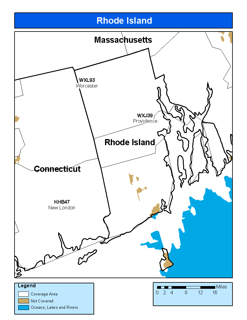
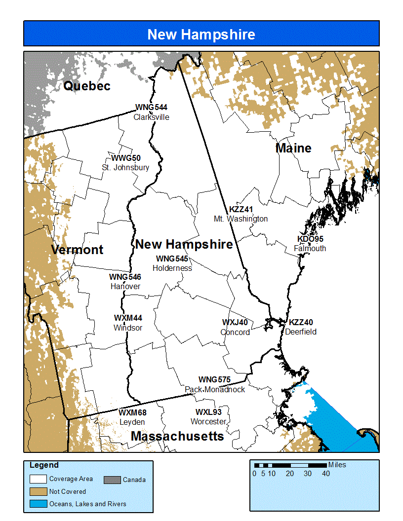
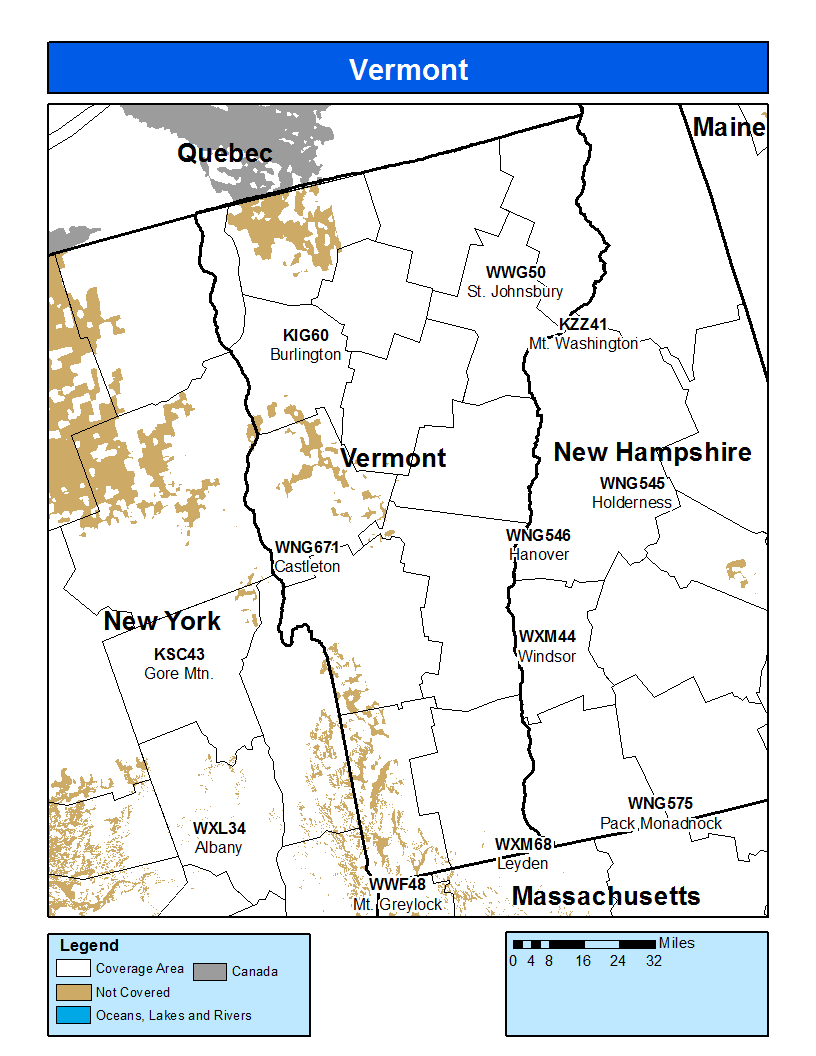
Consult the TRANSMITTERS tab above. Note the state identifiers to the adjacent right.

How can I find out if my home or office is covered by NWR?ExpandCollapse

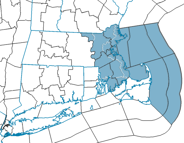
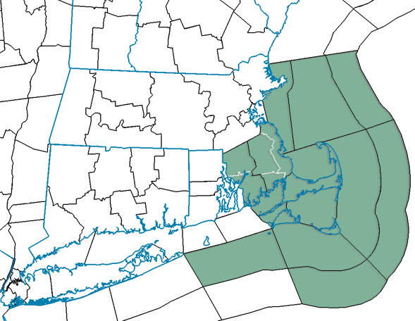
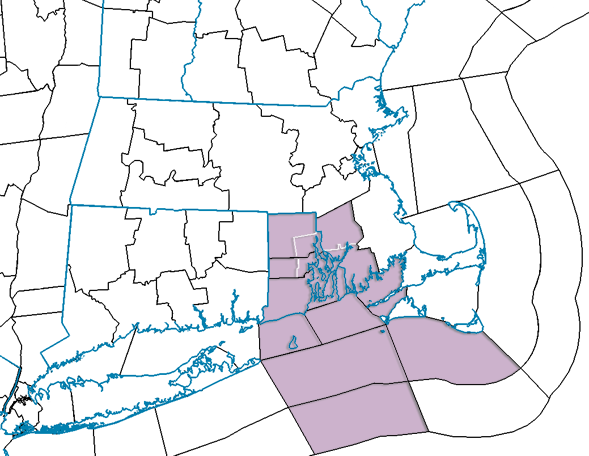
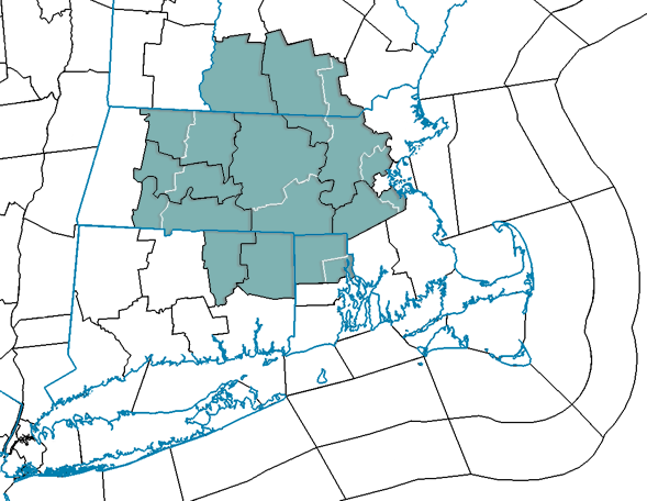
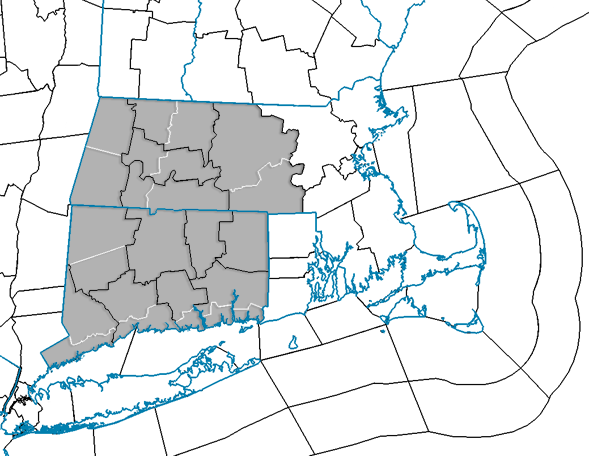
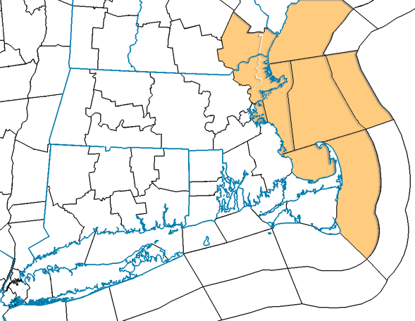
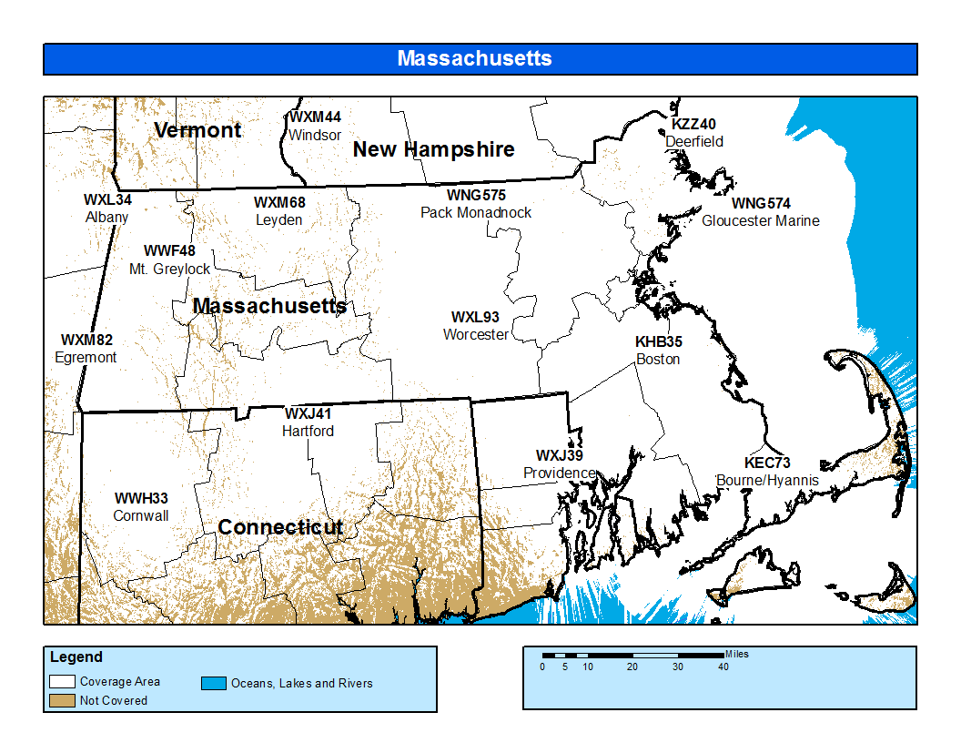
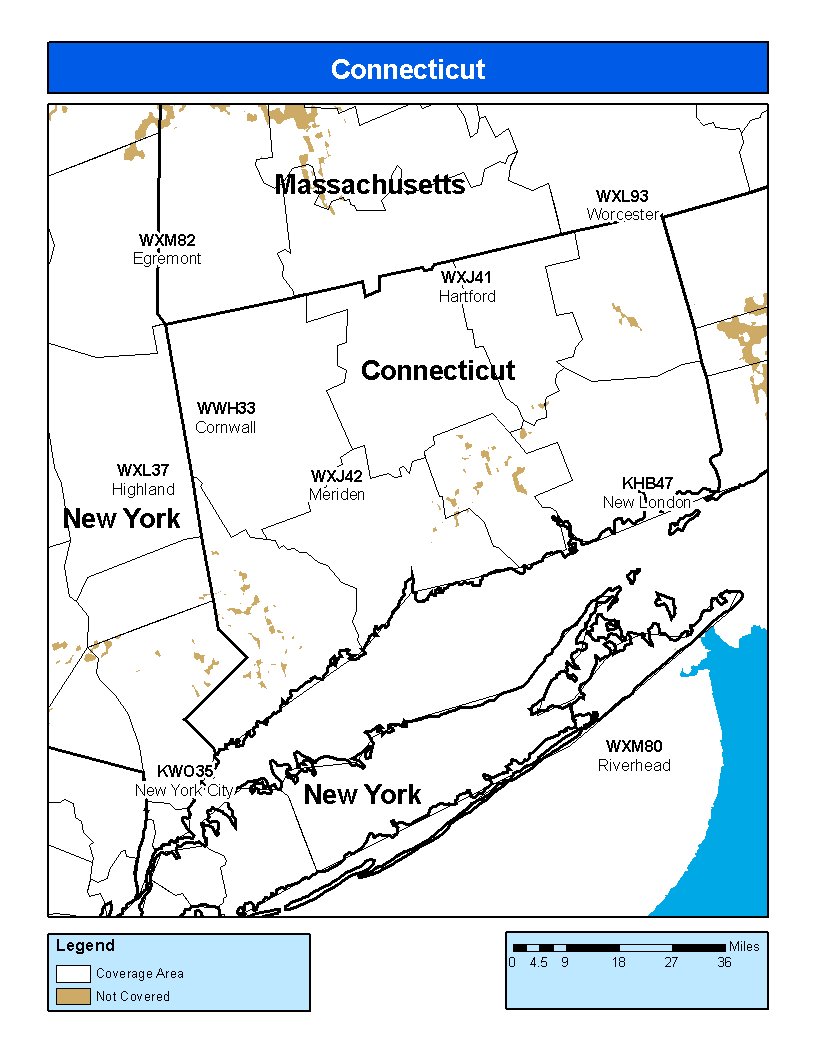
Check out the coverage maps or station lists on the TRANSMITTERS tab above to determine if the area in which you live is covered by NWR.

What messages are alerted and at what times on NWS Boston NWR Transmitters?ExpandCollapse

Only the most imminent life- and property-threatening hazards are broadcasted with both the Specific Area Message Encoding (SAME) signal and 1050 Hertz warning alarm tone, alerting listeners that they should immediately act to protect themselves and their property.

To find what messages contain both the SAME and 1050 Hertz warning, consult the BROADCAST SUITES tab and click through the HIGH and EXCLUSIVE suites. Products that are toned will be appended with a YES under the TONES? column.

Messages are alerted at all times only for hazards urgent enough to warrant waking people up in the "middle of the night" or otherwise interrupting someone's activities at any time. Times are denoted accordingly for only those products which have a "silent-period" in the middle of the night.

How do I program NOAA Weather Radio in general?ExpandCollapse

NWS does NOT manufacture any brand of weather radio receiver. To get assistance programming your receiver, or to discuss problems, you may be experiencing with its operation, please contact the receiver's manufacturer.

Below is a list of many NWR manufacturers. If your radio's manufacturer is not listed, please refer to your User/Owner’s Manual for contact information.

The following manufacturers have had their radios evaluated and approved by the National Weather Service. NOAA WEATHER RADIO approved manufactures may also produce other models which are not approved by the National Weather Service. Visit their web sites to view specifications and owner's manuals to compare features.

The links below take you outside this government site.

Company Phone Website
Alert Works419.843.9114http://www.alert-works.com/
Aervoe Industries, Inc800.227.0196http://aervoe.com/
Alerting Solutions925.228.2152http://www.alertingsolutions.com/
Ambient Weather480.346.3380http://www.ambientweather.com/
Bell and Howell847.550.9998http://www.bellhowell.com/
Chaney Instrument Co. (AcuRite)877.221.1252http://www.acurite.com/
Cobra773.889.3087http://www.cobra.com/
Energizer800.383.7323http://www.energizer.com/
Kaito Electronics, Inc866.524.8676http://www.kaitousa.com/
La Crosse Technology608.782.1610http://www.lacrossetechnology.com/
Midland Radio816.241.8500http://midlandusa.com/
Motorola (Giant International)800.638.5119http://shop.giantintl.com/WeatherProducts.aspx
MZ Berger800.221.0131http://www.mzb.com/
Oregon Scientific800.853.8883http://www.oregonscientific.com/us/
Radio Shack817.415.3200http://www.radioshack.com/
Reecom Electronics Inc.770.641.9228http://www.reecominc.com/
Sangean America888.726.4326http://www.sangean.com/
Spectra Merchandising International800.777.5331http://www.spectraintl.com/
viaRadio Corporation321.242.0001

How do I program NOAA Weather Radio to receive alerts for my county / parish / independent city / marine area?ExpandCollapse

After buying an NWR Specific Area Message Encoding (SAME) receiver, you must program your county, parish, independent city or marine area into the radio. Once programmed, your NWR will then alert you only of weather and other emergencies for the county(s)/ area(s) you chose.

To program NWR SAME receivers with the proper county(s) and marine area(s) of choice, you need to know the 6-digit SAME code number. Then follow the directions in your radio's user's manual.

You can get your SAME number by clicking the SAME / FIPS tab above.

NWR SAME Code is a 6-digit sequence that uniquely describes each county. For coding of a whole county, the first digit is zero. For coding of a part of a county, the first digit is a non-zero number. The 2nd through 6th digits use the Federal Information Processing Standard (FIPS). The 2nd and 3rd digits are the 2-digit state/equivalent territory identifier; the last three digits are the county or equivalent area identifier.

For example, Barnstable County in Massachusetts is 025001. The 0 identifies coding to the entire county, while 25 represents Massachusetts alphabetically within a listing of all states. Lastly, 001 is the county area identifier as Barnstable is the first county alphabetically within a list of all Massachusetts birthdays.

NWR receivers with SAME, alert for emergencies anywhere within the coverage area of the NWR transmitter, typically several counties, even though the emergency could be well away from the listener.

How does Specific Area Message Encoding (SAME) operate?ExpandCollapse

When an NWS office broadcasts a warning, watch or non-weather emergency, it also broadcasts a digital SAME code that may be heard as a very brief static burst, depending on the characteristics of the receiver. This SAME code contains the type of message, county(s) affected, and message expiration time. A programmed NWR SAME receiver will turn on for that message, with the listener hearing the 1050 Hz warning alarm tone as an attention signal, followed by the broadcast message. At the end of the broadcast message, listeners will hear a brief digital end-of-message static burst followed by a resumption of the NWR broadcast cycle.

SAME is also used in the Emergency Alert System (EAS). Using SAME, broadcasters may receive NWR warning messages for rebroadcast in accordance with EAS rules.

What do I do when I have received a Warning from NWR SAME?ExpandCollapse

If the Warning is for a tornado or flash flood, you should immediately take steps to protect yourself. Every household should have an emergency plan that lets everyone know what to do to prevent injury or death. These actions may include moving to the basement, a safe room, or lower, interior levels of your home during a tornado or evacuating to higher ground along a pre-established route during a flash flood.

Where can I get additional information about the event that caused the Warning to be issued?ExpandCollapse

The NWR SAME Warning message broadcast you receive also triggers the Emergency Alert System at your local television and radio stations. The message is also immediately available on the Web and at http://www.weather.gov. Either or both of these sources of text information can be monitored to get additional information, if you can do so without putting yourself at risk.

My reception isn't good. What can I do?ExpandCollapse

First check to see if your county is covered by a NWR station (consult the TRANSMITTERS tab above).

The range for NWR reception is about 40 miles from the transmitter. However, many things may impact reception. Forests, deserts and hills/mountains tend to greatly reduce reception. Reception in cities may be reduced due to steel and concrete, while higher elevations will enhance the signal. Reception can vary from room to room. Mineral deposits in the ground can affect your radio signal. Moving even a few feet can increase a weak signal to a strong one. It may help to be near a window facing the direction of the station, away from other electronic equipment, and on an upper level.

Generally, the least expensive NWR models are the ones that have reception problems. Many models will have a port to hook up an external antenna.

You can buy an external antenna from any electronics store or make your own:

Use a two-conductor piece of wire attached to a wall and stretched up the wall toward the ceiling. As the wire nears the ceiling, split the wire conductors to form a “T.” Where the wire splits into its horizontal section, each section should be at least 18 inches long. You can also tap into your regular outside or inside TV antenna.

How do I report a NWR Outage?ExpandCollapse

Problems receiving the NWR broadcast can be due to issues with the NWR transmitter, your NWR receiver, or possibly both. If you are unable to receive the NWR broadcast and are reasonably certain that your receiver is operating correctly, consult the page listed below where you can also check the list of known outages/degraded service before submitting an outage report.

http://www.nws.noaa.gov/nwr/outages/report.php

What are the different voices on NOAA Weather Radio?ExpandCollapse

From the introduction of NOAA Weather Radio until the late 1990s, nearly all the voices heard in the broadcasts were those of the staff at local National Weather Service (NWS) offices. The messages were manually recorded, first on tape cartridges and later digitally, and placed in the broadcast cycle.

As part of the NWS Modernization during the 1990s, many local offices were closed and their NOAA Weather Radio consoles were moved to the new or enhanced Weather Forecast Offices. This was also the start of a period of rapid expansion of the Weather Radio network. What had been about 400 transmitters in 1990 grew to near 600 by the end of 2000 and is now (at the end of 2006) over 960 transmitters across the 50 states, Puerto Rico, Guam, and American Samoa.

To cope with the increasing number of transmitters at each office, and to speed the overall delivery of warning messages to the public, the Console Replacement System (CRS) was deployed at NWS Weather Forecast Offices in the late 1990s. CRS introduced a computerized voice nicknamed "Paul" using the DECTalk text-to-speech system. DECTalk grew out of research by the late Dr. Dennis Klatt of MIT. While CRS greatly enhanced the speed of delivery and scheduling of Weather Radio messages, there was some dissatisfaction with Paul's voice.

The National Weather Service embarked on a Voice Improvement Processor (VIP) program in late 2000, and implemented newer text-to-speech voices nationwide in 2002, nicknamed "Donna" and "Craig". A year later, further updates were made. The "Donna" voice was improved, "Craig" was replaced by "Tom", and a Spanish voice "Javier" was added at a few sites.

The VIP voices generally have been better received by the public than "Paul". There is a better capability to fine-tune the pronunciation of words and phrases along with controls to adjust the volume and rate of speech. These all help to make the voices more understandable when it really counts - in warning situations.

For samples of all the voices, consult the following: http://www.nws.noaa.gov/nwr/info/newvoice.html

What good is a radio to people who are deaf or hard of hearing?ExpandCollapse

NWR offers non-verbal information imbedded in its broadcasts to provide timely, critical warnings of life threatening events to the deaf and hard of hearing. Some receivers are equipped with special output connectors that activate alerting devices such as bed and/or pillow shakers, strobe lights and other alerting systems.

With Specific Area Message Encoding (SAME) technology, NWR receivers can be programmed to set off an alarm for specific events (tornado, flash flood, etc.) and specific counties of interest to you.

How does it work?

Assuming a weather- or non-weather-hazard is occurring or about to occur that requires public notification, the associated information is immediately input to a computer at a local Weather Forecast Office and broadcast by NWR transmitters to areas at risk. Digital codes are added to each broadcast to identify the event (tornado, flash flood, local civil emergency, etc.) and the specific counties affected. When the Warning is received by an NWR SAME receiver, the receiver turns itself on, sounds an alarm, activates a Warning light, writes a short message (TORNADO) on the display, and activates connected external devices, strobe lights, sirens, etc.

Where can I get the necessary equipment and what does it cost?

Ready-to-use systems are marketed by Silent Call and Harris Communications. The cost of a basic NWR SAME receiver is $50 to $80. Systems packaged with external alarm devices start at $100.

NWR SAME receivers with features useful to the deaf and hard of hearing, such as an output to activate external devices, an LCD display, and battery back-up power are manufactured and/or sold by several companies, including Radio Shack, Midland, Uniden, and First Alert. Connecting some of them to external alarm devices requires a knowledge of electronics and some electronic technician skills for proper installation.\

Where can I buy an NWR receiver and accessories for the deaf and hard of hearing?

Contact one of the vendors listed below. Purchase an NWR receiver or system only with the understanding that if it does not work in your area that it can be returned for a full refund.

Vendors of NWR Specifically Packaged for Deaf and Hard of Hearing:
Company Phone Website
Harris Communications800.825.6758www.harriscomm.com
Silent Call800.572.5227www.silent-call.com
Thunder Eagle, Inc.888.877.8022www.thuneagle.com
More information can be found at the following: http://www.nws.noaa.gov/nwr/info/shhh.html

Is there a Weather Radio network in Canada?ExpandCollapse

Yes, and you can find information at the following: http://ec.gc.ca/meteo-weather/default.asp?lang=En&n=792F2D20-1