National Weather Service United States Department of Commerce
3 Weak Tornadoes on May 14, 2014

Event Summary for Central Alabama

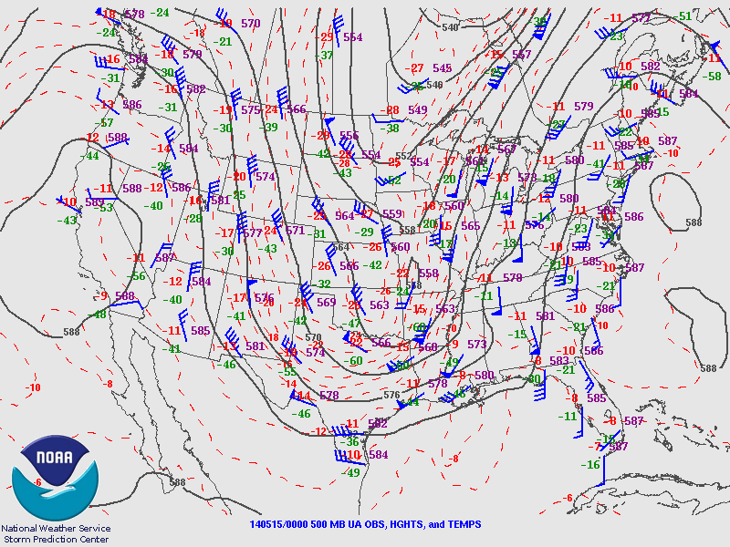
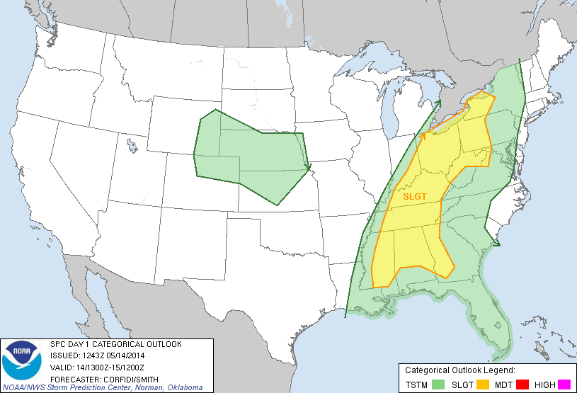
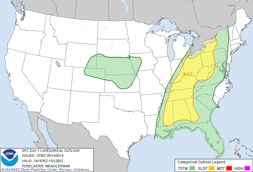
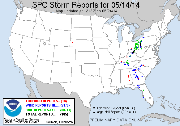
Widespread showers and thunderstorms moved northward across Central Alabama Wednesday afternoon, May 14. This activity developed just ahead of an approaching cold front. The atmosphere was quite tropical with precipitable water values over 1.50 inches. Environmental parameters were marginal for the development of severe thunderstorms, however, isolated thunderstorms exhibited rotation across East Central Alabama. Three weak, short-lived tornadoes did in fact touchdown and produce damage.

The information contained below is the individual tornado events that occurred. The data is PRELIMINARY and may be subject to change.

 
Location/Clickable Detailed Summary Link
Damage Rating/Estimated Maximum Wind Speeds
Injuries/Fatalities
Damage Path Length/Width
Starting Point/Time
Ending Point/Time
Perote Tornado
(Bullock County)
EF-0
85 mph
None
0.87 miles
200 yards
31.9493/-85.7406
218 pm
31.9581/-85.7300
220 pm
Alexander City Tornado
(Tallapoosa County)
EF-0
85 mph
None
1.90 miles
150 yards
32.9030/-85.9304
221 pm
32.9304/-85.9298
225 pm
Mines Road Tornado
(Clay County)
EF-0
80 mph
None
0.10 miles
30 yards
33.2496/-85.9490
328 pm
33.2510/-85.9495
329 pm

 GIS Data

Severe Weather Episode Data 

250 mb
250 mb Analysis
May 14 7 pm
500 mb
500 mb Analysis
May 14 7 pm
Sfc Analysis
Surface Analysis
May 14 7 pm
850 Analysis
850 mb Analysis
May 14 7 pm
Day 1 Outlook Issued at Midnight
Day 1 Outlook
Issued at Midnight
Day 1 Outlook Issued around Noon
Day 1 Outlook
Issued around Noon

Storm Reports
Storm Reports for May 14, 2014