|
Event Summary for Central Alabama
The morning of February 2nd, surface high pressure was set up east of Central Alabama. Therefore, the surface winds had a southerly component and this had been the case for a few days. Morning lows temperatures were in 50s and 60s, which was at or above the normal high temperature for early February.
By afternoon, high temperatures jumped into the upper 70s. These high temperatures were at record levels in a few locations and some 15 to 20 degrees above normal. Moisture values were also very high. Precipitable water, which measures the atmospheric column of moisture, was generally in the 1.6 to 1.7 inch range. This amount was greater than 200 percent of the normal. These values were also near record levels. Surface dew points were rose into the mid to upper 60s.
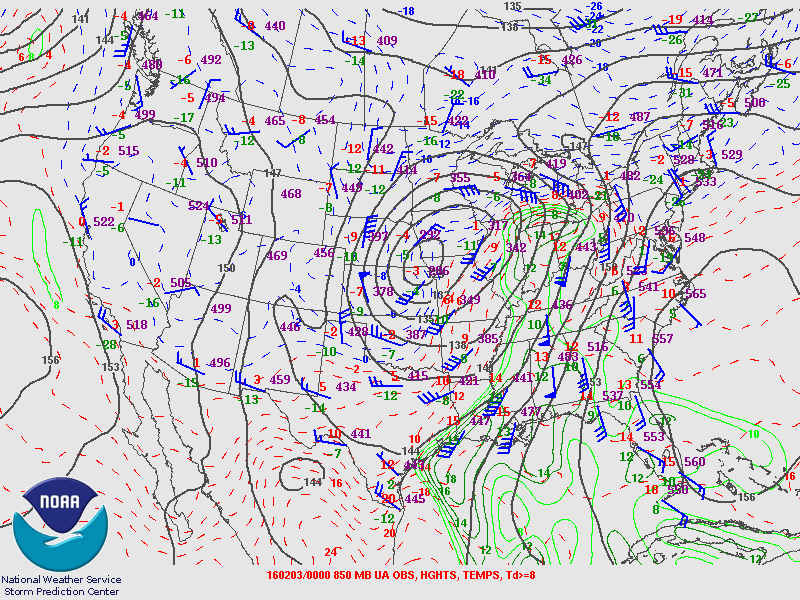
A strong upper level system developed over the Central Plains and a surface low moved from the Mid Mississippi Valley into the Great Lakes. Although this was well removed from Central Alabama, the system was strong enough that winds at the surface and aloft increased significantly. This produced high wind shear. The combination of the high moisture and high temperatures produced some instability too. As the cold front approached the region late Tuesday afternoon into Tuesday evening, a few supercell thunderstorms developed. Eventually, the storms became organized into a line and exited East Central Alabama early Wednesday morning.
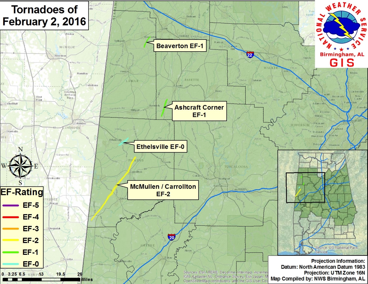
Four tornadoes developed in far West Central Alabama relatively close to the Mississippi State line. Two occurred in Pickens County, 1 in Fayette County and another one in Lamar County. Straight line wind damage also occurred as the storms organized into a line. Rain amounts generally range from 1 to 4 inches, with a few higher amounts. These rain totals produced some minor flooding across Central Alabama. Several river locations experienced quick rises and several spots will rise into minor flood stages.
The information contained below includes the individual tornado events that occurred.
|