|
Event Summary
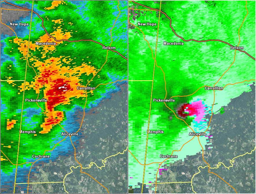
National Weather Service meteorologists surveyed damage in Pickens County and have determined that the damage is consistent with an EF-2 tornado. Winds were estimated to be around 135 mph.
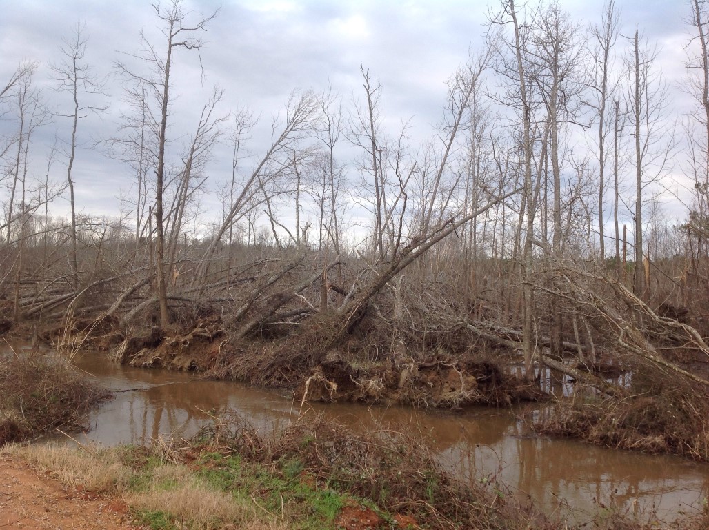
The tornado, produced by cyclic supercell coming out of Mississippi, first touched down in southwestern Pickens County south of AL Hwy 32 and west of County Road 87. From there, it continued on a north-northeastward path on a diagonal across a large part of Pickens County. The tornado was caught live on Camera by local media just after it crossed the intersection of Hwy 32 and County Road 1, just west of Cochrane. It continued northeast to the Cochrane Campground on the Tombigbee River, where scores of trees were snapped, causing minor damage to one of the buildings on the campground. The tornado first reached EF-2 magnitude as it crossed private wooded land just south of County Road 78 snapping and uprooting hundreds of trees. As the tornado crossed Huff-Barnett Road, it mowed down a wide swath of trees, with a distinct classic convergence pattern of tree fall just east of Beaver Creek. The tornado continued northeastward across Al Hwy 14 causing damage to the federal prison, and then moved on to the Martin Luther King Road/Sapp community northwest of Aliceville. Here, the tornado reached its highest rated strength (EF-2) damage. Many of the homes in this portion of the Sapp community received some extent of damage, and several were destroyed. From there, the weakening tornado continued north-northeastward roughly parallel to AL Hwy 17 over open and forested rural Pickens County until it passed just west of Carrollton. The tornado reintensified and broadened somewhat, with a more significant tree-fall causing damage to a few homes on the west side of Carrollton. The tornado continued on the same north-northeastward path gradually weakening over rural areas before lifting near Herbert Windle Road southwest of Reform.
|
 Shapefile