The primary responsibility of the NWS is to issue warnings for hazardous weather and water conditions. The NWS issues a comprehensive package of forecast products to support a variety of users, including the general public. Although text forecasts have been the primary means of product dissemination, the NWS has been converting its forecast products to a digital, gridded format. Each of the WFO's send their graphical forecasts to a national server to be compiled in the National Digital Forecast Database (NDFD). This is a collection of sensible weather elements such as: maximum and minimum temperature, humidity, sky cover, probability of precipitation, amount of precipitation and snowfall, weather type, and wind direction and speed.
A significant portion of NWS forecasting is directed toward the general public. Because coded products may be difficult to understand by someone not familiar with the coding, most NWS public products are written using basic meteorological terminology in a sentence format. The main public forecasts products are:
- Zone Forecast Product - text product issued by all WFO's to explicitly state expected weather conditions within each zone in their area of forecast responsibility through day seven.
- Short term Forecast - a localized, event-driven product used to provide the public with detailed weather information during significant and/or fast-changing hydrometeorological conditions during the next six hours.
- Point Forecast Matrices - displays various weather parameters at 3, 6, and 12 hour intervals for significant cities in the WFO area of responsibility.
- Tabular State Forecast - general seven-day public forecast of hydrometeorological conditions at specific locations over a WFO's area of responsibility.
- Area Forecast Discussion - a semi-technical product primarily used as a means to explain the scientific rationale behind a forecast and summarize watches, warnings and/or advisories in effect. This highly visible product is used to convey forecast and watch/warning/advisory information primarily to federal agencies, weather sensitive officials, and the media. The AFD is also useful for coordination among WFO's and River Forecast Centers, National Centers, and CWSU's. The forecast insight provided in the AFD is beyond that which can be found in other NWS products.
- Coastal Marine Forecast - a text product issued by all coastal WFO's to explicitly state expected weather conditions within their marine forecast area of responsibility through Day 5. The CWF is used by a wide variety of marine users and partners such as the media, emergency managers, and the general public. It is primarily used as a tool for planning purposes to support and promote safe transportation across the coastal waters.
- Offshore Marine Forecast - provides forecast and warning information to mariners who travel on the oceanic waters adjacent to the U.S. and its territorial coastal waters. The OFF, produced in both graphic and alphanumeric format, serve users who operate from the coastal waters out several hundred nautical miles from shore.
- Motoring Forecast (seasonal October 1 - April 30) - a seasonal product issued by WFO Juneau and Environment Canada that provides weather conditions for customers planning to travel along the Haines and/or Klondike Highways during the winter season. These highways link Southeast Alaska to the only major land-based shipping route into Canada and the rest of Alaska.
- Fire Weather Forecast(seasonal May 1 - August 31) - a seasonal zone-type product used by land management personnel primarily for input in decision making related to pre-suppression and other planning. The decisions impact firefighter safety, protection of the public and property, and resource allocation. Weather parameters represent average conditions across the given zone unless otherwise stated in the local Annual Operating Plan.
- Aviation Forecast TAF's, also known as Terminal Aerodrome Forecasts, are a critical element of NWS aviation weather services because they are a key product in decisions on aircraft movement within the National Airspace System (NAS).
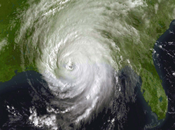
Covering from the sun to the seas, the National Weather Service provides local and regional forecasts, and emergency alerts for severe storms, tornadoes, hurricanes, floods, extreme heat, winter storms, fire threats, tsunamis and solar flares. From its national centers to its 122 Weather Forecast Offices and 13 River Forecast Centers, the National Weather Service is watching over the nation and your neighborhood.
| Weather and climate sensitive industries in the United States account for about one-third of the nation's Gross Domestic Product. Marine, aviation and space interests rely on National Weather Service information, alerts and warnings. In addition, NOAA has a responsibility to support the growth of an environmental information enterprise, a partnership between government, academia and the private sector. |
These services are supported by organizations throughout NOAA, including NOAA's Satellite and Information Service, which maintains the satellites and data used in weather forecasting as well as historical climate records, and research and products provided by NOAA's Office of Oceanic and Atmospheric Research and the National Ocean Service to improve forecasting ability.


