| 2018 Weather Highlights | Hydrology/Drought Status | Fire Weather | Records and Extremes | Monthly Highlights | Severe Weather |

.png)


|
Review of Severe Weather Across New Mexico in 2018
|
|
|
|||||||||||||||||||||||
|
|
|||||||||||||||||||||||
|
Severe weather is defined as hail greater than or equal to 1 inch, thunderstorm wind gusts greater than or equal to 58 mph, a flash flood or a tornado. However, prior to January 5, 2010, the criteria for severe hail was 3/4 inch. For consistency, the table below, as well as the map above, includes all severe weather reports, including hail reports as small as 3/4 inch. This year, the National Weather Service in Albuquerque received 239 severe weather reports. The total number of severe weather reports across the state as a whole was 280. These totals do not include wind gusts greater than or equal to 58 mph that occurred from non-thunderstorm wind events. The table below shows the breakdown of reports received. It should be noted, however, that winds less than 58 mph can blow over high profile vehicles, toss trampolines and cause tree damage to unhealthy trees. |
|||||||||||||||||||||||
|
 |
||||||||||||||||||||||
|
In 2018, there was a total of 280 severe weather reports across the state. To put this number in perspective, in 2017, there were a total of 420 reports, while in 2016, there were 222 reports. This years number of reports is slightly above average, while last year was well above average. A total of 329 severe thunderstorm warnings were issued by our office. Only 11 (out of 122) other NWS offices issued more severe thunderstorm warnings.
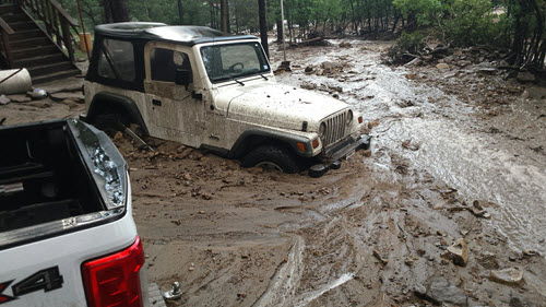
Here are the top severe weather events that occurred in New Mexico in chronological order. May 21st-23rd: Three days of severe weather plagued New Mexico in May. A strong low pressure system moving into Arizona from the west allowed abundant moisture to be pulled up into New Mexico as far west as the Continental Divide. On the 21st, storms fired by the late morning hours along the Continental Divide which brought high winds, hail and even funnel clouds to the area. These storms moved into the Rio Grande Valley during the afternoon, and dumped copious amounts of hail and rain to the Albuquerque Metro Area. One woman was killed and five others injured when they were swept away in the urban drainage system designed to carry flood waters. Storms then shifted across eastern NM through the evening hours. Portions of Lincoln County were among the hardest hit areas with several inches of hail accumulation noted in Corona and Alto. By the 22nd, the upper level storm system shifted toward the Four Corners area, and as such, the bulk of the severe weather shifted eastward as well, focusing on portions of central and eastern NM. A 12 car pileup was noted on I-25 near Santa Fe due to slick, hail covered roadways. The most active day of the three was the 23rd. Storms developed along the dryline across the high plains by mid to late afternoon. A beautiful supercell over eastern Lincoln County near Picacho spawned two tornadoes and large hail. One of tornadoes lasted at least 15 minutes, but occurred over private property, and NWS Meteorologists were unable to survey the damage. Another very impressive, long duration supercell storm over western San Miguel County produced torrential rainfall, flooding, high winds, and very large hail near Tecolotito and Anton Chico.
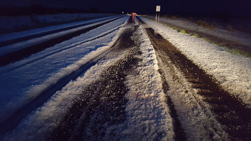
Left: Accumulated hail along U.S. Highway 54 southwest of Corona on May 21st. Photo by Kevin M. Smith.
Beautiful structure of the Picacho supercell and tornado on May 23rd. Photo by Justin Noonan. June 3rd: Though severe weather had occurred earlier in the afternoon, a storm during the late evening hours on June 3rd resulted in very high winds and substantial damage across portions of Chaves County. Three single-wide mobile homes were overturned and destroyed near Sagebrush Valley Road and U.S. Highway 285 west of Hagerman. All three trailers were supported on concrete blocks with no tie-downs and no skirting. Fortunately, there were no injuries as none of the units were occupied at the time. Several recreational vehicles were also overturned and damaged in the vicinity. Additionally, a large barn with concrete floors, concrete footings, and large wood beam trusses was completely destroyed by straight line winds causing a semi-trailer inside to be overturned. 
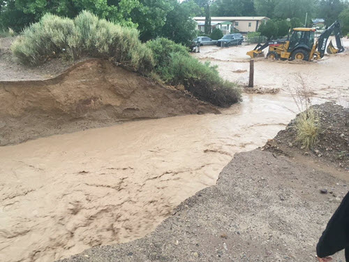
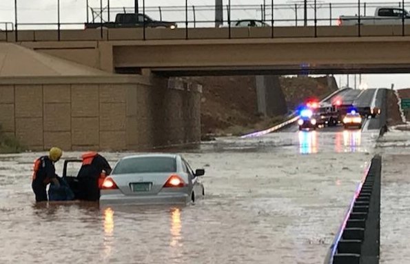
July 5: The first significant surge of monsoon moisture of the 2018 season generated numerous showers and thunderstorms with locally heavy rainfall across New Mexico. Heavy rainfall along NM-38 west of Red River forced a mud slide over the highway, but it wasn't the only mudslide of the day. Moderate rainfall over the Ute Park burn scar also generated a mud slide and the closure of U.S. Highway 64. Unfortunately, a motorcyclist crashed after hitting a muddy area at mile marker 303, but sustained only minor injuries. Flash flooding also occurred around the Agua Fria and Upper Hills area of Santa Fe causing roads to be closed. Significant flash flooding struck the Enchanted Hills area in northern Rio Rancho. Several roads were closed in the area including the intersection of U.S. 550 and NM 528. Over 2 inches of rain was recorded by several observers in Enchanted Hills, most of which fell in less than 90 minutes. Roads were closed in the area with a couple vehicles inundated by flood waters. One motorists was rescued from their vehicle at Paseo del Volcan in Enchanted Hills. Last but not least, a levee breach in Belen near Hansen Road flooded a large section of town near the Belen High School. Until the levee was repaired, this area was susceptible to more flooding for several days. Left: A levee breach in Belen resulted in flooding of nearby neighborhoods. Photo by Manuel Garcia. Right: Flooding in Rio Rancho. Photo courtesy of the Rio Rancho Fire Department. July 30th-31st: Though severe weather is more common across eastern NM, areas west of the Central Mountain Chain can receive devastating severe weather as well, and this was the case for two straight days at the end of July. Following a moisture resurgence behind a back door cold front, the Rio Grande Valley was primed for severe weather on the afternoon and evening of July 30th. Two storms impacted the Albuquerque Metro area with large hail which damaged many trees and vehicles. The first storm developed around Santa Ana Pueblo and moved southeast across Placitas into the Albuquerque Foothills. Heavy rainfall, strong winds, and nickel to quarter size hail was reported with this storm. A second storm developed over Rio Rancho and moved southeast across the Albuquerque Valley into the UNM area. This storm produced significant amounts of penny to ping pong ball (1.5" in diameter) size hail, with some of the largest hail stones near the UNM and Nob Hills area. A woman walking to her car was struck by the hail and required stitches. This is the first injury reported due to hail in Bernalillo County dating back to at least 1957. On July 31st, a strong thunderstorm that developed near Chama around 3 pm moved south and became severe as it reached the Youngsville area where two inch hail was reported. This was the largest hail ever reported in Rio Arriba County. This thunderstorm remained severe as it moved across the Jemez Mountains. Hail up to the size of golf balls with torrential rainfall in the Jemez Valley produced widespread hail damage and flash flooding. This storm continued southward into the Rio Rancho area with quarter size hail.
Large and some oddly shaped hail fell in Jemez Springs. Photos courtesy of Marcella Benton.
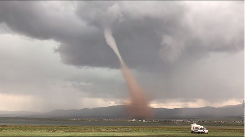
Other Interesting Facts: The first documented tornado occurred in the Moreno Valley on August 9th. The landspout tornado formed near Eagle Nest, just west of U.S. 64 between mile markers 283 and 284. The tornado was on the ground for several minutes, crossing U.S. 64 before dissipating over the northeast portion of Eagle Nest Lake. Most tornado rotate cyclonically, or counter-clockwise. Interestingly, this landspout rotated anti-cyclonically, or clockwise. Though only rated as an EF-0, the lowest on the Fujita Scale, it did some damage along it's path. For more on the damage, check out our Top Ten Weather Stories.
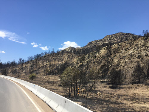
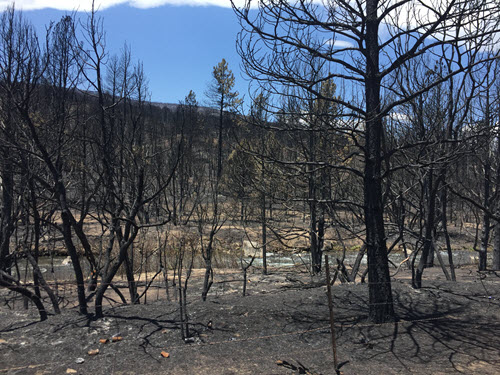
Eagle Nest Landspout. Snapshot taken from a video by Michael Harmon. The Ute Park wildfire started just after 2pm MDT on May 31, 2018, just south of U.S. Highway 64 in Ute Park. The fire crossed U.S. Highway 64 over the coming days, scorching in total over 36,000 acres, including over 26,000 on Philmont Scout Ranch, by June 17th. Though no residences and only 14 outbuildings were burned during the fire, residences were not as lucky following the fire once the heavy rains hit.
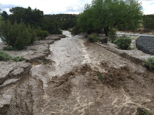
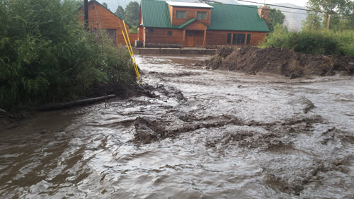
Ute Park burn scar. Photos by Kerry Jones. Over the duration of the monsoon, at least eleven flash flood events occurred within or downstream of the burn scar. Mudslides often closed the highway, but three of the flash flood events stood out due to the extent of the flood wave and resulting damage. On July 13, 12 homes were damaged along with several vehicles. Four of the 12 homes sustained at least moderate damage. On August 2nd, an even bigger flood wave damaged 28 homes, including six that were completely cut off from access due to the amount of mud, water and debris. Unfortunately, it wasn't long before it happened again. On August 8th, a similar flood wave damaged the same areas that were hit on August 2nd.
Ute Park burn scar flash flooding on August 2nd. Photos by Thomas Vigil. |
|||||||||||||||||||||||
|
Severe Stats: Ten of the 11 tornadoes this year were rated as an EF-0. The remaining tornado was ranked as an EF-U or EF-Unknown due to the fact the tornado occurred on private land and NWS meteorologists did not have access to assess the damage. The largest reported hail size this year was three inches which fell in Tecolotito, San Miguel County on May 23rd. The strongest reported measured wind gust was 75 mph on August 9th at the Gallup Airport, though on June 3rd, it was estimated that winds around 75 mph damaged three mobile homes and a barn in Chaves County. The highest non-thunderstorm wind gust was 90 mph at San Augustine Pass in southern New Mexico on March 15th. |
|||||||||||||||||||||||
|
How does 2018 compare to normal? Since 1950, the average number of tornadoes reported in the state is 8 to 9, which makes 2018 just above average. At least one tornado has been reported each year since 1953, and before that it is likely that most tornadoes went unreported. The highest number of tornadoes ever reported was in 1991, when 31 tornadoes devastated parts of the state, especially Eddy and Lea counties. The average number of hail reports has steadily increased since 1950 due to increased awareness, and today the average number of events is near 130. This makes the number of severe hail reports this year just above normal. Complete flash flooding records only date back to 1993, however since then, the average number of flash flooding events is around 40 per year, which makes 2018 right near normal. Reported thunderstorm wind events were nearly double the average number of 35 events per year.
|
|||||||||||||||||||||||
|
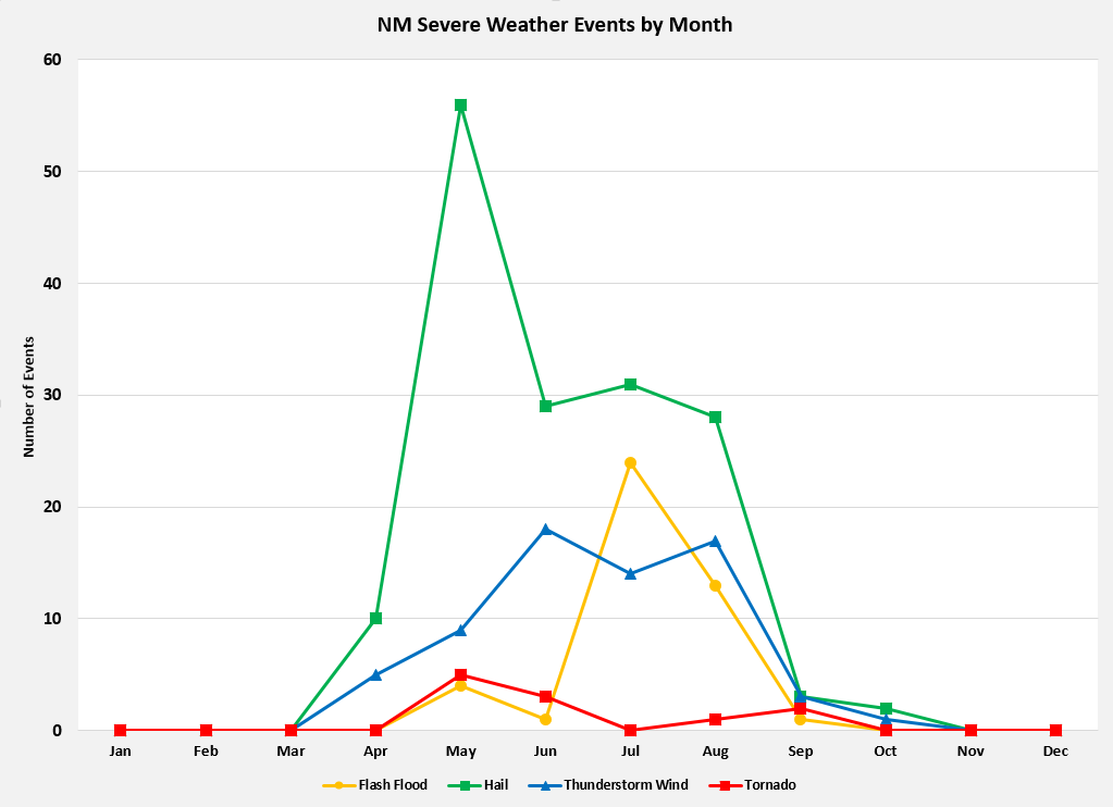
The graph on the left shows the distribution of New Mexico severe weather events by month. New Mexico's primary severe weather season is in the spring, though a secondary season often occurs in the fall. Interestingly, this years distribution was not bi-modal. Rather, despite the peak in hail reports in May, severe weather steadily occurred from May through the summer. This graph also shows that flash flooding in New Mexico is most frequent during monsoon season. Click on the graph for a larger image. |
|||||||||||||||||||||||
| (Return to the main page) | |||||||||||||||||||||||