Tornadoes Track Across the Florida Panhandle and Southwest Georgia
A squall line moved eastward across the tri-state area Sunday, April 15, 2018 producing numerous damaging wind reports and two tornadoes. The squall line weakened as it tracked eastward, but quickly reorganized near Tallahassee and some of this strengthening can be seen in the local storm reports (below).
 |
The synoptic pattern was one more typical for our area, with a deep upper level trough and strong cold front at the surface, along with very strong low-level shear and little instability. The 12Z sounding (below) shows only 793 J/kg of surface based instability but both the low level and deep layer shear were exceptionally strong with 0-1 km value of 45 knots and 0-6 km value of 62 knots.
 |
While the initial line of thunderstorms brought numerous reports of wind damage to the Florida Big Bend and southwest Georgia, one cell that formed in an area of rain behind the main line, produced a tornado that tracked across Bay County. The tornado touched down on the eastern portion of Tyndall Air Force Base. the tornado crossed US 98 causing damage to pine trees and utility lines. The full length of the path is uncertain given the limited access to the area.
Bay County Tornado
| Rating: | EF-0 |
| Estimated Peak Wind: | 80 mph |
| Path Length (statute): | 1.13 miles |
| Path Width (maximum): | 60 yards |
| Fatalities: | 0 |
| Injuries: | 0 |
| Start Date/Time: | April 15, 2018 6:09 AM CDT |
| Start Location: | 4 WSW Allanton, Bay County, FL |
| Start Lat/Lon: | 30.0087, -85.5206 |
| End Date/Time | April 15, 2018 6:13 AM CDT |
| End Location: | 3 WSW Allanton, Bay County, FL |
| End Lat/Lon: | 30.0214, -85.5088 |
 |
| Bay County Tornado Track |
 |
 |
| Bay County Reflectivity | Bay County SRM |
The same storm went on to produce another short lived tornado in Decatur County, GA. The brief tornado occurred with trees snapped and fallen in different directions along Brinson Airbase Road. Maximum winds were estimated around 90-05 mph based on the snapped trees.
Decatur County Tornado
| Rating: | EF-1 |
| Estimated Peak Wind: | 95 mph |
| Path Length (statute): | 0.46 miles |
| Path Width (maximum): | 31 yards |
| Fatalities: | 0 |
| Injuries: | 0 |
| Start Date/Time: | April 15, 2018 7:55 AM CDT |
| Start Location: | 1 SW Ausmac, Decatur County, GA |
| Start Lat/Lon: | 30.9838, -84.6355 |
| End Date/Time | April 15, 2018 7:56 AM CDT |
| End Location: | Ausmac, Decatur County, GA |
| End Lat/Lon: | 30.9887, -84.6303 |
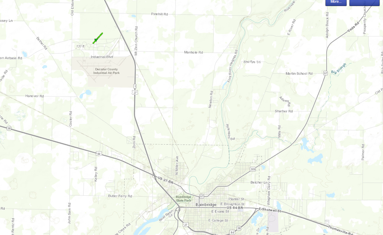 |
| Decatur County Tornado Track |
 |
 |
| Decatur County Reflectivity | Decatur County SRM |


 Follow us on YouTube