| Severe Weather of December 15-16, 2007 |
Beginning Saturday afternoon, December 15, and continuing into the early morning hours of Sunday, December 16, 2007, the NWS Weather Forecast Office in Tallahassee issued 18 warnings. These included 5 tornado, 7 severe thunderstorm, and 6 special marine warnings. So far, two tornadoes were confirmed by NWS survey crews, which tracked across Early County, GA, Worth County, GA, and Turner County in GA. Unfortunately, there was 1 fatality in Ashburn, Georgia located in Turner County. The Storm Data publication details storm surveys conducted by NWS employees. The SPC storm report archive summarizes all severe weather reports received by NWS Tallahassee during and after the event.
An unstable tropical air mass with high moisture and warm temperatures in advance of a strong cold front provided the potential to trigger severe weather. Another complicating factor was the remnant circulation of Sub-Tropical Storm Olga moving northeast across the eastern Gulf of Mexico.
Figure 1 shows the damage paths of the second tornado, indicated by the charcoal gray oval.

Figure 1. Damage paths of the tornado of December 15-16, 2007, indicated by the charcoal gray ovals. Click on the image for a larger view.
The tornado first touched down around 905 pm EST about 3 miles west of Sylvester, GA and tracked through the community of Isabella, damaging 29 homes, and was rated an EF-0. A peanut warehouse was also damaged. The tornado continued toward the northeast touching down only intermittently. The tornado touched down again just southwest of Ashburn destroying 4 mobile homes and damaging 39 homes, and was rated EF-1. Several businesses were also damaged and a tractor trailer rig was blown off I-75 by the tornado killing the driver, the only occupant.
The following figures show the base reflectivity and storm-relative velocity images as the tornado tracked across Worth and Turner Counties.
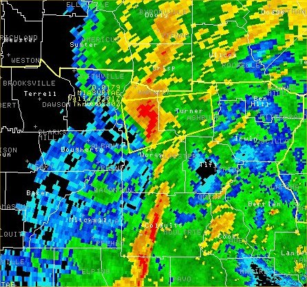
Figure 2. Reflectivity image from the WSR-88D radar at Moody AFB at 0205 UTC 16 December (905 pm EST on 15 December) near the time of first tornado touchdown.
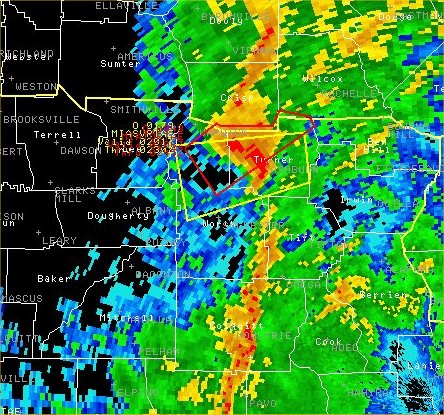
Figure 3. Reflectivity image from the WSR-88D radar at Moody AFB at 0213 UTC 16 December (913 pm EST on 15 December) near the time the tornado was hitting Ashburn. Polygons indicate the areal extent of a severe thunderstorms warning (yellow) and tornado warning (red) in effect at the time.
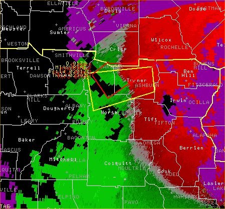
Figure 4. Storm relative velocity image from the WSR-88D radar at Moody AFB at 0213 UTC 16 December (913 pm EST on 15 December) near the time the tornado was hitting Ashburn. Polygons indicate the areal extent of a severe thunderstorms warning (yellow) and tornado warning (red) in effect at the time.
Earlier in the evening, tornado warnings were issued for the eastern Florida Panhandle, several of which were issued for the same parent supercell from which the tornado in Worth and Turner Counties were spawned. Another tornado, rated and EF-0 briefly touched down in north central Early County, GA approximately 3-4 miles northwest of Blakely, GA damaging a mobile home. Figures 5 and 6 correspond to the time of damage occurrence in Early County, GA.
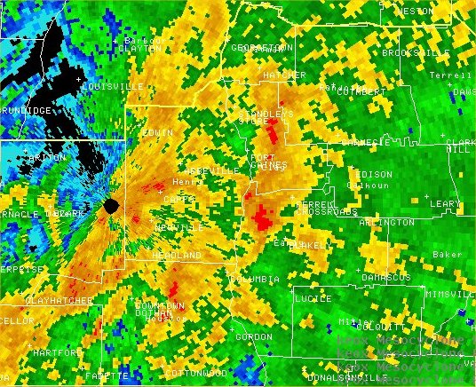
Figure 5. Reflectivity image from the WSR-88D radar at Ft. Rucker AFB at 2247 UTC 15 December (547 pm EST) near the time the EF-0 tornado was damaging a mobile home in early county.

Figure 6. Storm relative velocity image from the WSR-88D radar at Ft. Rucker AFB at 2247 UTC 15 December (547 pm EST) showing strong rotation near the time the EF-0 tornado was damaging a mobile home in Early County, GA.
The line of storms extended south from the tornadic supercell over Turner and Worth County into the Florida Big Bend and the adjacent offshore waters. Additional storm to severe thunderstorms were embedded within this southern portion of the line prompting severe thunderstorm and special marine warnings.
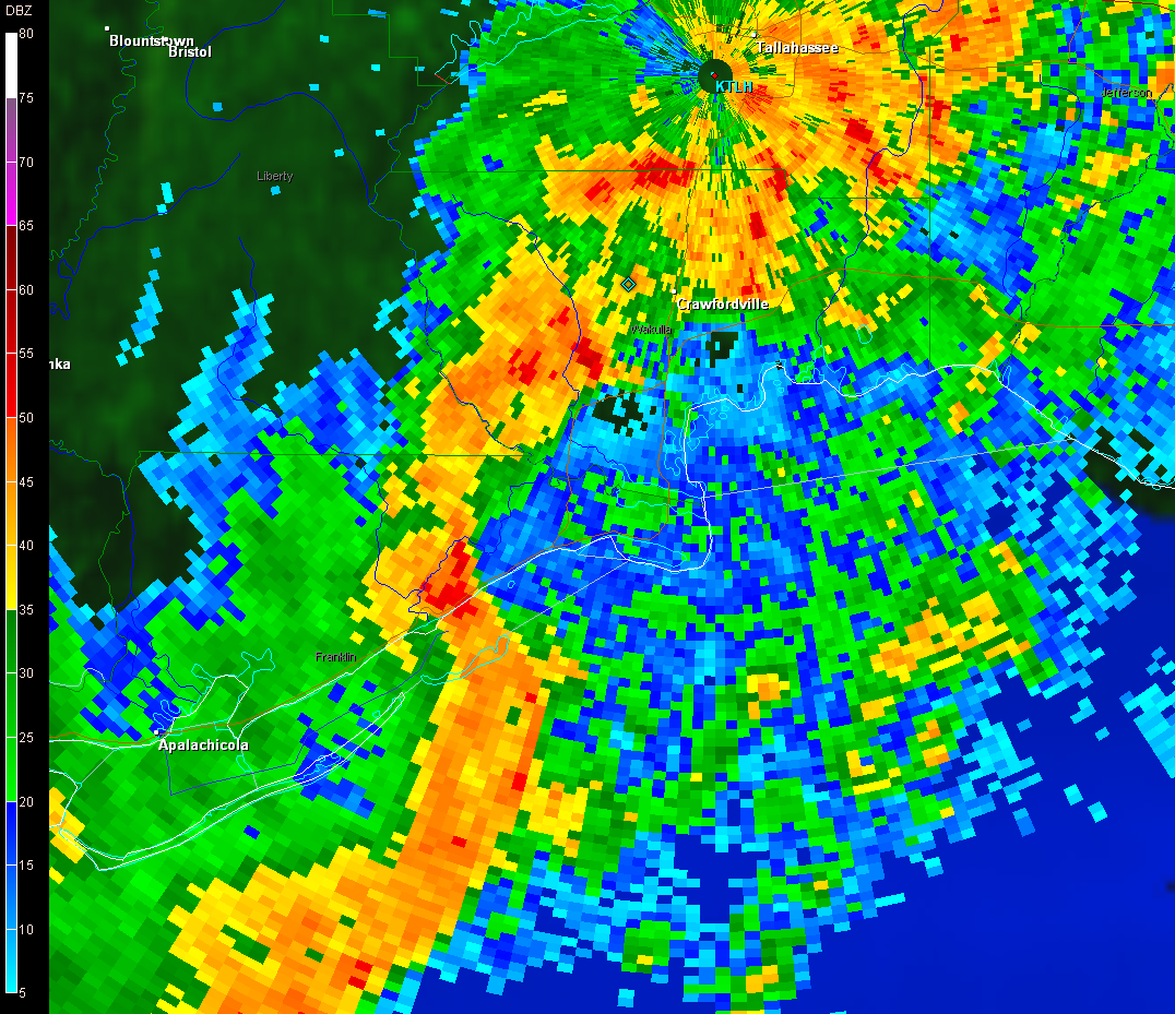

Figure 7. Reflectivity image (left) and Base Velocity image (right) from the Tallahassee WSR-88D radar at 0237 UTC 16 December (937 pm EST 15 December) showing a bow echo with a strong straight-line wind signature moving along the Franklin County, FL coastline toward Alligator Point, FL. Click each for larger image.


 Follow us on YouTube